
Climbing Mt Baker via the Coleman Deming route
I needed a plan, fast. My partner’s birthday weekend was rapidly approaching, and my original plan – a canoe of Alouette Lake to summit Mt Robbie Reid – had fallen through due to a climbing injury. I needed to find a new August epic. Fortunately, I didn’t have to look far. In fact, all I had to do was simply look up: Baker. The classic skyline peak of Vancouver and the Fraser Valley.
Hard to ignore that mountain, really. Every hike on the North Shore in Vancouver leads to views of King Baker on the descent. Every drive through the Fraser Valley is dominated by that majestic giant. And now, with pandemic border restrictions lifted, it was time to dust off my old dream of climbing all of the glaciated Cascade volcanoes. And Baker, at 3288m, and only about 2.5 hours drive from my home, was very high on that list. Numerous years had passed with failed trip plans: rain and storms, poor snow conditions, and pandemic border closures had all led to a four year delay. But with an unseasonably high snow-pack this year plus a stretch of hot and glorious weather, an early August weekend seemed like the perfect chance to tackle this magnificent, snowy mammoth.
I had always had my eye on the classic Coleman Deming route, which is considered the standard ascent route. In fact, it’s actually the easiest route in the local mountaineering guidebook, Alpine Select. In our pre-trip research however, we learned that, due to some of the weather-related chaos British Columbia and Washington state experienced last fall, the road to the trailhead was washed out. Selecting this route would mean that we’d have to add on a road walk of roughly 7km. Being the optimistic enthusiasts we are, we decided to bring our bikes. It’s just 7km, we thought to ourselves. What’s an extra hour, hour-and-a-half before starting the approach? Simple fools.
On a sunny Friday morning, we crossed the Sumas border and headed to the Mt Baker Wilderness area. After a gentle drive up the park road, we reached a sign closing the road due to the washout. We stopped and parked here in a gravel pullout, uncertain of how far we should drive in our ‘adventure car’ (a laughably low-clearance Tesla Model 3 we’re somewhat fond of unsticking), but learned shortly afterwards from a family biking down the road that there is a decently sized gravel area about a kilometer up, directly in front of the final impassable blockade for the washout. A dozen or so cars were already parked there. We were ready to go by then though, so threw on the heavy backpacks, hopped on the bikes, and hit the road.
That first kilometer of riding was unfortunately about the only riding we would do. Once we had walked the bikes around the dramatic road washout (the pavement sunk into the river), the road cruelly began to climb steeply uphill. And kept climbing. Soon, we were just pushing the bikes, not having the biking fitness nor desire to destroy our legs before we had even started the actual hiking! We encountered a fair amount of people descending the road as we climbed however – despite the washout, many alpinists were taking the extra challenge in stride. I even got a few laughs (although I think they were still envious laughs) about my choice to bring my road bike on this bumpy forest road. What can I say? I like to roll with low-clearance and thin tires.
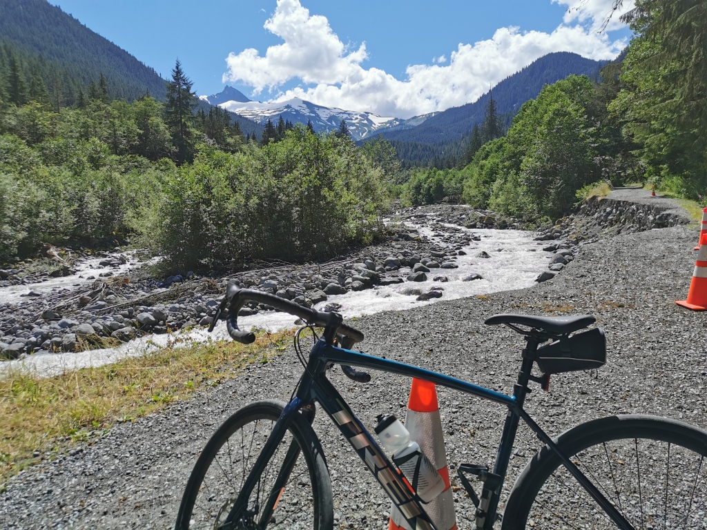
In total, our ‘approach’ to the trailhead was about 8.5km from our car, including about 600m of elevation gain. We completed it in about 2 hours. The trailhead is marked with a picnic table, park signboard, and pit toilets. We stopped here to lock up the bikes in the trees and take a short break before plunging into the Baker Wilderness.
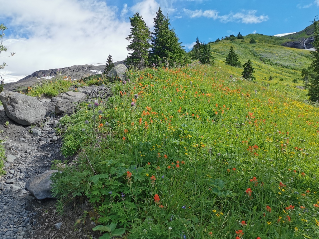
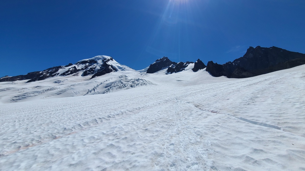
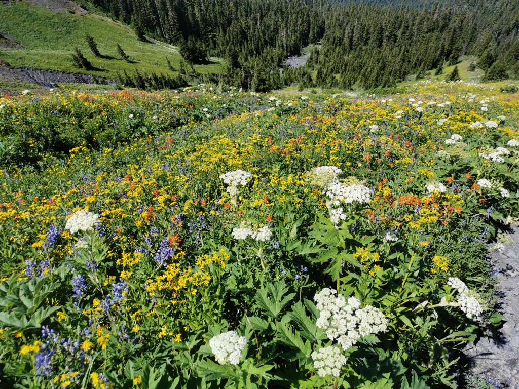
Following the well-established and surprisingly gentle trail for Heliotrope Ridge, we gained 650m of elevation in roughly 5km. The rolling, shady terrain was actually a welcome break from the steep pavement of the road. There are a couple interesting creeks to cross as well, requiring a bit of thought to safely cross with dry feet, especially in late afternoon. After about 4km, a junction is marked with a wooden sign. Straight takes you to the glacier lookout, and right takes you up the climber’s trail for a Baker basecamp at Hogsback Camp at the toe of the Coleman glacier.
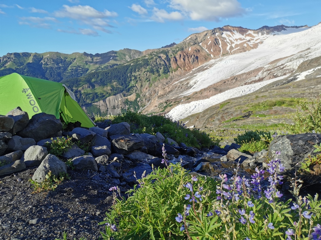
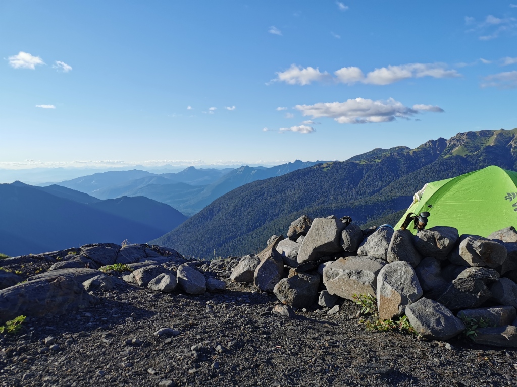
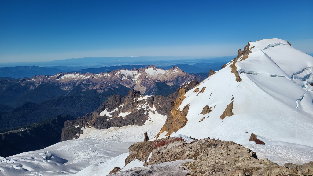
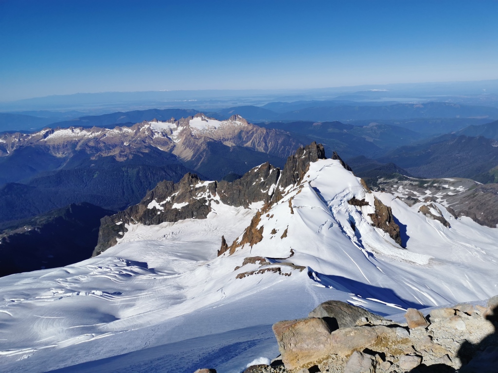
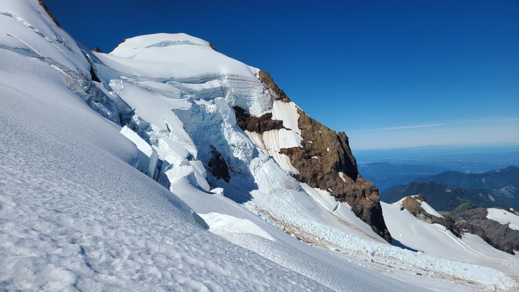
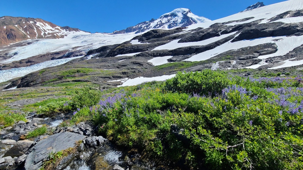
The climber’s trail is rougher than the hiking trail, but fortunately it’s short and absolutely stunning. You emerge quickly from the trees and head straight up a spine of the mountain. Very steep, but with panoramic views of Mt Baker, the Coleman glacier and icefall, the Baker Wilderness valley, the high peaks of Washington and BC, and the endless fields of blossoming wildflowers through which we hiked, I was not complaining. I stopped a lot here simply to stare and enjoy (and I guess to give my tired legs a break too…). After a few hundred meters of climbing over about a kilometer, the trail peters out a bit. Keep taking the path of least resistance upwards, and you’ll encounter numerous flat spaces with pre-built rock wind screens: the campsite, Hogsback. While we had read that another common place to camp is located 200m up on the glacier itself beneath the Black Buttes, gaining this short distance that day hardly seemed worth the effort, given that we’d need to stop and put on our mountaineering boots and crampons, and that Hogsback looked much more comfortable, with easy water access.
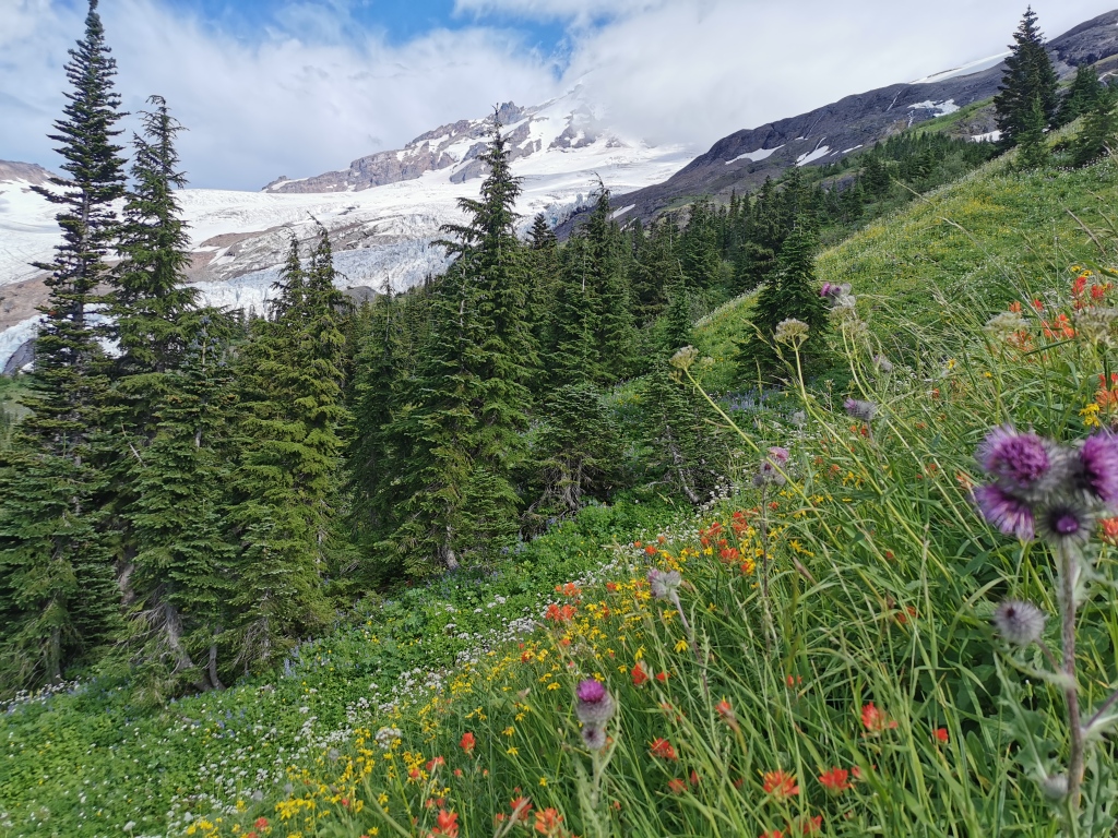
Hogsback Camp below Coleman glacier is quite possibly one of the most beautiful places in the mountains I’ve ever been – overflowing with brilliant wildflowers, delicate and icy creeks tracing lines through rock and grass, walls of blinding white and pale blue looming above, and the muted pink light of the late afternoon sun crowning the snowy triangle of Baker – a calling and a challenge. Against this backdrop, we quickly set up camp and made dinner, carefully guarding our food from the lurking but adorable marmots. We were treated to a magnificent sunset as we climbed into our sleeping bags at a conservative 8:00pm.
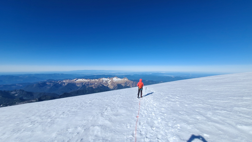
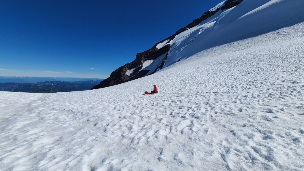
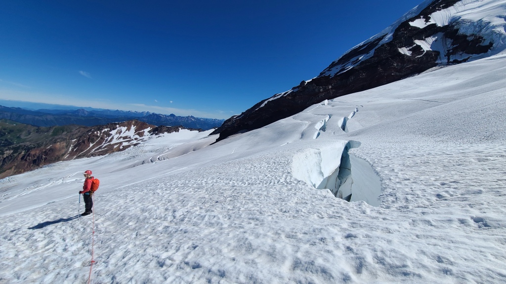
Despite the early bedtime, we had a hard time sleeping, and when the alarm went off at 1:30am, I was mildly devastated to have to crawl out of the warm tent and into the cold wind coming off the glacier. Having prepped our bags and gear the night before, we set up the recommended marmot precautions – any food to be left behind goes in as many bags as possible and in the centre of your tent for maximum difficulty and reduced smell – and we were trekking out of camp by the light of our headlamps by 2:30am. Short bursts of light from the handful of other tents in camp would occasionally hit us as we climbed up the rocks above; it appeared that everyone was making an effort at an alpine start. We stopped to put on our crampons and rope up as soon as we hit the base of the snow. Aiming for the dim flashing of the 3 headlamps of the group ahead of us, we followed light footprints onto the Coleman glacier.

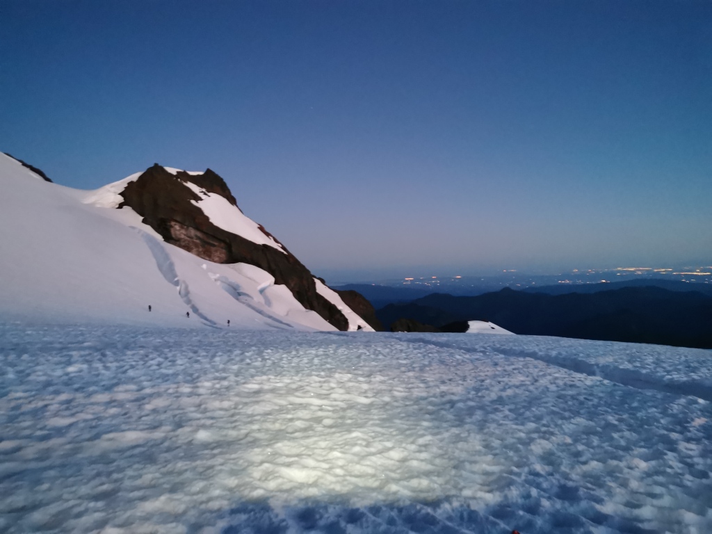
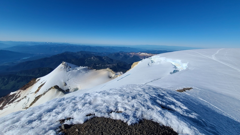
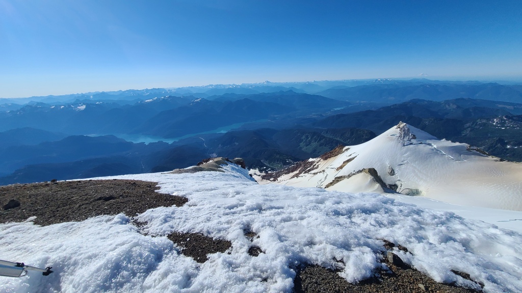
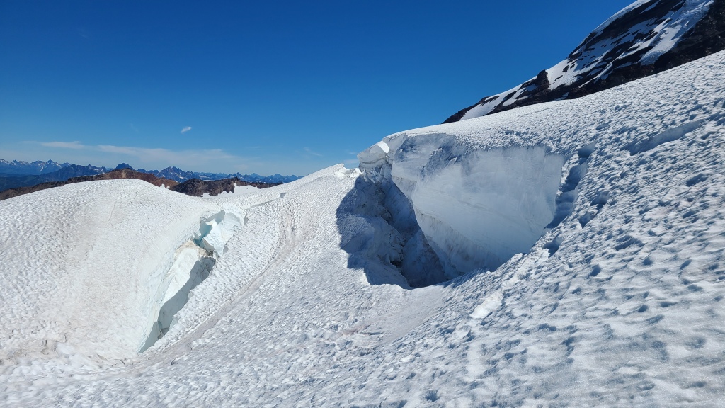
We continued to follow footprints across the snow until it no longer made sense. Crevasses were minimal at the start (up to a foot across), but became more cumbersome as we climbed higher. At one point, faced with some large crevasse bands, we abandoned the footprint track to find our own way, not knowing if the ‘main’ route was still doable this late in the season. We followed some recent trip report advice to keep climber’s right and get high, as near as was safe to the base of the adjacent peak, Colfax, which was starting to crumble with the summer heat. Some of the crevasses were truly epic, the biggest I’ve ever seen. Spanning several meters across, with completely sheer walls and bottoms that could not be seen, we’d peer down at least 30m into the darkness, wondering what subterranean world was down there, but not keen to find out. Fortunately, it was always possible to find a way around them, and the snow was firm and hard under the clear dark sky of our alpine start.
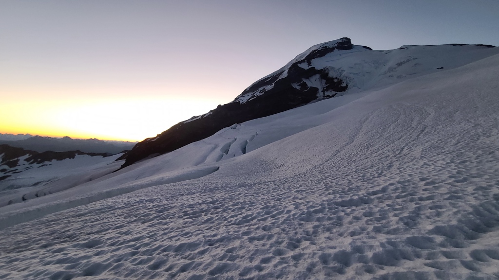
As we neared Colfax, we passed the group ahead of us, taking the lead on the Coleman Deming route for the day. Moving quickly through some alarming rock and snow debris under Colfax, we took our first proper break at the col between Colfax and Baker. From here, the steeper climbing begins to gain the Roman Wall, the broad, long headwall that ends in the summit cone. Note that the Coleman Deming route involves no technical climbing – it is essentially just a long, snowy walk, albeit with crevasse fall risk on the glacier. As we steeply ascended, I was glad to have a longer ice axe to use as a walking stick.
The ascent to the summit was slow. After 1300m of climbing the previous day with camping and climbing gear, and another 1400m to go that day on about one and a half hours of sleep, I was spent. The breaks became longer, and the steps in between became shorter. But seeing the group below us on the Roman Wall mimicking our go-rest pattern, I realized it wasn’t entirely due to my lack of fitness or training. I wondered what toll the altitude might be taking at that time. Altitude sickness (a very dramatic word in this context) can leave you breathless and tired, and can kick in anywhere above 2500m, and on this clear, still, and brilliant morning, we were finishing off the last couple hundreds meters towards the Baker summit at 3288m.
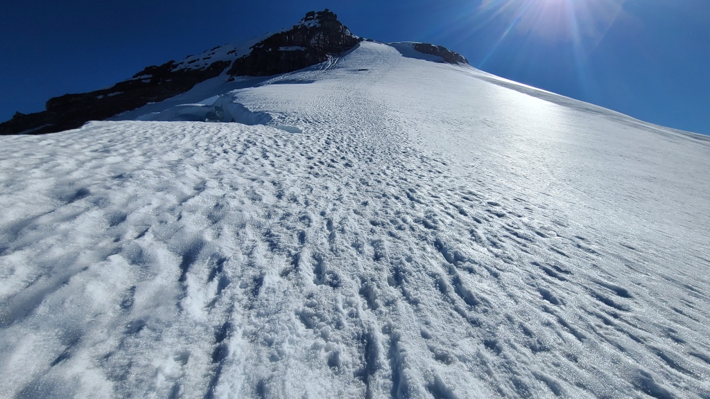
But I’d been on much steeper snow terrain, and the snow was firm and perfect for the points of our crampons (even the small sections of frozen rock were surprisingly firm and ‘sticky’), and we’d come way too far to turn back now. Using every trick in my mental book to push on, we eventually completed the Roman wall, rock by rock, step by step.
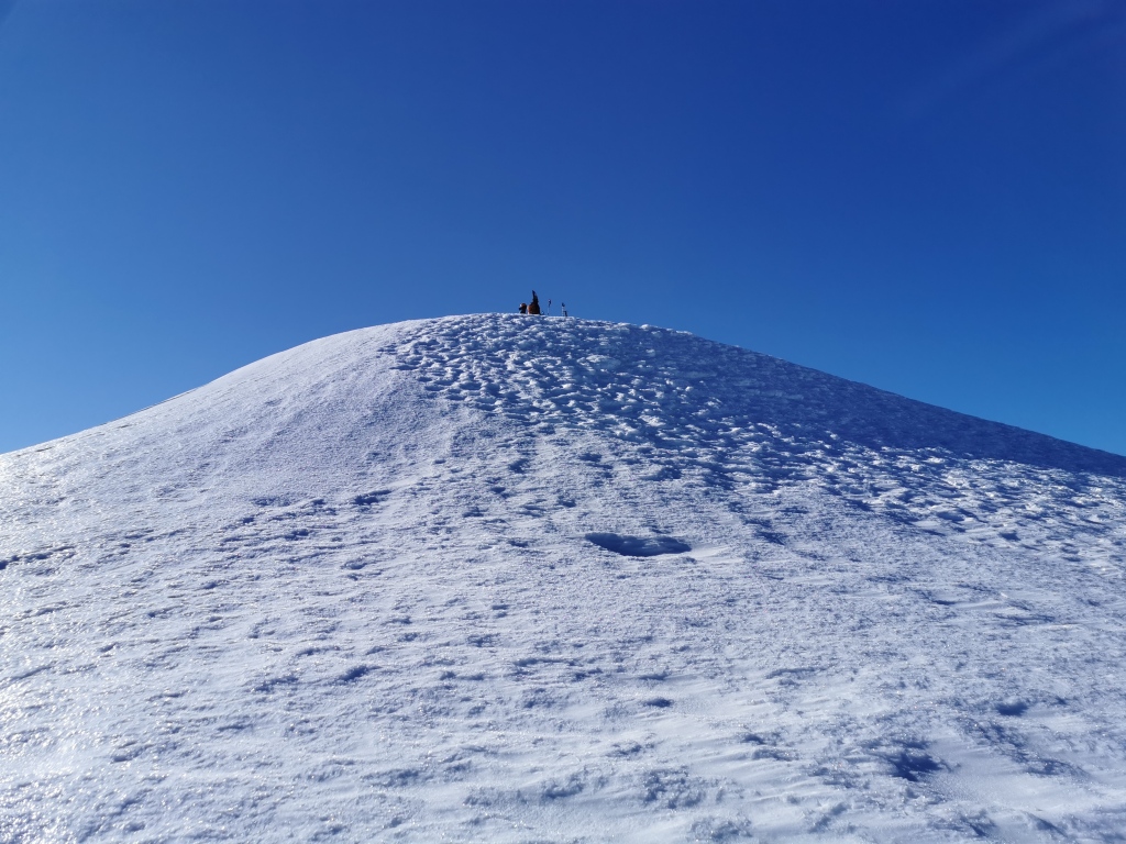
The summit cone is a gentle, open area about the size of a football field, containing one small little mound with a pirate flag that denotes the true summit of Baker. While we had the ascent route all to ourselves, with the closest group from camp behind by about 30 minutes, the summit was surprisingly busy, and our jaws dropped when we got a look at the other standard route up the mountain: Easton, starting at the Baker Ski Resort. An Everest-style conga line was slowly making its way up the mountain below us in a deep trench, worn by thousands of climbers on the route this season. My partner counted something like 140 people making their way up in this single file line. We were struck with gratitude suddenly for the calm on our side of the mountain (13 people across 4 groups, including our team of 2), and, despite the extra 600m climb pushing bikes up the washed out road, we were glad we chose the harder, quieter route.
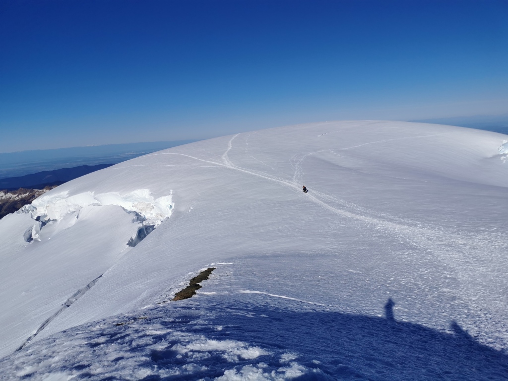
We basked in the morning sun at the top of the world for about 30 minutes, eating our ‘power food’ (homemade chocolate chip cookies and gummy worms). While it would be a hot day below, nearly 30 degrees Celsius, the summit at 8am was frigid and windy – certainly below zero, and sadly much too windy for me to pull out my secret birthday candle for a summit cookie. As the sun crested the mountain and began to strike the Roman Wall, we figured we should get a move on before the route began to get slushy. The descent began carefully, not knowing what to expect, but we discovered pretty quickly that it was way less steep than our fatigue made us believe on the way up. No need to face in and down-climb, and the snow conditions, just beginning to soften in the morning sun, were ideal for a rapid, cushioned, and relaxed decent.
The trip back across the glacier was uneventful. We stripped off our layers in the suddenly roasting sun, and used our GPS ascent track to retrace our steps through the crevasse bands, which looked very different in the light of day. As the snow got slushier, the glacier began to feel very long for our sun burnt legs and tired skin. I wanted nothing more than to reach camp, take off my boots, and soak my feet in the ice-cold stream next to our tent.
Finally, in a hilariously horrible attempt at ‘simul-glissading’ (ie: sliding down the snow with the alpine rope still connecting us), we tumbled in a hot-icy mess at the base of the campsite. Two minutes later, we were at the tent. Camp to camp, about 9.5 hours. The next closest group, the ones we had passed in the dark that morning, were nowhere to be seen on the vast glacier above camp. We wouldn’t see them there until about an hour and half later, after we had made lunch, changed, packed up the campsite, and were ready to leave.
I regretted that we hadn’t planned for another night at the campsite – it was superbly beautiful, and I would have very much welcomed a nap. But, while we had an extra dinner, we had no beer. A deal-breaker, in other words. Next time, I vowed to bring some cans to chill in the ice-cold creek for celebration post-summit. So, we shouldered the packs, and began the 1300m descent. We made short work of the hiking trail, but boy were we glad to be reunited with the bikes at the trailhead parking lot. While the ride down was horribly uncomfortable for me on my road bike (a ridiculous choice, I know, but it has somewhat beefy tires (32s)), it was definitely better than walking. The road is a mix of gravel and pavement, with some potholes; the gravel is loose-ish in some spots, but I could always find a good-enough track, and only had one near-bail on the way down. We cleared the 8.5km road in about 35 minutes of nearly constant downhill. Back at the car, we Tetris’d the bikes and packs back into our inappropriate adventure car, and began our drive back to Canada.
Overall, the trip was exactly what I had expected: low-stress and very easy as a ‘mountaineering’ route, but physically very challenging due to the amount of elevation gain. I was never worried, scared, or nervous about any of the terrain (as seems to be the hallmark of mountaineering routes), but the amount of climbing over 2 days pushed me to my limit, considering that I hadn’t done any proper training beforehand. But now, after four years of failed trips, I can finally cross Baker off my list. It made for an epic birthday weekend trip, and boy does it feel good to see that beautiful, snowy triangle looming in the distance from all over Vancouver and the Lower Mainland!
The Breakdown:
Cycle/hike to trailhead: 8.5km, 630m gain, 2 hours
Trailhead to camp: 5km, 650m gain, 2 hours 15 min
Camp to summit: 4.6km, 1430m gain, 5 hours 15 min (average ascent time is 5-7 hours per trailhead sign)
Summit to camp descent: 4.6km, 4 hours 15 min
Camp to trailhead descent: 5km, 2 hours
Trailhead to car descent (by bike): 8.5km, 35 min
Totals: 36.2km, 2700m elevation gain, 16hrs:15min moving time
Technical gear:
Climbing harness, crampons, helmet, ice axe, 30m alpine rope, crevasse rescue kit, extra large bag of emergency candy

Thank you for taking me on another adventure through your blogs. It is a beautiful mountain. Now every time I see Mt Baker I will say my niece climbed it❤️
LikeLike
Wow, what a climb! Love reading about your adventures, keeps me wanting to do more.I am hoping to do some easier Baker hikes next year
LikeLike