
Completing a lesser known traverse to a popular hiking trail at Coquihalla Summit, BC
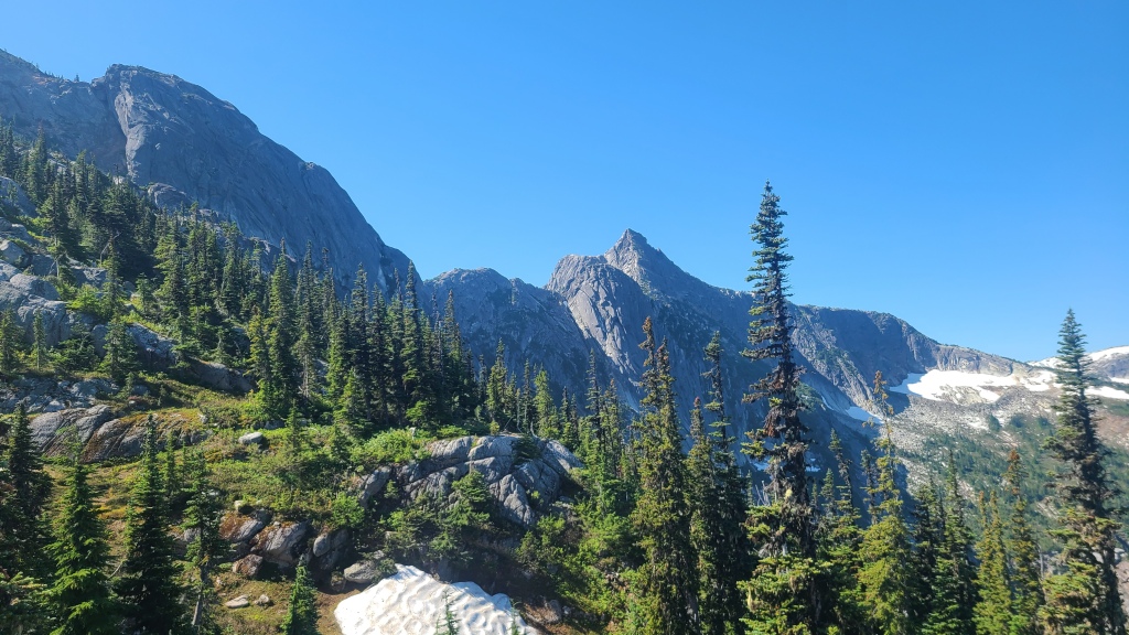
I was warned by an alpine guide recently: “If there’s no beta on a route, don’t do it”. (Beta being the climber slang term for route information.) Hard to argue with professional advice. But doesn’t the lack of description and directions make the climb more exciting, more adventurous – a true foray into the unknown? How about if there’s just a little bit of information? Would that not be the perfect mix of excitement and safety? This is what we found in the Markhor – Needle traverse, in the Coquihalla Summit Recreation Area off highway 5 in southwest BC. It was hatched out of some obscure Reddit post I’m sure, but the photos were endlessly appealing: a thin, knife-edge ridge connecting the famous Needle Peak with its neighbour, Markhor. It was a traverse with some cool scrambling at least, perhaps light technical climbing and a few rappels at most, and beautiful views of the Coquihalla area, and furthermore, it was completely absent from the local scrambling and alpine climbing guidebooks. What a chance to explore something new!
After watching for the right opportunity for nearly a year, the stars finally aligned with the perfect combination of free time (a spare Saturday), weather (sunny, with zero rain in the forecast), and season (mid-summer, with no chance of snow on the higher portions of the traverse). In the early morning, we set off from Vancouver for the parking lot of the supremely popular Needle Peak hiking trail, located about 30 minutes outside of Hope, BC. Parking behind numerous other cars already queuing up for the Needle trail, we packed our day-bags, racked up our climbing gear, coiled our rope, and promptly set off in the wrong direction.
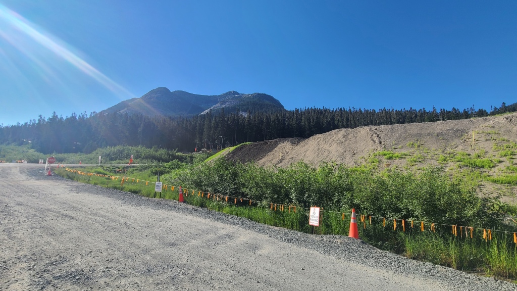
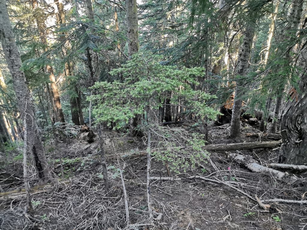
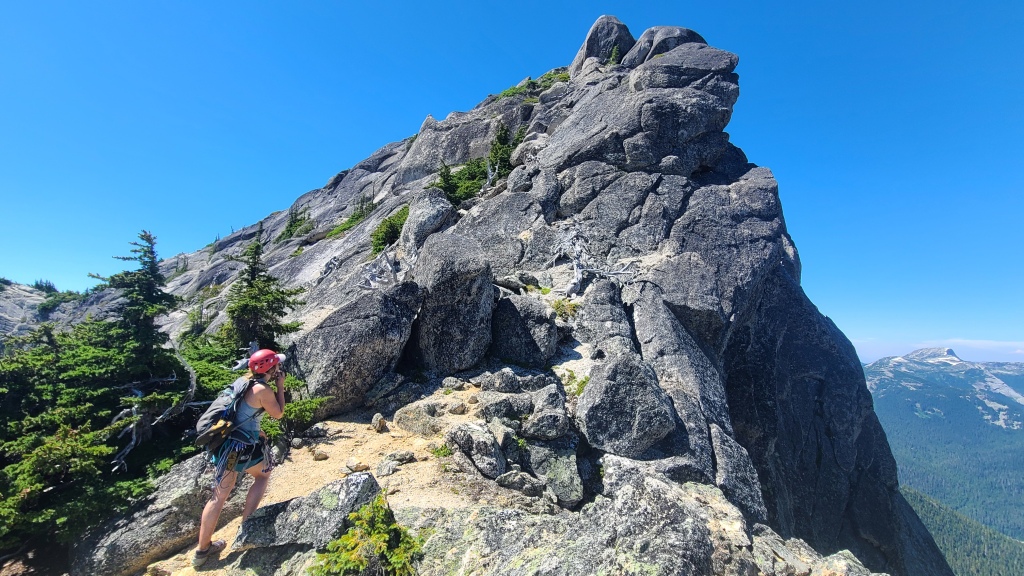
To begin the Markhor – Needle traverse, one must first locate a somewhat bush-wacky and faint trail up the side of Markhor peak, directly adjacent (left) to Needle. The proper way to do this is to cut through the construction site above the parking lot (subtly – although the security guy didn’t yell at us, we have talked to people with whom security has been quite cranky). From here, a footpath can be discerned; the trail is actually flagged at wide intervals, and looks like it has become much less bush-wacky than internet descriptions led me to believe. In our effort to covertly avoid the security guy, we avoided the construction zone, crossed a small creek, and were immediately thwarted by incredibly thick undergrowth. This forced a turn around and return to the construction zone, where we tagged along with a small group heading up Markhor to go high-lining near the peak. Once directed to the proper start, the trail was actually easy enough to follow – essentially, just keep working straight up. Eventually, the trees will thin, and you’ll reach gentle slab, followed by some light scrambling.
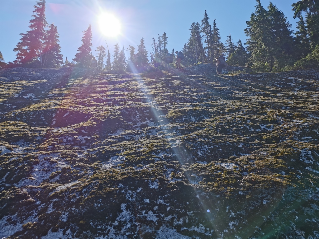
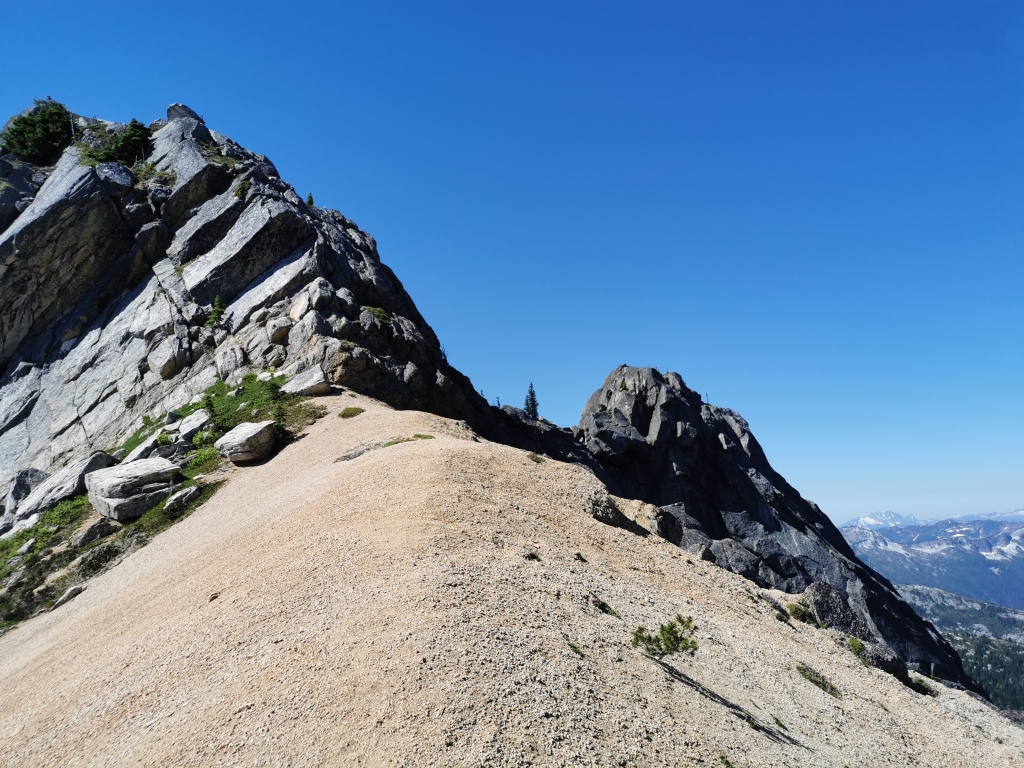
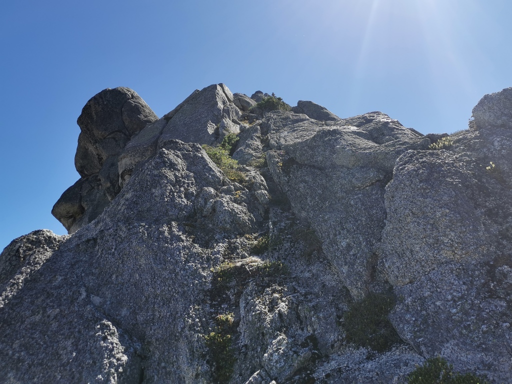
Reaching the top of Markhor is a cool trip in its own right, requiring some fun moments of route-finding and class 3 scrambling. Generally, we kept high and climbers left, and found easy climbing to the summit. There are some faint paths that traverse and descend climbers left, which we avoided. Here, we parted ways with the high-line group (who were to set up a slack-line between the peak of Markhor and a small neighbouring false summit). We completed the hike to the top of Markhor in about 2 hours. After some snacks and photos on the top, we began hunting for a path down.
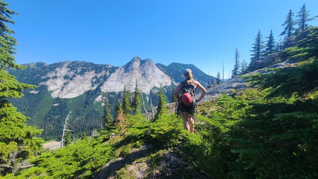
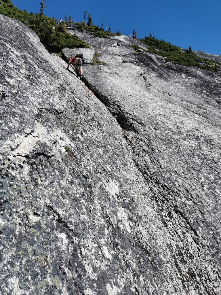
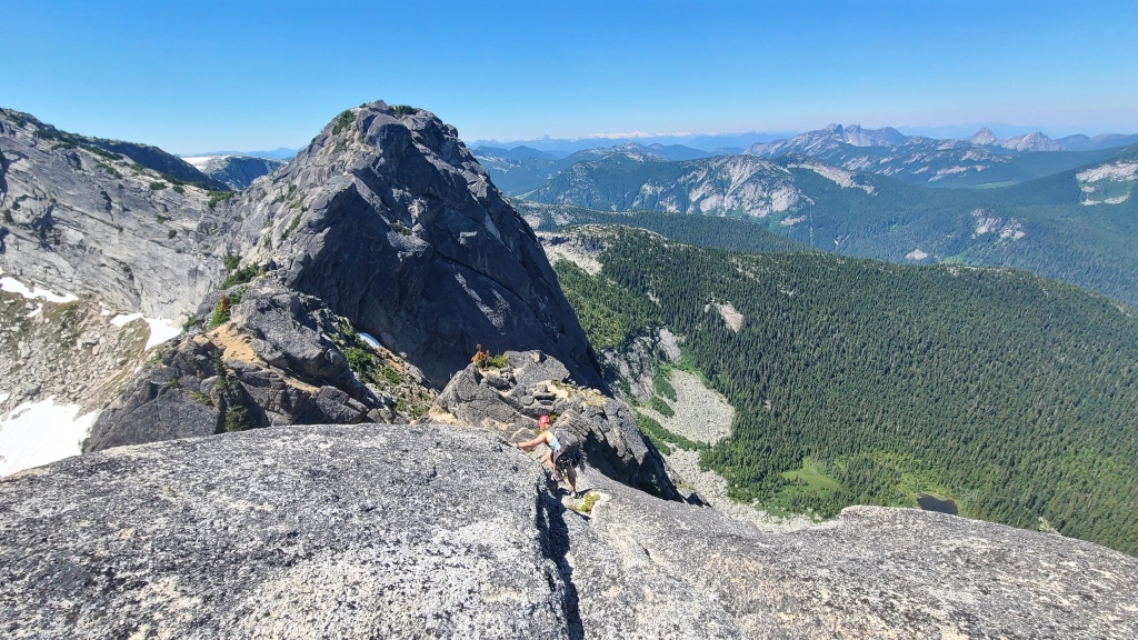
The beta to begin the traverse is to find a trail descending off the summit down somewhat steep slab to the ridge leading to Needle. The direction is easy enough to assess, as Needle is obvious in the distance, but the micro-terrain proved an interesting challenge to tackle. We followed what we thought was a faint footpath (or so we hoped) down from the summit, generally keeping skier’s left. However, we realized afterwards that we missed some notable landmarks contained in other trip reports, such as the notorious ‘leg-eating’ or ‘butt’ crack, a deep off-width crack to downclimb. However, our route had certainly been well-traveled. The crux of this descent was a fairly steep slab with a shallow indentation. A sad attempt to fix a handline for this descent had been attempted by numerous groups: a long, thin line of miscellaneous cord and string had been tied together, clearly by different parties at different times, in an attempt to extend the line and thus have something to hold onto for the psychologically taxing downclimb. While I had zero trust in that pathetic handline’s ability to arrest a fall and not snap, I’ll admit that I still held onto it as I carefully descended, rock shoes on, and face-in towards the rock, heart pounding more than a little. While we considered a rappel, there were no trees big enough and alive enough to rap off (the handline was simply tied to a whimpy bush. Another strike.). But I’ve downclimbed worse, and it seem reasonable enough. My partner left his approach shoes on and breezed down without a care. Go figure.
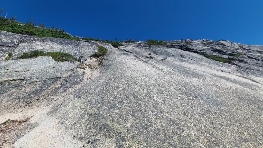
The slabby downclimbing continued. We looked for path of least resistance, aiming for the low point of the ridge below us, and looking for ledges, steps, and footpaths whenever possible. I left my rock shoes on and breezed through the slab but continuously slipped on dirt and grass, whereas my partner used his approach shoes with the opposite problem. Pick your poison! Unlike some other trip reports, we did no rappels here; we found no opportunities to do so – only small bushes and thin trees, and no blocks or horns. We suspect the route described by these trip reports was skier’s right of us.
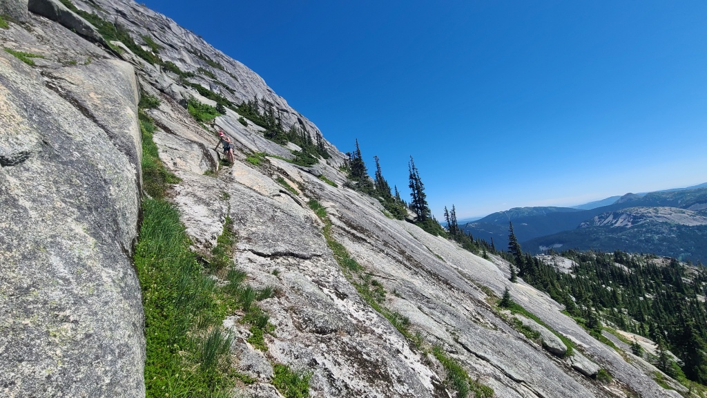
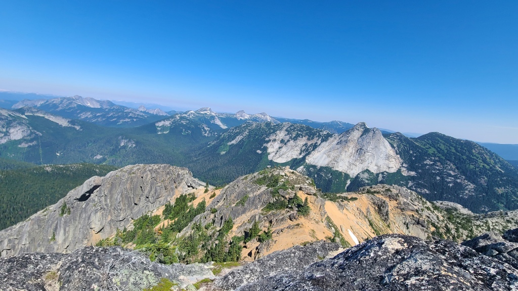
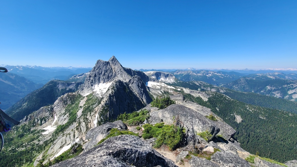
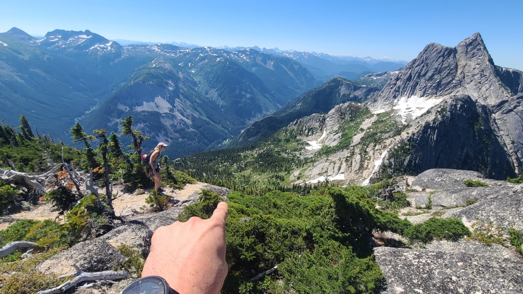
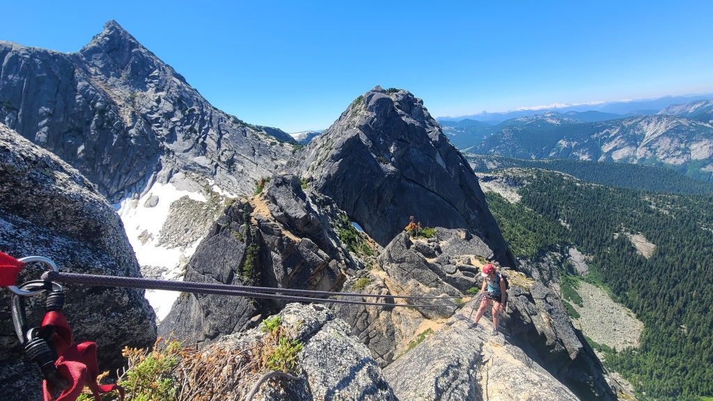
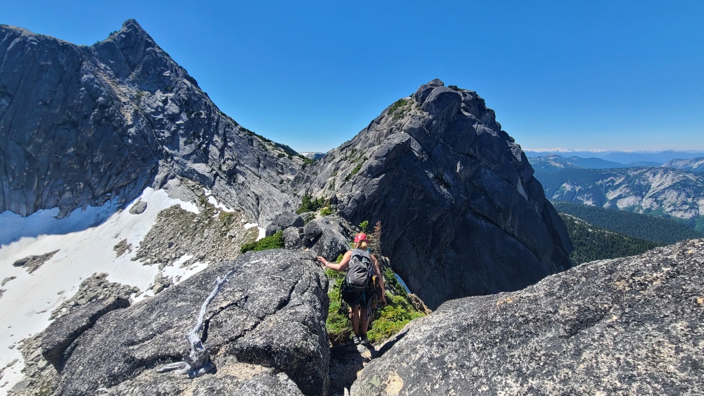
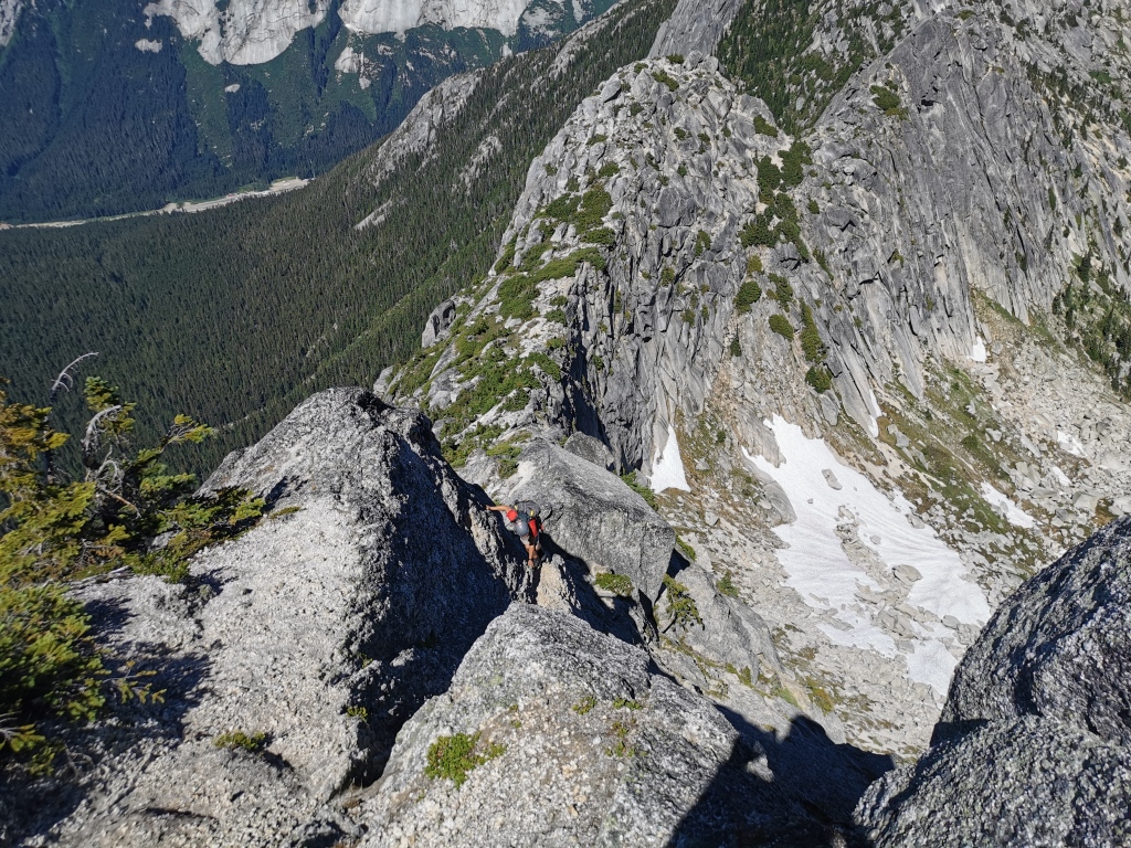
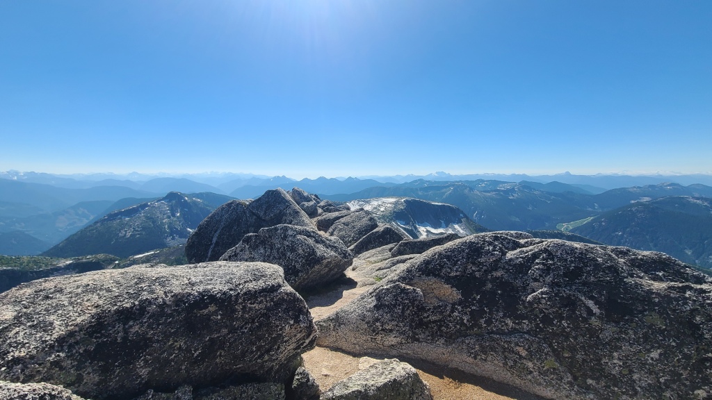
Finally reaching some shade at the low point of the ridge, we paused to gulp water and reapply sunscreen. I’d consider the downclimb from Markhor the hardest (or most psychological) part of the route, and thoroughly enjoyed the climbing from here on. From here, the ridge is a series of ascents and descents through a number of bumps, culminating in a final climb up the backside of Needle Peak itself. Much of the ridge is hiking terrain, with obvious route finding – just stay on top of the ridge! A few scrambling cruxes with some exposure awaited us however.
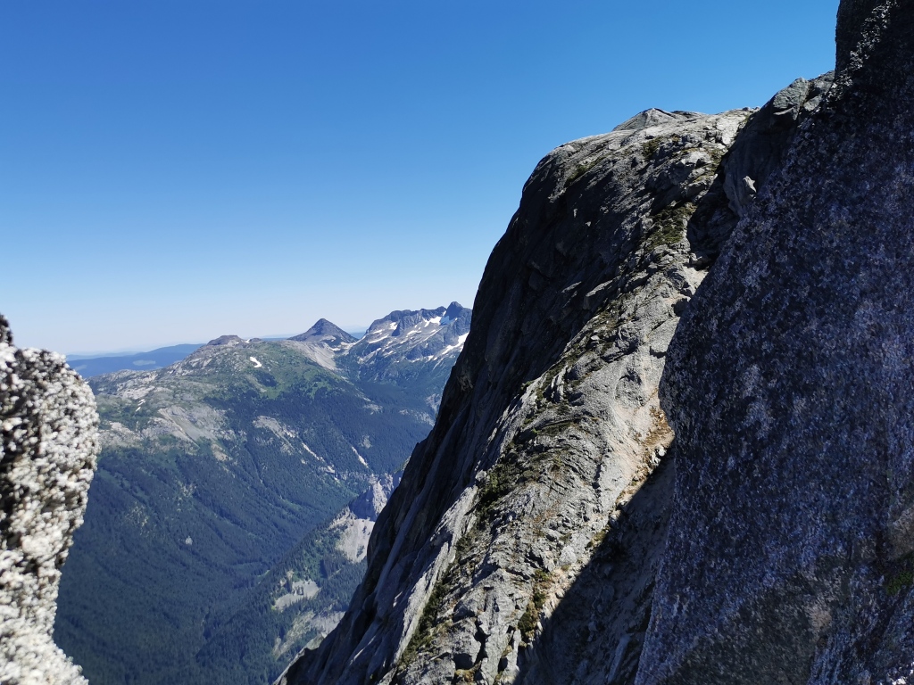
The next crux is the “au cheval”, a thin triangle of slab with extreme drops on either side. (“Au cheval” is a climbing technique whereby you sit and straddle a sharp ridge.) A shiny new piece of nylon webbing, complete with rap ring, had clearly just been left slung over a rock horn for a rappel to bypass this section. This suggestion to rappel was too perfect to ignore, so we quickly prepared the rope and enjoyed this exciting rock feature with no fear of falling. I’ve met people who have downclimbed this section without a rope, and they describe it as terrifying, so while it is doable, it’s perhaps not advisable unless you have nerves of steel. A 60m rope was more than sufficient – the section is only about 20m. From here, we stayed low and climber’s left, circling around left of the next bump.
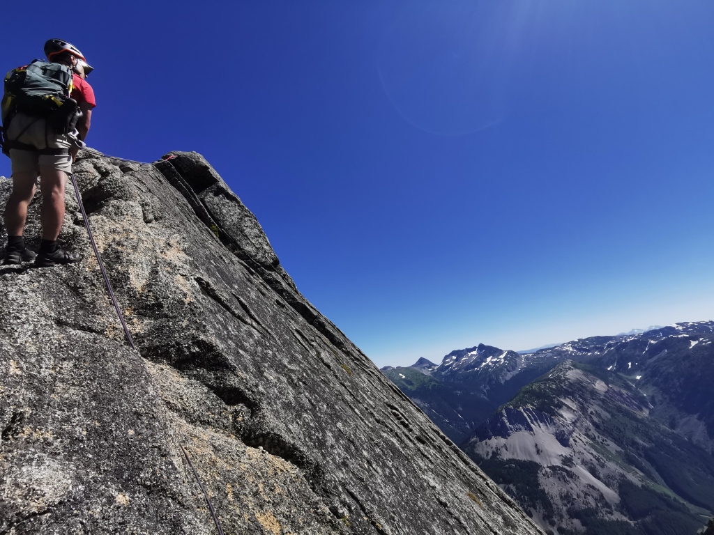
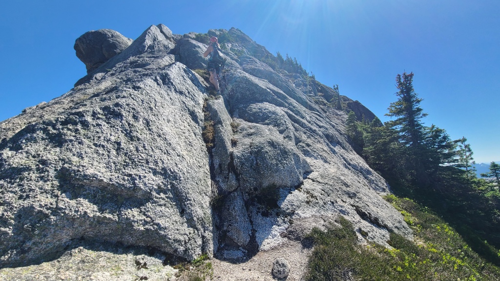
The ridge continues in more-or-less the same manner from the au cheval. The next crux awaits on the last bump before the final climb up Needle. There is generally a very reasonable path up, with large blocky holds and the occasional tree to grab. However, there’s a somewhat thin traverse near the top on a crimpy hold that’s a bit loose. We did not feel the need to rope up, as some other parties have, but to each his own.
From here, it’s a straight shot up the back of Needle Peak. The climbing here is very enjoyable, and a little more thoughtful and technical than the ridge, with some sustained sections. Again, however, we did not feel the need to rope up and place gear, nor did we even switch to our rock shoes. A handful of moves require good technique and balance, and thoughtful route selection is key, as well as testing holds before committing. If you felt the need to place protection, gear placements felt somewhat minimal to me, although I was not seriously watching for them.
By the time we climbed up and over the top of Needle, we were seriously thirsty, bug-bitten, and scratched. It had been a 30 degree day thrashing through bushes, and the 6-something liters of water we had brought between the two of us were not enough for such a long day. We greedily ate our fluid-rich apples, re-packed our climbing gear, and set to work on a quick descent of the Needle hiker’s trail, stopping only to chat with ascending hikers (who noticed our rope and rack and were eager to talk about climbing), and shove handfuls of snow into our mouths. As one does in situations of thirst, we talked mostly about water on the way down, vowing to relieve the Zopkios food truck of all their cold drinks once we arrived. Aside from this, the hike down was uneventful, our car significantly dustier than when we had left it, and our victory Gatorades sweet and refreshing on the drive home.
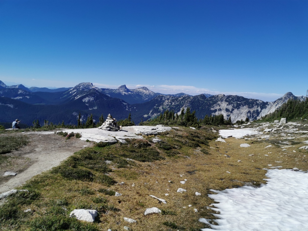
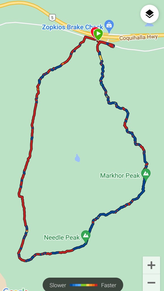
The total round trip time for the Markhor – Needle Traverse was about 9.5 hours car to car, with 8.5km distance and 1100m elevation gain. The trip was completed in late July 2022. There was no snow on the route (despite a record snowpack), but patches of snow were visible on some slopes, as well as adjacent to the hiking trail near the Needle summit.
Ever heard of the Markhor – Needle traverse, or any other lesser known scrambles? Let me know in the comments below!
