Climbing Mt Shasta in Northern California
What do religious pilgrimages and mountain climbing have in common? Apparently, they intersect at Mount Shasta, in Northern California. Mt Shasta made it onto my climbing list years ago, mostly due to its honoured place as the second tallest of the Cascade volcanoes, right behind the majestic Mt Rainier. As a non-technical but extraordinarily high peak, Chris and I were excited to tackle it as single-day trip. We were fresh off our ultramarathon in April, and figured we had the fitness and ability to tolerate suffering required for the project. But also, I was curious due some of the stories I’d heard about Shasta during my previous trips to California. Friends from the state had mentioned that Shasta was something of a spiritual centre for New Age mysticism in America. Further reading on the subject indicated that the peak had been attracting spiritual attention from numerous faiths for decades; everyone from Buddhists to Catholics, and of course the local Indigenous peoples, held retreats there every year. But the most compelling story I heard concerned the Lemurians. An 1899 occult book written by Frederick Spencer Oliver claimed that Lemurians, who began as a theory on our human ancestry according to a discredited 19th century zoologist, but ended up as mythological super-human beings, lived in a complex network of tunnels beneath Mt Shasta. Numerous accounts of white-robed figures showing themselves to believers have been reported since the publication of the book, and around the Lemurians has sprouted a devout following, many of whom make pilgrimages to the mountain every year wielding crystals to harness the spiritual teachings of enlightenment broadcasted by the subterranean society.
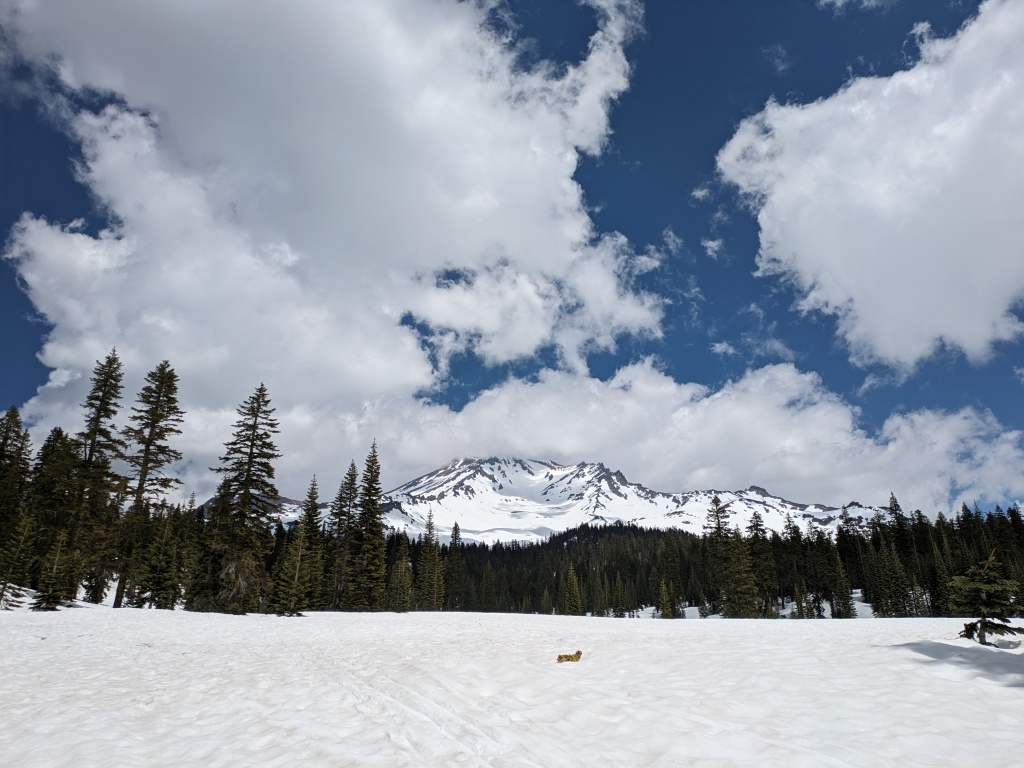
So what about Shasta made it the stuff of legend, more so than any other Cascade peak? It certainly was tall, if tallness is any qualifier of a spiritual heavyweight. It dominated the skyline as we drove from southern Oregon, snowy white in late May, a voluminous pyramid jutting up from the flat greenness of the country. At 4322 meters, it has the honour of inclusion on the “14’er” list, a group of mountain peaks that exceeded 14 thousand feet, coveted by many climbers. As altitude sickness, marked by headaches, light-headedness, dizziness, and nausea, can start to set in anywhere above 2500 meters, its height certainly made it formidable.
We pulled into the small town of Mount Shasta the day before the climb, setting up camp at Castle Crags State Park. We chose this site due to its proximity to some excellent climbing at Castle Crags, and of course, the presence of showers at the campsite! While I set up camp, Chris went to check us in at the office, casually dropping that we intended to climb Shasta the next day to the ranger, an old-hand who had been up there twice himself. While Chris played dumb as the ranger explained in exasperation to yet another idiot tourist that he was underestimating the mountain – this was no hike – Chris finally let on that we do our share of mountaineering, are armed with technical climbing gear, and just came from Mt Hood. This seemed to placate him, and began the running joke that Chris was more worried about our tent spot at the campsite than the massive, glaciated volcano that ate casual hikers for breakfast.
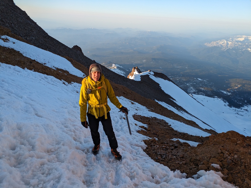
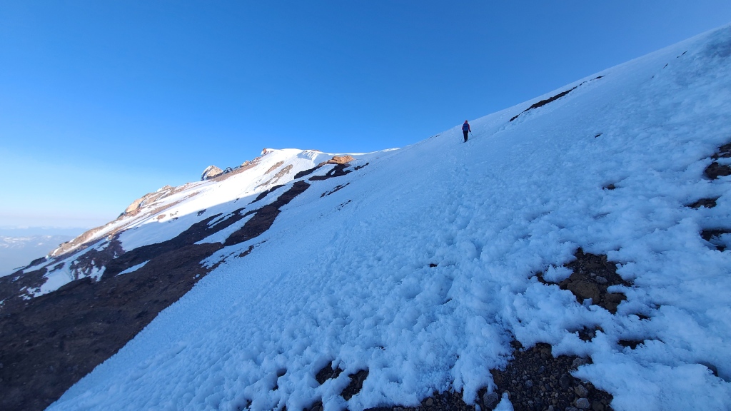
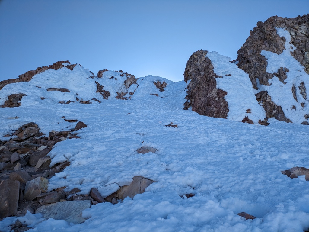
But this wasn’t our first rodeo, and we dutifully arose in pitch black night at 11:30 pm after only a couple hours sleep to prep for our climb. A 35-minute drive deposited us at Bunny Flats trailhead, a few thousand meters (2110 m) up the side of the mountain. In the shockingly cold darkness of the parking lot (a surprisingly busy lot, but then again, it was peak volcano-climbing season), we self-registered for the required permits: a free wilderness permit, and a $25 climbing permit. Bags packed, we threw our crampons on immediately to tackle the hard-packed icy slopes, and hit the trail at 1 am. Having learned that the secret to managing suffering is low expectations, I purposely told myself repeatedly that this mountain would be absolutely miserable so that I was not disappointed. I was convinced that the recent spell of warm weather meant that our crampons would be a foolish choice for the first half of the ascent, useless in slushy, warm snow – but alas, we had no skis nor snowshoes with us. Additionally, I was expecting a headwind the likes of which we experienced for hours on Mt Hood – so cold and strong in my face that I could barely breathe as we trudged up. I was very pleasantly surprised when neither of my doomsday predictions came true however: the snow was firm and icy under our crampons, and the wind was non-existent under the inky black sky.
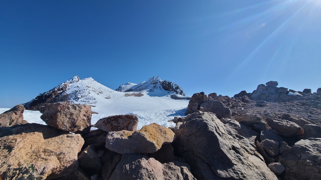
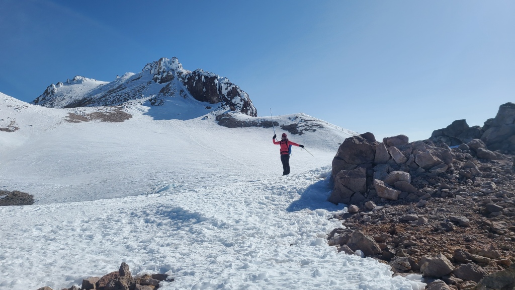
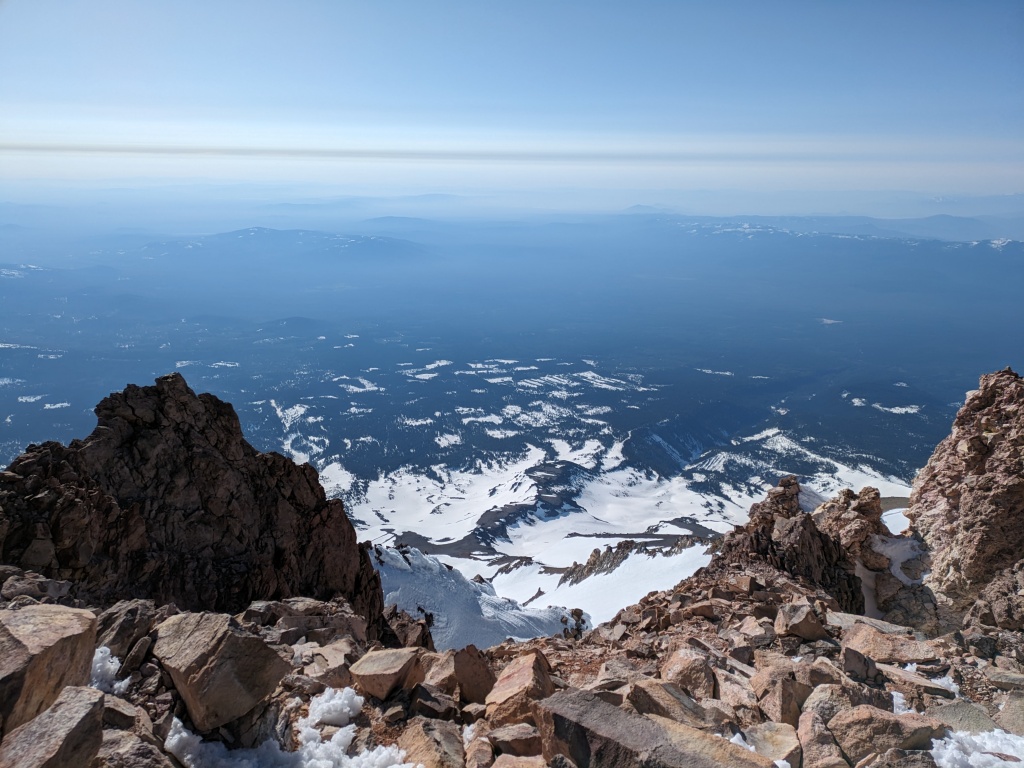
We had chosen the Avalanche Gully route up Shasta, a straightforward route following a long gully up the mountain. Despite its sketchy name, it’s the easiest and most popular route to the summit (except in the winter, for obvious reasons). At this point in the spring, the snow was generally too consolidated for avalanches, the exception being the wet-loose variety triggered by heat and melting sluff. After a couple hours of gradual uphill hiking through the gully, with only a handful of other headlamps twinkling in the distance to keep us company, we reached the campsite at Helen Lake sitting at 3180 m. Here, we found a sleeping camp of four tents on the frozen lake plateau, its inhabitants yet to stir for their summit attempt. I was a bit surprised by this, as we had purposedly started very early to maximize our time on firm footing before the icy gave way to morning slush and drearily slow travel (as well as decrease our exposure to wet-loose slides). But hey, maybe the sleepers were skiers! As most people that climb Shasta do it in two or even three days, it seemed like it would be a pretty quiet day on the mountain.
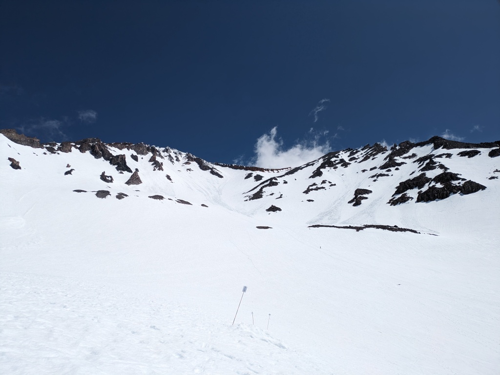
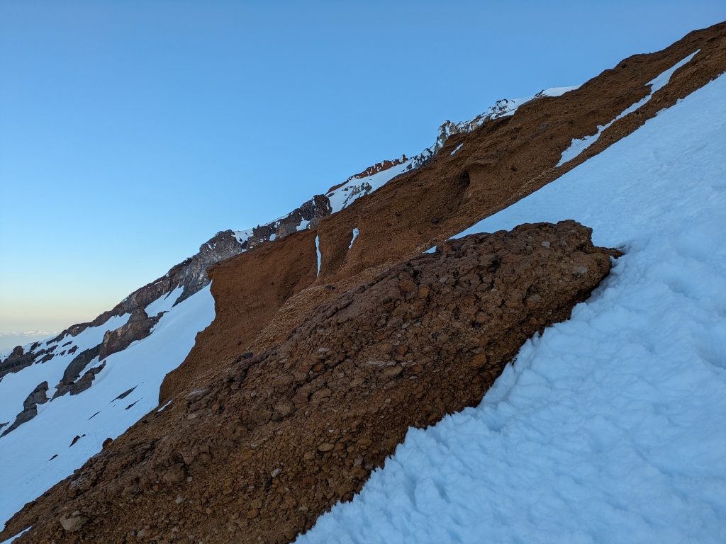
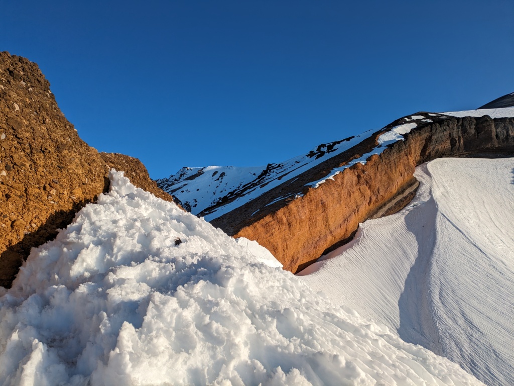
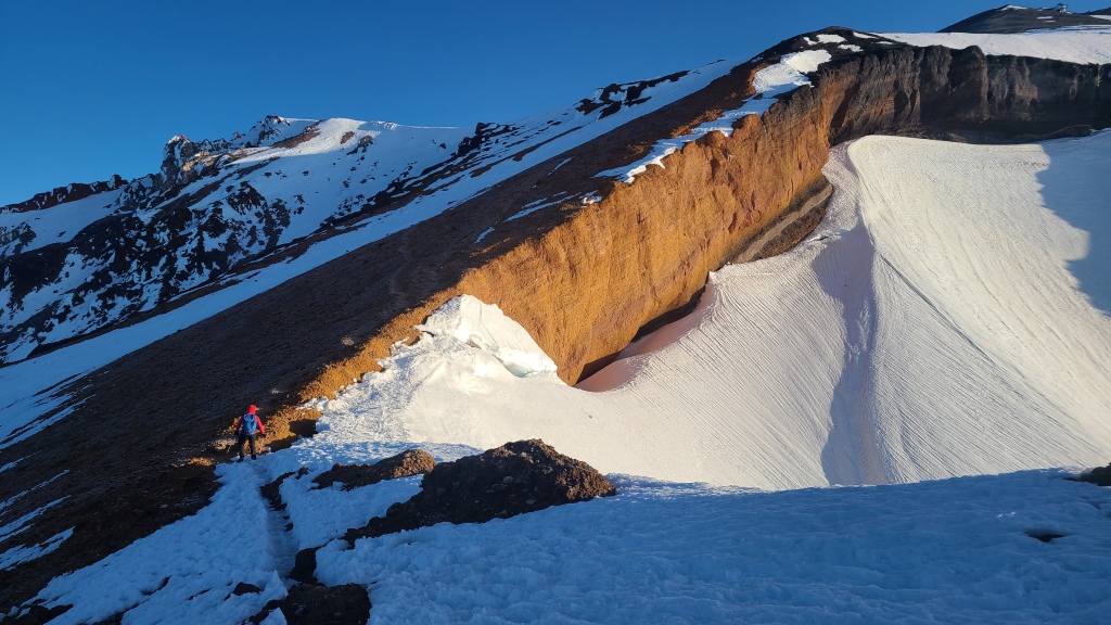
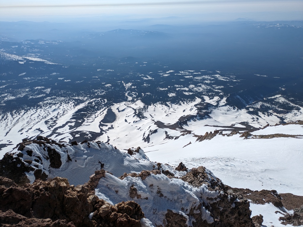
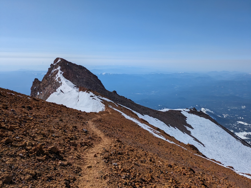
The most challenging route finding of the trip occurred right after the campsite, in addition to the technical crux of the route. From the lake, a massive 700 meter climb awaits. Climbers generally aim right as they trudge up this gradually steepening slope, ice axe in hand to protect against a fall, altitude starting to hit each individual like a sack of bricks. As the heat of the day begins to strike this wall, overhead hazard exists in the form of loose rocks falling from above as they loosen their bonds to the frozen earth (or are knocked down by careless climbers). A few rocky landmarks – the ‘heart’, the ‘thumb’, and the ‘red banks’ – are all climbers have to orient themselves to the correct chute that will lead them to a sub-summit ridge. However, in the blackness of the early morning, spotting these landmarks was not an easy task. I led us to far left, and ended up making a long traverse when the ‘heart’ finally came into view in the milky blue light of approaching dawn. From here, conditions advice provided by the park rangers instructed us to disregard the ‘standard’ approach towards the rocky pillar of the ‘thumb’ due to a quickly widening bergschrund and moat on the backside glacier grazing the top ridge, instead skirting just right of the ‘red banks’ and up through any one of three chutes to gain the ridge. Simple advice which became clearer as the sky lightened and the ridge was within striking distance, but the challenge quickly changed from route selection to altitude. I had experienced some mild difficulties with altitude once before while climbing Mt Baker in northern Washington – a small headache coupled with exhaustion in the thin air as I trudged through the steep climb of the final headwall – but it was nothing compared to what was starting to hit me on Shasta. A headache and a tiny bit of light-headedness began to set in, along with a knowledge that I must slow down and be extra precise in my movements because my motor skills were no longer 100% of normal. But the biggest indicator of the onset of altitude sickness, and something that I couldn’t simply chock up to tiredness from a huge climb on a couple hours of sleep, was that Chris had suddenly fallen behind me. Chris, the speed-demon usually charging ahead at suicide-pace, was now slower than me. Oh boy.
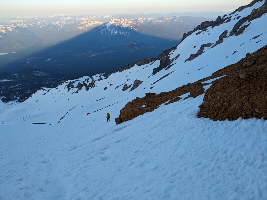
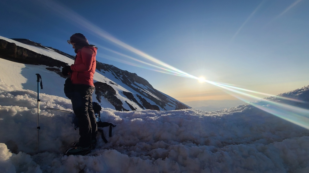
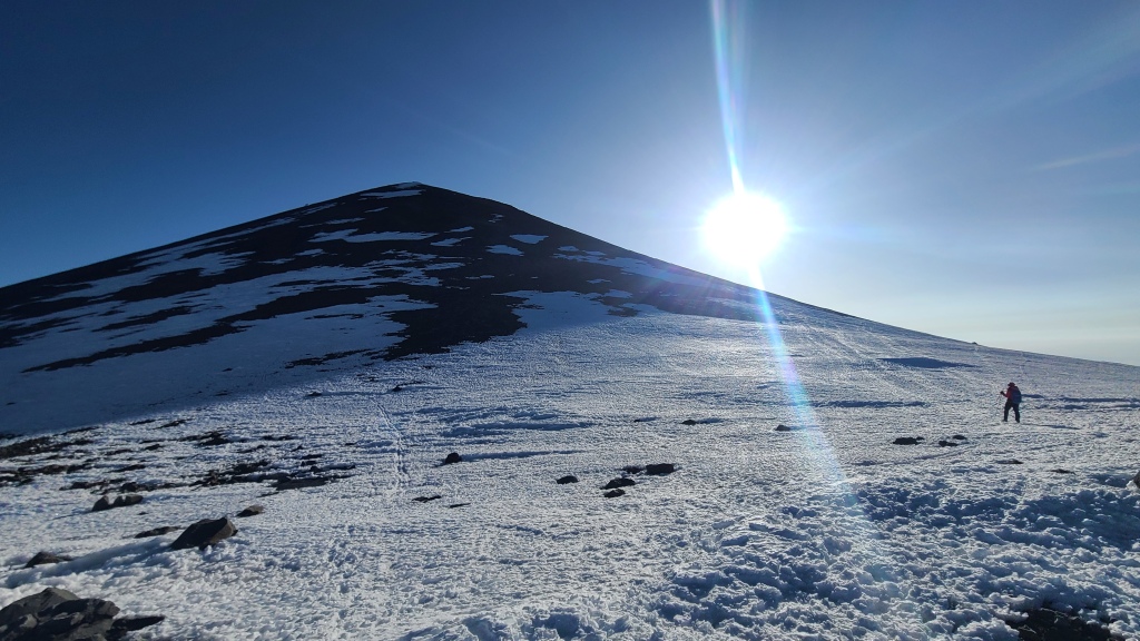
Some freak combination of factors had apparently stacked such that Chris was getting slammed with an awful bout of altitude sickness. As crappy as I felt, his capacity for suffering is a near-bottomless well, and I knew he must be near the bottom of it if he was pulling back and expressing discomfort. But here we were – more than halfway up the mysterious behemoth of Mt Shasta – and I’d be damned if I was going to wake up at an ungodly hour a second time to try again. It was our ultramarathon training of the previous months that saved the day. The fitness was not at all the problem; even though we’d already climbed nearly 1500 meters that morning, our legs felt good enough. The problem was psychological: another 800 meters remained. 800 meters of bracing wind, numb fingers, upset stomach, spinning head. Another 800 meters of struggling to intake food and water to fuel the steps. Another 800 meters of struggle and discomfort. But as I’d learned while distance running, it’s a mistake to think about the end game. It’s too far, and overwhelming. I set my eyes on the ridge above us, maybe 350 meters, and just now tickled with rosy morning sunshine. That ridge was all that mattered. That was the only goal. It didn’t matter what happened afterwards, as if nothing existed beyond that skyline. I suspected that Chris was full of doubt at this moment, but asked “can you make it to that ridge? Do you have that in you?” He did, and we made it past the first leg of the psychological crux and onto Shasta’s ridge above the Konwakiton glacier.
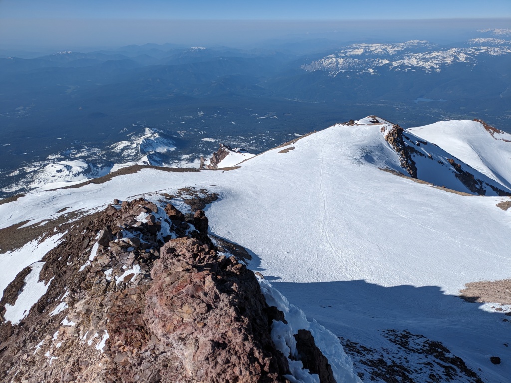
After forcing ourselves to consume some food and water in the morning sun and eying the next stage of our climb, we decided we had a bit more in us. A gentle path, flat at some points, and gently ascending at others, led to another ridge and skyline, significantly less effort than the previous push. Unfortunately for me, a long ridge and false summit adorned the top of this ridge, and my less-than-clear thinking put it in my head that I was looking at the top of Shasta. Looking confusedly at my Garmin GPS watch, noting my current elevation, and amount we’d climbed so far, and the elevation of my fake summit, I knew the numbers didn’t add up – I was missing 400 m. I convinced myself they were wrong. All of those numbers were wrong, and what’s math good for anyway!? That was my summit, and I was so close. Upon reaching a flat plateau ahead of Chris, I hurriedly slammed down a Clif bar and marched purposefully towards its ascending banks. At this point, Chris called out for me to stop, pointing instead directly behind me to what I realized, with a slap in the face, was the next stage of our climb: Misery Hill. I’d seen it on a map, knew it existed, and knew it was our route, but double checked my trail map and GPX track anyway, trying to manage the rapidly spreading cracks in my crumbling spirit. The ‘summit’ I’d hung my hat on didn’t even look like the summit in the photos I’d studied before the trip. Shasta had led me to depths of self-delusion I didn’t know I had. Was that a spiritual lesson?
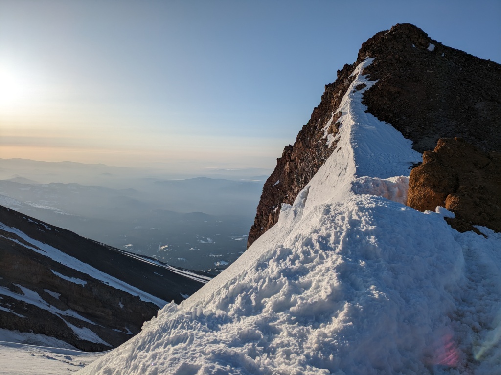
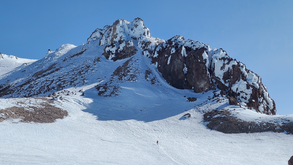
Shaking it off and getting back on track, we began the slow plod up Misery Hill, stopping after nearly every short switchback to catch our breath and allow the burning in our legs to subside. The switchbacks were mercifully short on the obvious track of gravel and rock however, weirdly clear of snow. But the climb up the hill was a further detriment to our rapidly diminishing energy reserves, and when I was finally standing atop Misery Hill, Shasta summit now firmly visible in front of me, I wondered if I had it in me. From my feet, a short descent led to a friendly and sunny plateau, but a blue wall rose quickly out of it to encircle the rocky flanks of the jagged summit, icy in the shade and sharp chill of the thin air. A little part of me – that part we all have that looks for reasons to quit when we’re uncomfortable – was trying to find a reason to end my day here, atop Misery Hill. But I came up blank. I stared at that summit, and it stared back, and I knew I had it in me, those final 150 meters, and that I had no valid reason to turn around.
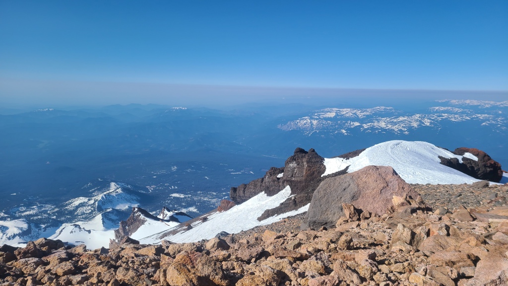
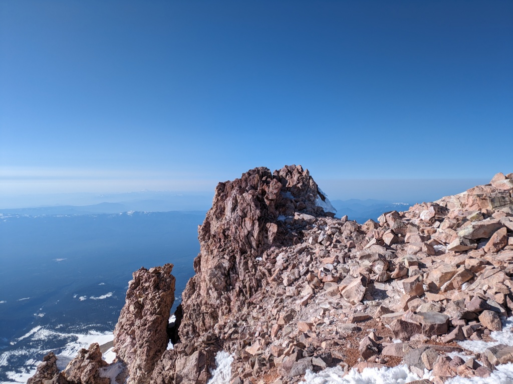
The plateau felt as gentle as it looked, and a final surge of adrenaline and desire to escape the rotten smell of the nearby sulphur springs got me up the steep ice surprisingly quickly. I think the standard ascent of the summit block wraps around the rock north, taking a gradual ramp, but I chose instead to take a steep-ish chimney. Large, blocky steps had already been kicked in and frozen, and these got me up as easily as climbing a ladder. At my feet lay the summit register box. I dropped my pack and ice axe, and scrambled on top of the rocks to sit on the true summit for a moment and savour the victory. The single-day elevation gain – what ended up at 2150 meters for the day – plus the ravages of altitude sickness, had made this the most physically demanding mountain I’d climbed. I’d climbed technically harder mountains, alpine rock and snow and ice, where fear and skill were the dominant themes, but Shasta had presented a new flavour of challenge that was uniquely satisfying.
Descent from the summit was slow. I downclimbed the chimney very slowly, aware that my motor skills were sub-standard due to the light-headedness. It was fortunately short, and I was soon back to Misery Hill, and we were descending in earnest. Just past the bottom of the Hill, we encountered a group of skiers boot-packing up. It turned out they were the group we had passed in the wee hours of the morning, also attempting a single-day summit. We were suitably gratified that they were impressed with our speed – I think our tired minds needed the morale boost to make it through the descent! We began to encounter many other groups of backcountry skiers as we left behind the gentle ridge and dropped onto the steep wall around the Red Banks. It turned out we were the only two climbers not armed with skis that day. While I knew I’d soon be jealous of their quick descent of the lower mountain, I did not at all regret our decision of boots and crampons; there was no ascending of the upper mountain on skis, and climbing the worst of the route in heavy ski boots with skis on my back only to have to hike back down another third sounded absolutely horrible. After a brief and failed attempt to glissade down the hard-packed ice of the headwall above Helen Lake, we submitted ourselves to the long walk.
Heat grew as the day mounted on and we lost elevation. Layers came off, and we began to sink deeper with each step down. By keeping on the tracks of others’ footprints however, we were able to make it back to the parking lot with minimal sinking and almost no post-holing. We completed our climb, car to car, in just under 12 hours, including nearly 15 km of travel, and 2150 m of elevation gain. In short, we made it back to the town of Mount Shasta at a reasonable hour for lunch and beers. Mission accomplished.
Reflecting back on my time on Shasta, I ask myself the question: did I have a spiritual experience? In one sense, the answer is a hard no. I did not see God, discover my faith, or encounter otherworldly white-robed Lemurians in the snowy vistas. But did I find some strength deep within myself to overcome challenge and transcend physical suffering? Yes, I did. And do I find myself leaving with some sense of kinship with this beautiful, powerful, and wild place where I’d suffered and triumphed? Again, yes. Having experienced hours of light-headedness during the climb, and especially hearing about Chris’ more severe altitude sickness symptoms of dizziness and spotted vision, it isn’t difficult to imagine the superstitions that might arise about the source of such phenomenon in a world pre-dating the discovery of the medical condition, phenomenon which could give rise to all manner of spiritual beliefs and rites. I arrived intrigued by the myths of Mt Shasta, and the methods by which to scale it, and I can leave Shasta now with a better understanding of both.