
A spring ascent of the east ridge of Mount Harvey in Lions Bay, BC
“Wow, you guys are really prepared!” I looked up proudly from my task: waxing the skins of my backcountry skis so they wouldn’t clump with wet, spring snow. It’s 6:00am in the parking lot, and I’m surrounded by skis, avalanche gear, ice axe, and GPS as we prepare for our day’s ascent. “You brought headlamps!” Oh. Our cheerful neighbours were very impressed with our forethought in bringing light for our pitch-black start. They wandered off happily into the darkness, a single phone light illuminating a small patch of ground in front of them. Hoping they were just off to Tunnel Bluffs, I resumed my preparations.
The parking lot in Lions Bay was strangely full at this hour, considering it was still early March. It’s not a big lot, but it pained me a little to realize that, even in shoulder season, one has to get up before the crack of dawn to get a parking spot these days. But it was going to be a beautiful day – clear blue skies and full sun, and unusually warm for March, so I suppose it wasn’t surprising that everyone was eager to make the most of their Sunday by spending it in the mountains. We, and likely most others, had chosen to wake up at 4am due to the increasing avalanche danger throughout the day as the sun melted everything in its path. Mountain objectives were safest when done early, before the snow dangerously weakened and began to slough, potentially creating wet, loose slides. While we weren’t convinced that we would find any quality skiing on this trip due to the recent weather pattern (high freezing level, and almost zero new snow in weeks), we were excited to check out a new area: the cut-block on the south face of Mt Harvey, in Cypress Provincial Park.
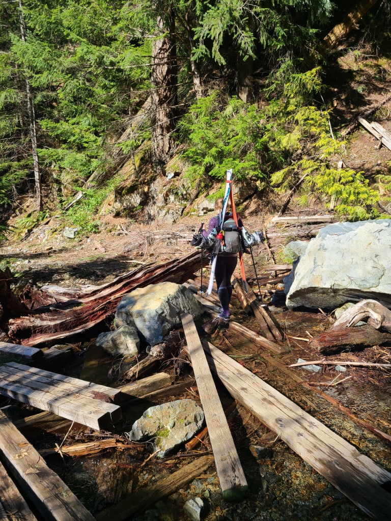
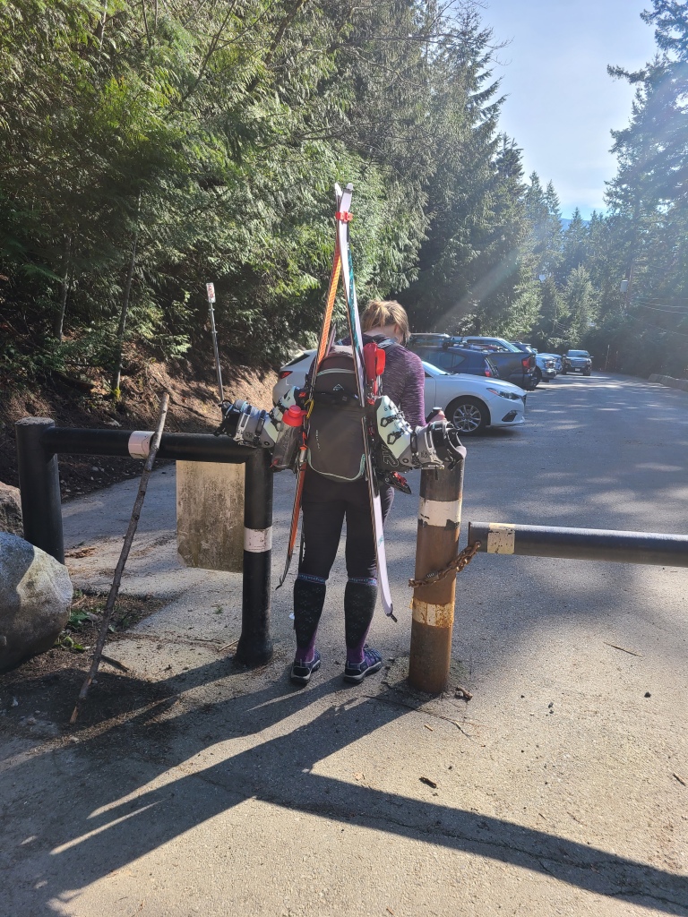
What was particularly appealing to me about this trip was the opportunity to do some actual hiking – the first we’d done all year in fact. The parking lot in Lions Bay – the trailhead for many popular summer trails, such as Tunnel Bluffs, Mt Brunswick, Mt Harvey, and the infamous Lions – is quite low (around 350m), and only gets snow when the city gets snow essentially. Because of the low start, we’d be carrying our skis on our backs and hiking up until we hit the snowline, which we estimated to be around 1000-1100m elevation (based on trips to North Shore ski hills). But because the weather was so glorious, and we had no more room in our packs for hiking boots (and because we were feeling a bit silly to be honest), we decided to hike the bottom in our west-coast best: socks and sandals. We’d switch to our ski boots when the going got too tough.
With our poor day-packs groaning under the intense weight of all our ski gear, we set off on the trail. We met a handful of others on the first portion, as all routes share the same start. A pair were headed off to Brunswick that morning, and had hiked Harvey the previous weekend. Another person, solo, was off to Magnesia Peak, just off the Howe Sound Crest Trail. Both parties looked better prepared than the first group we had met fortunately.
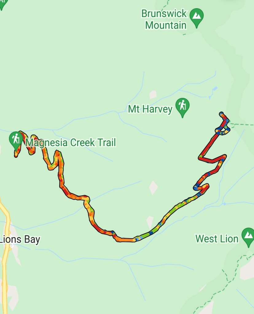
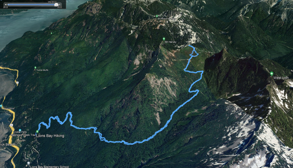
Our route was straightforward: we were basically following the logging road as far as we could take it into Harvey Creek and onto the slopes of Mt Harvey, then switch-backing up to the east ridge once the road ends. To get there, we’d keep right at all road junctions until the final turnoff to the Lions trail, making sure to ignore the summer Harvey trail as well – this trail is narrow and steep, and no fun for skiing. Snowshoers might have better luck there, but we were not going to touch it. At the Lions turn-off, we’d keep heading straight up the decommissioned road.
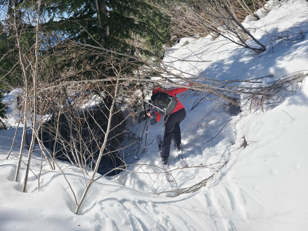
In researching the trip, we had heard words like “bushwacky” and “alder bashing”, and so were prepared for the worst. However, I would say that the road has largely remained clear (as of 2022); there are small sections of persistent alders that require some finesse, and a couple creeks to cross (bridges are intact), but we had no issues, and didn’t mind these short interruptions.
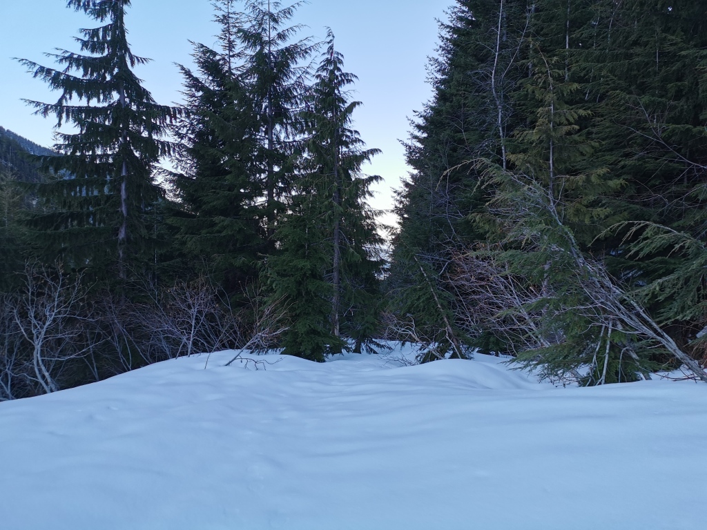
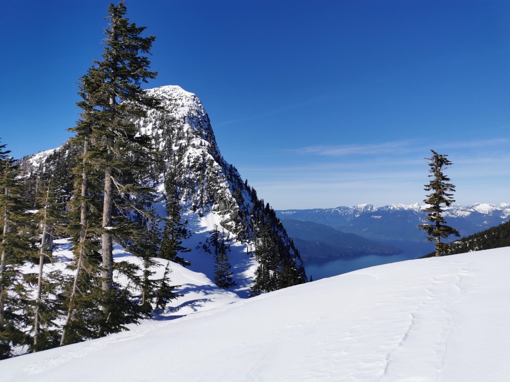
We cruised the lower trail in our hiking sandals, and didn’t encounter any snow until around 900m elevation. At the turnoff from the Lions trail, we were walking fully on top of the snow, but it was hard and crusty enough from the spring melt that our sandals were up for it with no post-holing (this section of road is not very steep either, so minimal slipping concerns). Around 1000m elevation, there was finally enough snow to switch to skis. In a clearing, the first section of the road after the junction where the sky opens up and you’re awarded your first view of the Lions in the distance, we took a short break to swap gear and eat snacks.
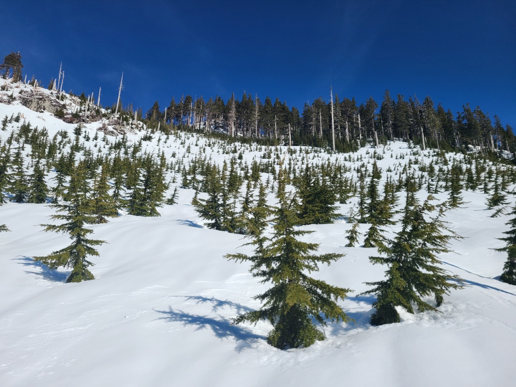
From here, we continued skinning up the logging road. The road is more open here, and less used; while it’s sort of possible to tell which direction the road switchbacks, I’d recommend a map/GPX track to confirm, as the overgrown sections can make you doubt that you’re really on the trail. While we saw the odd orange marker on a tree, they were few and far between. We followed this road up the southern slopes of Mt Harvey until reaching the bottom of the cut-block.
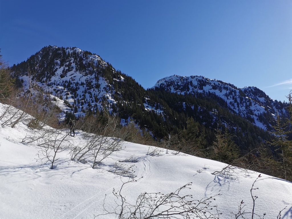
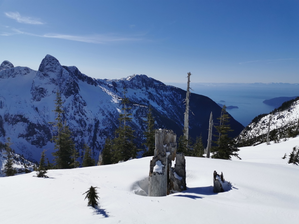
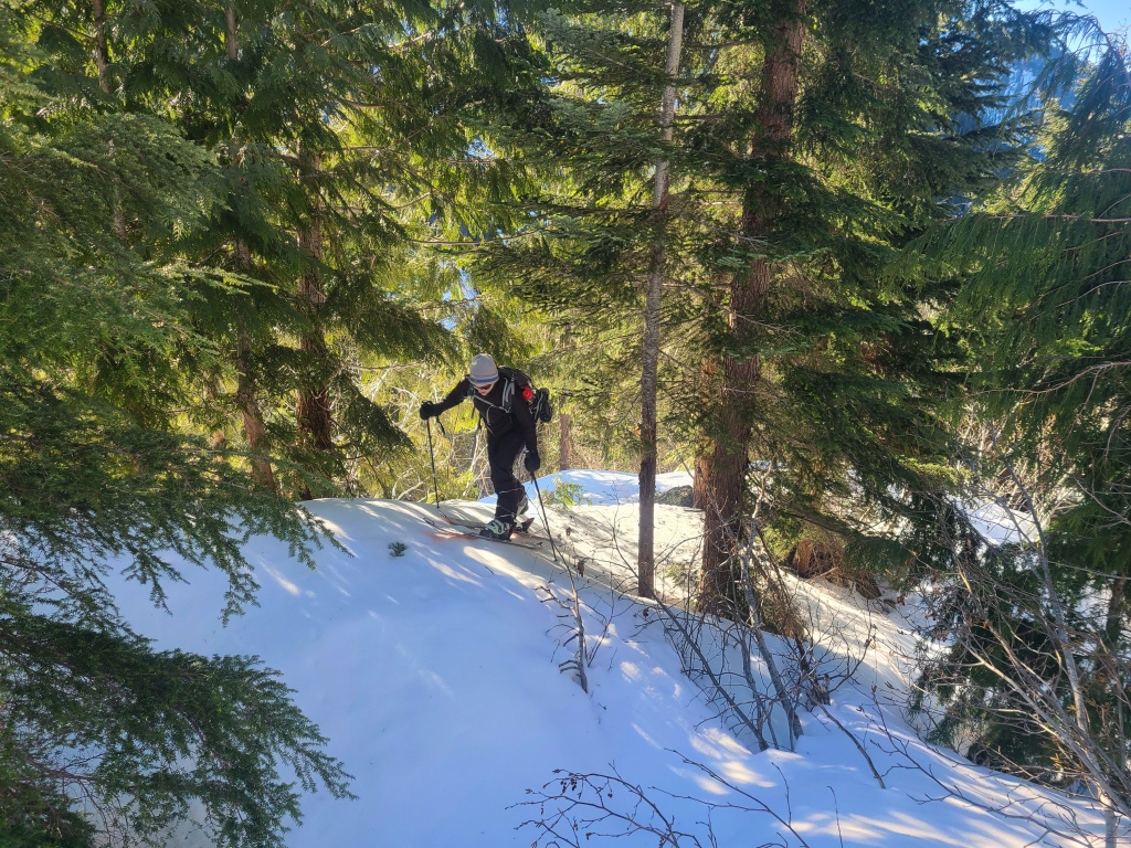
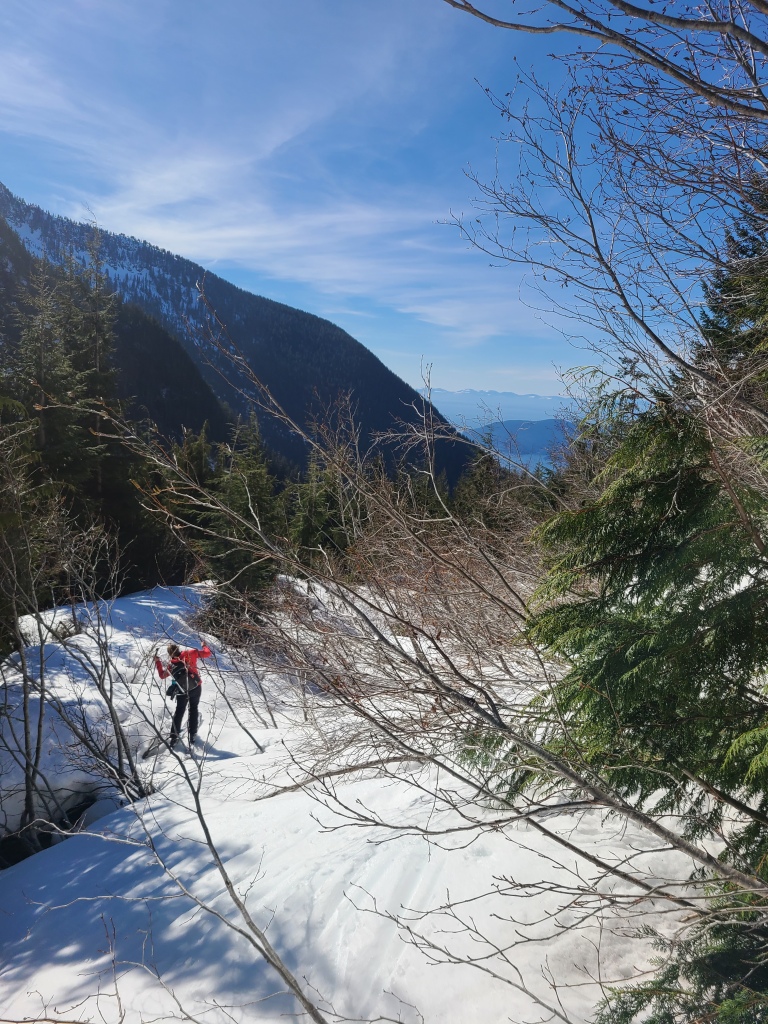
Mt Harvey is an appealing ski destination because of this cut-block. Logged in the 1960’s, only small trees grow there now, and they are widely spaced, leaving a steep, open glade running down from Harvey’s east ridge (the intersection of the Howe Sound Crest Trail actually). Here we left the logging road, and switch-backed up the cut-block, following the path of least resistance (and avoiding areas of the previous day’s slough) to the top of the ridge. While the steepest parts of this slope are probably over 30 degrees, we made it up on skis without having to boot-pack with some good route selection and solid kick-turns.
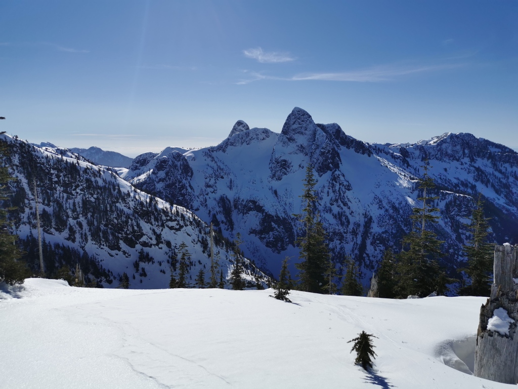
Cresting the ridge around 10:30am, the south-exposed slope was starting to melt and loosen in the warm spring sun, so we decided to ski the cut-block without delay and take a break once we were back on the logging road below. Looking climber’s left towards the summit of Harvey, we briefly entertained the thought of a summit-push, but the avalanche danger was worsening with every minute, and the north-east ascent was a somewhat dicey mountaineering line for which we did not feel fully prepared (we did not bring our crampons, and had only one ice axe apiece). An easier summit route, according to the guidebook, is to cut hard to climber’s left as you ascent the cut-block, and meet up with the summer hiking trail on top of the southwest ridge.
We had a fast and fun ski out through the cut-block back to the road. By then, the sun had warmed the crusty snow enough to make for pleasant skiing on the road. We were slowed down by the tight patches of alders, which required a fair bit of acrobatics and side stepping to get around, but we made it through in good time without having to take our skis off or put skins back on, which was a win. We ended up removing the skis and transitioning back to sandals just a little past where we had originally swapped, but couldn’t ski any further, as the snow under the shady trees was hard and icy, with spotty coverage.
Our last leg – a final hike out in sandals – was quick and warm. We met no one on the trail until we hit the Tunnel Bluffs connector, at which point the trail was packed. We were back at the parking lot for about 2pm. I’ve hiked the network of trails in Lions Bay at least half a dozen times, and I was pleasantly surprised how un-tired my legs felt in the final 2 kilometers (as I’m usually counting every second until I can sit down again). Breaking up the miles with hiking, skinning, and skiing was the way to go. But the best part? A 2pm finish. Back with plenty of time for cocktails and snacks on a sunny patio. Our forest ski-hike had been a success.
Stats
From the parking lot in Lions Bay to the top of the east ridge on Mt Harvey was about 17km of distance, and about 1250m of elevation gain. It took us about 7.5 hours roundtrip, with snow ideal for fast travel. The ascent was roughly half hiking and half skiing, with skiable snow around 1000m in early March (2022).
Ever skied Harvey in the winter? How do you feel about carrying skis on your back? Know any other awesome ski trips in the North Shore? Let me know in the comments below!

Thanks for the story. Makes me want to get out.
LikeLiked by 1 person
We’ve had such warm weather lately, it’s a great time to get out! Thanks for reading. 🙂
LikeLiked by 1 person