
A traverse of Zupjok, Llama, and Alpaca peaks at the Coquihalla Summit Recreation Area.
Fall is my absolute favourite time of year. Like so many others, I’m a sucker for hot, spicy drinks, cozy sweaters, pumpkins, and orangey gold leaves everywhere. But, I also absolutely love the drama of fall mountains – the blueberry leaves popping bright red against alpine heather, the showdown between icy winds and hot sun, and the dark, sleepy morning car rides to trailheads. But the tradeoff, the eternal struggle, is that weather forecast. We watch it all week, hoping for a window for hiking on the weekend. And when one strikes – even if it’s not perfect – you seize that chance. And that’s how we found ourselves lacing up hiking boots, lashed with rain, in the Zopkios rest area parking lot, in the Coquihalla Summit Recreation Area. It wasn’t teeeerrible, we said; it would only rain for a couple hours, then the clouds were scheduled to depart, at least partly. Time enough to get some views on our chosen ridge.
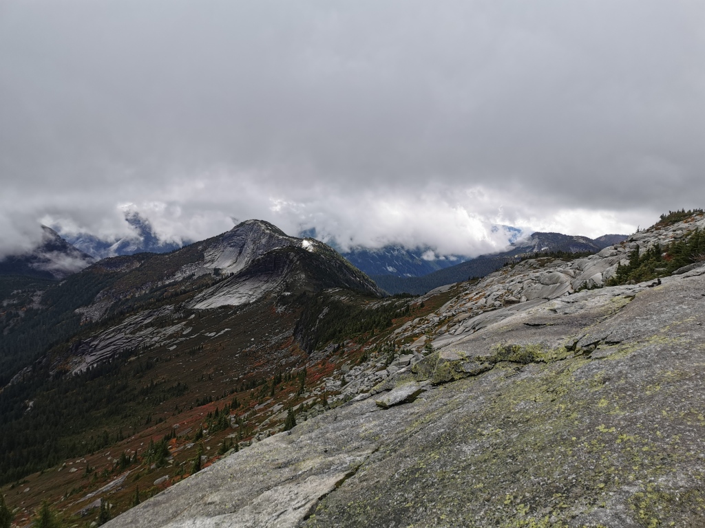
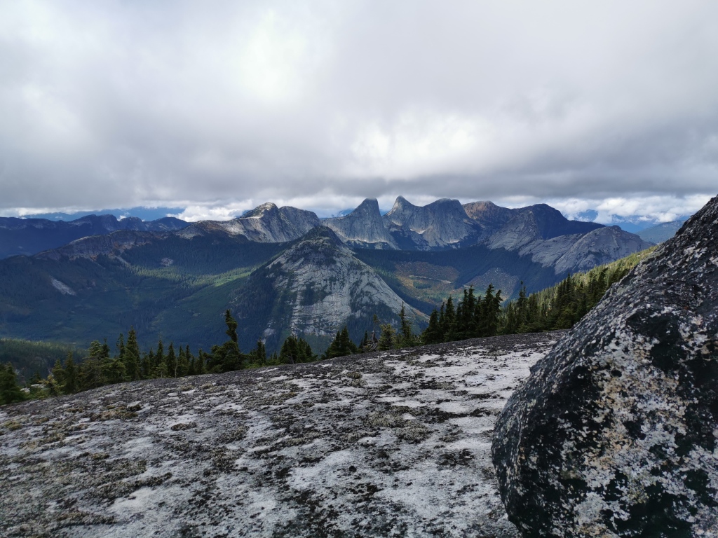
After a few more technical plans fell through due to wet rock, we had settled on the Zupjok-Llama-Alpaca traverse, a beautiful and sparsely traveled three-peak ridge hike. At 20 km and about 1200 m of elevation gain, it’s no slouch of a trail, but well do-able as a day trip. And for something you’ll likely have all to yourself, the trail is well-marked and obvious (no bushwacking required!). You get three full mountain summits out of it (plus a bonus summit, unnamed, but containing some of the steepest terrain, so I like to count it), and those panoramic views are completely worth it! Passing through the first summit Zupjok will take you across a ridge to Llama peak, then a final trek up the ridge will leave you at your destination: Alpaca peak. The ridge offers incredible views of the surrounding summits, and some other famous hikes, Needle and Yak, as well as a close up view of the intimidating Vicuna peak.
To begin, travel to the Coquihalla highway (hwy 5), and stop at the Zopkios rest area, a large parking lot complete with washrooms and a food truck, and a very popular stop for hikers and travelers to and from the Interior alike. If coming from Vancouver, this exit is about 25 minutes past the town of Hope.
From the lot, begin your hike by trekking past the washrooms, back along the highway exit ramp towards Hope. Take a right at the large gravel lot immediately after the washrooms, and look for the trail that takes you down and into the trees. This wide trail is your warm-up: it’s about 3.5 km of semi-flat dirt and gravel, taking you through beautiful trees, gentle streams, and creek crossings. Make sure you keep straight at the massive rock cairn at the first junction. Taking a left here will you take you up Ottomite Mountain – a nice hike, but not where we’re headed!
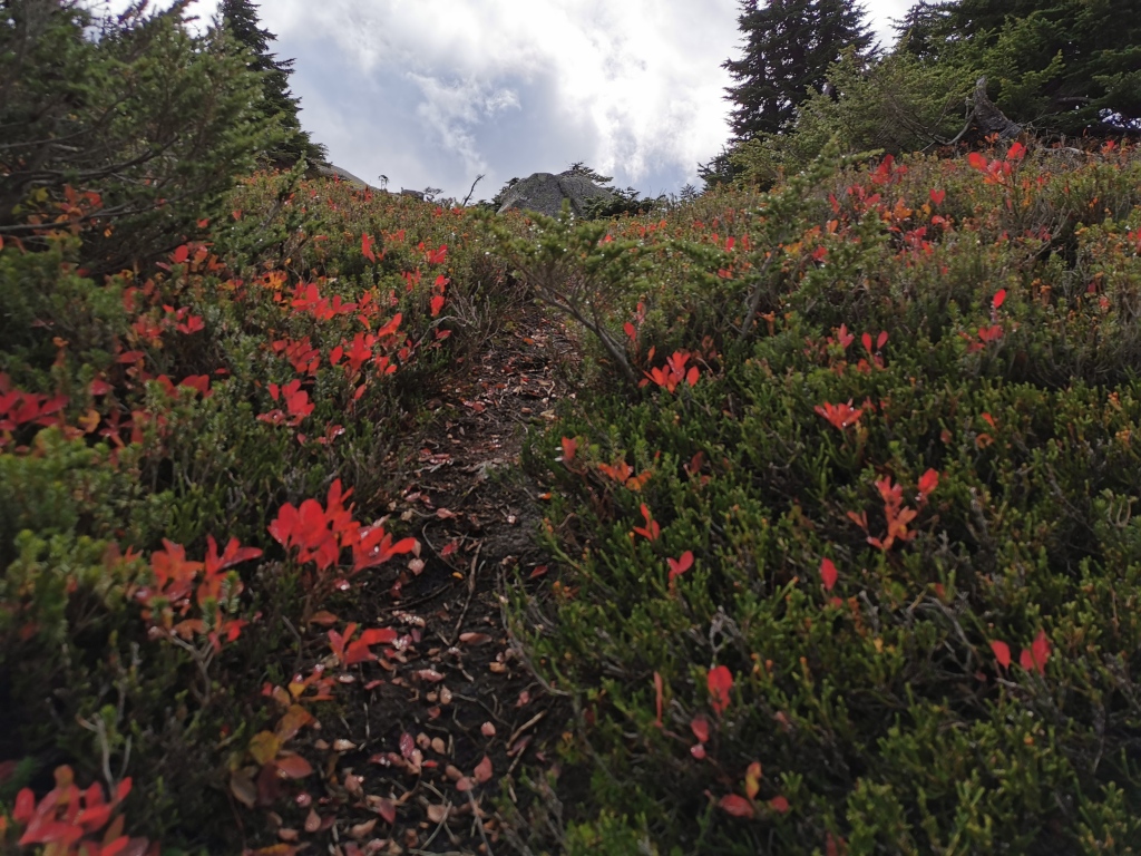
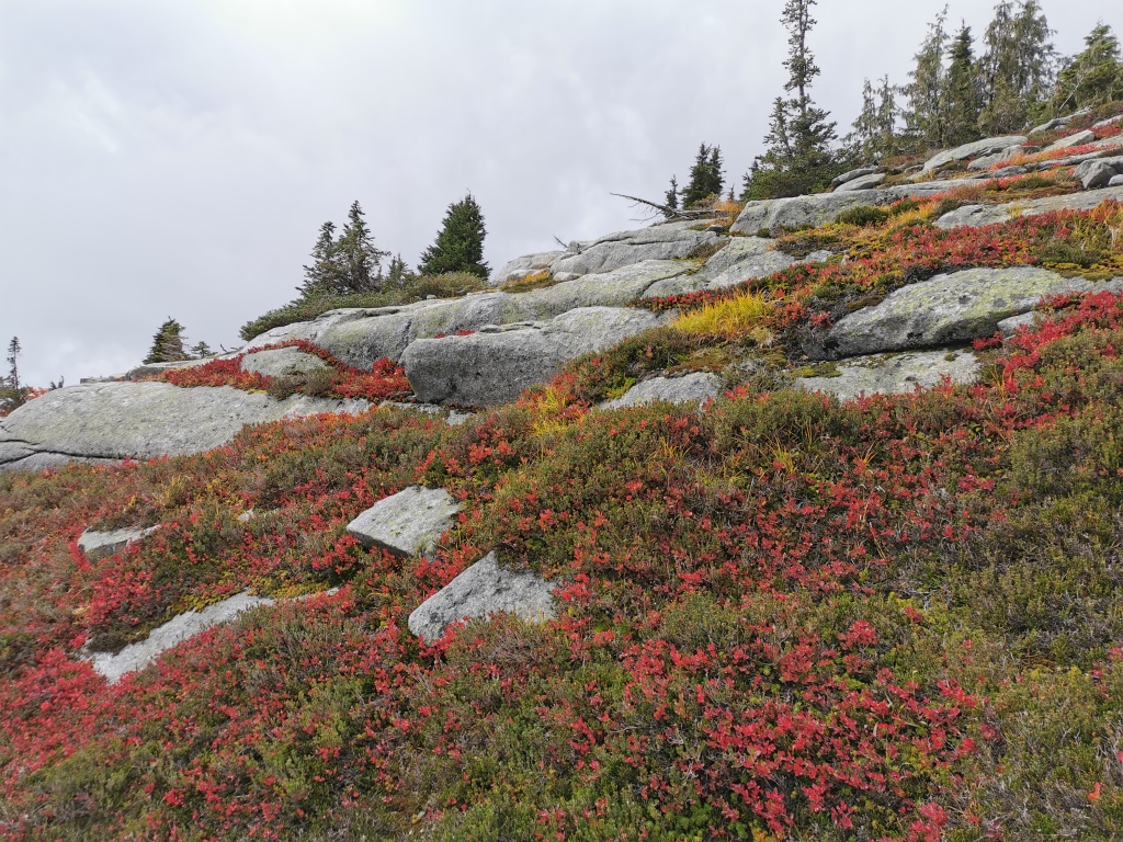
After the junction, the path narrows, and the trees get tighter. Note that the trail is obvious and well-flagged here. A brief respite in a beautiful open meadow, full of red in the fall, quickly leads to a much steeper trail. Unfortunately, from here, you’ll follow a very steep path up the mountain to the first summit, Zupjok. While this steep section is a bit of a slog, the trail is quite pleasant (minus the burning calves, of course). But the trail is soft and you’re right in the heart of the trees. This is what hiking is all about, after all.
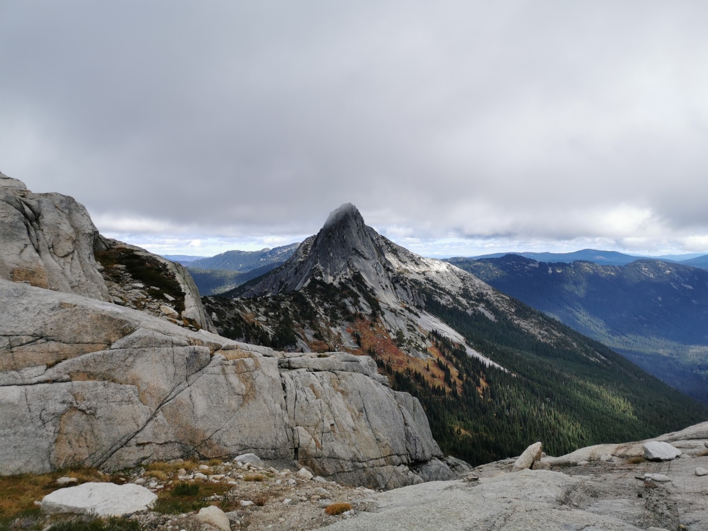
The crunch will soon end with a break in the trees, and large slabs of granite. Soon after, you’ll hit the Zupjok summit. Here, there’s a wide open flat area and a lookout, seemingly made for camping. Pause here for a snack, then follow the trail, flags, and cairns through to your next objective.
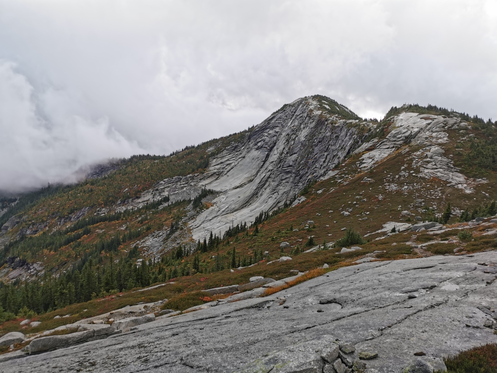
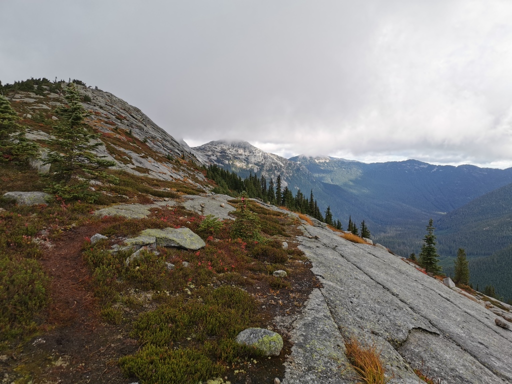
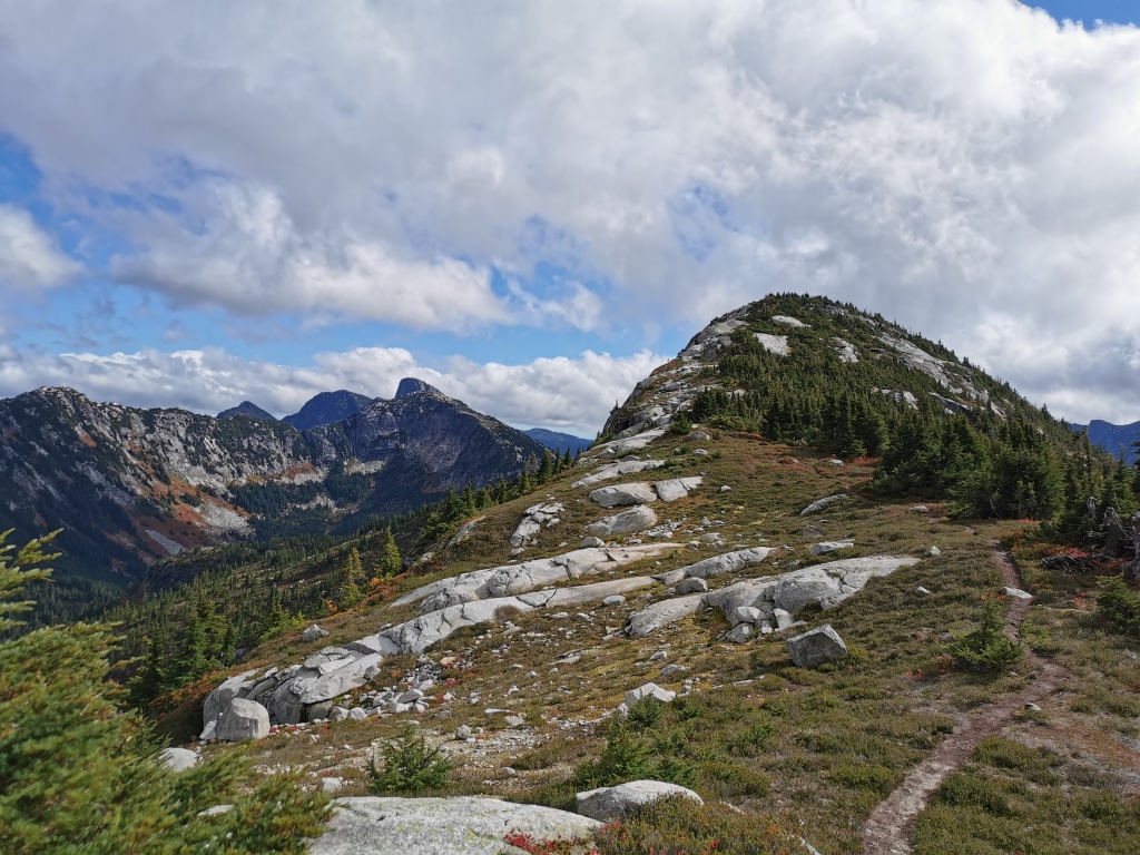
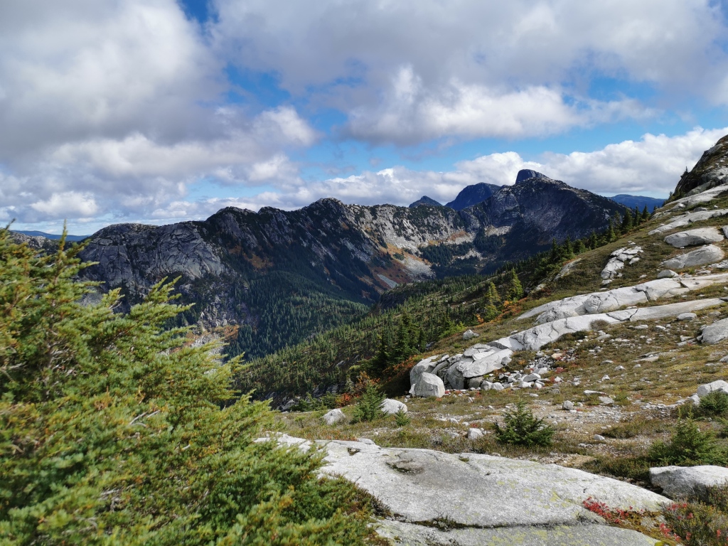
From Zupjok, you’ll descend down the ridge, then ascend a small, unnamed summit, before another descent and ascent up Llama peak. The ups and downs can be a bit trying psychologically, but you’ve already done the vast majority of the elevation gain on the way up to Zupjok. Take the panoramic views as solace, and makes sure to snap some pictures of the monolithic granite walls for which the Coquihalla summit is famous. The ridge scenery is classic alpine: small shrubs and trees and lots of rock. If you come in the fall like we did, you’ll be treated to fields of red and and gold foliage (and handfuls of lingering blueberries).
Following the unnamed bump in the ridge, you’ll ascend the right side of Llama, stopping just shy of the summit (or take a side trip up, if you like). The trail gets a little harder to follow from here, but it’s impossible to get lost on the ridge – just keep heading towards Alpaca, and you’ll stumble across flags and cairns as you go.
While the final ascent up Alpaca peak looks steep from lower down the ridge, it’s really not that bad. There is minimal scrambling required on this trail, and no exposure. The rock can be slippery when wet, but there’s always a path upwards that avoids slippery rock, so this hike is a good one if conditions are sub-optimal.
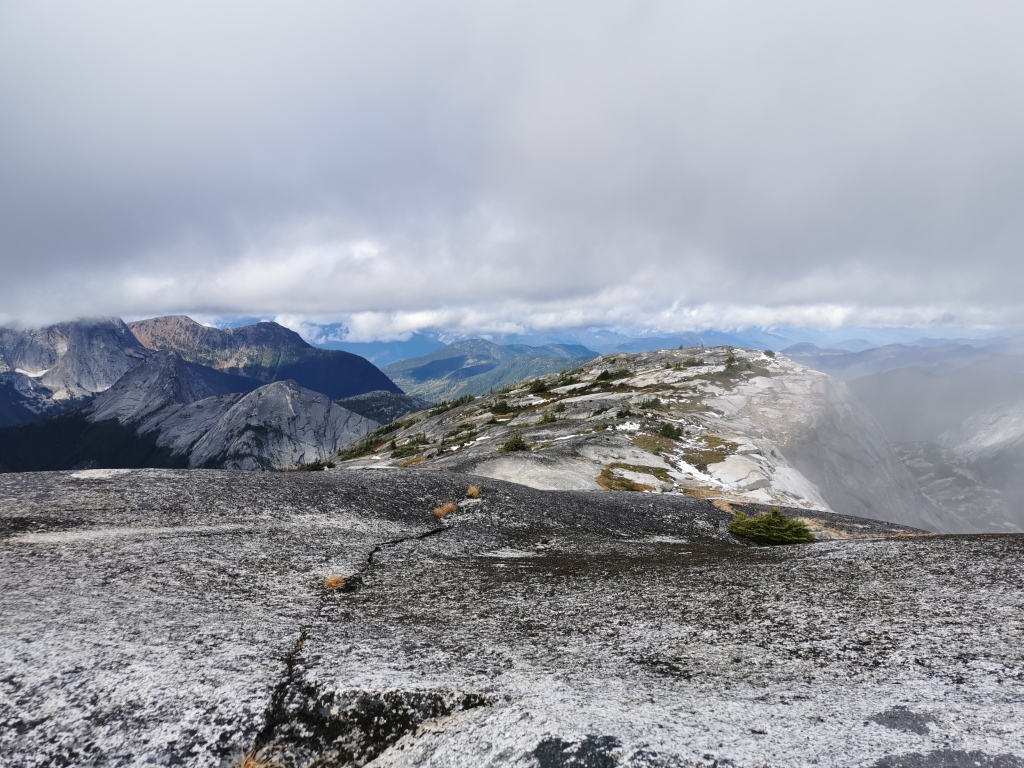
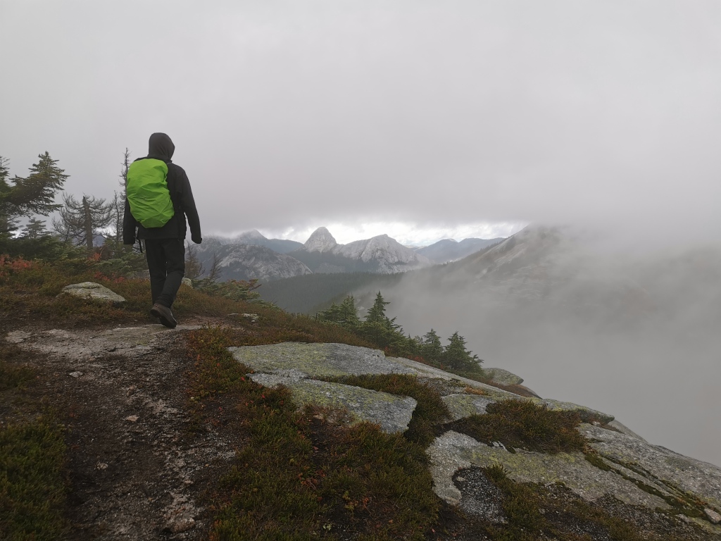
Standing on the summit of Alpaca lets you soak up the magnificent ridge, plus views of the endless granite spires that make up the Coquihalla area.
To descend, retrace your steps down the ridge. While you might be dreading the amount of climbing that you have to do on the way back, it’s really not as bad as it looks from the top of Alpaca. Remind yourself it’s still a net downhill, and that every step gets you closer to a hot drink from the food truck in the parking lot. Tell yourself this in particular when you’re on the last 3.5 km stretch back to the car, as this part may feel like the absolute longest walk of your life.
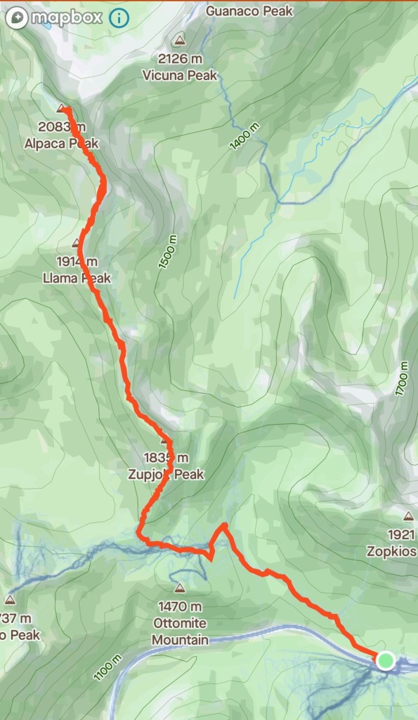
Overall, the Zupjok-Llama-Alpaca traverse will take you over 20 km of mountain terrain, with about 1200 m of elevation gain. Moderate hikers should allow 7-8 hours for the entire trail, while slower hikers should allow 8-10 hours. If you don’t have that much time to spare, or have simply had enough hiking mid-range, Llama peak makes a great final destination as well.
Ever heard of this trail? What’s your favourite hike in the Coquihalla region? Leave me a note in the comments below!

Thank you for those photos. All the years I’ve travelled the Coq, I’ve always was in awe of the granite slabs of rock. Beautiful. When we travelled to Port Renfrew, I was in awe of the different rock formation- looks like basalt and sandstone. A mixture of hard and soft.
Sent from my iPhone
>
LikeLike
Driving down the Coq, that huge slab up the side of Yak peak is so iconic! I had no idea that so many of the mountains up there looked like that too. It’s almost like the Rockies. Quite a gem!
Thanks for reading! 🙂
LikeLike
Very nice! Would love to try that next year. Well written and great pictures.
LikeLike
Thank you! 🙂 Definitely worth a visit, especially if you’re looking to escape the hiking crowds. It was deserted up there, even though it’s easy access!
LikeLike