
Hiking to Goat Mountain via the secret alternative to the Grouse Grind
You’ll have to forgive the click-baity tagline here, but I’m really excited about this new ‘secret’ trail! Ask any Vancouver local what the worst hike in Van is, and the answer is always the same: the Grind. The Grouse Grind trail, while arguably the most famous hike in the area, takes you on a crowded one hour, quad burning, prison-style march underneath the Grouse Gondola, ending in a tourist-trap chalet. I don’t know about you, but being trapped on endless narrow staircases behind slow and overwhelmed tourists blaring loud music from backpack speakers is not my idea of a hike. Beside the Grind is the classic alternative: the BCMC trail. While a bit quieter and less traveled, BCMC suffers from many of the same drawbacks as its celebrity neighbour. I had heard rumours for a while of an alternative to these two (something with a bit of rock climbing even), but had no other information. Fate smiled at me last week, however. After a brief hike up BCMC for some exercise after work last week, I ran into a local hiking guru, who happened to be the founder of multiple local hiking clubs, and an organizer of the Vancouver International Mountain Film Festival to boot. I finally extracted the name of the elusive trail: Flint and Feather. Game on.
The originally nondescript Sunday we selected to explore the trail proved to be likely the busiest of the year, as the yearly Seek the Peak trail race was going on that day at Grouse. The parking lot by the gondola, where we were to begin, was absolutely packed, with runners/hikers in bright pink bibs streaming past. Luckily, we would bypass all of this on our hidden trail. The plan was to hike part way up the BCMC and hunt for the Flint and Feather trailhead. We would take this trail to the top of the mountain where it reconnects to BCMC. From there, we would continue past the chalet and tag on Goat Mountain, in the Lynn Headwaters backcountry (just for sport. We were there anyway, so why not add a second mountain really?). We started at the Grind/BCMC gate, keeping right for BCMC, and followed the trail up for about 20 minutes.
Now, let me warn you that we found nothing like the directions we researched online. I suspect that those directions are very outdated (and many seem to be duplicates of a single description…). Basically, you’re looking for an unmarked footpath branching from the left of BCMC as it takes a sharp turn to the right. You will see a creek bed from the branch point. We suspect there are multiple places to enter this trail, but for us, after about 20 minutes on BCMC, we found a footpath on the left that took us downhill briefly. Orange markers on the backsides of some trees indicated that this was the old BCMC trail (did you know there was an old one!?). After a minute or two, we crossed the empty creek bed, and followed the path uphill. While there were a few other paths branching off, our guiding principle (stay as far away from the Grind as possible) proved sound. We always choose the right-most path (in fear of reconnecting with the Grind to the left), and it took us where we wanted to be.
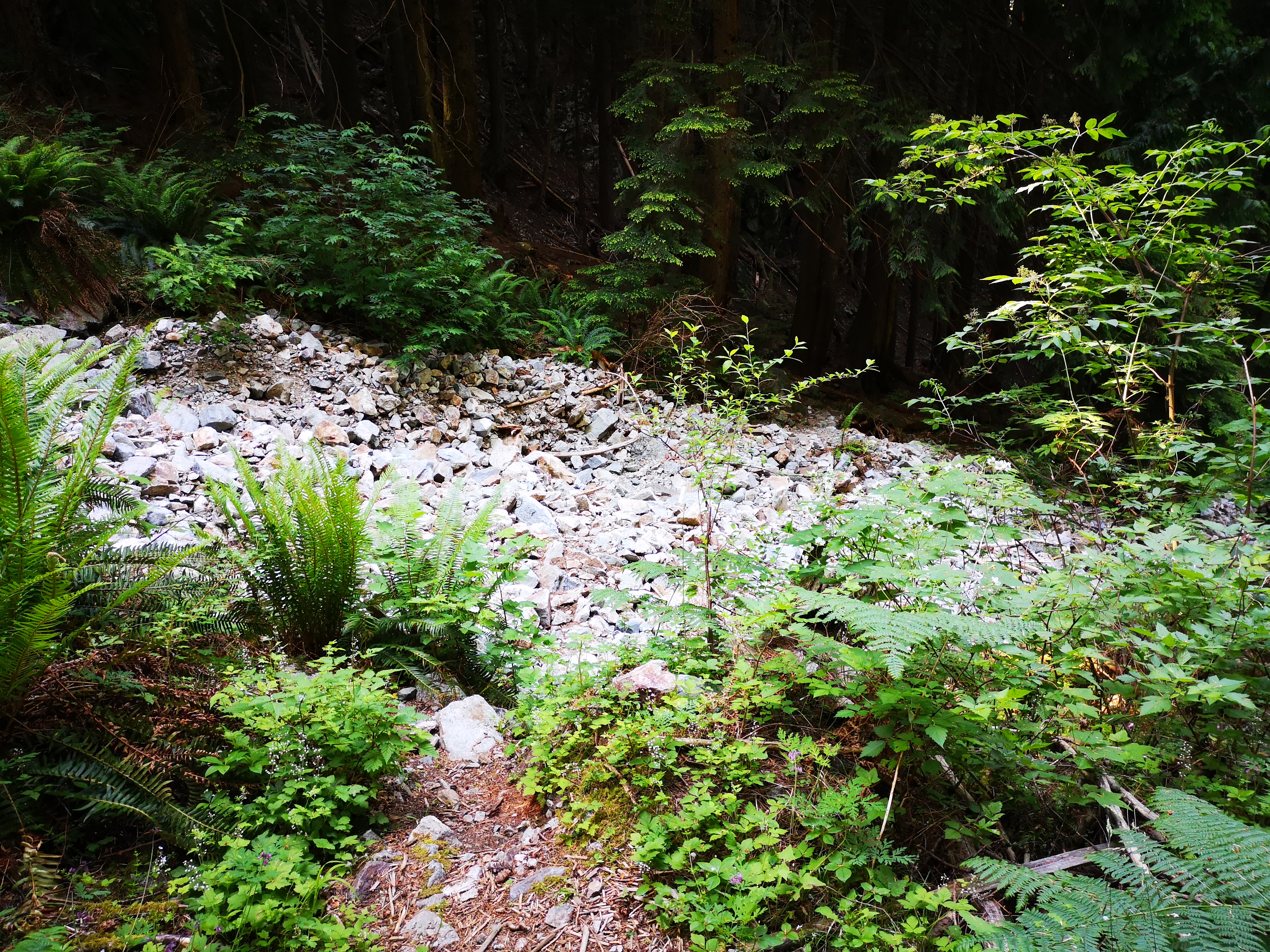
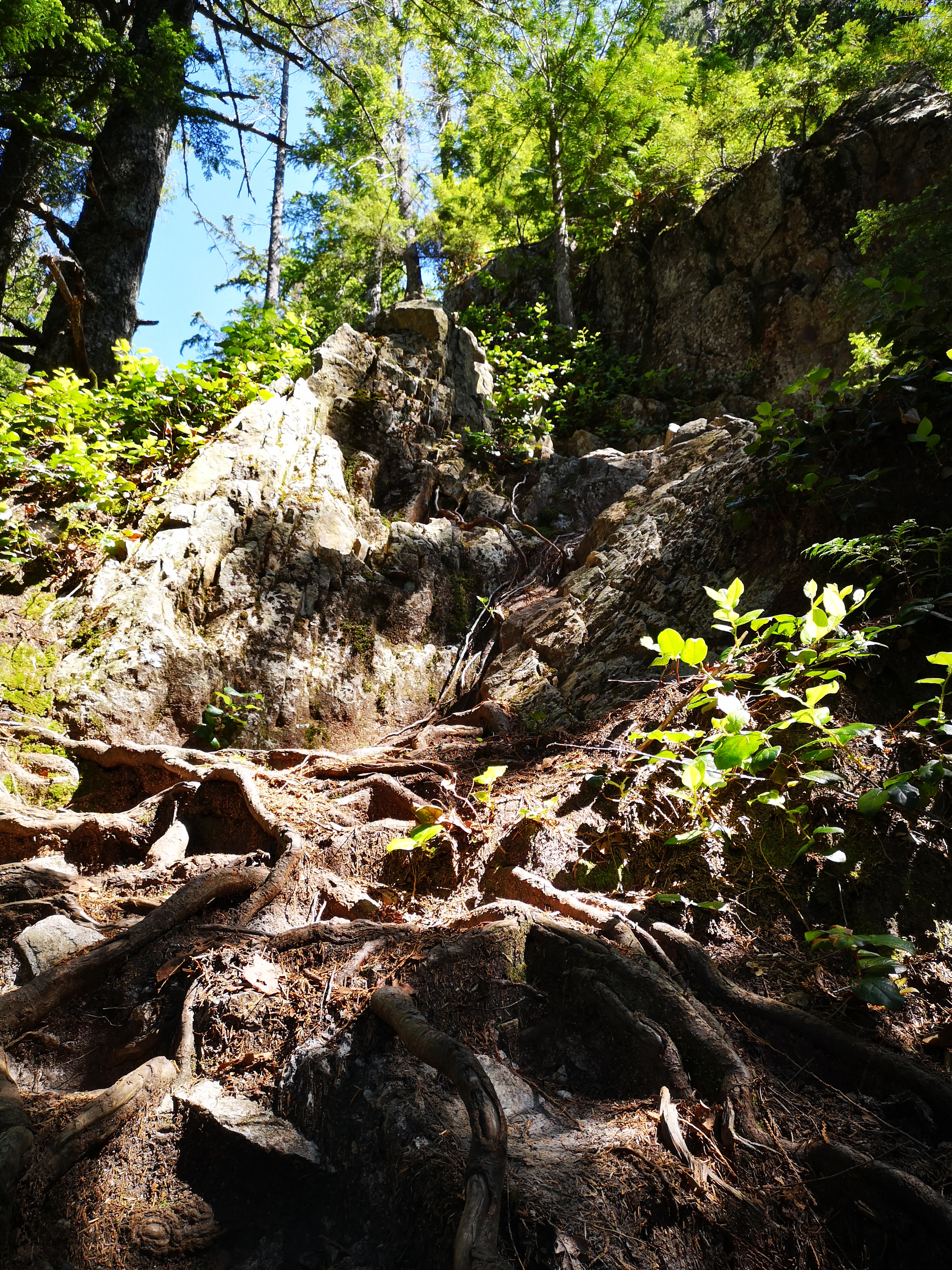
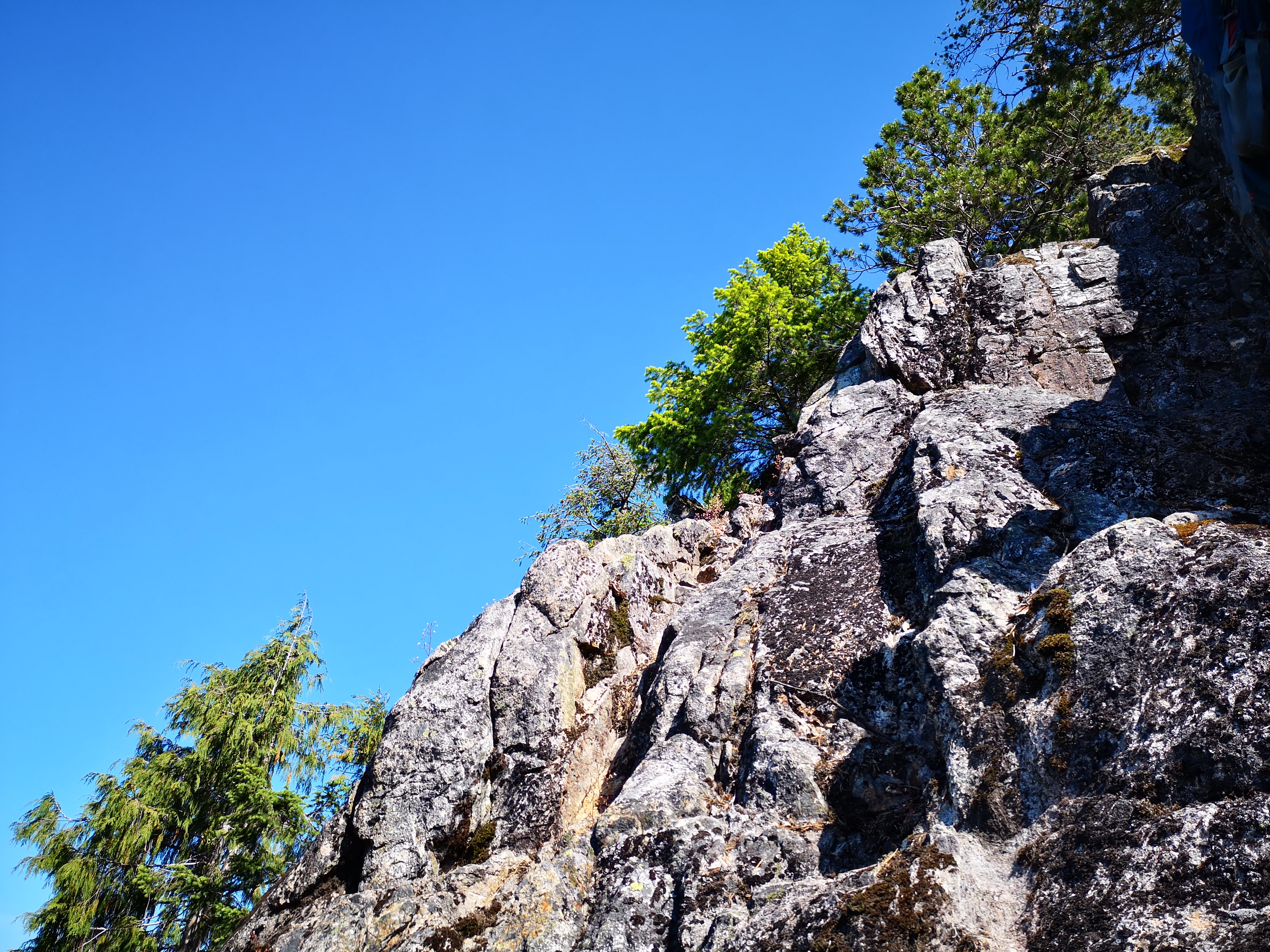
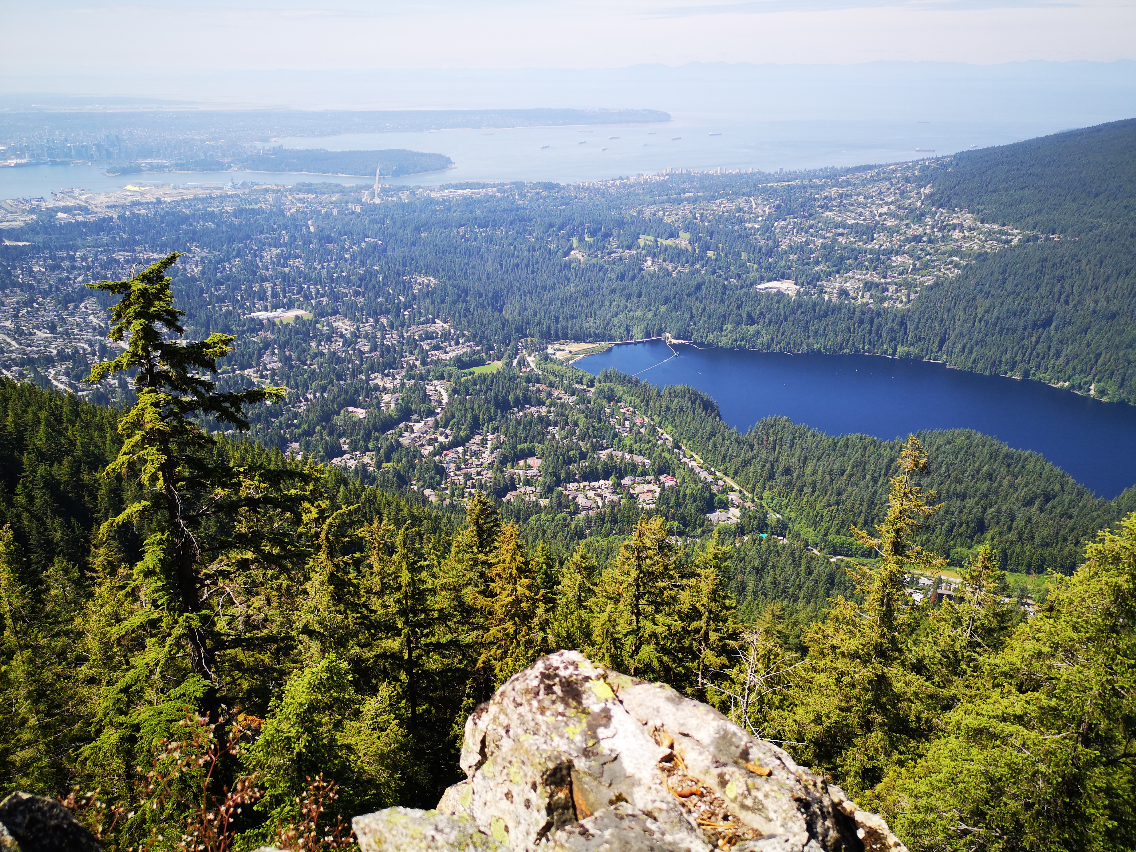
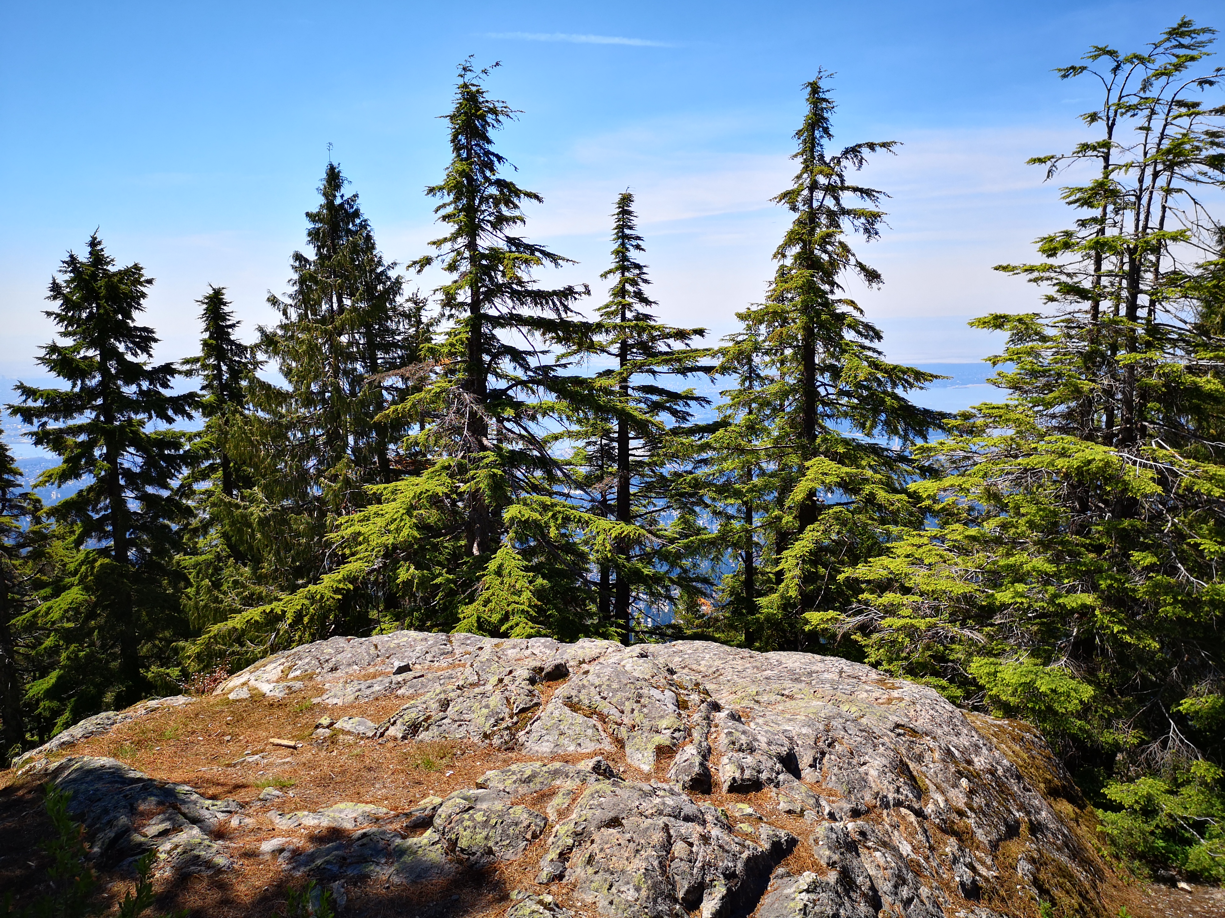
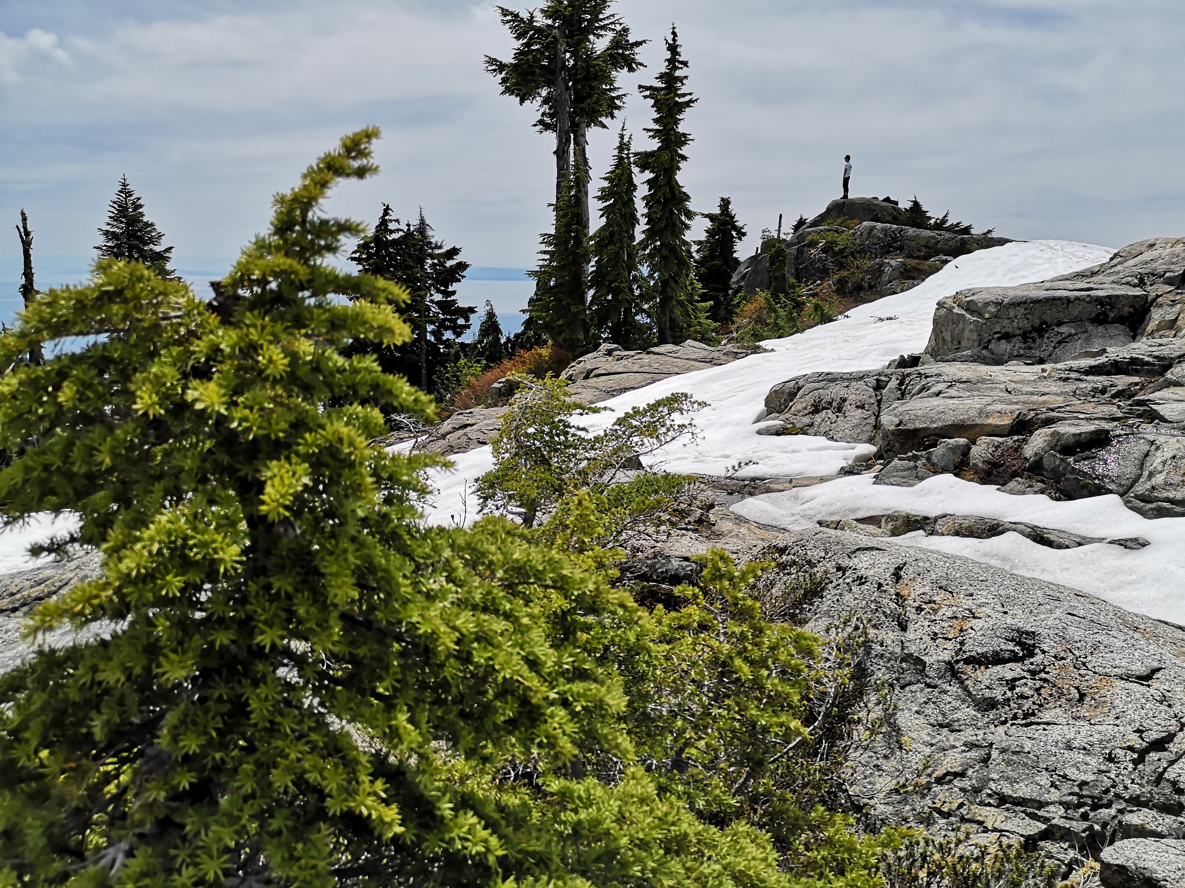
Flint and Feather did not disappoint. It is a soft forest trail littered in fresh-smelling pine needles, as opposed to the hard-packed, severely eroded, and monstrously dusty BCMC and Grind trails. It wound its way up between the two well-known trails, mostly staying out of sight. In the last third of the trail, we broke free from the trees onto some rocks bluffs, and were treated to a spectacular view of Vancouver, something that you definitely do not get on the other trails! There are opportunities for some scrambling (low grade rock climbing), plus some gorgeous sunny ledges. At one particularly epic moment, while I was finishing climbing a rocky bluff, an eagle swooped through the blue sky right behind me. Basically out of an adventure movie.
Shortly after the rocks bluffs, you return briefly to the trees for a short time, then finally emerge onto a wide open slab of granite. From here, you traverse back into the trees and connect with the BCMC trail, about ten minutes from the chalet. The entire trail, from lot to chalet, took us about one hour and twenty minutes, including some photo breaks and route-finding discussions.
We took a short break at the chalet before starting phase 2 of the day. We refilled water bottles (I whine about the intrusion in nature, but you can’t argue with access to water, beer, and food in the mountains. So conflicted…). We observed racers finishing Seek the Peak (I enjoyed a brief boost in self-esteem as the race announcers at the finish line enthusiastically cheered “Emily! Emily!”, until I realized that the registered racer behind me was named Emily). We checked out the after-race party, scoring free teas, electrolyte mixes, and sweet sweet bananas. Then we left Grouse society behind and hit the mountains.
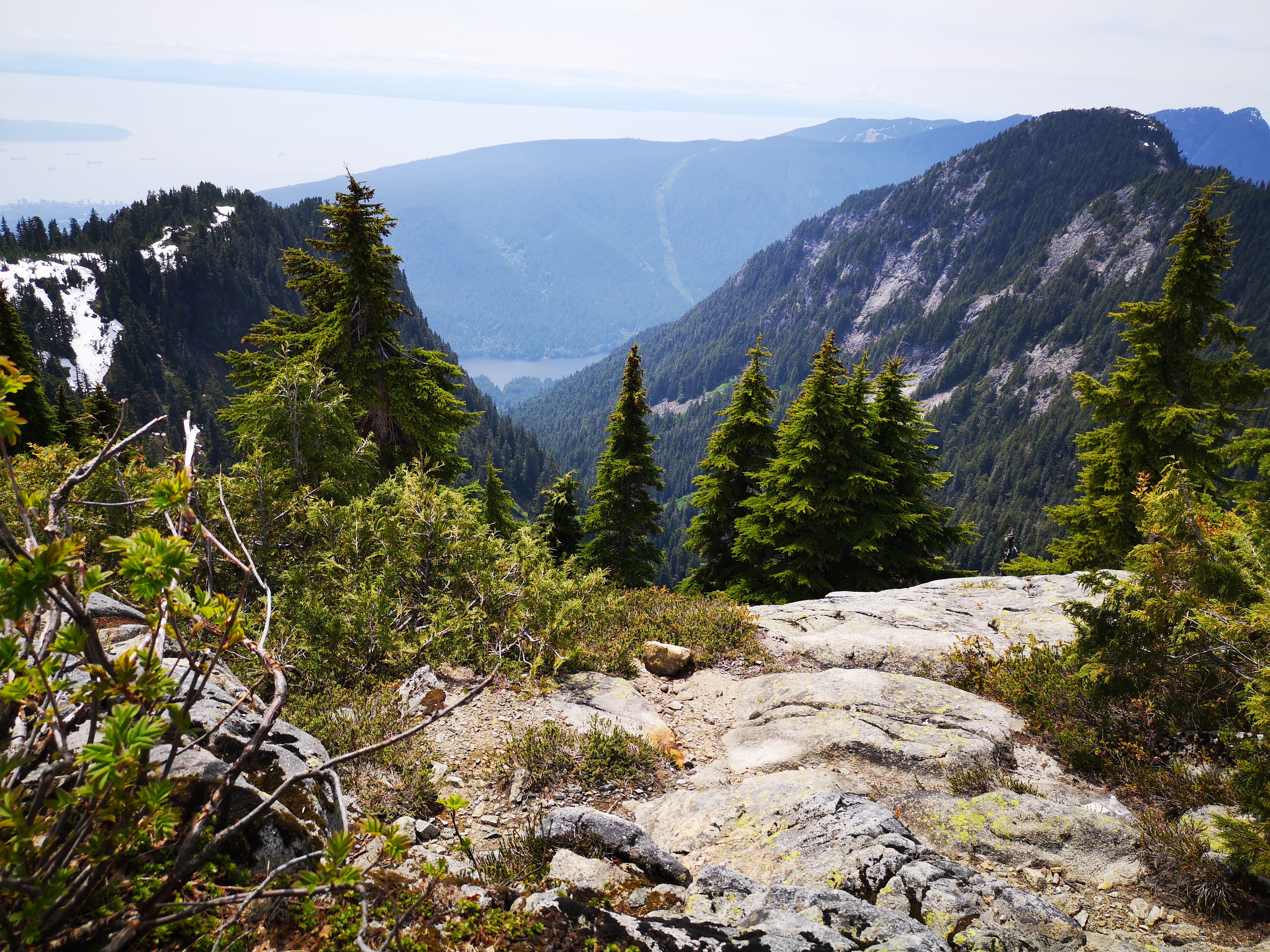
To find the trail to Goat, head down toward the other mountain attractions, keeping left of the bear enclosure and chairlift (and yes, for those who didn’t know, Grouse mountain keeps live Grizzly bears in a pen for display purposes). Follow the wide gravel trail as it begins to gently ascend. From here, the trail narrows. It branches in a few spots, but I don’t think you’ll go wrong following any of the obvious ones. After some muddy hiking and some patches of snow, you’ll summit a baby peak: Dam Mountain. Continuing on past Dam, you’ll begin to lose elevation, and you’ll see Goat in the distance. You’ll descend a few hundred meters, then come up on the left side of the mountain on Goat Ridge. The final ascent is a fairly steep, treed scramble to the summit.
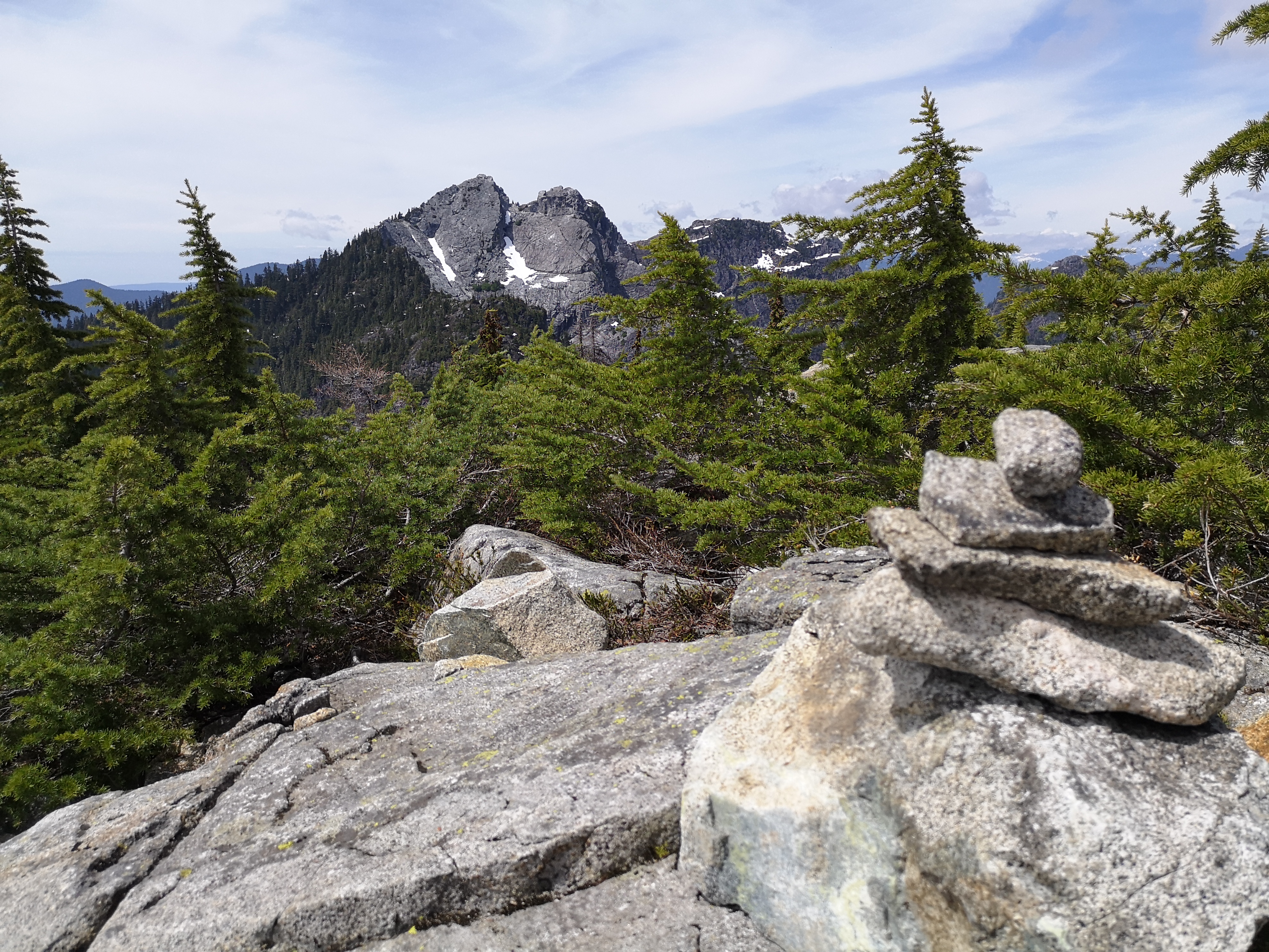
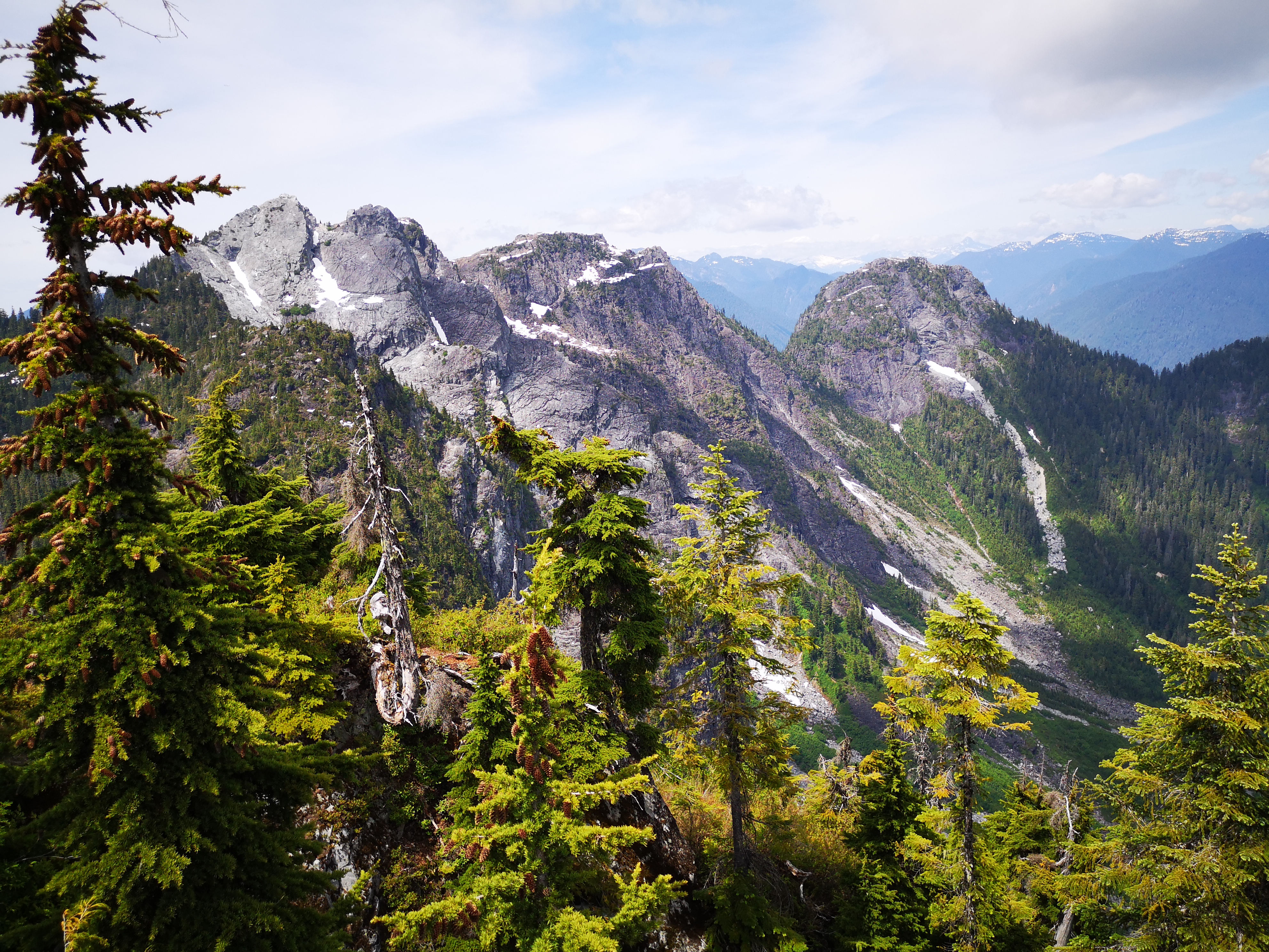
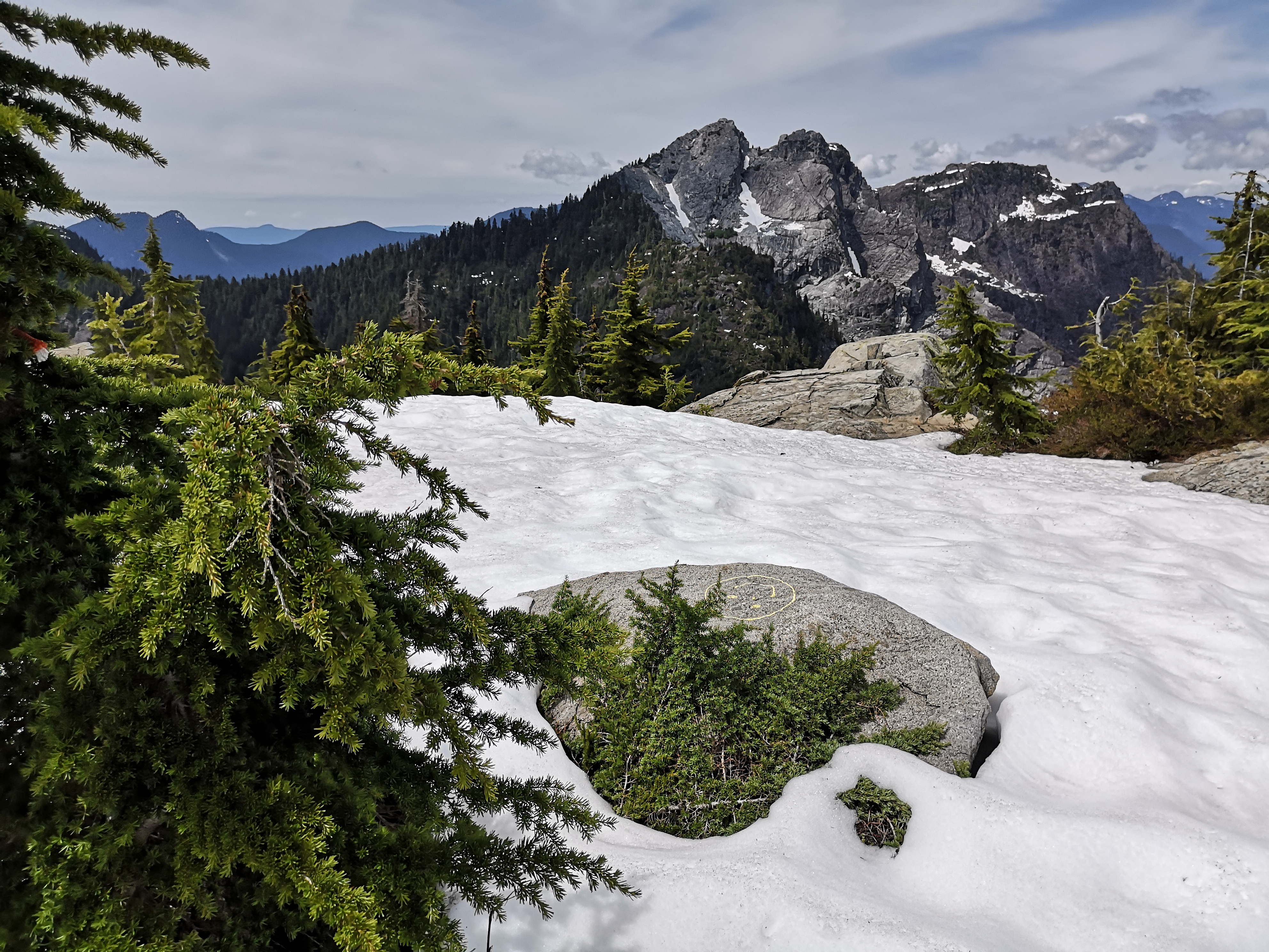
This was my first time in this section of Lynn Headwaters Park, and I was surprised how poorly flagged the trails were. No signs, and the flags were sporadic and sometimes illogical. I guess I figured that we were so close to a massively commercial mountain park, so things would be well-labeled, but I was wrong. Take it as a lesson in preparedness: we had a GPS map, and used it! The only major wrong turn that I’ll warn you about is a junction you’ll hit after Dam: the left branch, marked with bright yellow spray paint, will take you to Crown Mountain. Keep right for Goat. While Crown is utterly epic (you get stunning views of this beast for a large portion of the trail to Goat), it is a very different kind of day, involving an absolutely massive descent to the valley below, then a steep and grueling climb to the ridge, and ending with an exposed scramble up the rock face. Not for novices. Make sure you don’t take a wrong turn.
Continuing past this junction, we met JR, a personal trainer who recently relocated to Vancouver from China. JR had received the same bear warning we had received earlier that day from another hiker (apparently, baby bears were spotted on the trail), and was debating turning back, as he was by himself. Now, the bear must be my spirit animal, as I encounter them with a bizarre frequency (like I literally ran into a bear on my bike during my morning commute at 8 am through Burnaby last week). I think I’m decent at scaring them off at this point, so we were prepared to plow on. We asked JR to join us, and the three of us continued on to the summit, discussing the difference between American Chinese food and real Chinese food. The final portion of the trail involved some cool scrambles up small waterfalls (there are some fixed lines to assist, as it can be muddy and slick).
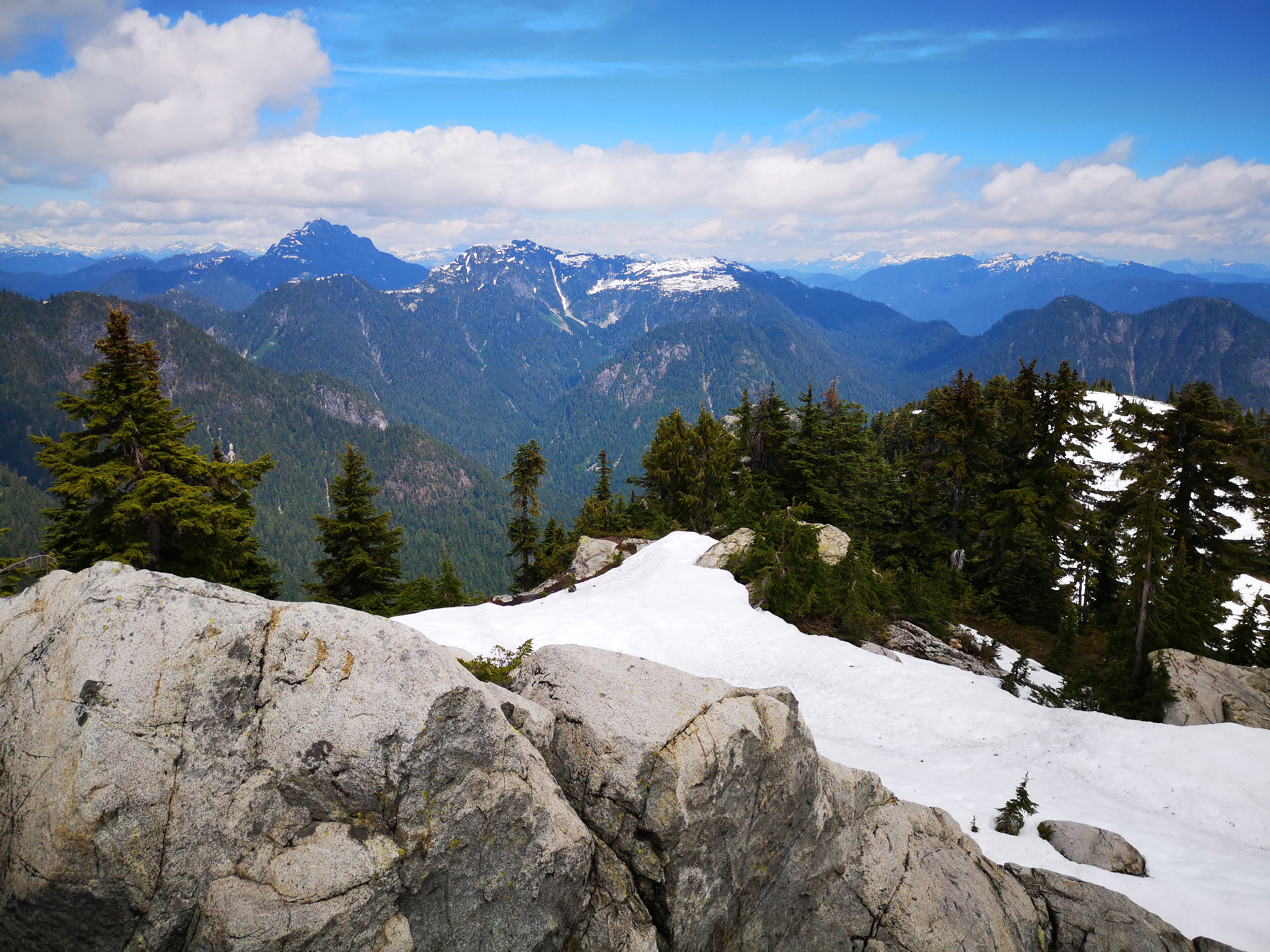
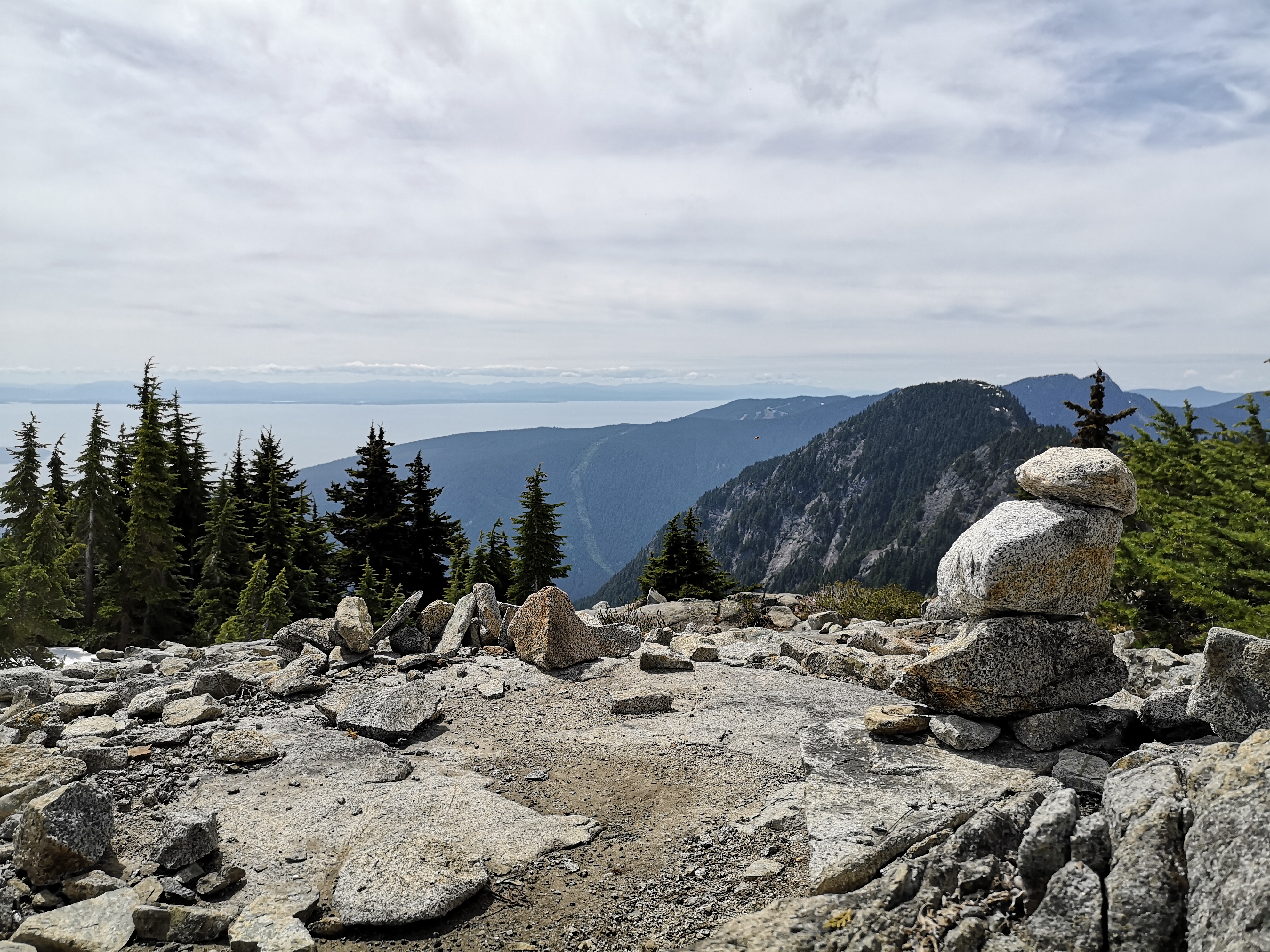
The summit of Goat is a large flat expanse, still partially covered by snow, and offering a 360 degree view of the surrounding mountains, notably Crown, Garibaldi, Cathedral, Coliseum, and Seymour. After some lunch, photos, and high-minded talk about a ridiculous and likely unrealistic plan to attempt a through-hike from Coliseum to Crown in a single day (a plan that I wanted no part of) we packed up and began the descent.
The way back from Goat was uneventful. When we arrived back at the Grouse chalet, expecting to see that the madness had calmed, we were still shocked by the length of the line for the gondola down. Seems we really did pick a busy weekend. Since we were there, and since beer was there, we grabbed a drink at the restaurant and enjoyed some last views of Vancouver before taking the BCMC trail down the mountain.
The final verdict? Flint and Feather was awesome! Better views, quieter, more interesting, and easier on your knees. While I suspect there is an entrance to the trail much lower down than where we started, even cutting off a portion of the mid-day rush on BCMC was worth it. I’ll have to hunt for this lower entrance next time, as I’m already planning my next trip back!
Trail Stats
The Flint and Feather portion of the trail is about 850 m (2789 feet) of elevation gain over 2.5 km (1.6 miles), and took about one hour and twenty minutes, including some long stops for route finding. It’s a pretty intense sprint uphill; you will feel the burn! To reach the summit of Goat Mountain, it was an additional hour and forty minutes (so three hours totals from the parking lot). The distance was 9 km (5.6 miles) and the elevation gain was 500 m (1640 feet). The total round trip time, not including breaks was about five and half hours, and came in at 14 km (8.7 miles) with 1350 m (4429 feet) of gain.
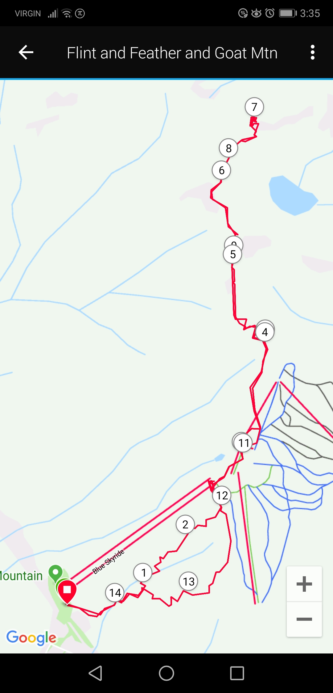
This is the map from my Garmin watch. At the bottom, the branch in the paths around marker 1 shows BCMC on the right, and Flint and Feather on the left. The trails meet again around marker 12. This is also roughly where the chalet is (where the Skyride lines end). The Grouse Mountain ski runs can been seen in blue in the bottom right corner; to get to Goat, we stayed left of those.
These trails were completed in mid-June, and large patches of snow were still present on the Goat Mountain portion (snow line was at about 1100 m). We brought micro-spikes for the trail, but got by without using them (I only fell once haha).
Have you ever done Flint and Feather? Are you thinking about checking it out now? How do you feel about easy access to beer in the mountains? Let me know in the comments below!

One thought on “Flint and Feather Flock Together”