
A bike-packing trip up the backside of Mt. Coliseum in North Vancouver
Mt. Coliseum is my Everest. I say that somewhat jokingly, but it has long held the dishonorable title of the only mountain I have tried and failed to climb. While no mere walk in the woods, it is not even particularly challenging. I have climbed many taller, steeper, longer, and more technical trails. Yet Coliseum has served as a long-standing lesson for me on the the power of nature, of preparedness, and of proper gear. Years ago, I and three friends attempted Coliseum in November in a rainstorm. It was here that I learned a lesson about waterproofing (that there is no such thing as 100% waterproof). It was here that I learned a lesson about essential hiking gear (extra layers, dry bags, calories, headlamps, etc.). It was here that I learned a lesson about hypothermia (as I entered the early stages on one of the false summits). It was here that I learned a lesson about the importance of level-headed teammates, as nothing is done individually in the mountains. It was here that I confronted my physical limits in nature for the first time in a real and unsettling and perhaps dangerous way. And while the final hours on those endless false summits in the stinging hail were as miserable and exhausted as I’ve ever been, I am thoroughly grateful for the experience of being able to explore all these limits in a way that didn’t end in disaster. This experience has contributed very significantly to who I am in the mountains today, which is why it’s been given the tongue-in-cheek title of ‘my Everest’.
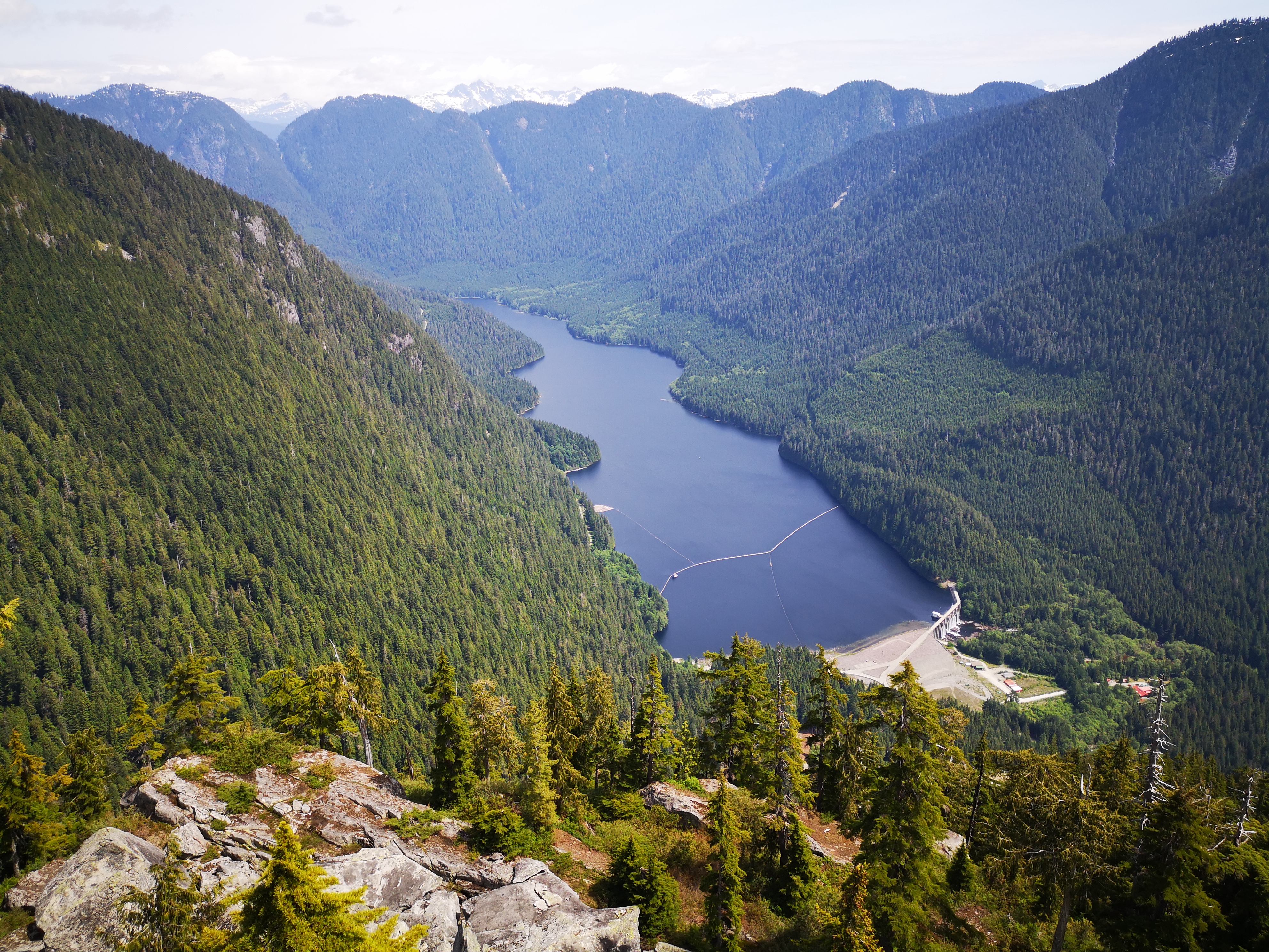
Given my history with that mountain, I was due for some redemption. Despite a bit of reluctance, a hot June day was about the best chance I would have for round two with Coliseum, and I was thoroughly intrigued by the adventure that we had cooked up: a bike-pack of the Seymour valley, and the exploration of an unheard of and likely snow- and bush-obscured trail up the backside of the mountain (as Coliseum is traditionally approached from Lynn Headwaters, the valley on the other side of the mountain). The regular route up Coliseum is made challenging by the long and painful approach to the trailhead – usually, you would have to walk nearly the entire 7 km trail to Norvan Falls before even beginning your hike – a hike of considerable steepness, involving some scrambling and serious elevation gain. By approaching by bike from the other side, we were able to cut off a total of 14 km of walking, sparing our legs considerable strain. With zero rain in the forecast, I was content to at least give this route a try.
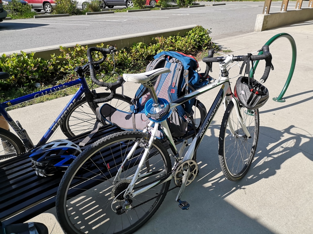
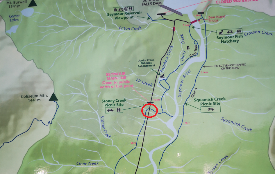
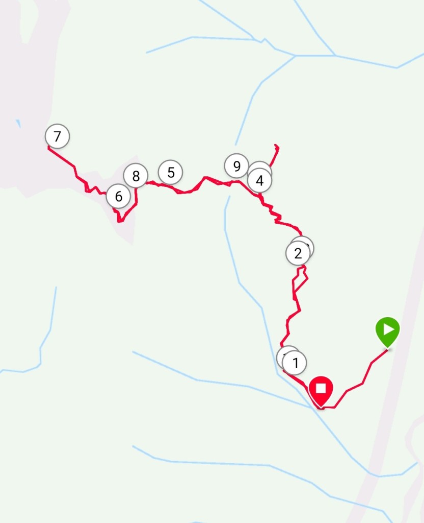
The day started in the parking lot for Rice Lake, at the end of Lillooet Rd in North Vancouver. From here, we shouldered our day-bags, and hopped on the bikes. The plan was to cycle about 9 km down the Lower Seymour Conservatory Road, turn off onto a logging road, then stash the bikes in the trees and tackle the trailhead. We were off to a fast start, as the Seymour Road is a cyclist’s dream – perfectly paved, no cars, and wide and smooth with not even a single rock out of place. This was a good chance for me to test out my new cyclo-cross bike, which did not disappoint. We covered the 9 km in about a half hour, then took a sharp left turn onto a steep and wide logging road, which headed back the direction we just came. After about half a kilometer, this road ends, and the flags for the Coliseum trailhead can be seen on the right side of the road. We took some care in hiding the bikes and locking them to a tree, and then we began our hike.
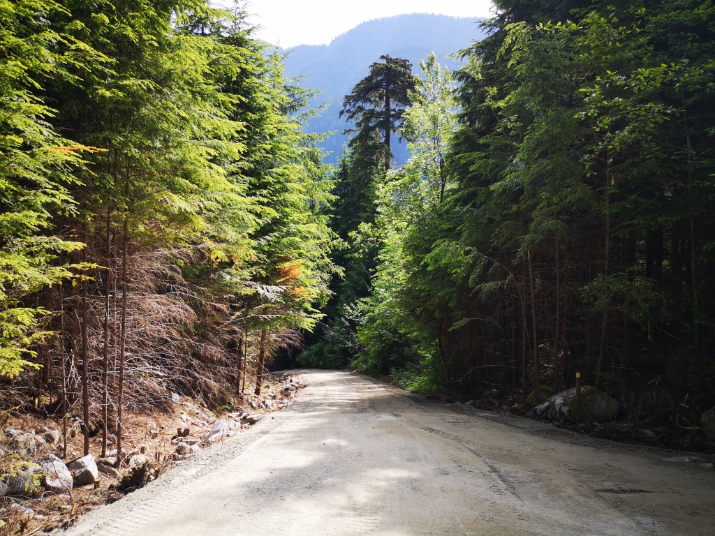
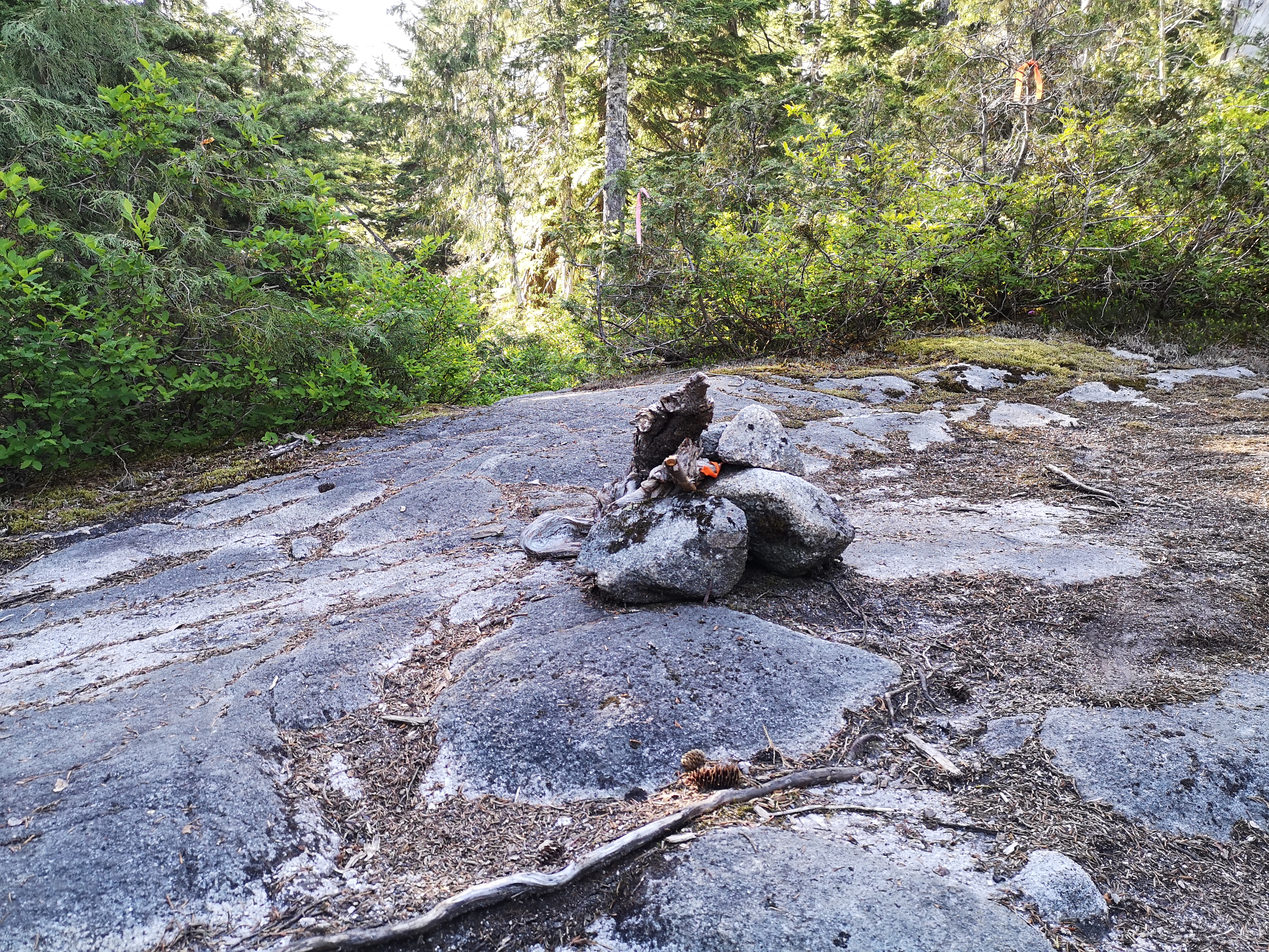
The trail ascends quickly through the forest. I could tell it was little-traveled by the amount of spider webs I walked through that morning. It starts off gradually, then gets pretty steep, passing through three roped sections, then leveling out a tiny bit. After about a hour and a half of fast hiking, we reached the Paton/Coliseum junction, marked by a small rock cairn on the trail.
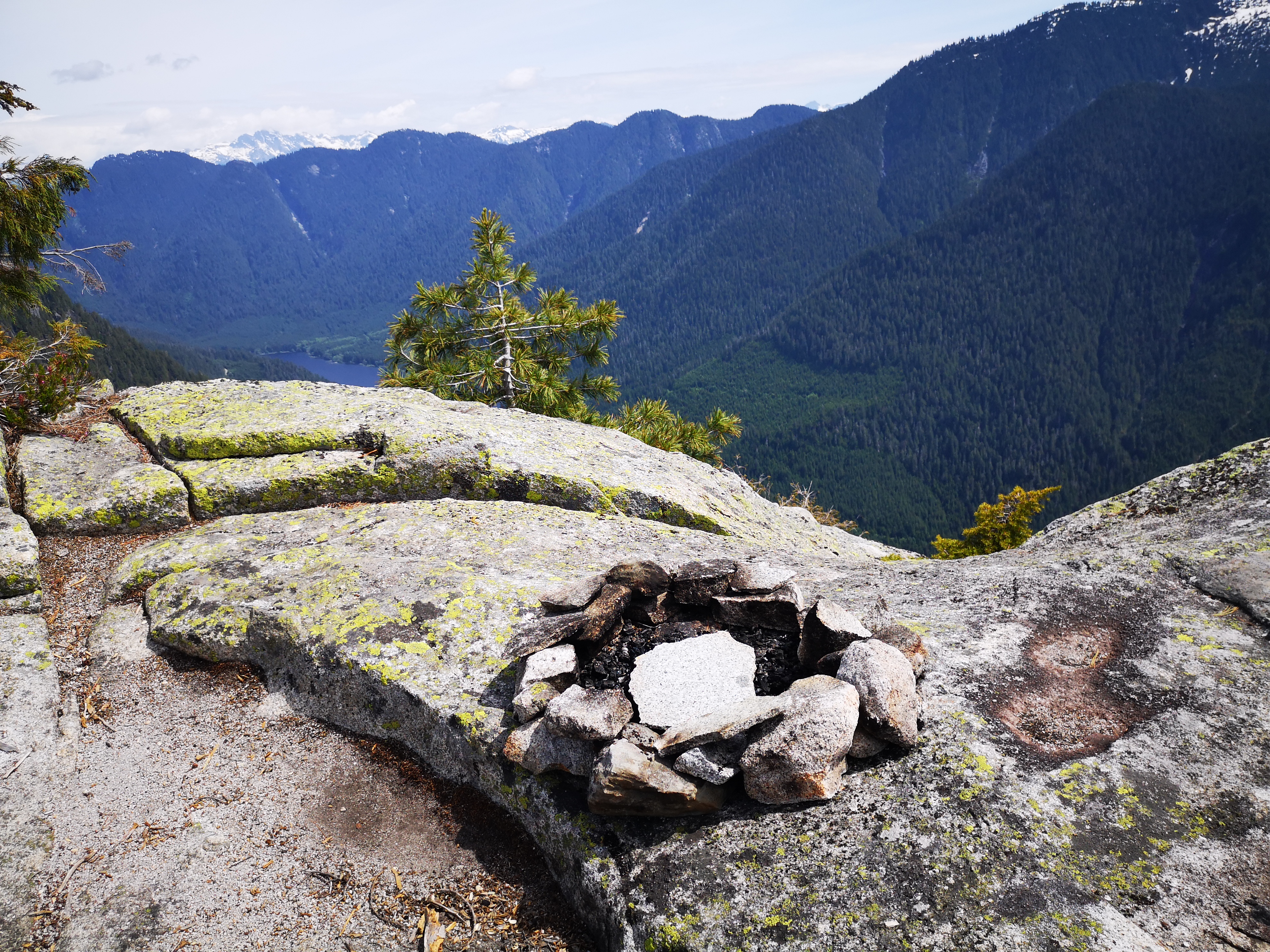
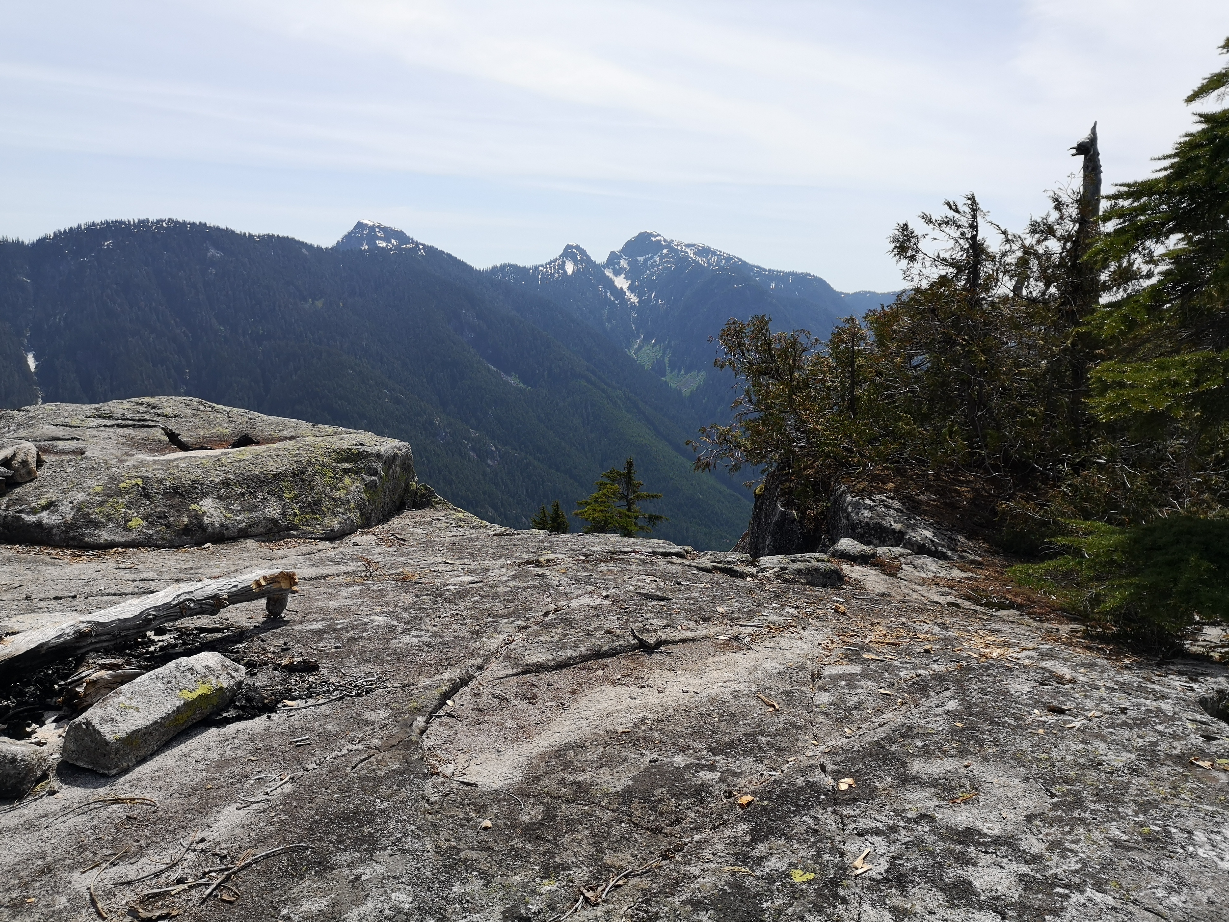
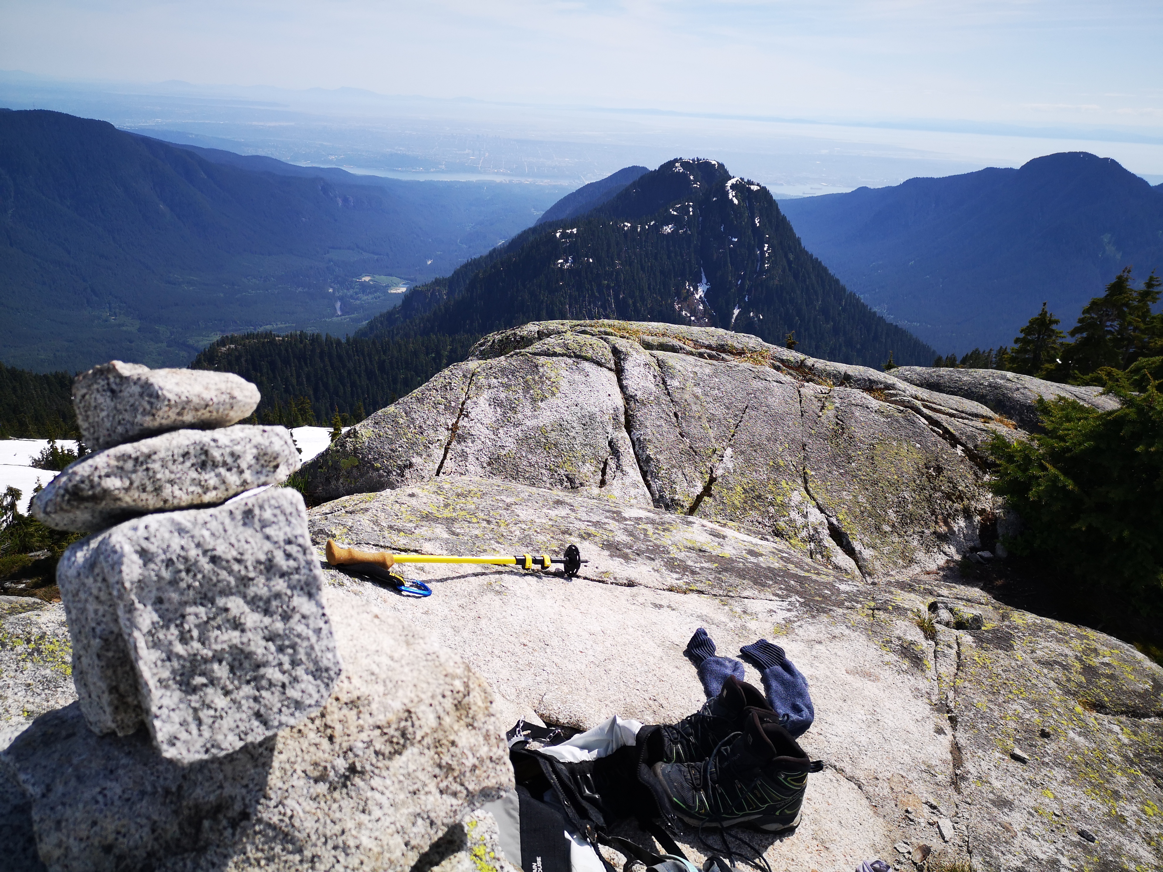
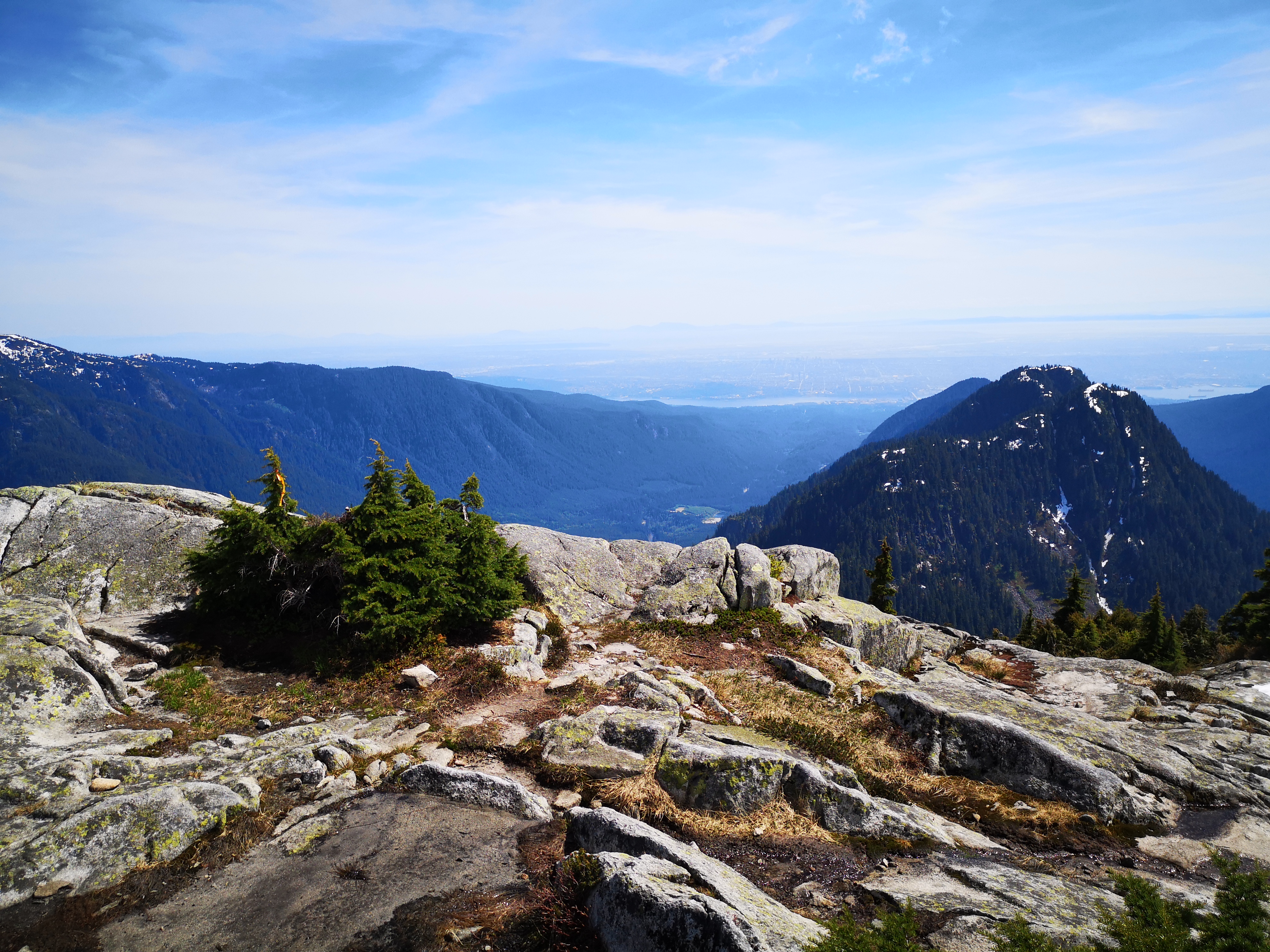
We briefly debated skipping Paton Peak and making straight for our main objective, but boy am I glad we made that detour. To reach Paton, stay straight at the junction and hike for another 5-10 minutes. Paton is a massive and open rock island amidst of sea of mountains. It sits below the surrounding peaks, and provides a 360 degree view of this mountain playground. We spent some time admiring the unobstructed view of all of the famous peaks of the North Shore and the multi-level waterfalls cascading from their summits. It was cool to stand on that lookout and count all the peaks we had stood upon, and dream about the ones we had yet to conquer. We turned our eyes to Coliseum – close, yet still far enough. We were tired after Paton, but this was my Everest, and so we pushed on.
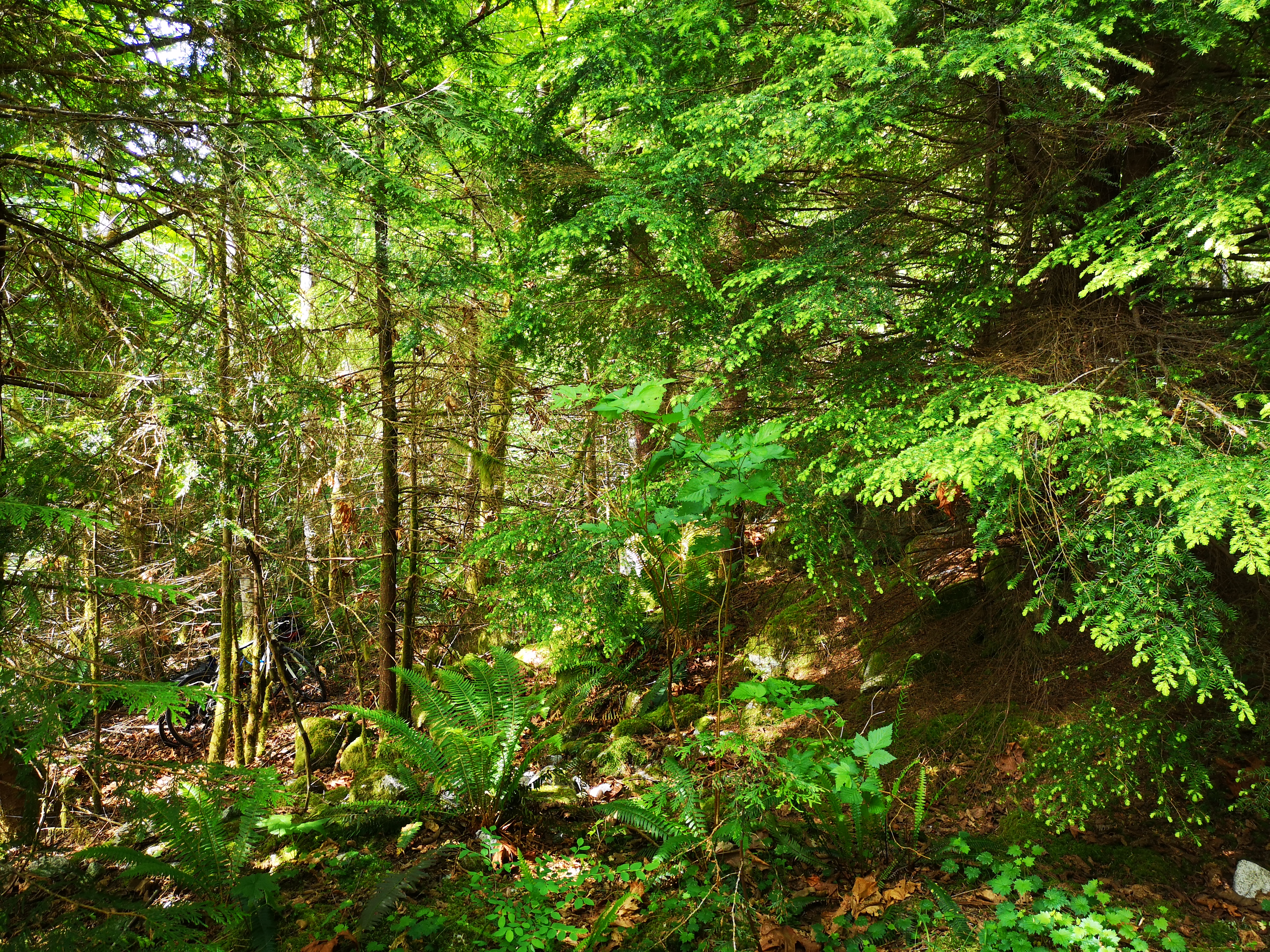
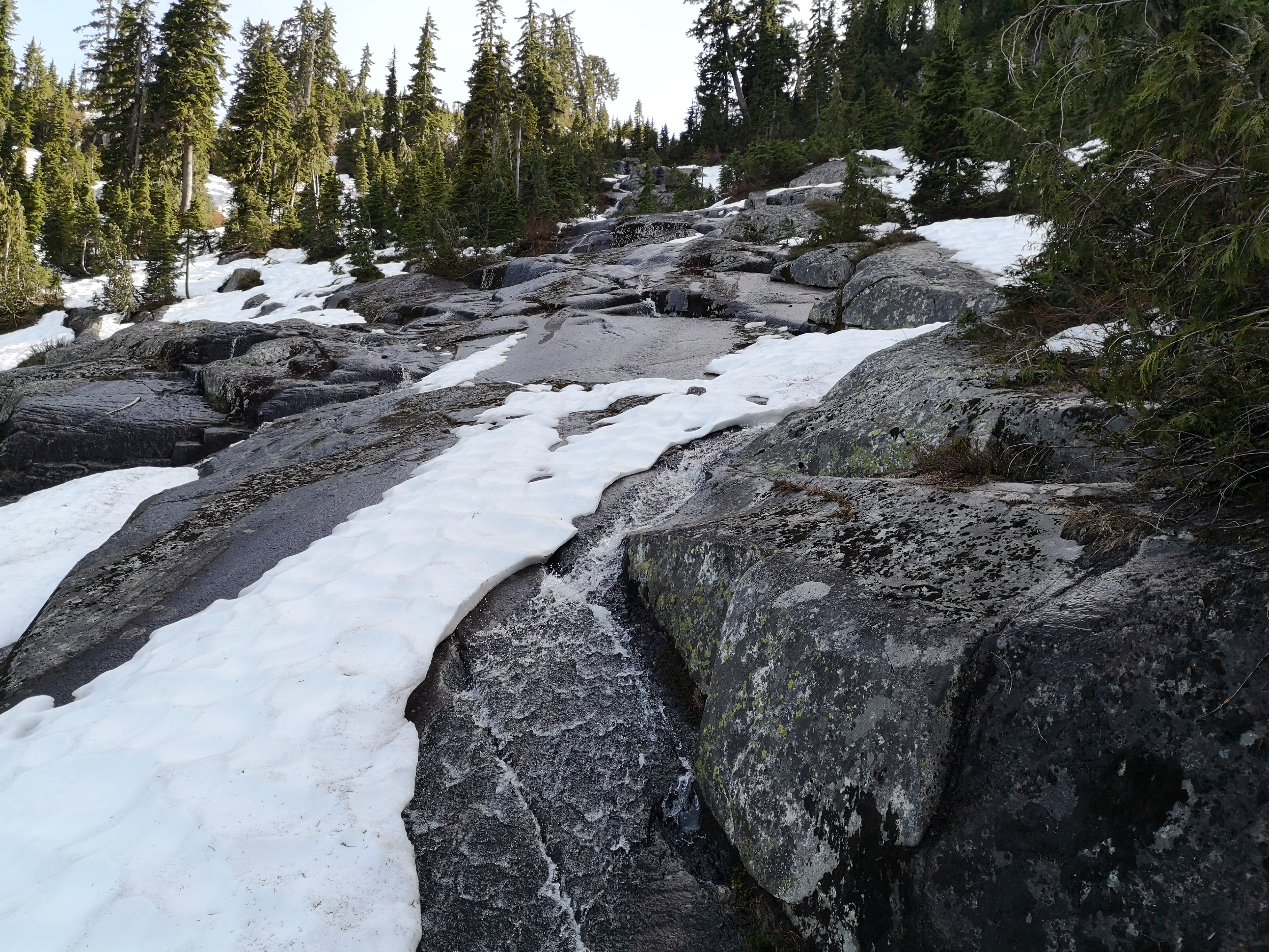
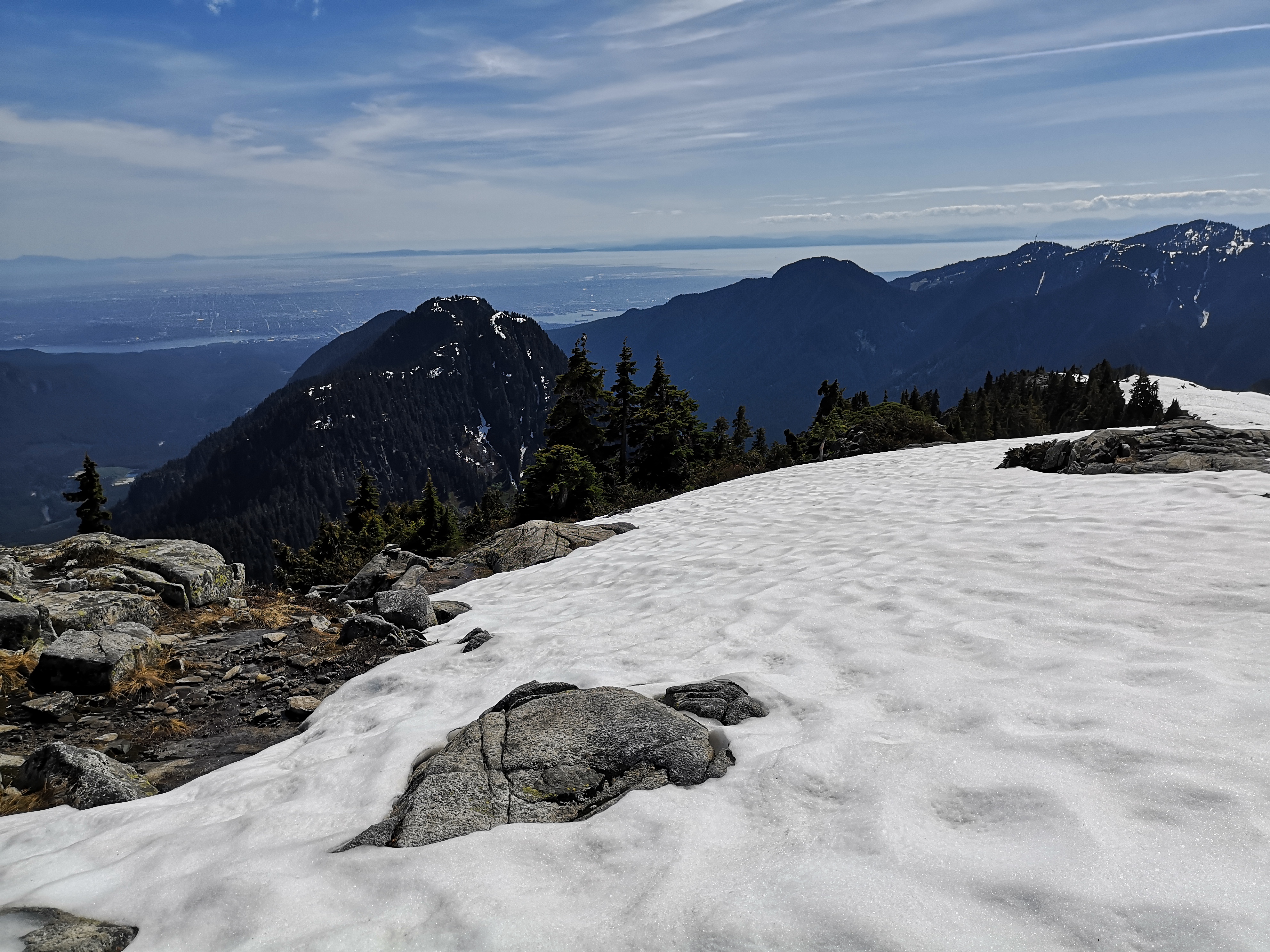
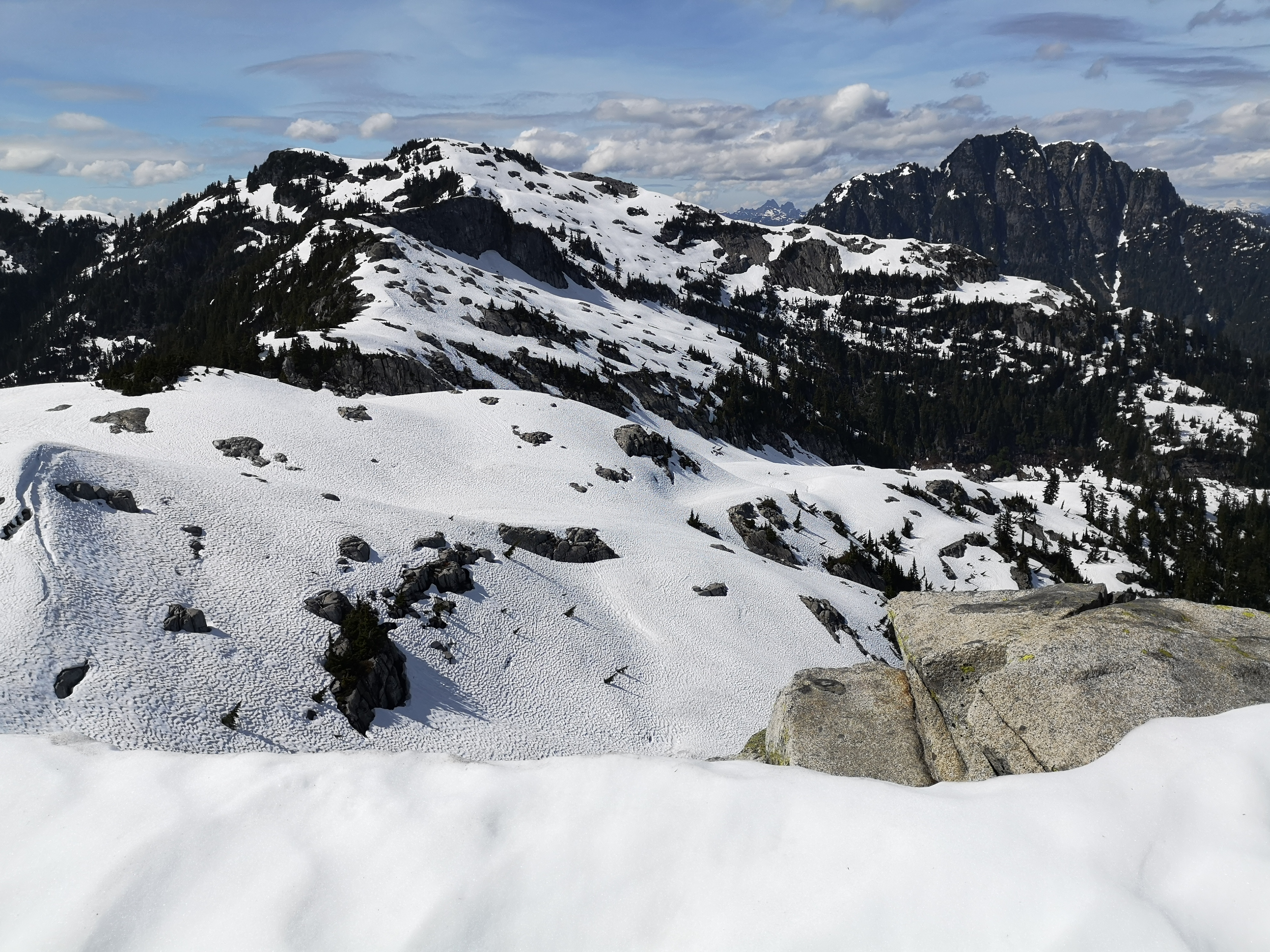
Retracing our steps to the junction, we took a hard right to begin the ascent up Coliseum. Soon after the junction, we hit snow (around the 1100 meter mark in early June). We put on our spikes and gators and stomped through, searching for flags to ensure we stayed on track. However, we shortly lost the flags, as most were still buried beneath the snow. After searching in vain, we decided to just wing it – we knew we needed to ascend this side of the mountain and reach the ridge, and from there, we would intersect with the traditional trail, and follow that route to the summit. Picking a likely path and stomaching some bush-wacking, we just began climbing straight up the snowy face. I had some misgivings about our chosen course, but luckily, we stumbled upon a trail-runner on his way down the face (as we always seem to – whenever we think we’re doing something hardcore, we run into a trail-runner in tiny shorts and a running vest, being way more badass than us…). He confirmed that we were on the right path, and only about 5 minutes from the ridge. Following his tracks, we were soon up and on the traditional flagged trail.
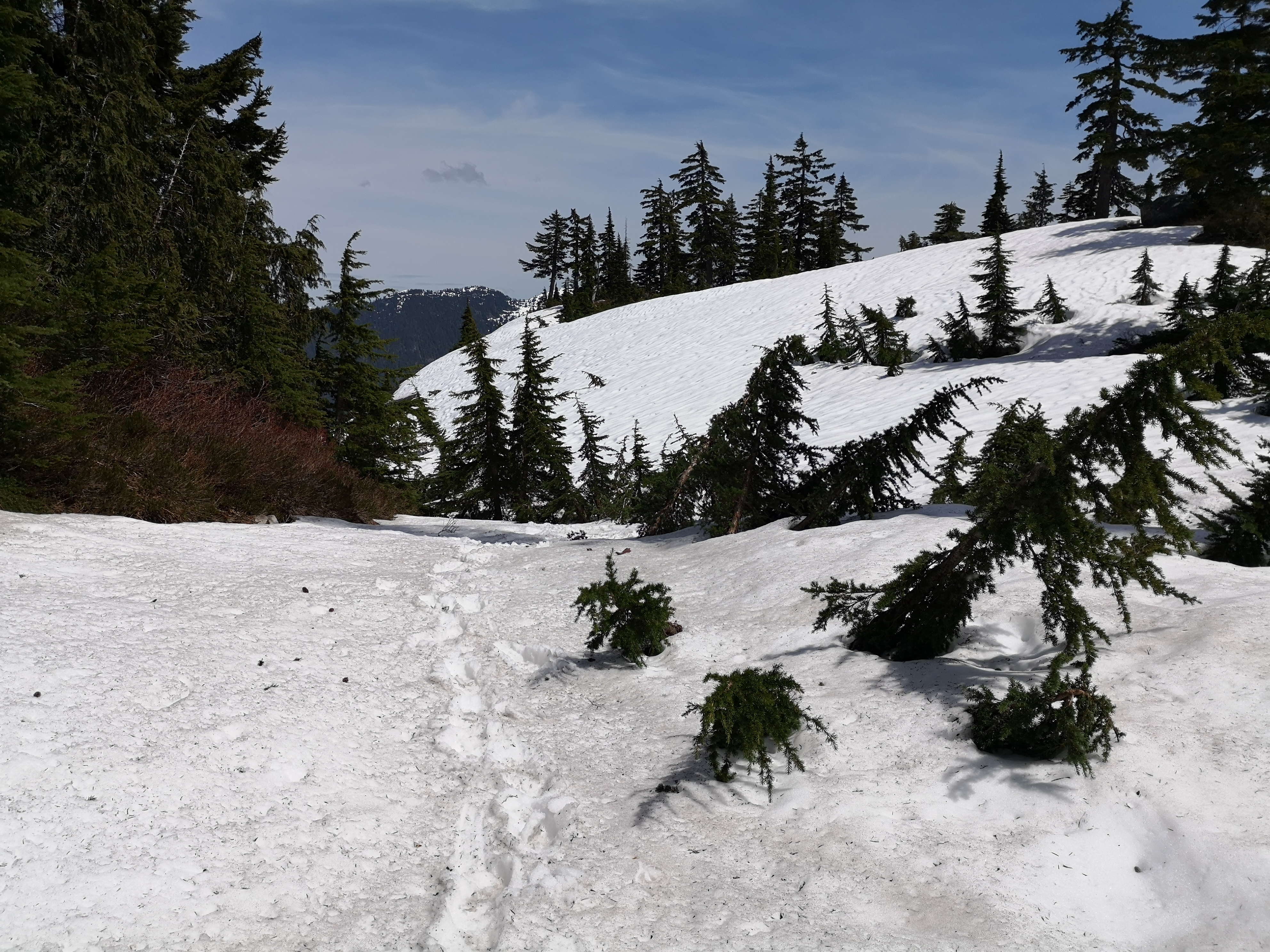
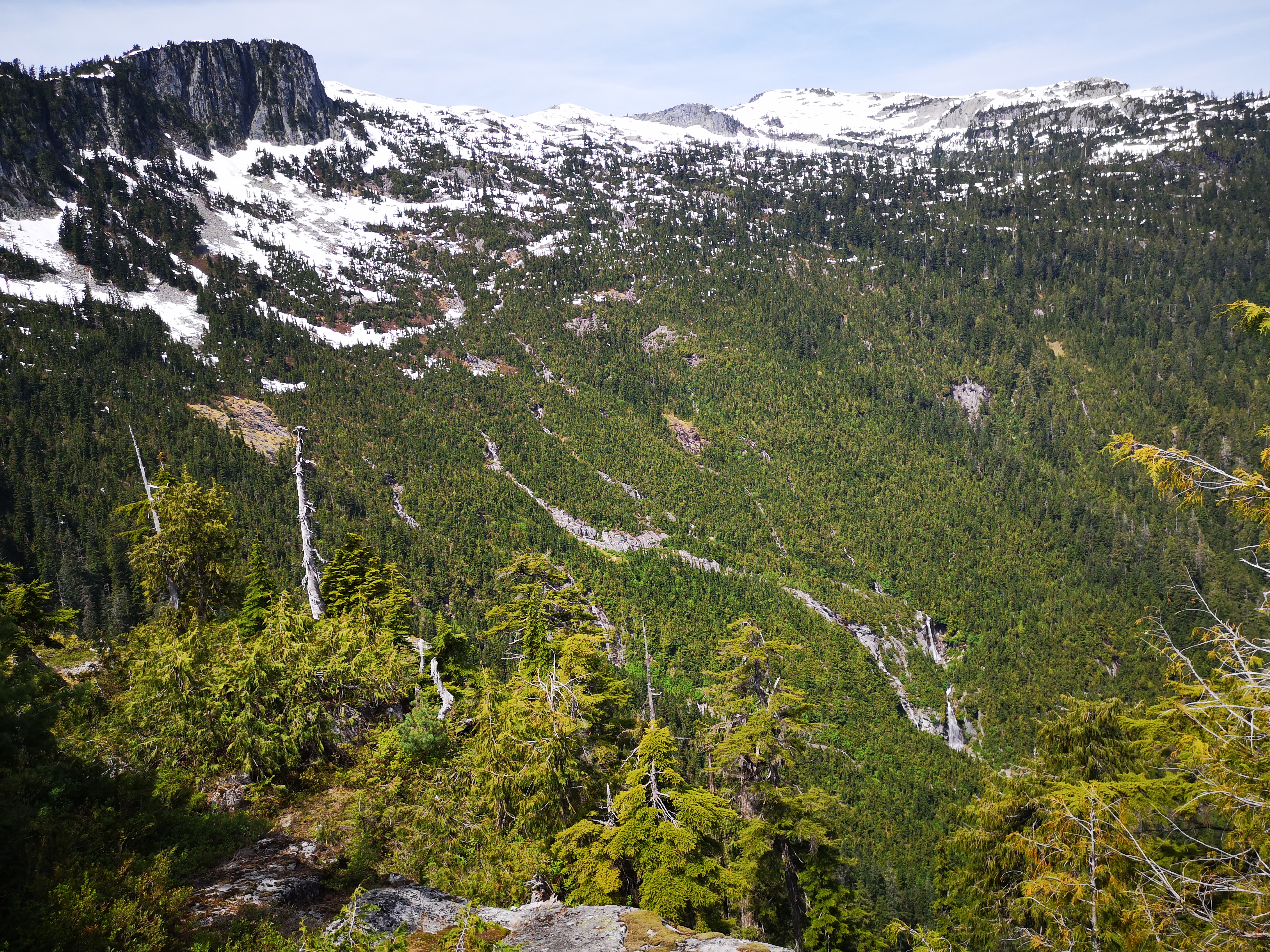
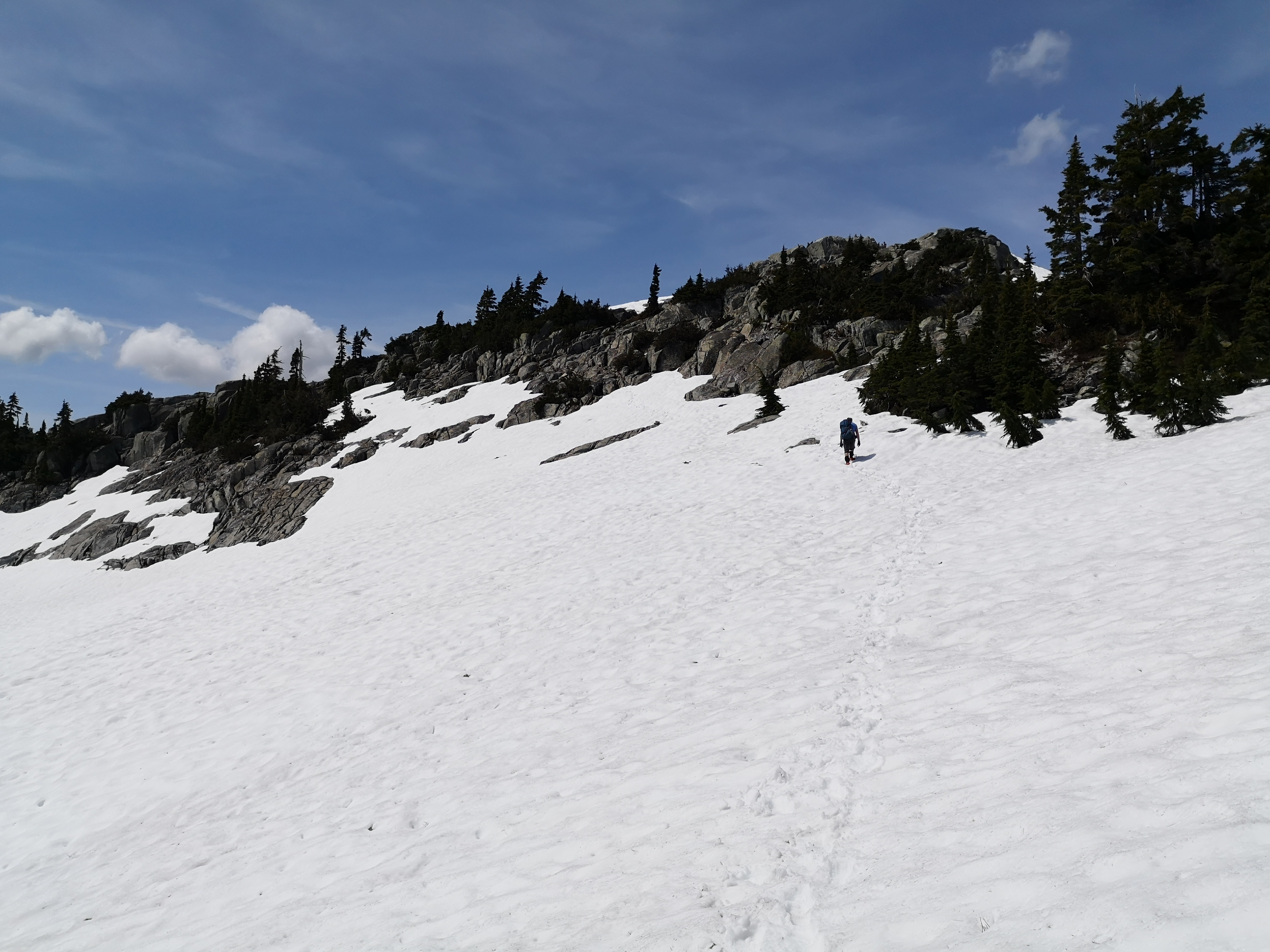
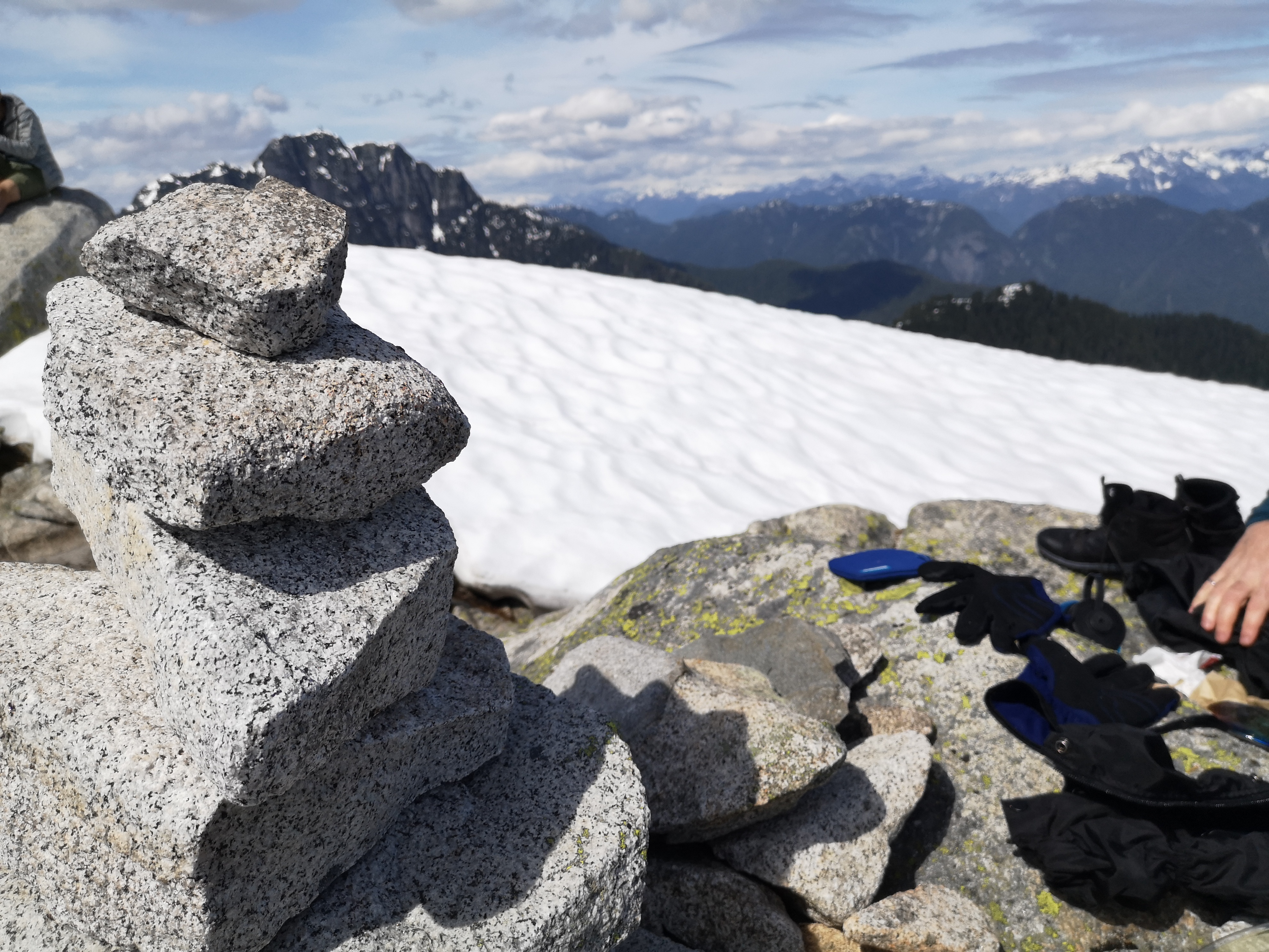
We were getting pretty tired by then, and the snow slowed us down considerably, but we pressed on, as we had about an hour left to reach the summit. What lay ahead was some good mixed hiking up rock and snow. Leaving the treeline and entering the alpine was a jolt of energy: full sun on gleaming snow dotted with the brave heads of early alpine flowers, azure sky, surrounded by mountain peaks like sentinels in this remote land. When the bowl of peaks is laid below my feet in glorious panorama, I forget all tiredness; the surge of adrenaline is enough to push me to the top. There is no joy like alpine ridges.
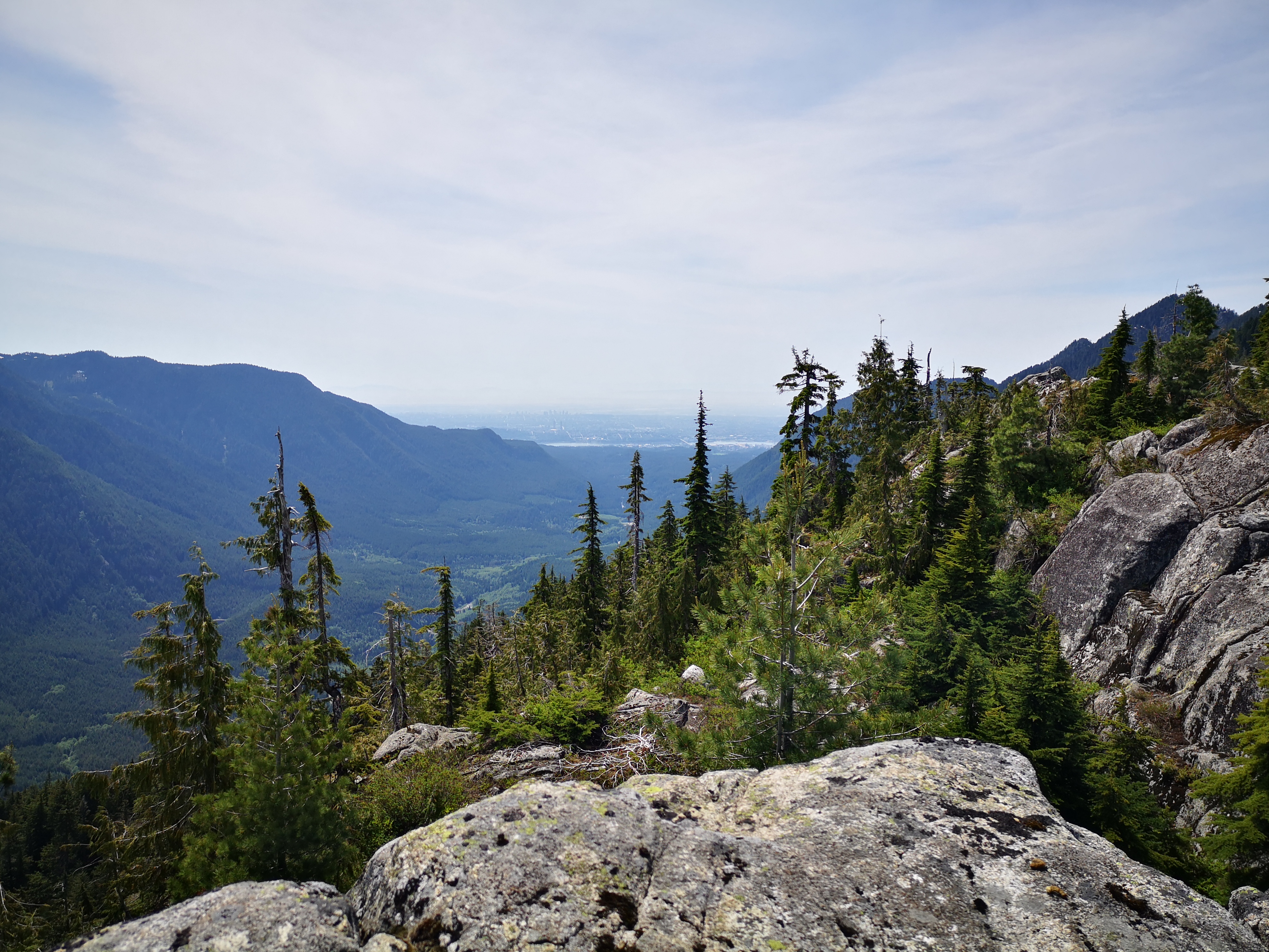
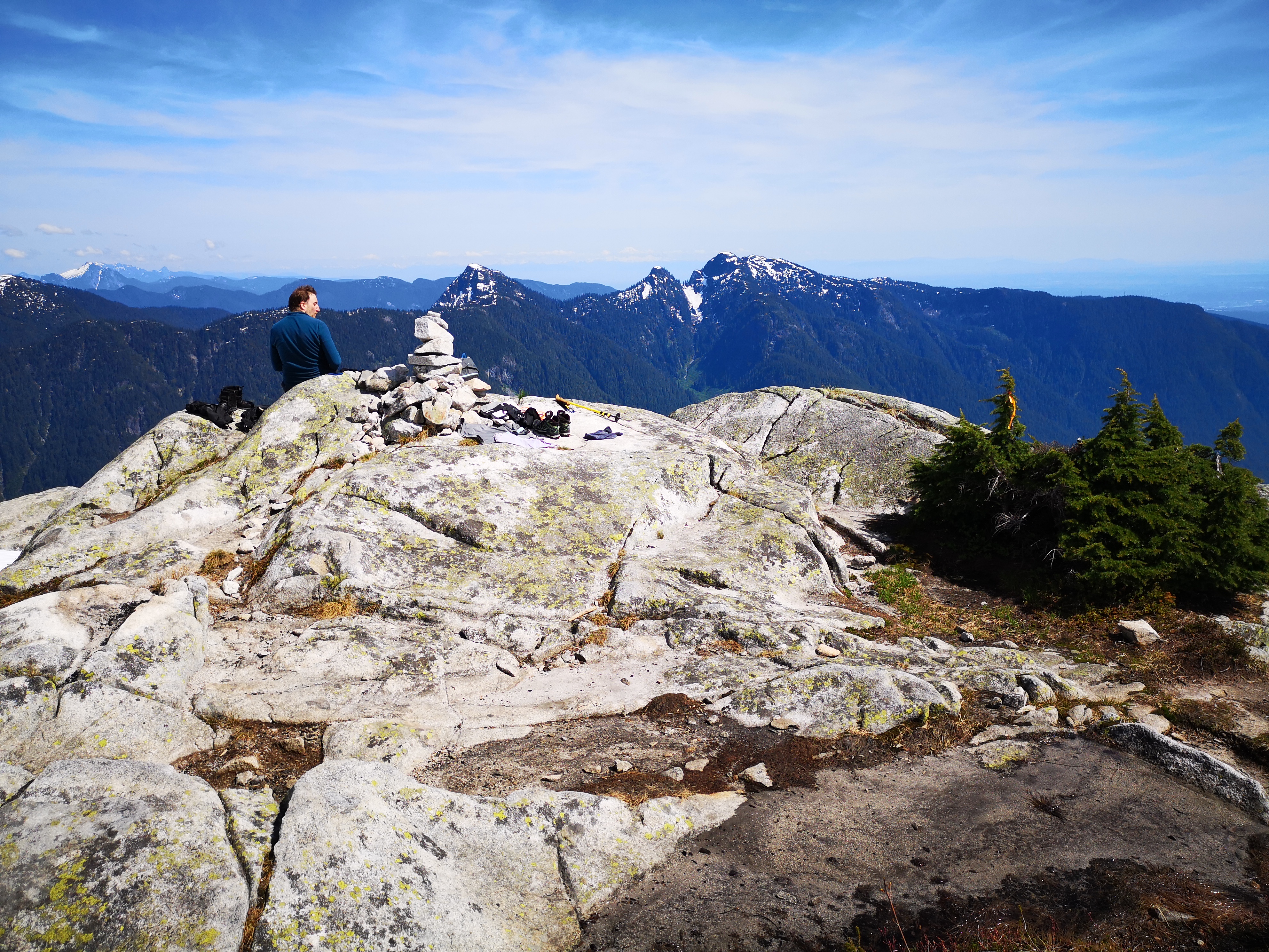
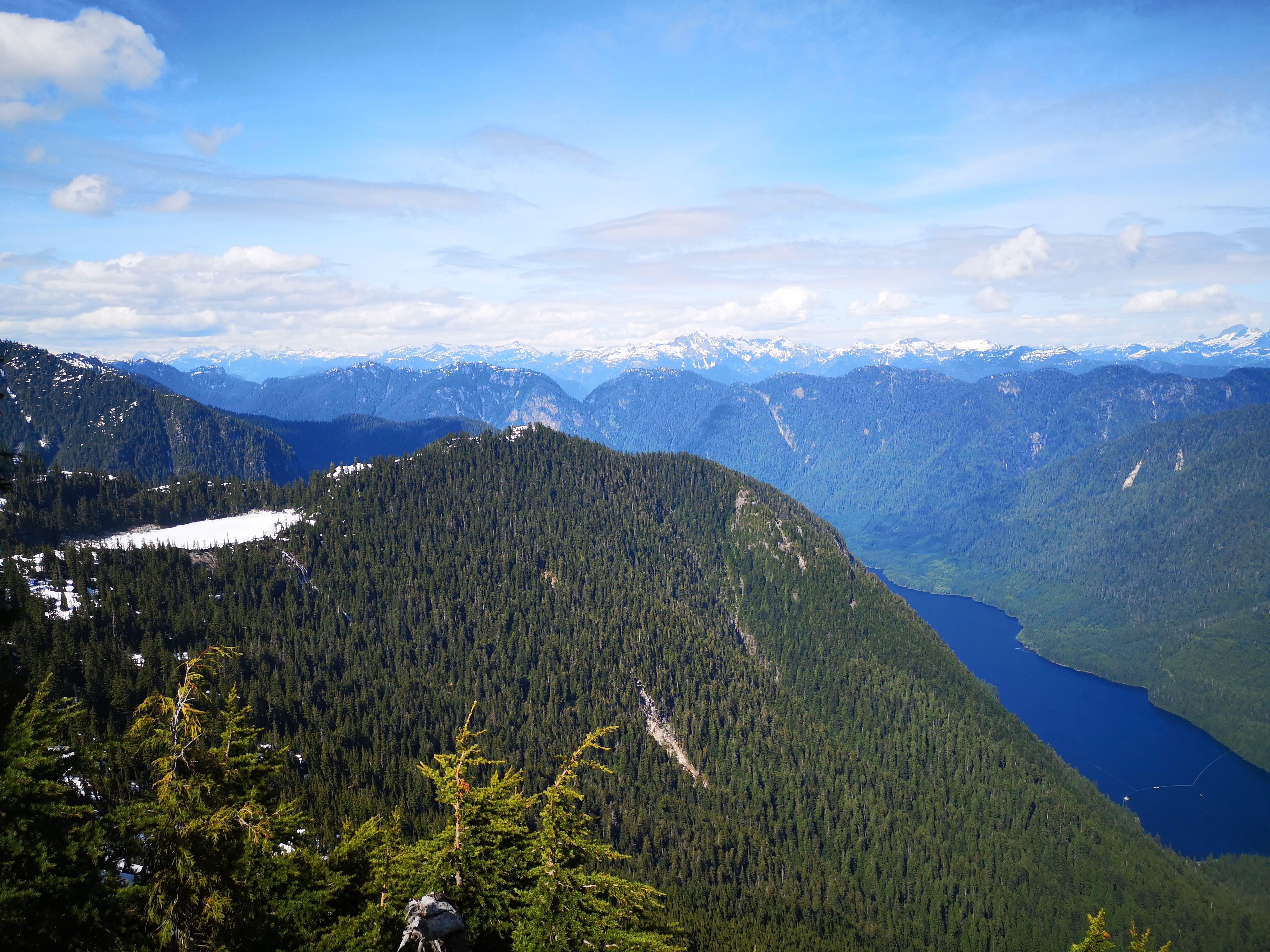
The peak was not unoccupied, to our surprise. We shared our trophy with three other hikers who had taken the regular trail from Lynn Headwaters. Emerging from an ocean of snow onto an island of blissfully hot granite, we shed our wet layers and indulged ourselves in a long lunch, getting our bare feet on that warm rock, suntanning at 1400 meters. Below us was an alpine lake, frosty blue. Behind us was the col and looming mass of Cathedral (a trip for another day), and the jagged peaks of Garibaldi Park. To our left was Seymour, Bishop, Elsay. To our right was the windmill of Grouse and the infamous summit of Crown. In front of us, the city of Vancouver receding into a hazy ocean.
While our trip up had taken about 5 hours (including several leisurely breaks, plus some full-stops for route-finding), we blazed down the trail in 2 hours (you heard that right). The afternoon snow was the perfect consistency for basically running down from the summit. As I could feel my core get shakier as we descended, I started getting concerned about the bike ride awaiting us. There were certainly some significant hills to contend with on that road. Retrieving our bikes from their hiding spot, we began the final leg. I think I had entered a state of ‘runner’s high’ though, because I pushed hard and happily on every hill we met, and raced down at an unbelievable speed on those wonderful machines. While I live for mountains, I was surprised to experience such a feeling of flow on that ride back, letting this sense of weary and exhilarating euphoria take hold of me while we sped through the wind on a perfect road surrounded by the quiet and restful forest. I am definitely hooked on bike-packing.
So Coliseum was climbed. Nothing too strenuous or scary even. Learn from my mistakes and take the mountains seriously. Here’s a list of some backcountry packing essentials (even on hot summer days), and other tips:
- Navigation – unless you’re on a heavily trafficked front-country trail with frequent signposts, take navigational aids. Find what info you can online about the elevation gain and profile, distance, and rough directions so you know what to expect. On trail, we use a GPS trail-map phone app, plus a GPS watch with breadcrumb trail and altimeter.
- Extra layers – mountain-tops get cold when you stop moving. Wear fast-drying, sweat-wicking fabrics, and bring at least a dry shirt to change into, as well as some emergency layers. With snow-travel, bring a extra pair of dry socks. Remember, you only have about 5 minutes of body heat when you stop, so get out of those wet layers or throw on a jacket right away. I bring a thermal baselayer top to change into (my leggings don’t hold any moisture, so I don’t change them), plus an emergency fleece or a down alpine-climbing jacket.
- Extra calories – depending on your metabolic needs, you could burn 2000-4000 extra calories in a day of hiking. Bring more food than you think you’ll need. No harm in having extra.
- Extra water – once again, bring more than you think you’ll need. Be aware of sources of fresh water on your trail where you can refill if needed. Consider bringing a water-treatment device, such as a filter or UV pen. I bring a small manual filter – the Sawyer Mini. It’s cheap and weights nothing, and I know that I can safely drink from even the most disgusting mud puddle if needed.
- Light – I bring a headlamp and spare batteries on basically every hike. I throw it in a waterproof bag with my first aid kit and forget about it. I wouldn’t rely on a phone light on the trail should it get dark.
- Moisture is your enemy. You will freeze when you stop at high altitudes. In addition to changing out of wet clothes, splurge on a pack-cover for the rain (they’re like 10 bucks). I put things that can’t get wet in a small dry bag (extra layers, gloves, socks), and have a waterproof case for my phone.
- There is no such thing as 100% waterproof; there are only grades of waterproof. Even your expensive Gore-Tex will get wet with enough time and volume of water. Consider rescheduling if you’re seeing an excessive amount of rain in the forecast. You can still get hypothermia on summer evenings in the wilderness.
- If the situation calls for it, watch your companions for signs of hypothermia. Look for pale or bluish skin, shivering, slurred speech, altered coordination or balance, and confusion (often manifesting as poor choices).
- Be aware of ‘peak fever’. When the desire to reach a summit begins to outweigh the safety of both the individual and the group, you’ve got a problem. Be aware of it in yourself and your group, and remember that no summit is worth your life. There is more to be proud of in a mature and thoughtful decision to turn back than a dangerous summit.
Trail Stats
The bike ride to the trailhead was completed in about 30 minutes, and spanned 9 km (5.6 miles) and 90 meters (295 feet) of elevation gain. The Coliseum trail itself, with a small detour to Paton Peak, was about 1350 meters (4430 feet) of gain and 12 km (7.5 miles). The climb took about 5 hours, including a long break at Paton and a few smaller breaks (likely an hour of breaks, actually), and the descent was completed in 2 hours. Similarly, the bike ride back was another 30 minutes. Allow a full day for this trip (8 to 10 hours). This trail was done in early June and had considerable snow still, so micro-spikes, gators, and proper waterproof boots are a must, plus all of the other backcountry essentials.
I’d love to hear from you! Tell me about your Everest, your forays into bike-packing, or some secret ‘back-door’ trails you’ve discovered in the comments below!

I enjoyed your journey. Loved the photos and had a chuckle from your description of the trail runner. Those flat rock surfaces worn over time look slippery. Well done Emily!!
Love
Aunt Barb
LikeLike
Thank you! Yes, those trail runners just pop out of nowhere. I simultaneously shake my head and admire them. Thanks so much for reading! 🙂
LikeLike
Looks like a must do this summer! Great post!
LikeLike
Every mountain is a ‘must do this summer’ unfortunately… 😛 Thanks so much for reading Phil!
LikeLiked by 1 person