
Volcano climbing on Mt Hood, Oregon
The first time I visited the city of Portland, Oregon, was perhaps five or six years ago, and I was enthralled by Mt Hood. Towering over everything nearby, a lone monolith at 3400 meters, was this stunning, snow-capped mountain, surrounded by lush forest, expansive woodlands, and icy blue rivers. At the time, the closest I ever got was camping in its imposing shadow in Mt Hood National Forest, as well as a brief foray onto a lower hiking trail on its gentle shoulder. But I was struck – Oregon locals may notice that a photo of Mt Hood is on the homepage of my website, taken on that trip years ago. And here I find myself again in Oregon, in the prime volcano-climbing season of May.
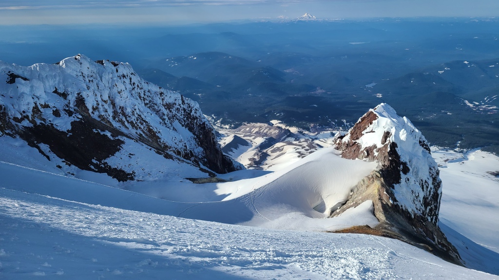
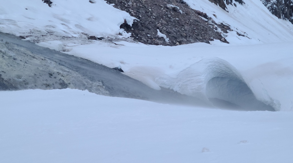
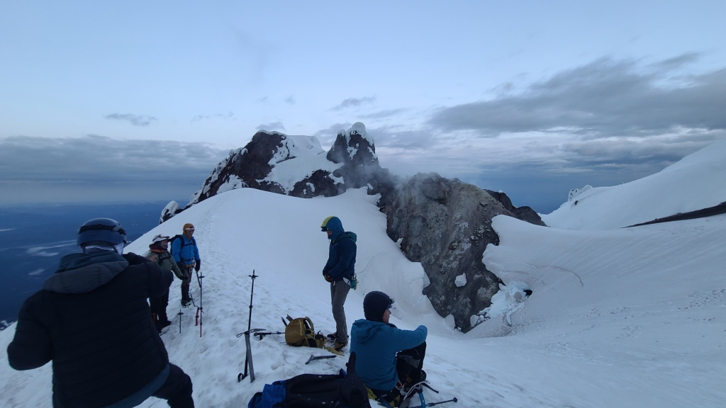
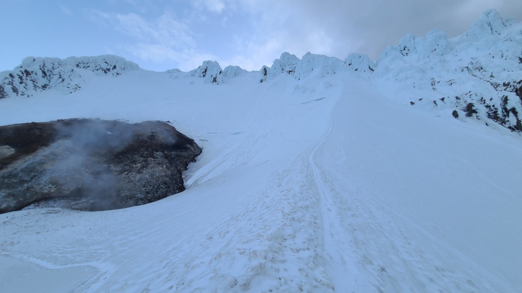
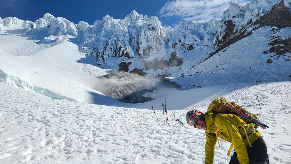
Mt Hood is indeed a volcano in the Cascade Range, although informally considered to be dormant. The highest peak in Oregon, sitting adjacent to Washington state against the boundary of the Colombia River, its snowy flanks can be seen from vantage points across the state. With a peak at 3400 meters, it’s actually the 4th tallest of the Cascade volcanoes. While Mt Hood is generally inactive, and unlikely to errupt, the presence of fumaroles make the mountain climate unique. Fumaroles are vents or fissures in the mountain which allow volcanic gasses to escape. The standard climbing route up the south side of Mt Hood has several fumaroles. These holes ooze sulphury steam, lending mystic to the final climb, and contributing to the distinctive rime-covered walls of the summit. Rime is a very fragile type of ice that forms in humid environments; it coats the rock and rains shards of ice down on those who approach.
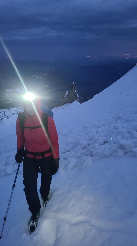
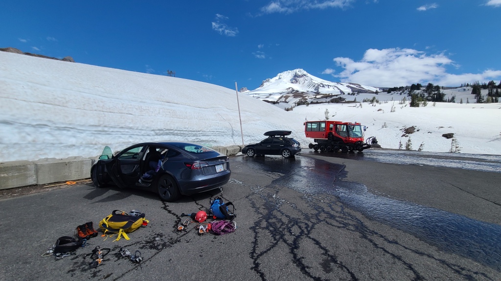
While it certainly is tall, Mt Hood is not really a technical mountain to climb. The south route begins at a ski resort, and follows a groomed track halfway up the mountain. From there, crampons and an ice axe, plus some general mountaineering sense on navigation, and hazards such as rock/ice fall and bergschrunds, are all that’s required. However, to enable fast travel and minimize some of the dangers related to warming, a true alpine start is required (ie: being ready at the trailhead in the wee hours of the morning). We strategically camped at a nearby Oregon Sno-Park called White River West (which features free overnight parking after the winter season ends on April 30th), and were in the overflow parking lot of Timberline Lodge, which is next to the Hood backcountry corridor, at 1:30am. As this is prime mountain climbing season, we were not alone. At least a dozen other cars were present, and many pinpricks of headlamps were visible on the slopes above us.
While we had chosen our mid-May ascent day thoughtfully, waiting for clear weather and the storm-strength winds of the previous weekend to die down, we were buffeted from the moment we stepped out of the car in the parking lot, with nearly zero reprieve the entire day. Gusts had been forecasted around 20 km/h, which I thought was reasonable, down from the 50 km/h of the weekend, but I still struggled to breathe as we walked uphill for hours into that headwind. It was deeply unpleasant. My internal mutterings were validated by a couple who passed us on the way down. They had decided to turn around, stating that they “were not as tough as they thought they were”, and that they were going to try Mt St Helen’s instead! However, another group that we passed mentioned that this was their second attempt – they had tried to climb the previous weekend during the wind-storm. In comparison, they were thrilled with this morning’s ‘gentle breeze’.
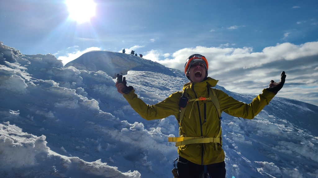
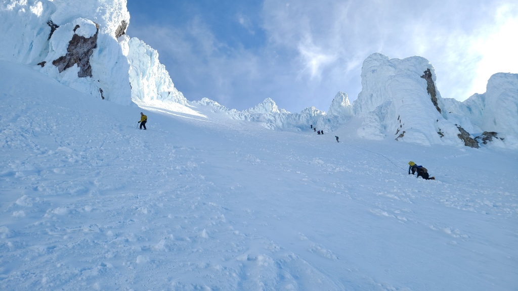
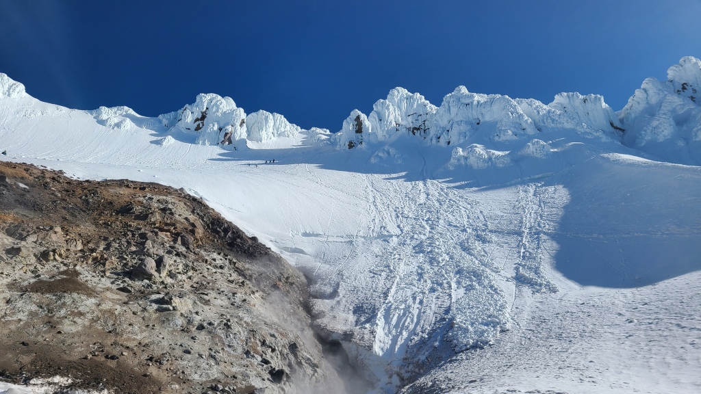
As we continued to climb, we overtook the rest of the groups on the mountain, all guided groups who had stopped to put on their crampons, as we left behind the groomed track and approached the steeper sections. Passing Illumination Rock, a distinctly sharp rock fin, we switch-backed up a short and steep section to reach the famous landmarks of Hogsback ridge, a small, snowy white hump dividing the mountain almost vertically, and Devil’s Kitchen, a bowl a few hundred meters below the summit containing a few fumaroles. While smelling strongly of sulphur, Devil’s Kitchen was a pleasant place to stop for photos and a snack, as we were finally out of the howling wind!
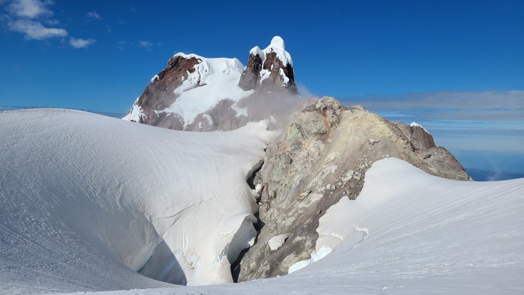
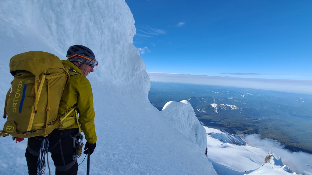
While we ate and put on our climbing harnesses, just in case, a few of the guided groups passed us and began their ascent up the “One O’clock” route, a mildly steep and obvious route up the final headwall to the summit, just climber’s right of the most commonly used “Old Chute” route. As Chris and I snacked, we assessed our other summit options. Another famous route, the “Pearly Gates” lay before us, nearly straight up Hogsback ridge – steeper, skirting an open bergschrund, with an exposed traverse, but still moderate enough in difficulty that it’s commonly done by new mountaineers. Chris, in classic Chris style, opted for the most direct path to the summit, what we thought was Pearly Gates, Left Route. After bypassing the opening bergschrund on climber’s left, we quickly punched steps in the steep, icy crust and reached an intimidating rime-covered ice chimney. Chris explored the chimney for a good half-hour, chipping away at holds with his axe and stemming on ice pillars, while I shielded myself below from shards of falling ice, feeling both dubious about the route selection and somewhat satisfied in a perverse way that at least I was getting a true mountaineering experience – how many books had I read where the second climber must patiently wait out a shower of rime? And what was mountaineering without a bit of grit, fear, and suffering? Why do I like this sport?
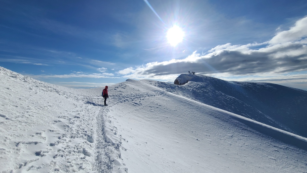
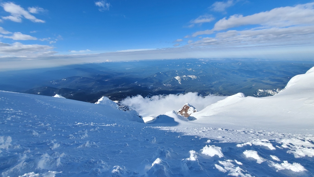
Eventually however, we gave up our chosen chimney as a bad job, and painstakingly down-climbed and traversed to rejoin the popular One O’Clock route. Once back on the main track, reaching the summit was easy. We rapidly climbed the pre-kicked steps, passing the last of the guided groups, who were climbing on roped belay from their guides (unnecessary in my books, as the route wasn’t that steep, but you pay for a full mountaineering experience with a guide, and probably want the excitement and security of rope systems as part of your trip). After climbing about 70 meters, we found ourselves finally in the sun on the final ridge. A short walk of a few minutes along the beautiful, gentle ridge leads to the true summit and panoramic views. We hung out with a dozen other folks on the summit, snapping photos in the early morning light. A few asked about our aborted route, as we had lots of eyes on us during the climb. While quick to admit it was a route-finding mistake on our part (although more sophisticated ice climbers than us probably could have made it work with the right tools), I appreciated one guide’s statement that 1) that route didn’t go; and 2) he’d tried it before himself. Good to know other experienced climbers have made that mistake in the past!
The descent off the summit was straightforward. We moved quickly to get ahead of the bottleneck of guided groups – the first 50 or so meters were steep enough that we faced into the mountain and downclimbed with our ice axes, but the slope soon mellowed out enough that we turned around and carefully walked down the rest. We soon found ourselves back at Devil’s Kitchen, where we stopped again to snack, store some technical gear we would no longer need, and de-layer – the wind had died significantly, and the morning sun was now striking the mountain. The rest of the descent was somewhat trivial – just a long, gradual walk down the snow, the parking lot of the ski resort visible nearly the entire time. We passed many backcountry skiers on the way up – by then, the sun had softened the crusty snow just enough to be a passably enjoyable ski. The descent was warm and a little awkward as our boots kept punching through the warming snow, but it was a quick and efficient straight line back to the car.
In total, the trip took us about 9 hours, including about an hour and half of extra time on our failed detour. We climbed about 1700 meters, and covered about 10 km of distance. Conditions were perfect for quick climbing in crampons (mid-May, after a few weeks of hot weather had baked the south route and consolidated the snowpack into a solid mass).
While I’ll admit that I suffered more than expected on the ascent (the alpine start, strong headwind, and cold wore me down), I’m glad I stuck it out and can finally cross Hood off the list. Now, on to the next volcano!

One thought on “Steamy Adventures on Mt Hood”