
Climbing Wedge Mountain in Whistler, BC
Note: This is a special post. Its intent is to capture aweekend trip to Wedge Mountain in Garibaldi Park. This is not meant to be aguide, but a narrative, and is thus quite lengthy. Wedge is not a hike. It isclassic mountaineering, requiring proper equipment, training in crevasserescue, a high level of physical fitness, skill in backcountry navigation, andcomfort in exposed climbing and glacier travel.
The intent at Ridge and River has always been to be real, and the reality is that there is a large degree of “type 2 fun” (better defined as satisfaction than fun perhaps) associated with some outdoor activities. Heavy packs, sleepless nights, sunburns, aching feet, and psychological stress are just some of the things we endure for the feeling of being an explorer. But if it was just for the view, I’d stick to front-country hikes in my backyard in Vancouver. I toyed with this sentiment as I sat in the middle of a vast scree-field on the remote west ridge of Wedge, completely lost and little overwhelmed at the journey I had voluntarily undertaken. What was I out there to gain? At the time, the answer was unclear, and I swore off mountaineering in favour of simple hiking. I think I can answer that question now though, perhaps best described as a collection of moments. It was elation as we scaled 60-degree ice-walls on the knife-edge arête, but also the feeling of being a million miles from safety under a wide, anonymous sky. An exposed climb worthy of a magazine cover, and the ten minutes it took to collect myself after a heart-stopping fall. Gazing in exhaustion at the wall of the col that stood between us and familiar terrain, and laughing on the summit in the sun and blue air. Resting and discussing if we wanted to continue in the one spot where we could safely sit, checking in, just as we had promised we would. The gentle blue and savage arms of the glacier locking down the earth. Lake campers and their question, with mild interest, “were you on the glacier?!”, and our shell-shocked and wholly insufficient response: “we climbed Wedge.” Taking off the harness at camp, the soft pink eyes of sunset, counting carabiners, coiling rope, the feeling gradually dawning that it was over, and that it was absolutely massive. Put simply, we are born to discover.
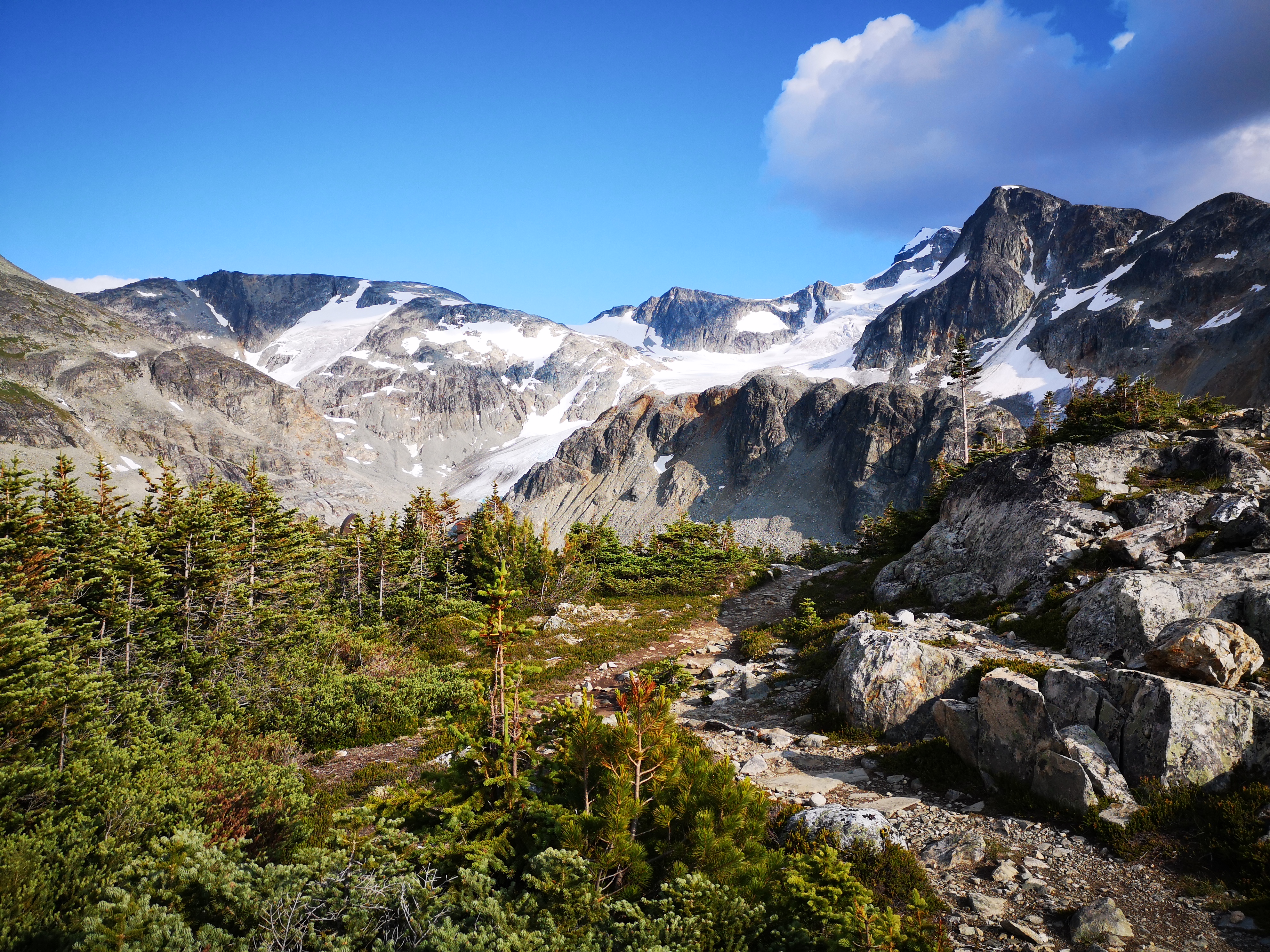
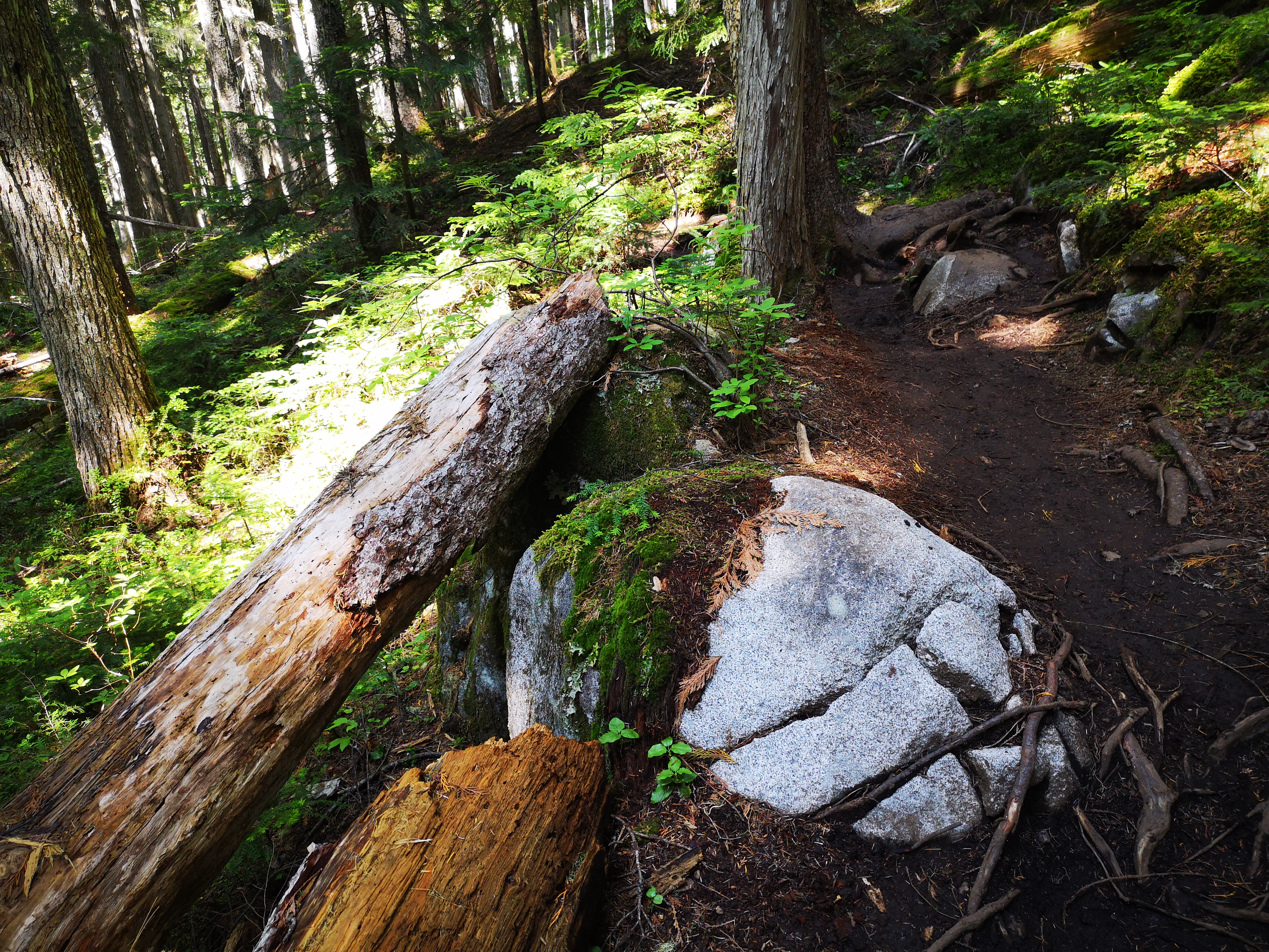
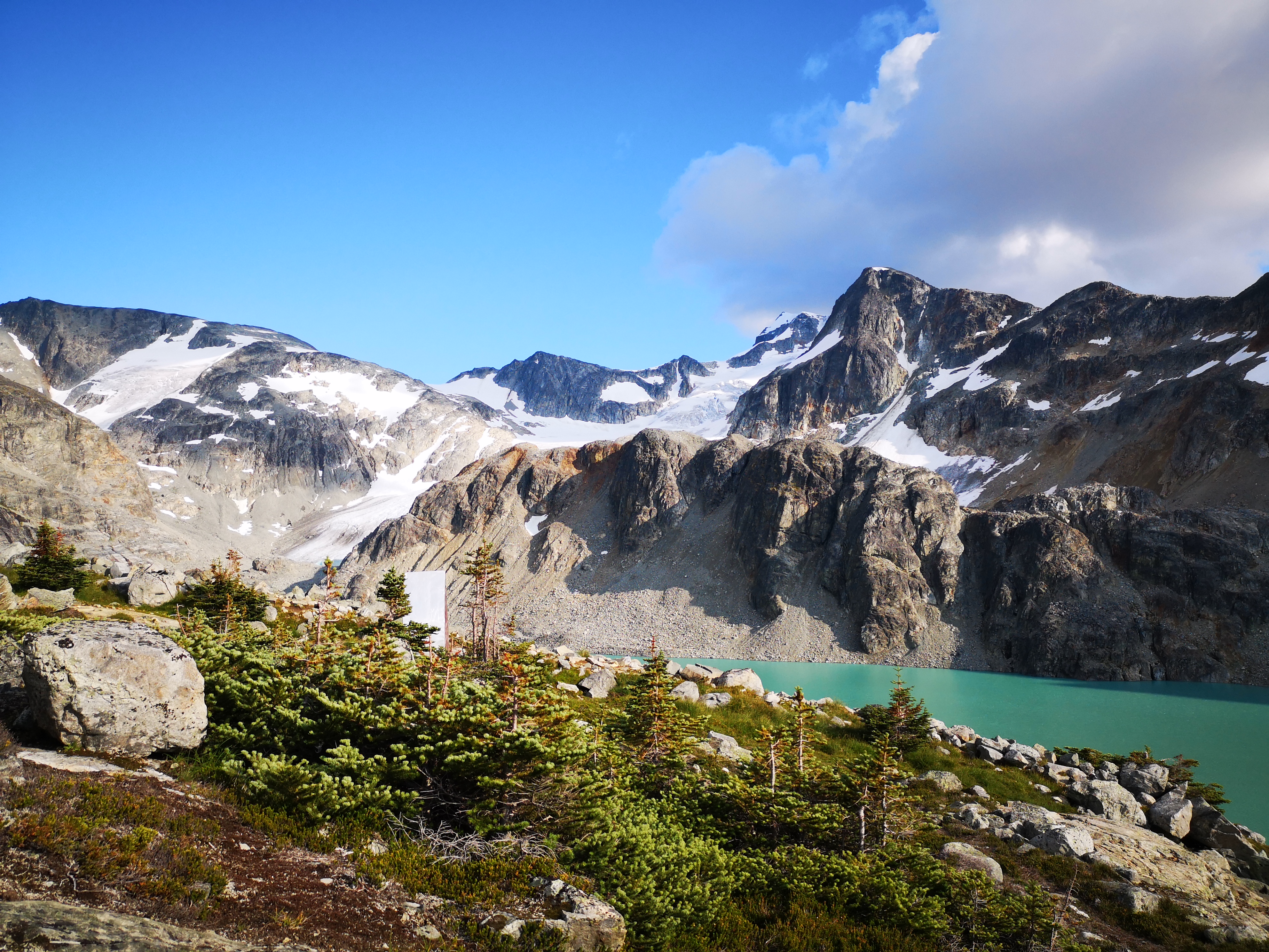
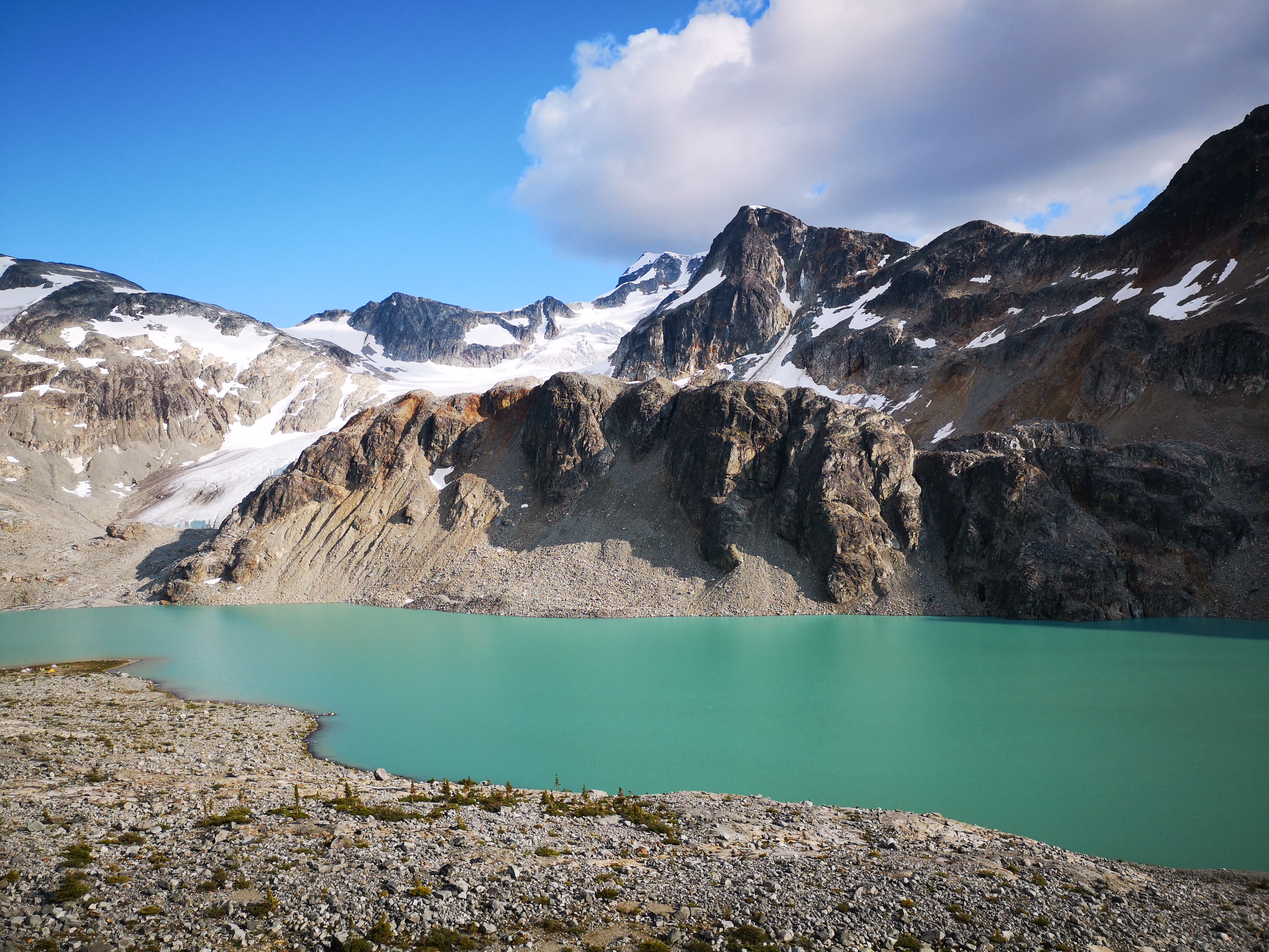
Mt Wedge lies just outside of Whistler, BC. It holds the honour of being the tallest peak in Garibaldi Provincial Park, and sits beside Wedgemount Lake, a local hiking classic. A 20-minute drive from Whistler brings you to the Wedgemount parking lot (no 4×4 required), and a 3-hour hike on a well-marked trail deposits you at the lovely turquoise lake, which would serve as our basecamp for the weekend. A busy backcountry campground, the lake has about 20 tent pads on the ridge and beside the water (plus plenty of room for “unofficial” camping).
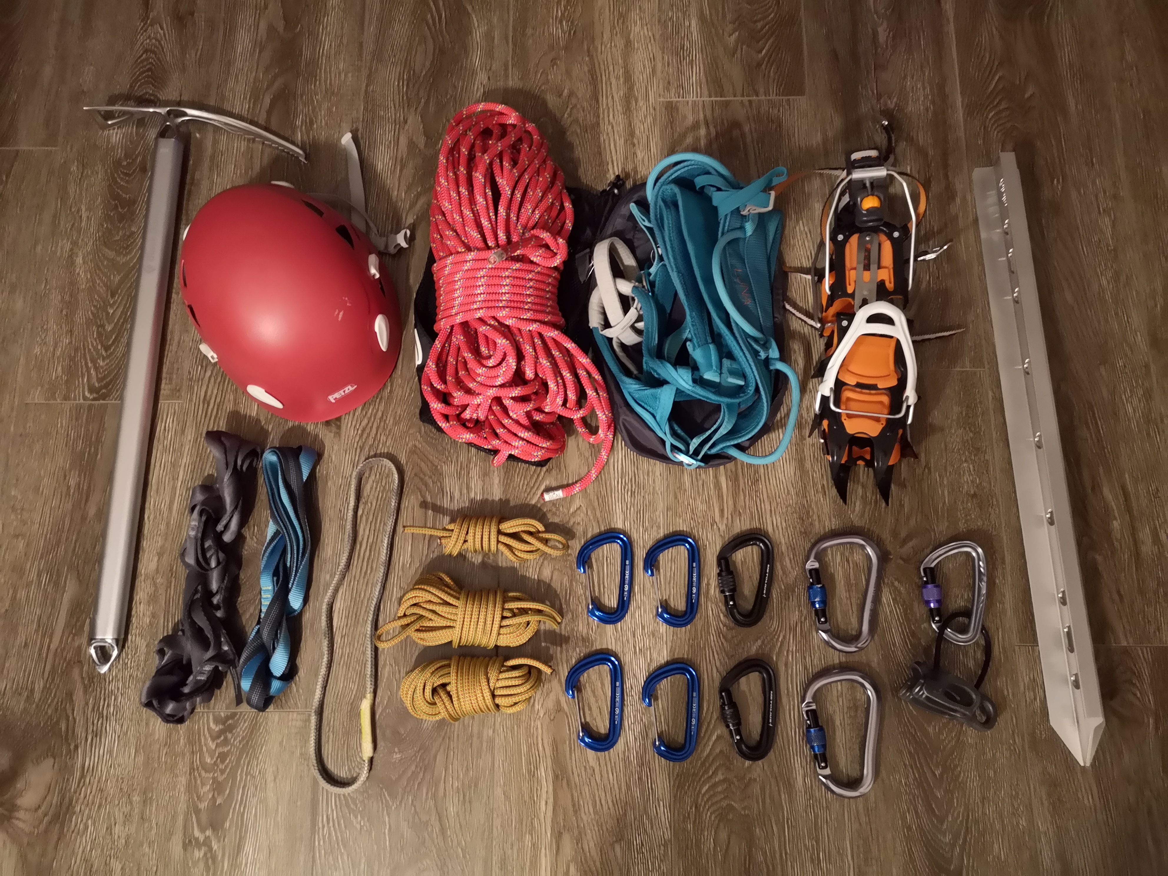
I’m rarely nervous when packing for trips, but I felt rushed and a bit anxious on Friday night as I gathered gear, prepped food, and reviewed the route. This was to be my biggest summit to date, both in terms of literal height, and in terms of difficulty. While I’ve completed many trips requiring more elevation gain and horizontal distance than Wedge (which only clocks in at a pitiful 11 km and 1000 m of gain), the technical challenges of this medium-grade mountaineering route were somewhat intimidating. Despite the plan to complete this trip in two days, my hopes for a light pack were dashed by the substantial amount of safety gear required to navigate a significant amount of unknowns: harnesses, helmets, crampons, ice axes, rope, cordlette, carabiners, belay device, slings, picket, headlamps, GPS, and a satellite phone. Plus camping gear, it made for a heavy bag!
A late start saw us at the Wedgemount trailhead at noon. The trail was busy with hikers, including another group sporting ice axes and pickets on their bags. Recognizing that we’d be sharing Wedge, we stopped to say hi. They happened to be planning the same route as us: ascent via the northeast arête, and descent via the west ridge. I think both groups were happy to have another set of people on the mountain.
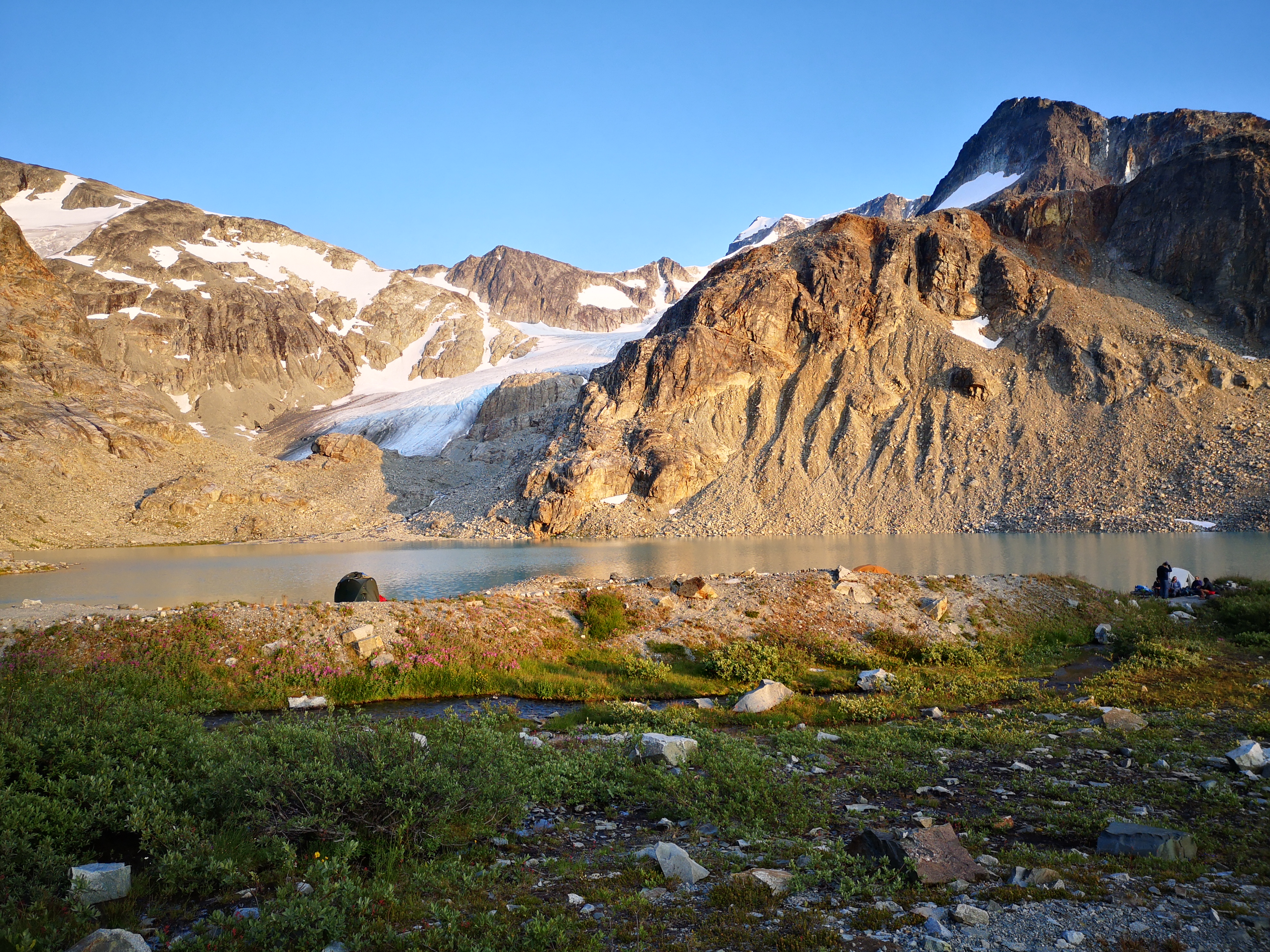
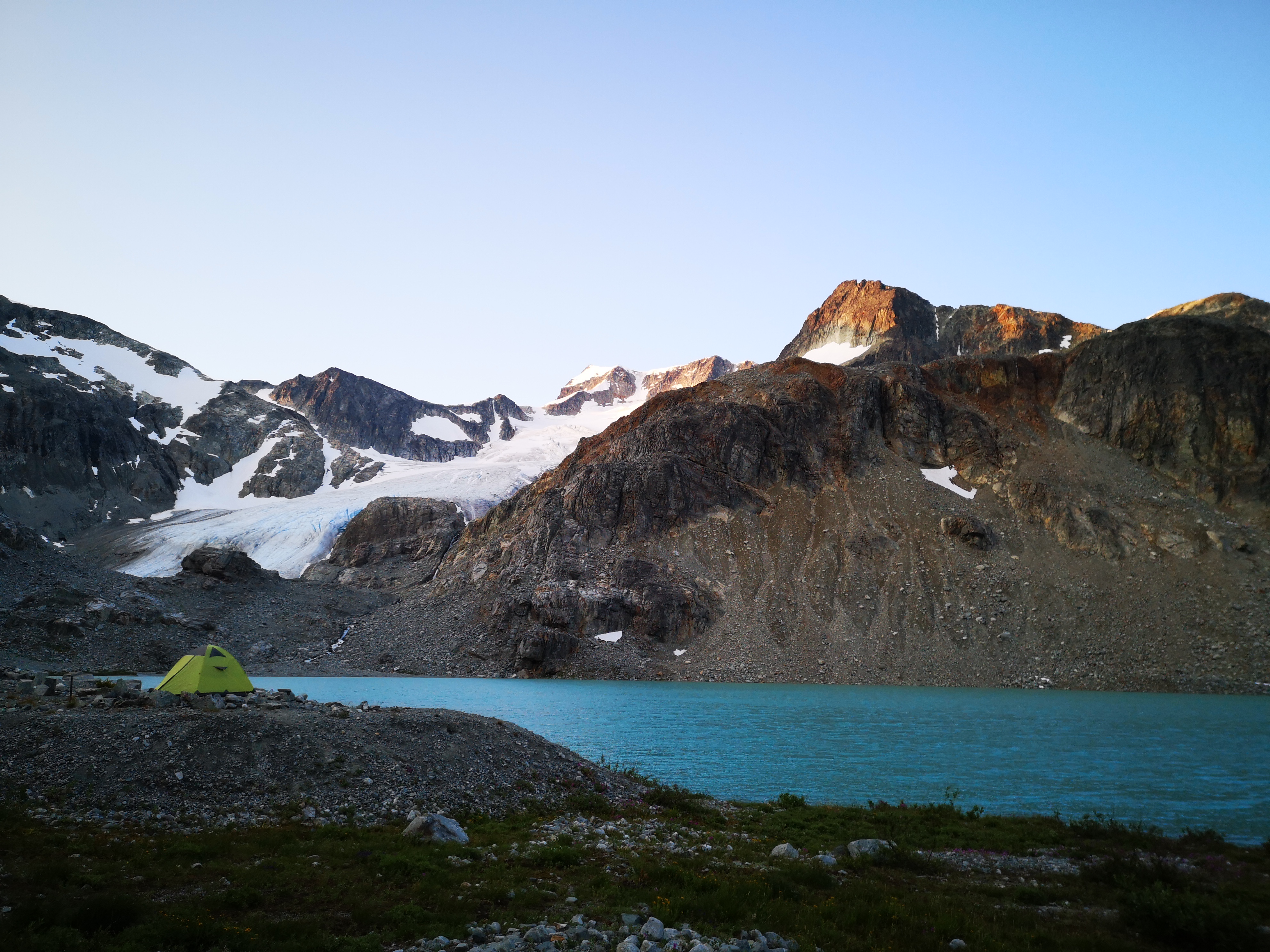
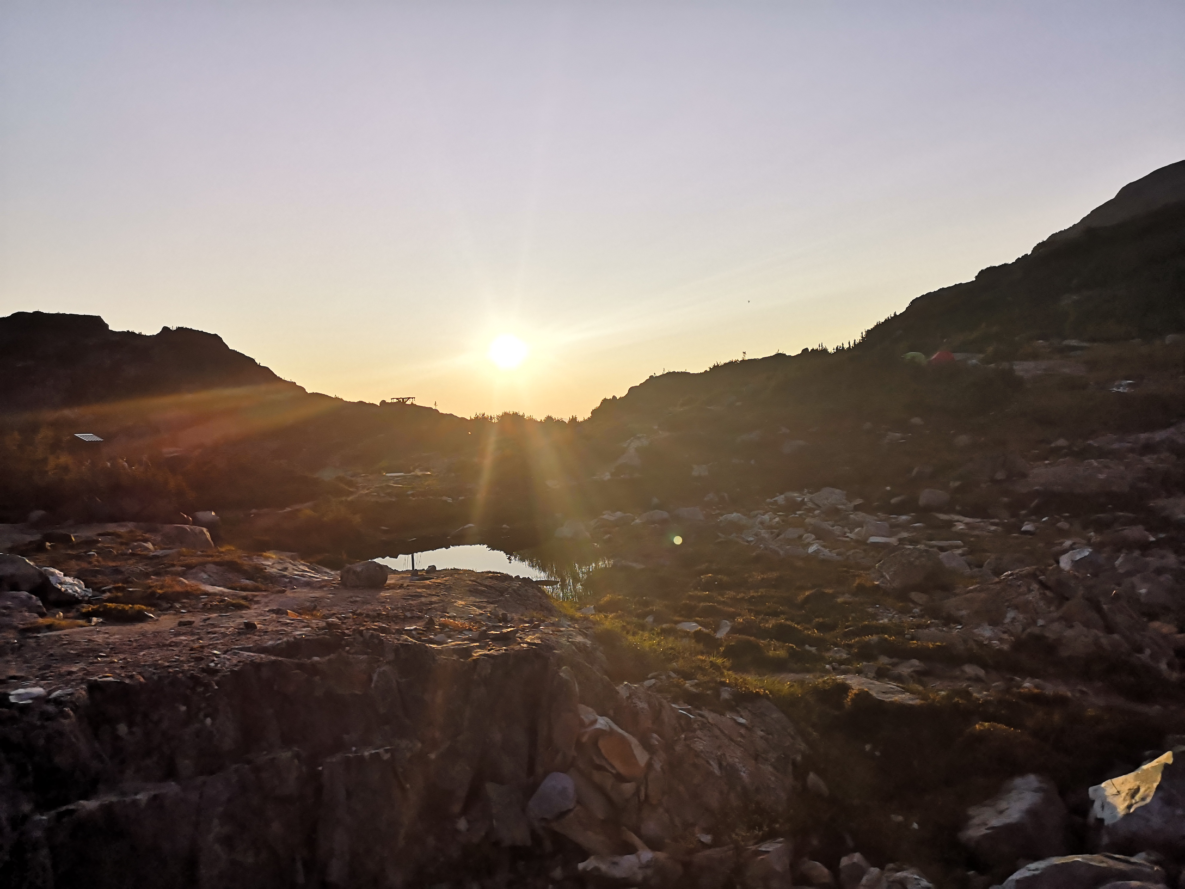
2 hours and 45 minutes of fast hiking saw us to the campsite at the lake. We secured a tend pad on the ridge, and spent a lazy afternoon admiring the lake-basin, surrounding peaks, waterfall, and alpine flowers. Wedge was silent in the distance. Overshadowed by its neighbours Weart and Parkhurst, which sit closer and thus look bigger, Wedge seemed so humble as we sized it up, tracing our route on its snowy slopes: up the glacier to the Weart-Wedge col, a steep chute to the sharp edge of the northeast arête, the ridge-line until the arête petered out into an open face, then the final climb and crux before the gently-corniced summit ridge. As the sun went down, we rehearsed glacier travel logistics, which required teams to be roped together to protect against falls into deep crevasses, which can happen when the unstable snow-bridges covering these chasms in the ice collapse under a climber’s weight. We ran through useful knots, building ice anchors, and the pulley systems required to rescue a fallen climber. We went to bed early, setting our alarms for an hour before sunrise.
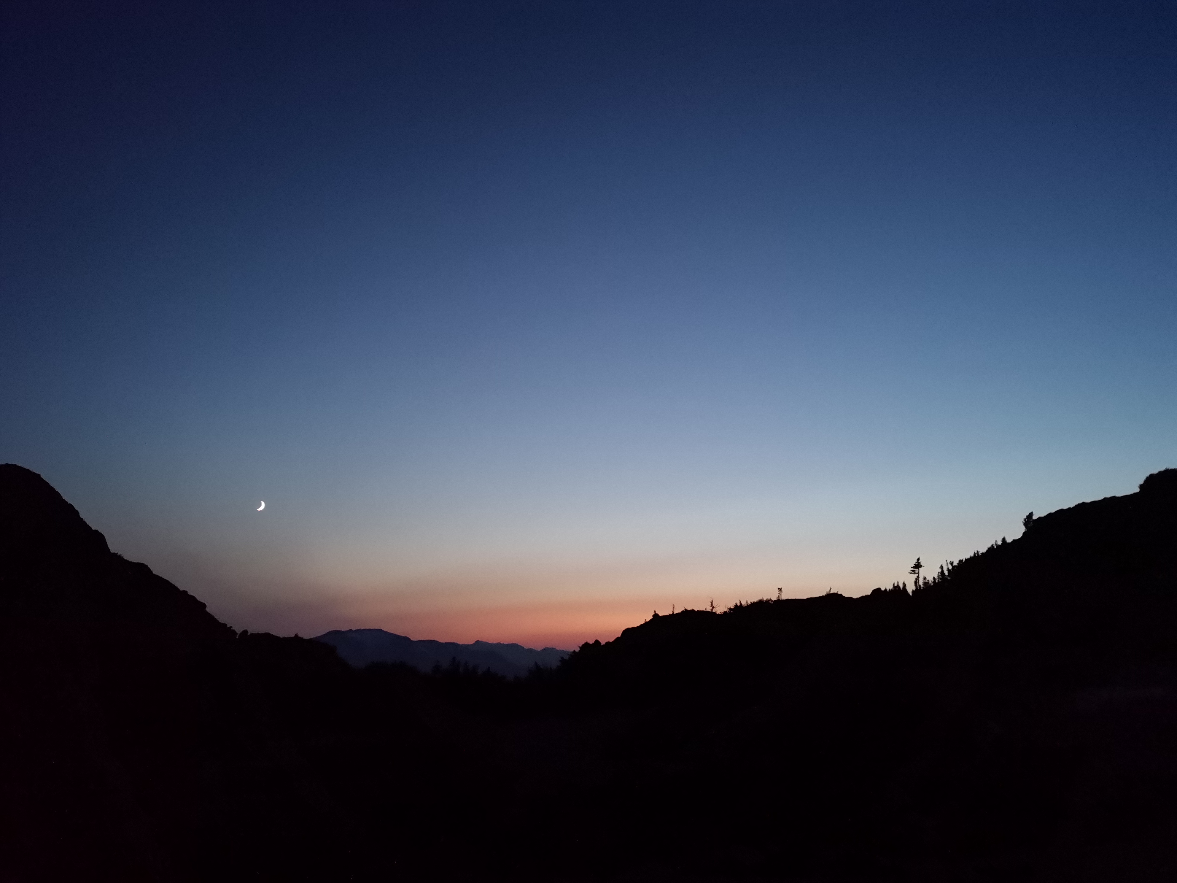
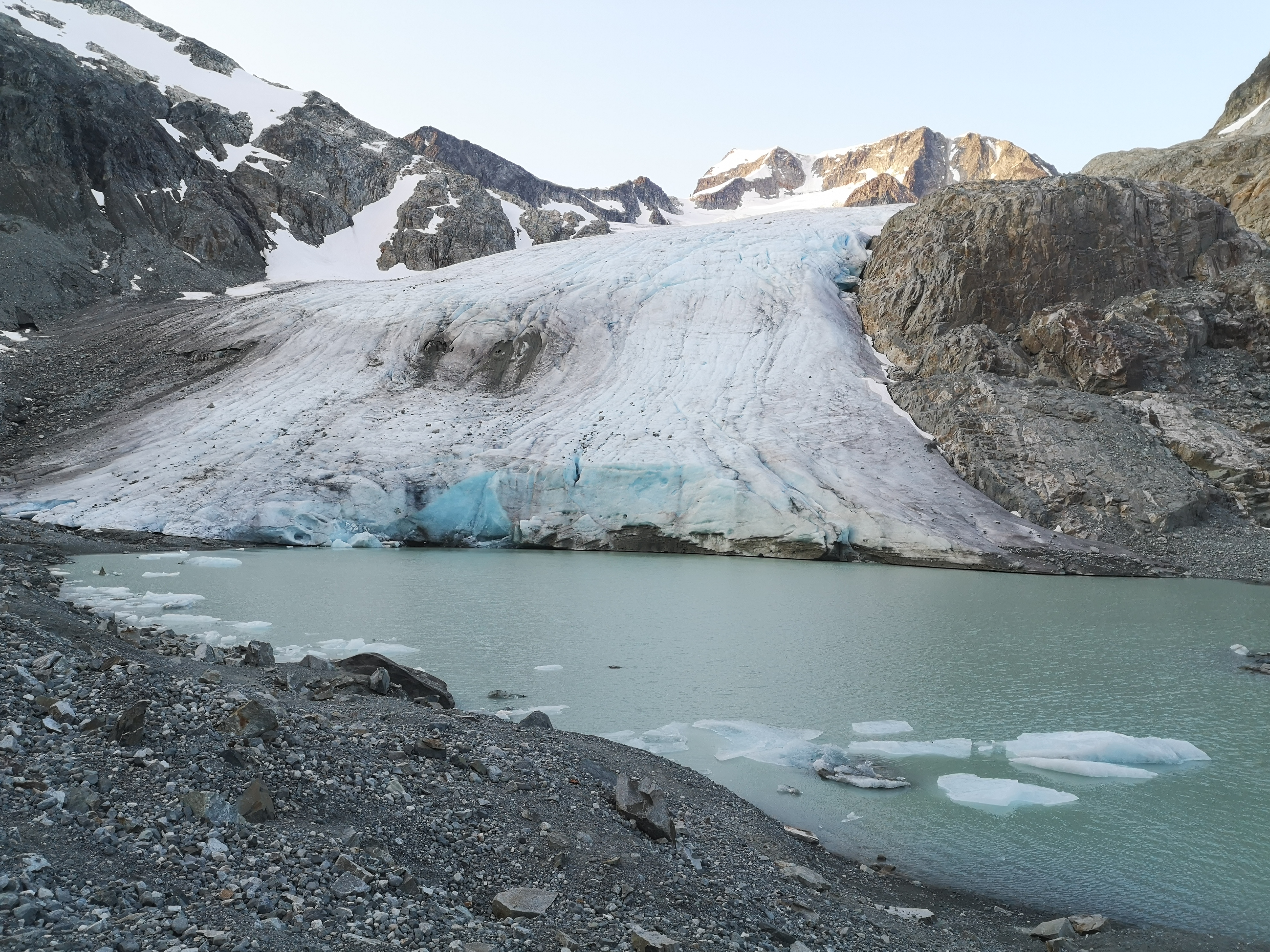
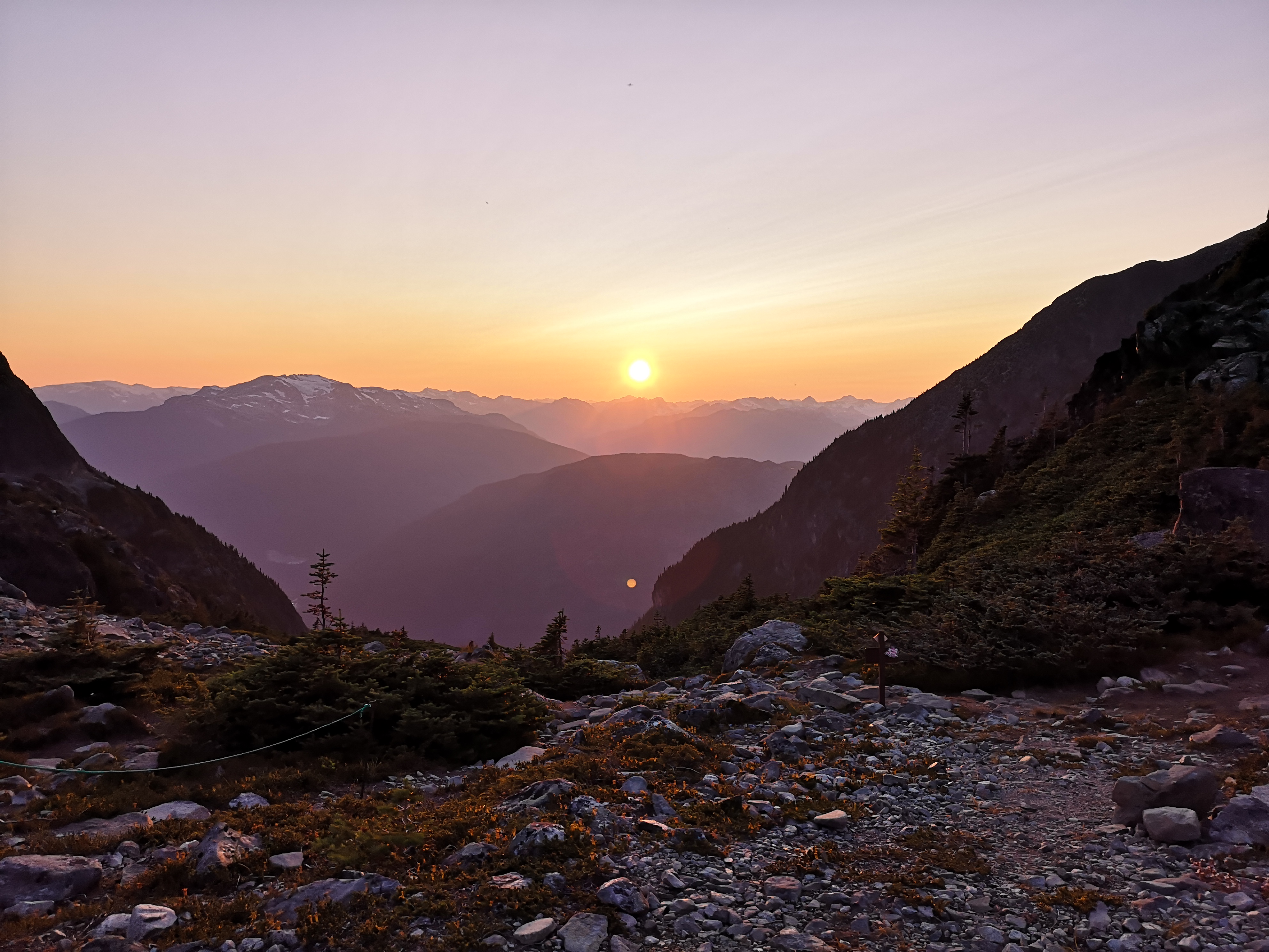
A windy night bled out into a chilly dawn. I watched the sun strike Wedge’s distant peak as I shielded my stove’s flame with my cold hands. I was anxious to be underway before the day’s heat began, destabilizing the snow and ice. We had decided against a true “alpine start“, usually about 2am, as the chance of picking a poor path in the dark seemed like a greater risk. Additionally, the relatively short time indicated by my guidebook, 5 to 8 hours, promised that we’d be off the mountain before too much warming occurred. Still wrapped in cozy down jackets, we trekked through silent, still meadows, grey and purple, to the edge of the cloudy lake, following its curve east and making for the toe of the ancient ice. A turquoise pool lay at its feet, and a lone tent on its banks. Later, we learned that the pre-dawn glow had seen some massive shards of ice fall from the glacial wall into the water. The 3-meter wave took nearly 5 seconds to traverse the lake, and almost engulfed the tent and its slumbering occupants.
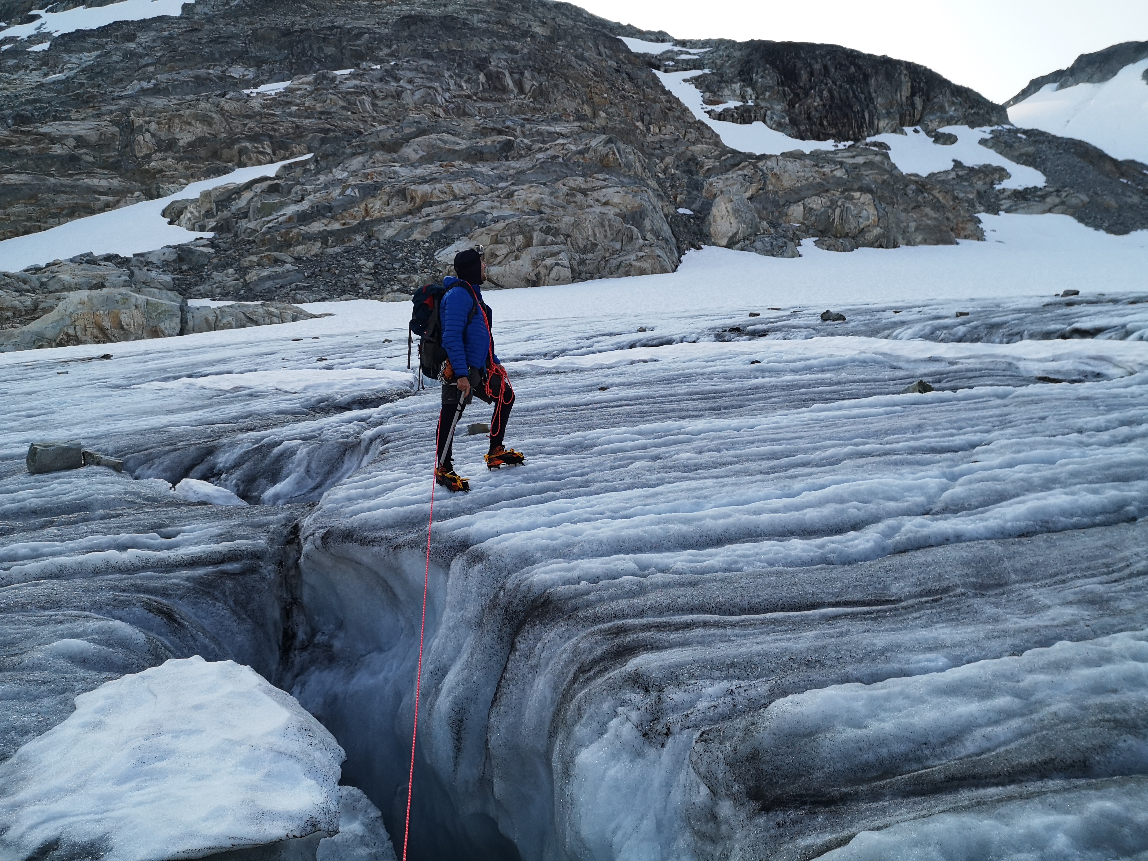
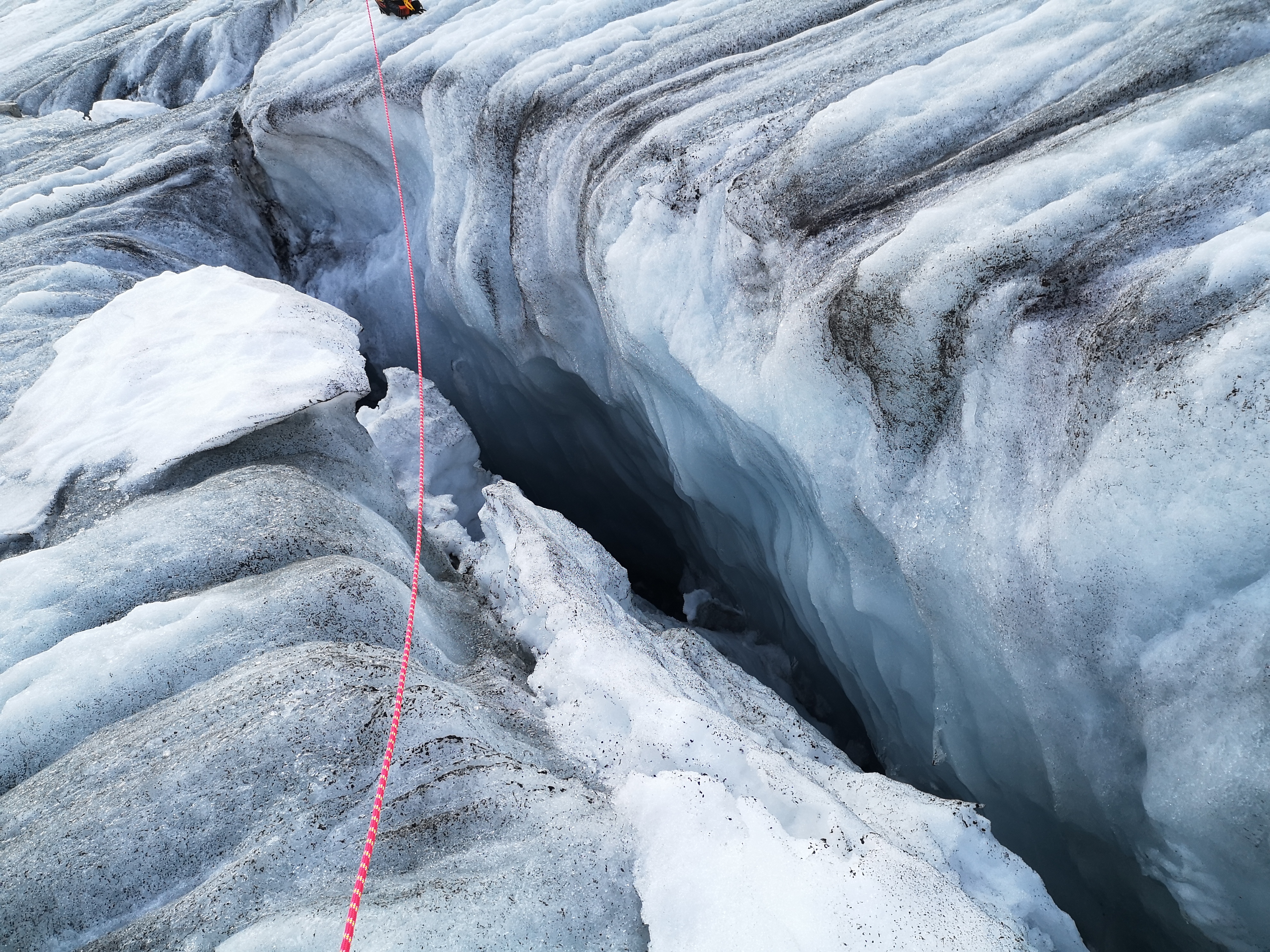
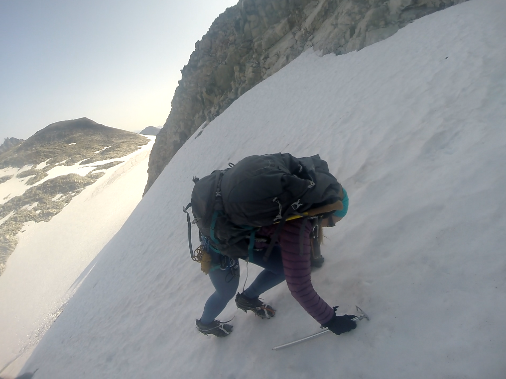
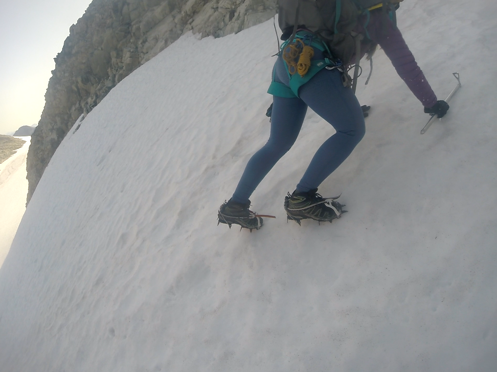
A tricky crossing of a deep and rapid stream – Mt Weart guarding the glacier – found us on the black, rock-studded ice. Ice axes in hand, we clattered up the hard slope in our crampons, knowing the adventure had now begun. Crevasses began to flow in gentle lines, requiring only a large step at first, but soon full traverses to find suitable places to jump. Further up, snow crept over the ice, and we attached my alpine rope between our harnesses here, binding ourselves together. Should one fall, the other would self-arrest the motion by planting their axe in the ice, thus preventing a longer fall, then work to pull out their partner by means of the rope and various climbing tools. Fortunately, few crevasse issues presented themselves (my entire left leg did punch through a snow bridge once, but I was able to maintain balance on my right foot, and so didn’t fall). As we neared the Weart-Wedge col, we were pleased to see two climbers on the slope ahead of us. The pair we had met the day before, who became known as ‘the Guys’, were about a half hour ahead of us. Their selection of the same path, and watching them progress through the difficult terrain ahead, served to boost our confidence as we climbed.
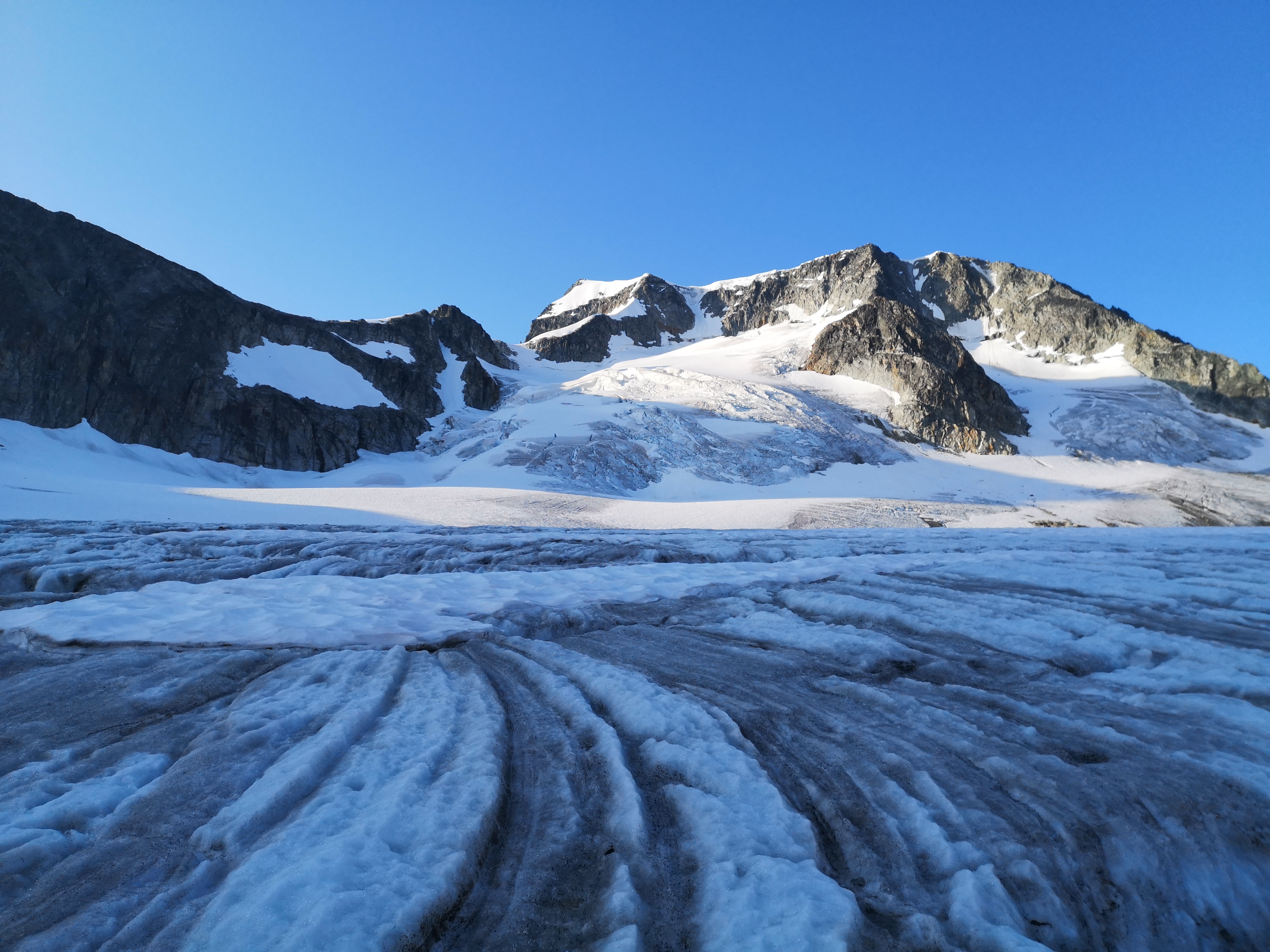
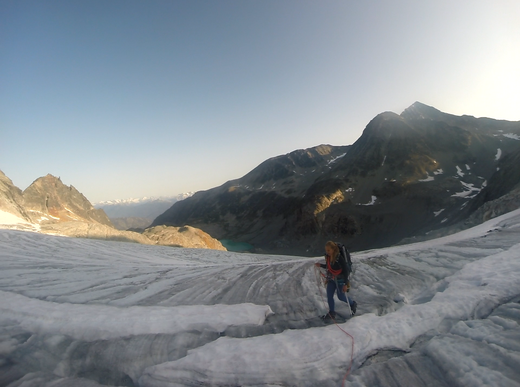
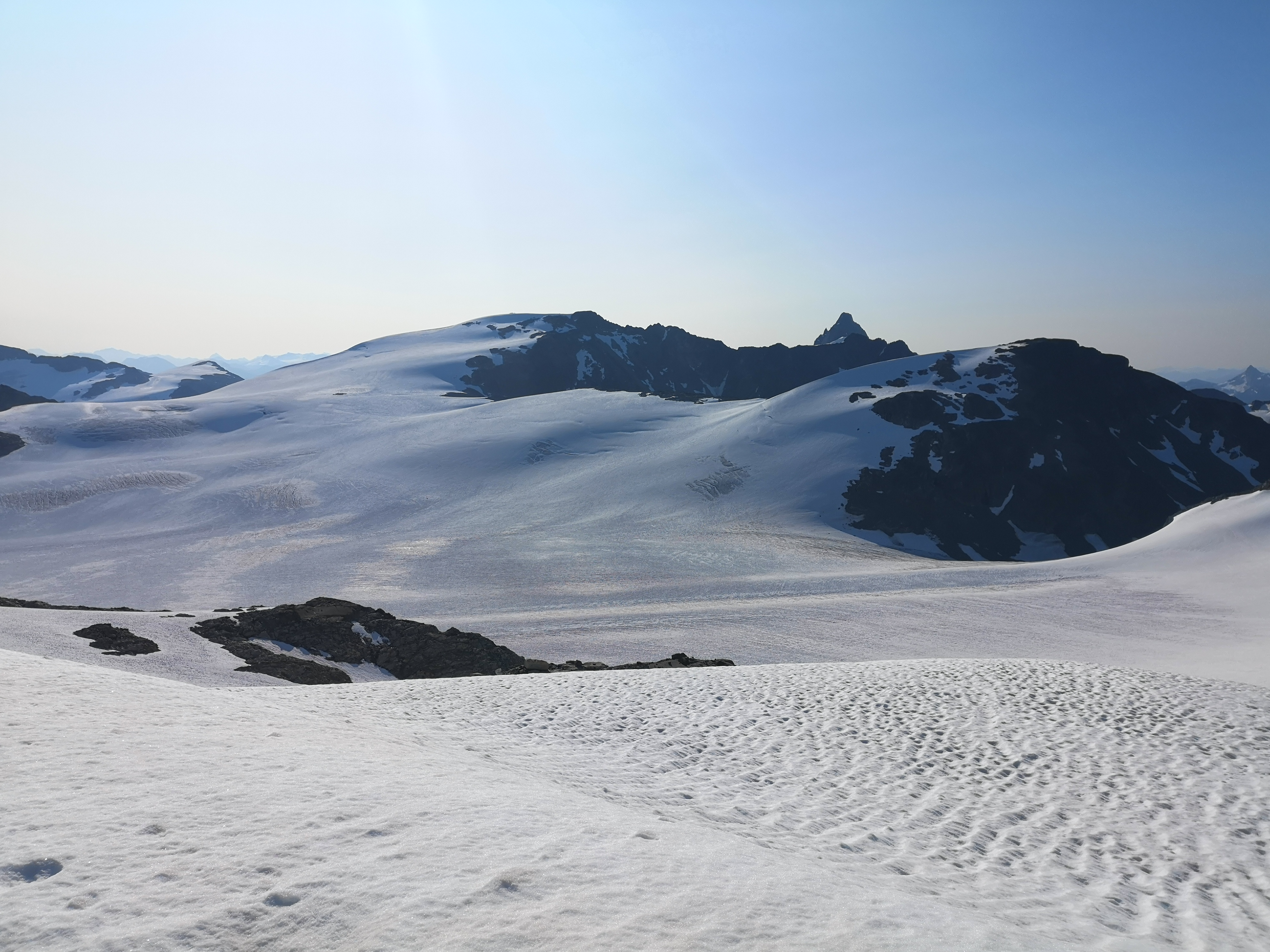
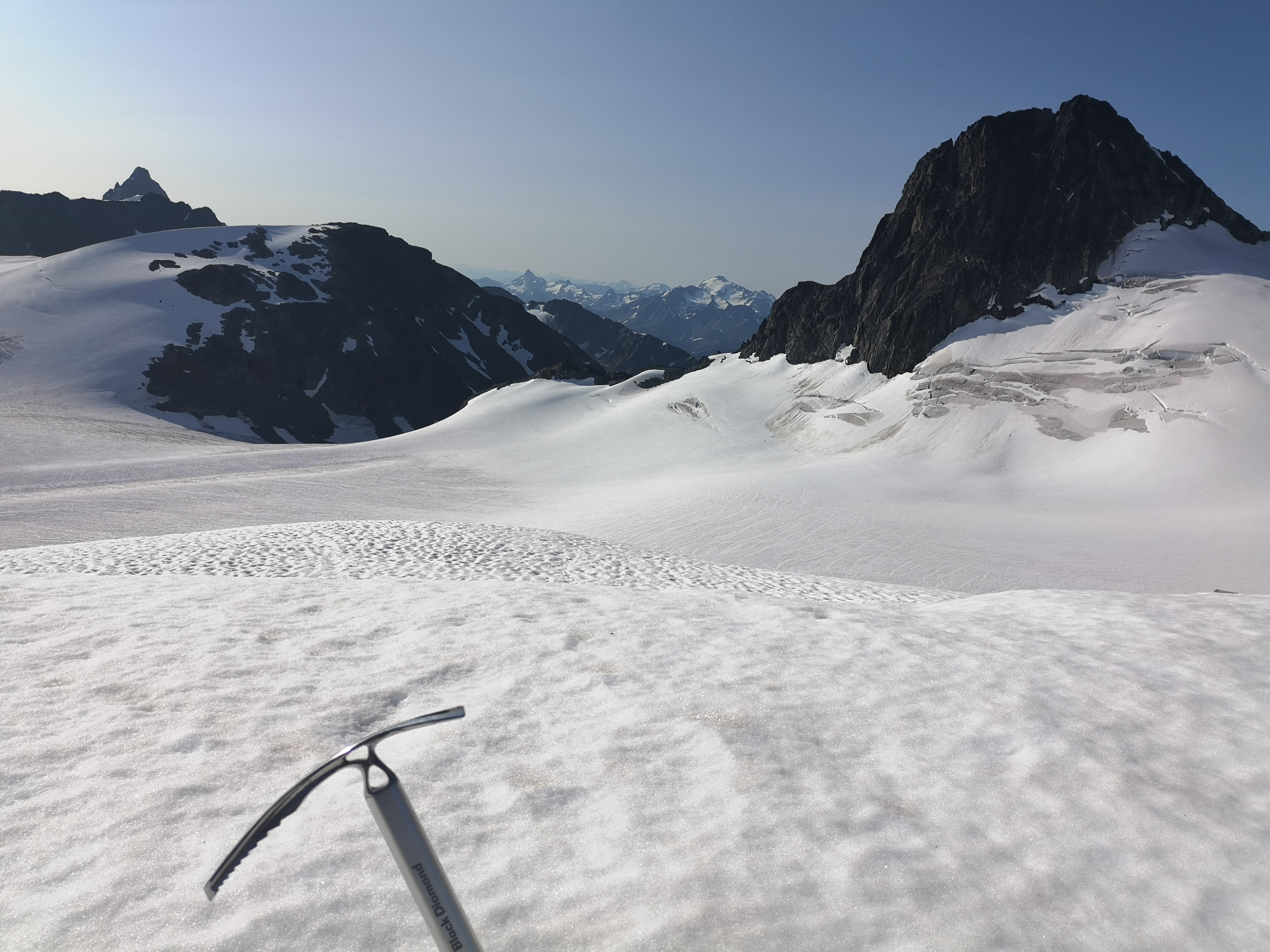
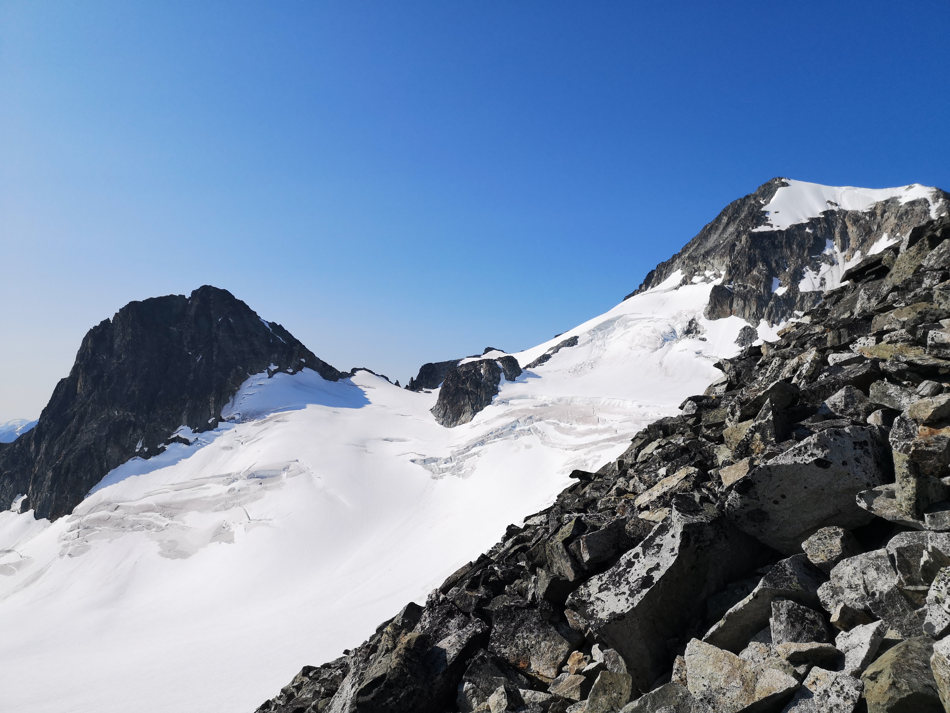
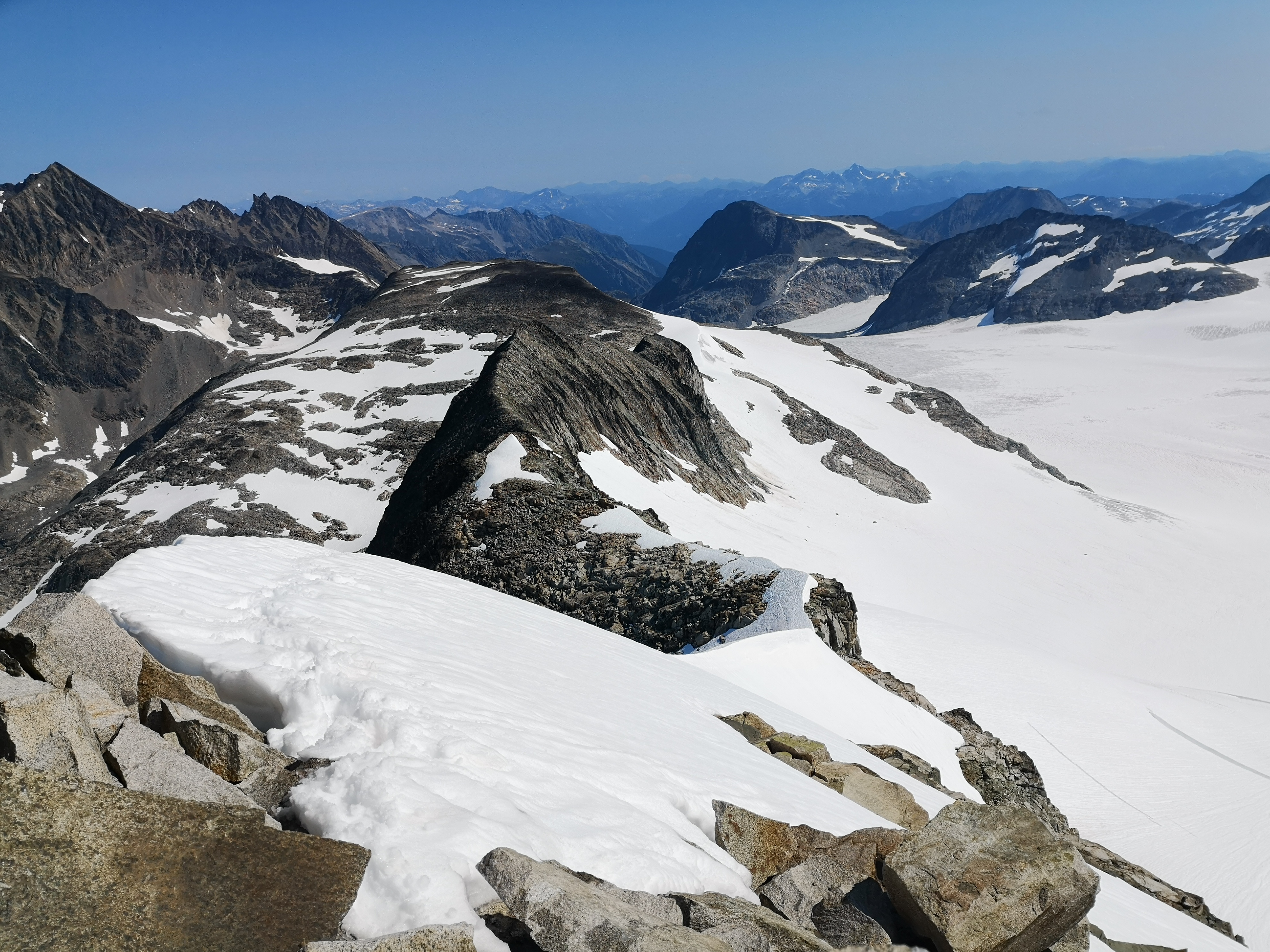
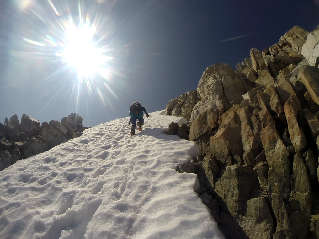
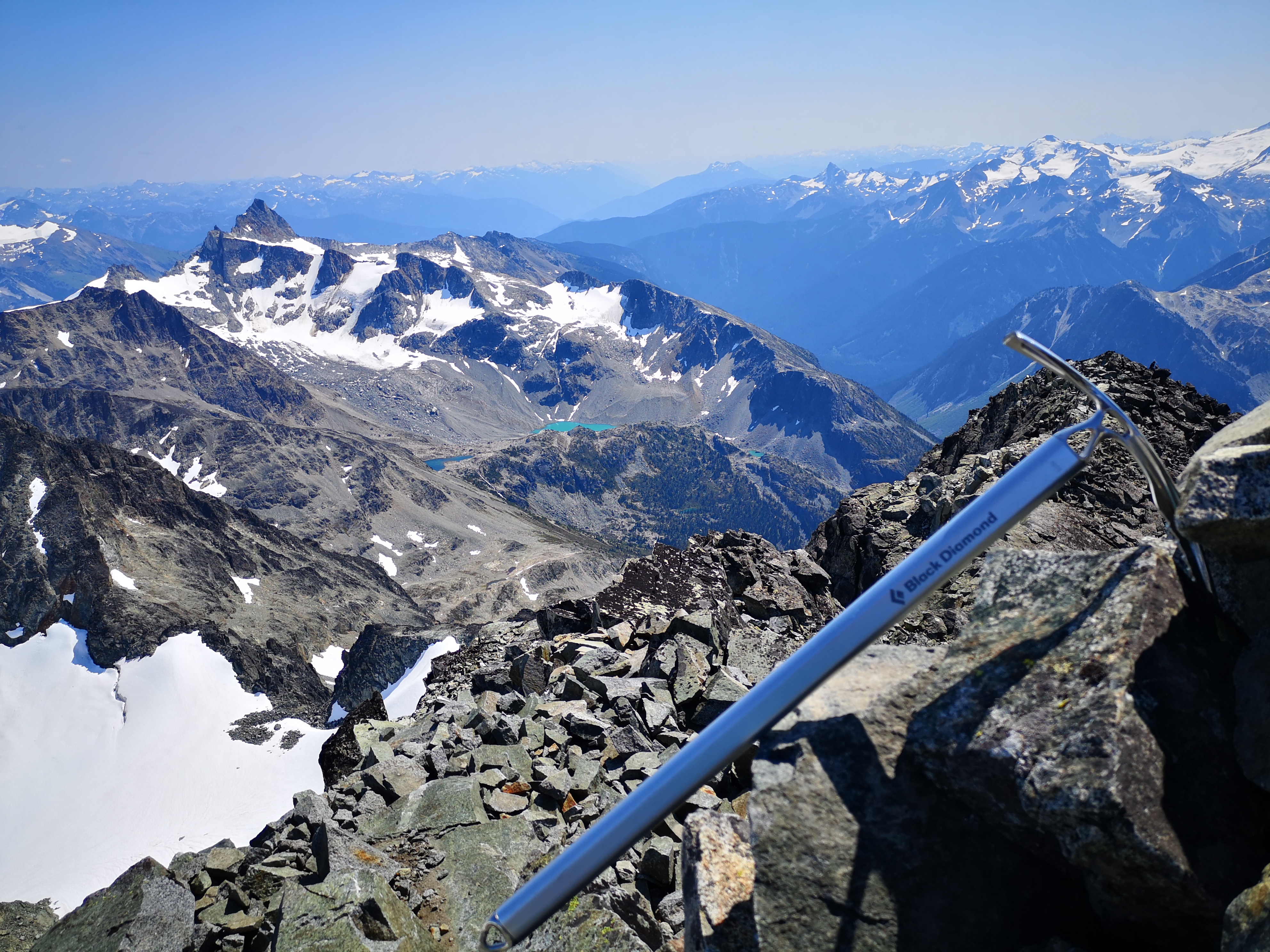
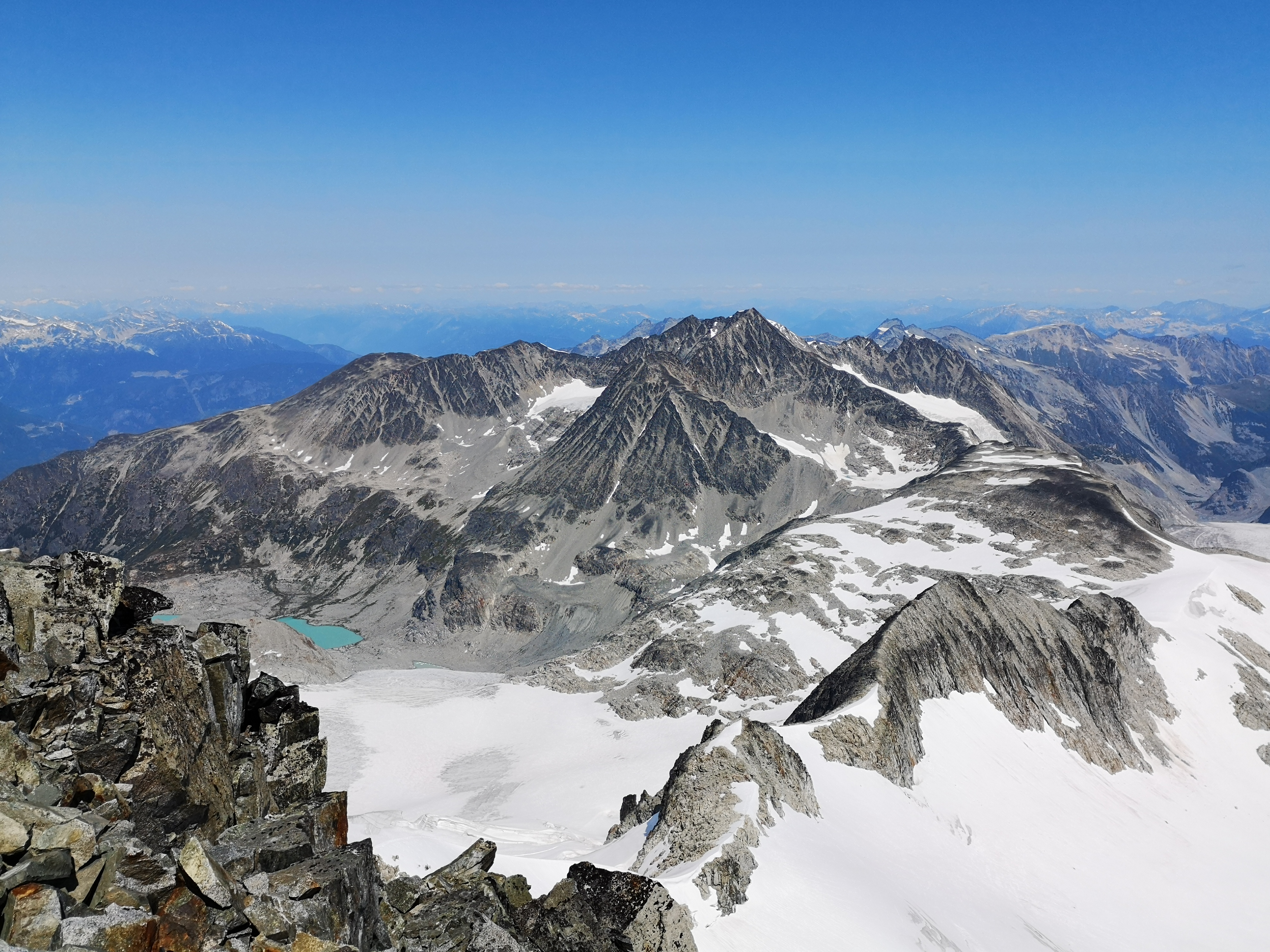
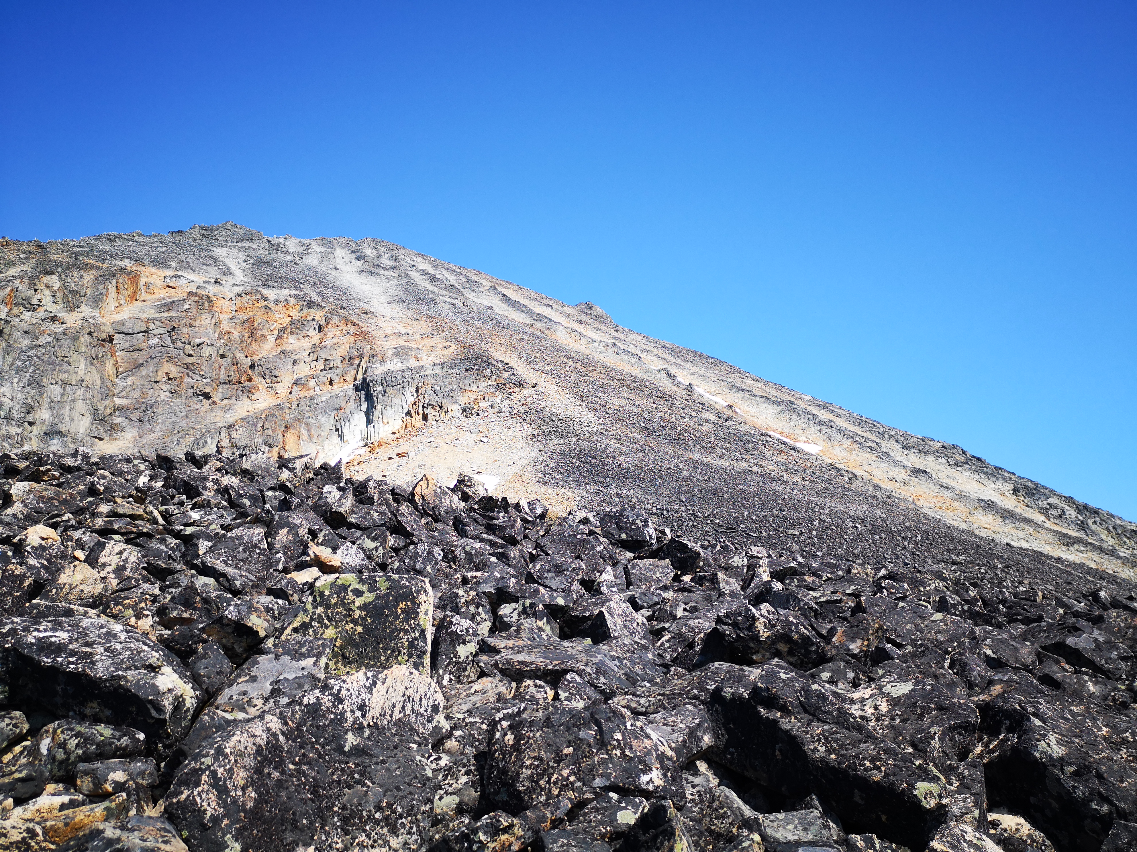
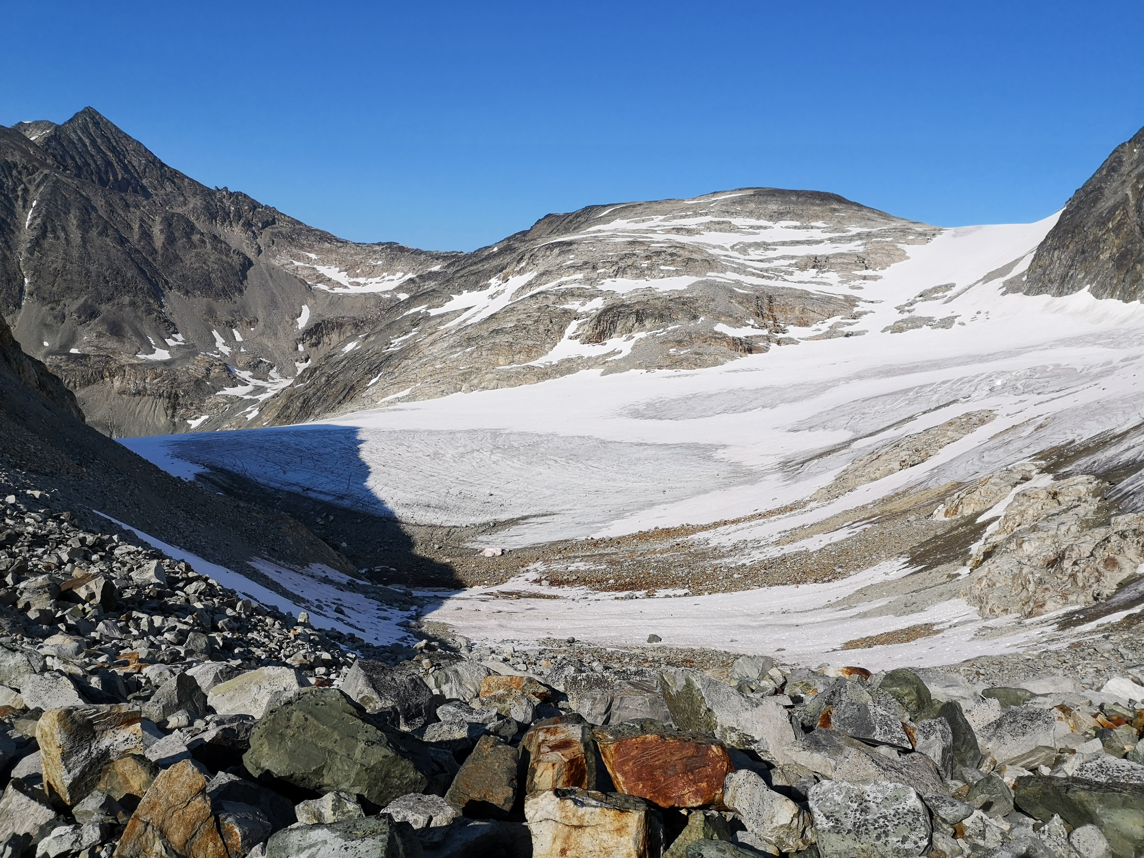
An unexpectedly stunning panorama of Weart glacier awaited at the top of the col. The surreal tinge of the morning deepened when we encountered this other world, all frosty-white winter, vast sweeping ridges and caustic peaks, heavy horizontal lines of ice and azure with all the promise of morning adventure on this hidden kingdom while the campers slept at their lake below, unaware of this window into something entirely inconsistent with hot summer hikes in the dripping green of the pacific northwest. We traversed the monstrously vertical slope to the chute, a 60-degree wall of snow. Here, we got the opportunity to “front point” our way up; kicking steps with our crampons, expecting their front spikes to hold as we drove an axe into the wall, we slowly ascended the chute. A final scramble onto the rocks, and we had gained the ridge.
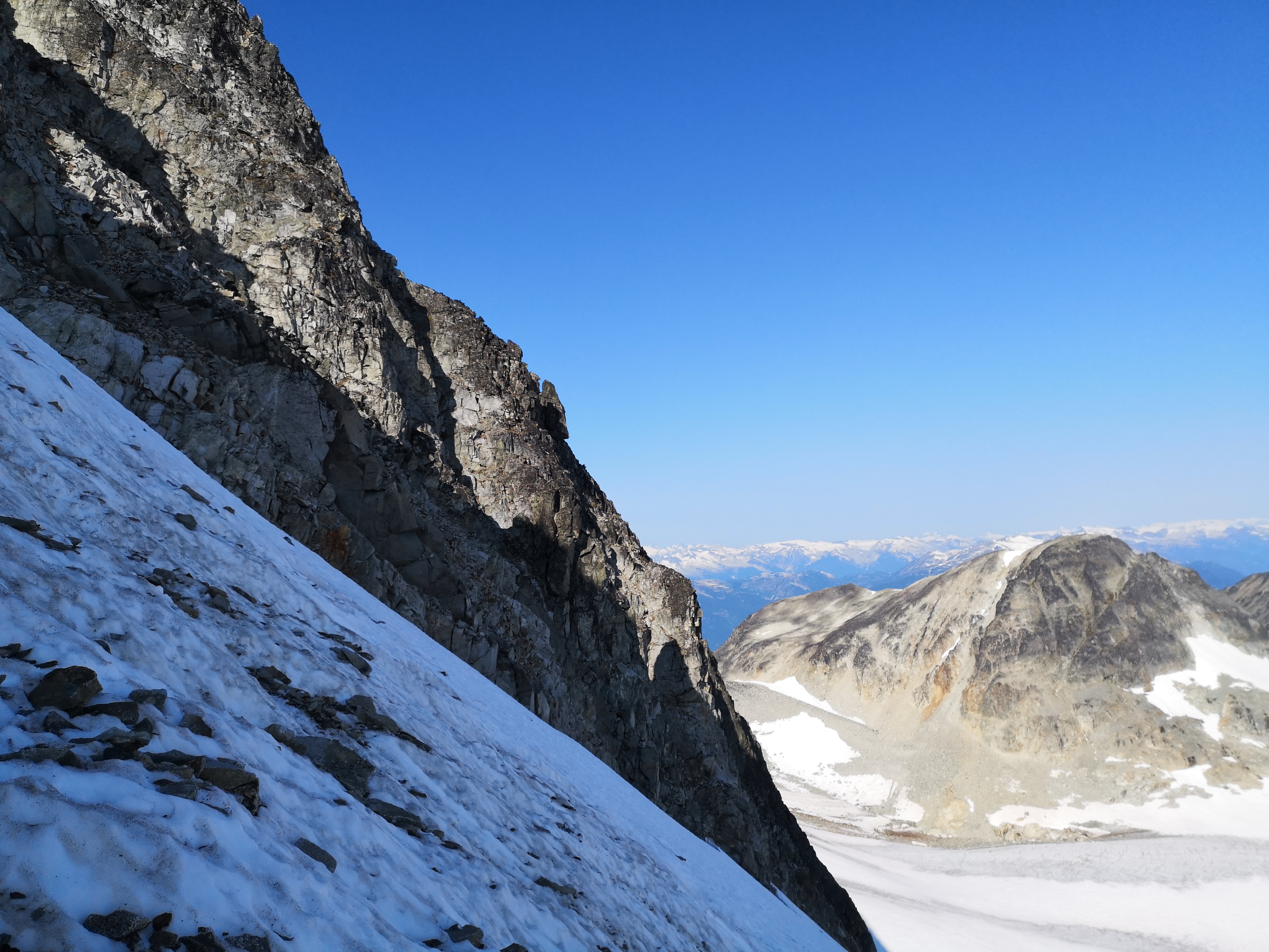
The northeast arête wound up towards the sky before us, Wedge’s summit at rainbow’s end of layers of rusted black rock and pure snow. Despite the extreme exposure, the edges dropping away into the depths of the shadowed glacier below, the solidness of the terrain was comforting, and seeing each step of the journey laid out in sequence before us, plus the flashes of light glinting off the Guys’ ice tools in the distance ahead, gave us confidence. We had passed the point of no return, as we were very reluctant to descend the chute back to the col. The only way on was up.
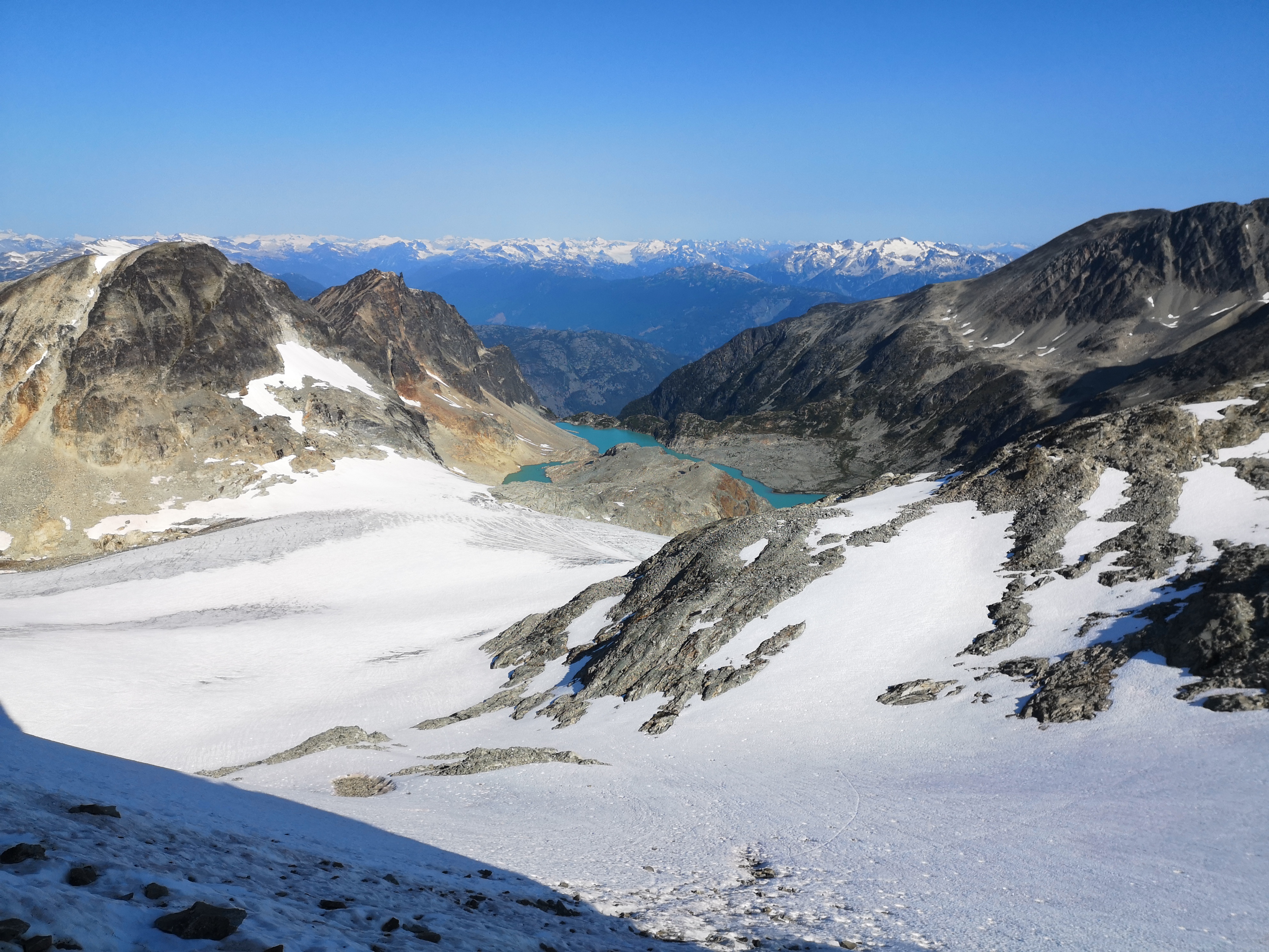
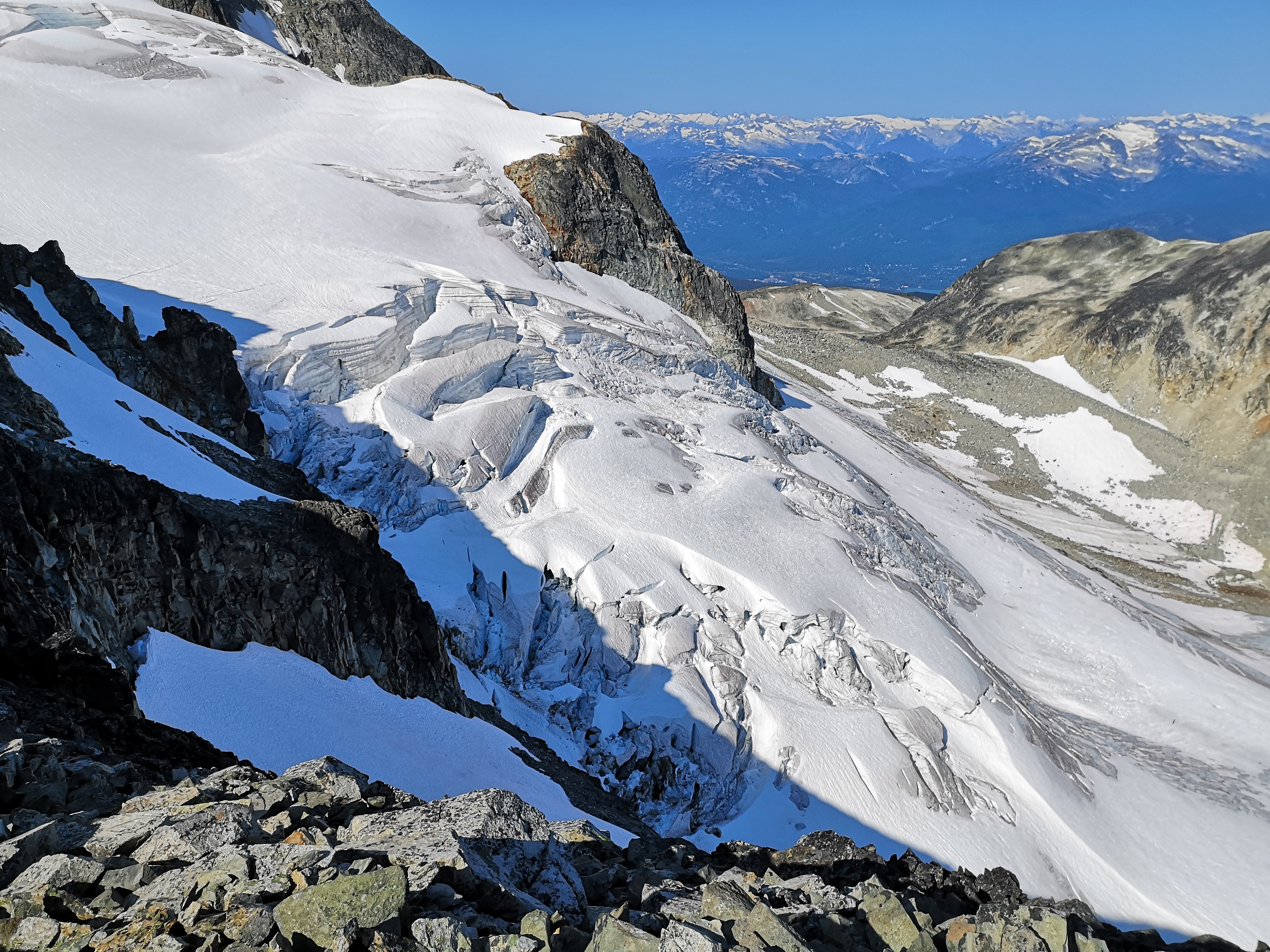
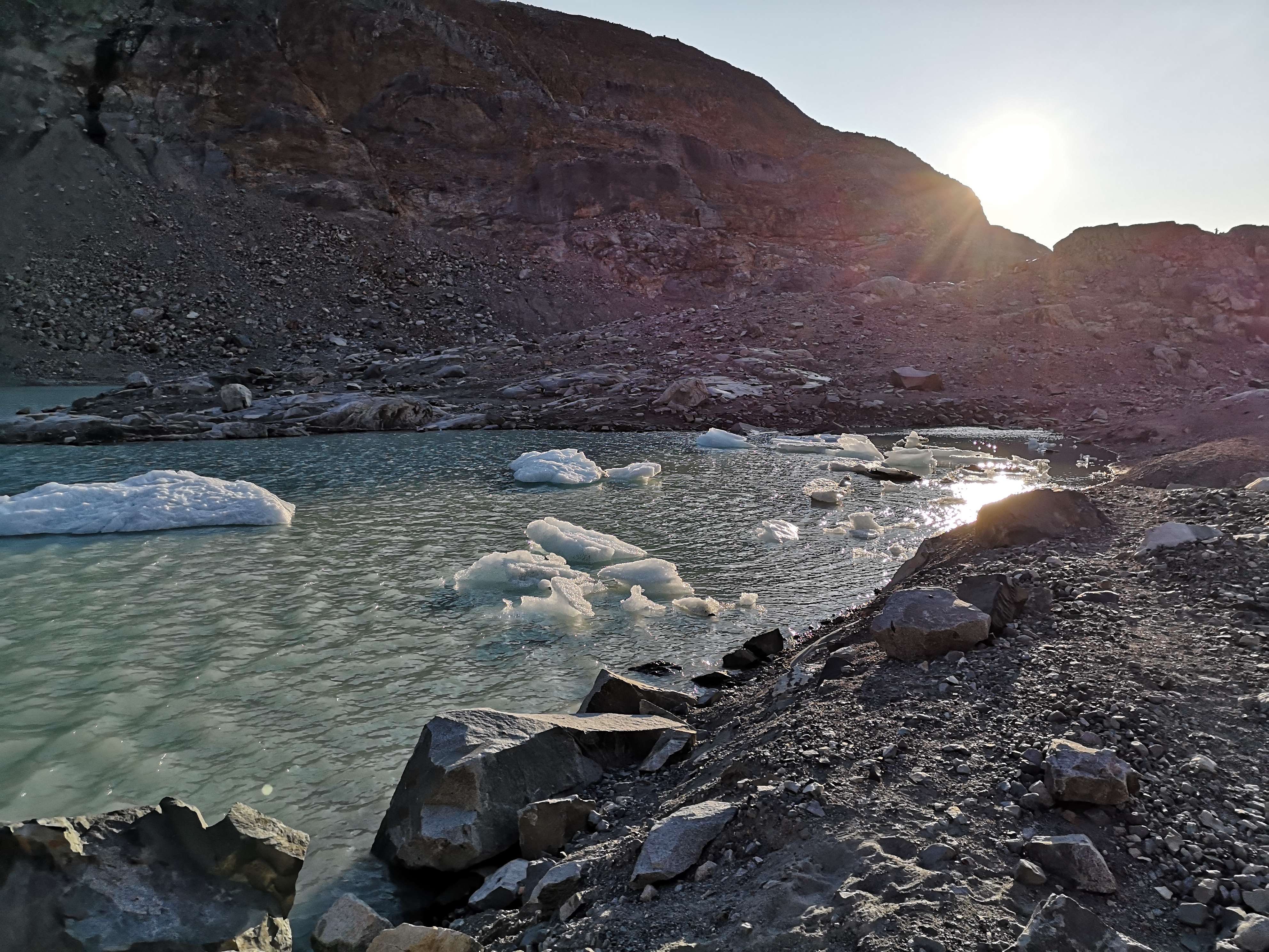
We alternated rock and snow. Below us to the left, Weart glacier glistened. To the right, the glassy waves of the Wedgemount icefall rose out of the slopes, cracks and tumultuous towers crafted by the flow of the creaking glacier over countless years. In the 1970’s, the toe of the glacier touched the edge of the lake in a ten-foot wall of blue crystal; now, its naked, crevassed body clawed back by the warming earth, it sits hundreds of meters back, new lake spawning, baby icebergs, its phantom across the carved valley.
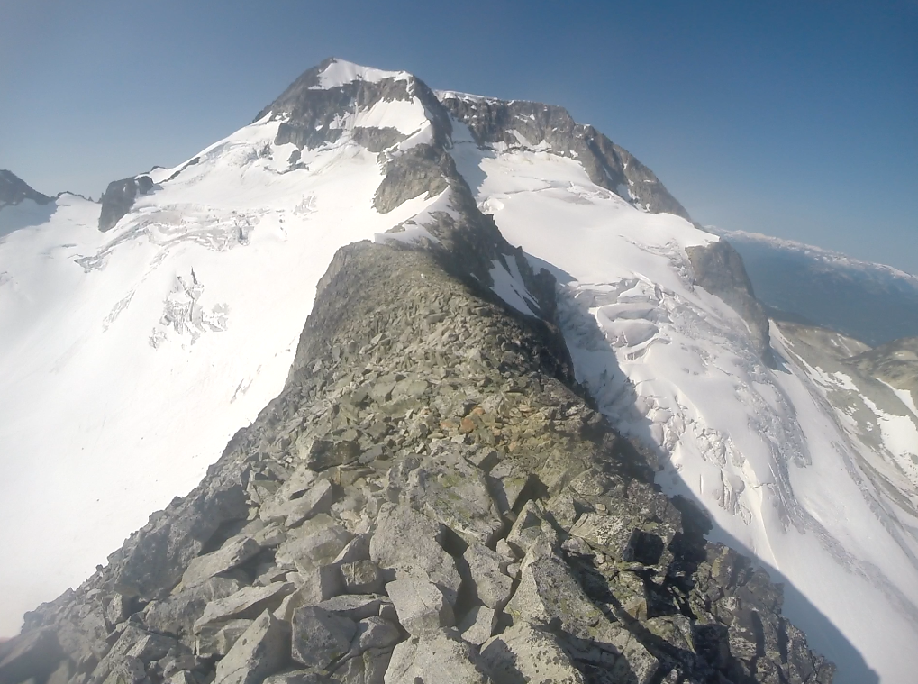
I thought of my favourite mountain stories as we ascended to the top of the world (or Whistler anyway). In more extreme conditions than ours, you and your partner rope together, so that if one falls, the other has a split second to throw themselves off the opposite side of the arête, thereby arresting the fall in dramatic counterbalance. Our climb was not so demanding, but we certainly felt like conquerors as we approached the final challenge. The crux was before us, a jumble of rock and snow at its base, an open expanse of snow and stone above. We had watched the Guys climb the rocks, and, being more comfortable on rock myself, I eagerly took off my crampons, only to hurriedly replace them several terribly unstable moves later. The rock was atrocious, about to collapse, and our success in the chute below persuaded me that perhaps the ice-climb would be safer. I sluggishly scaled this slope, consoling myself as I struggled that at least this section was very short!
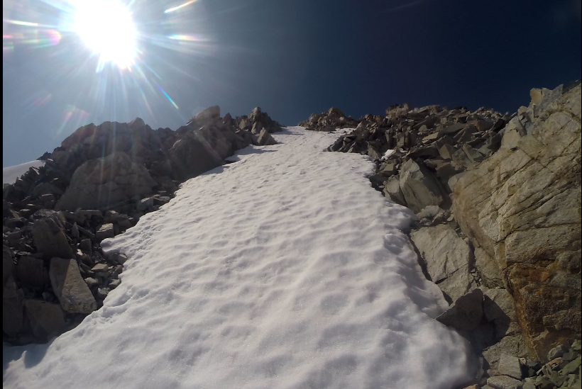
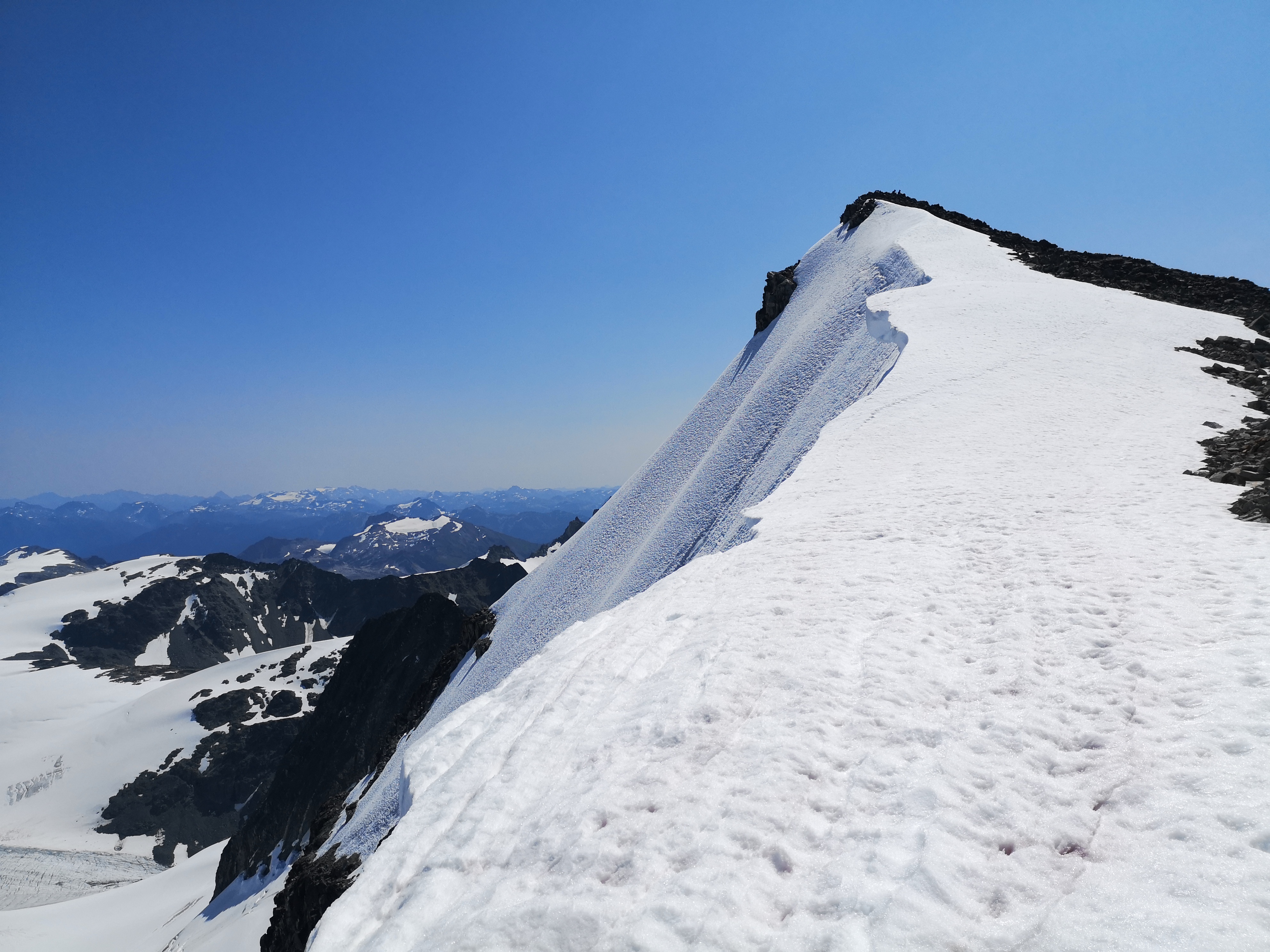
The summit ridge was practically flat after the final wall.A rolling cornice, light wind, rocks that might as well have been gravel, andthe summit cairn, effigy and centre of the world, black and blue against thesilhouettes of the Guys eating victorious sandwiches. The top of Mt Wedge, thehighest and hardest, but only half of our journey.
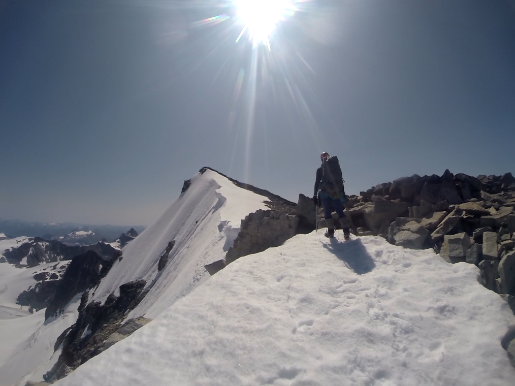
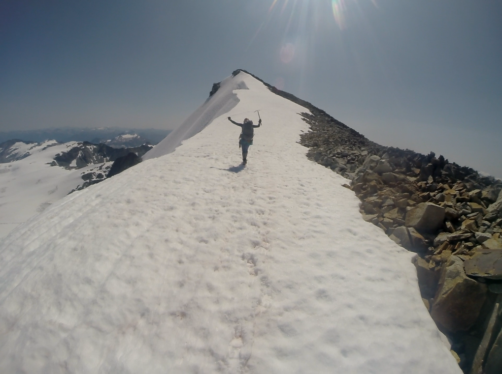
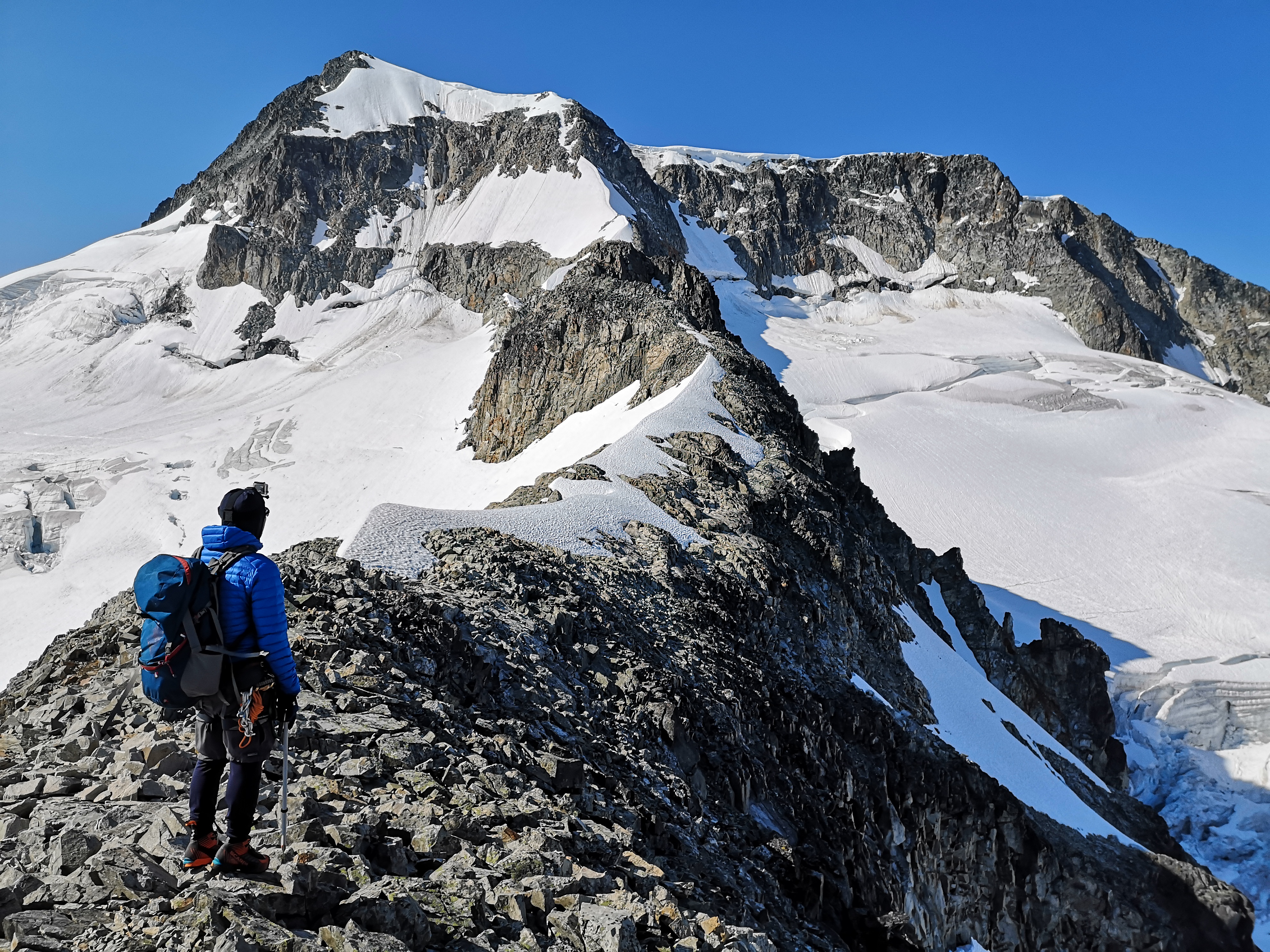
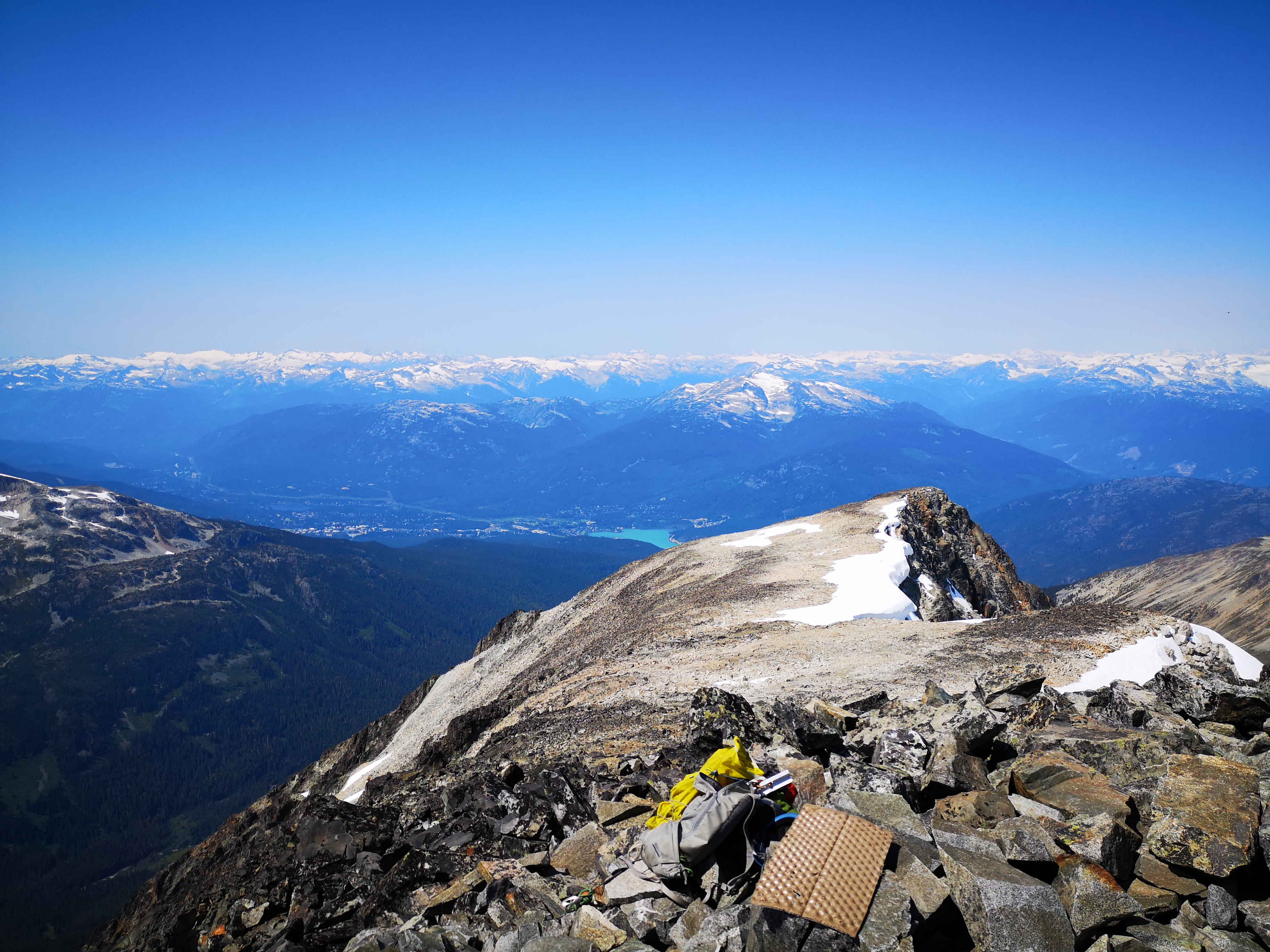
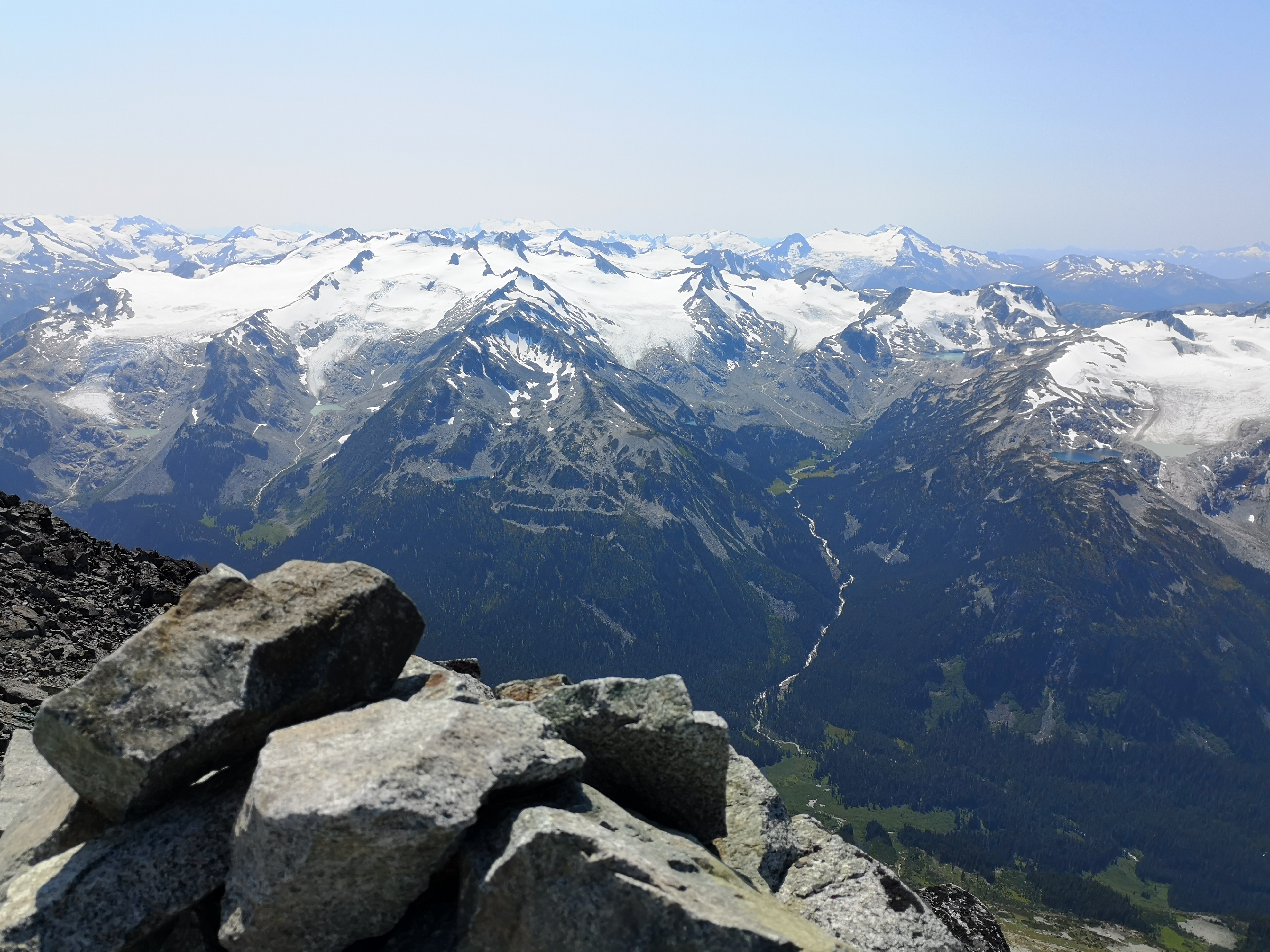
We stripped off climbing gear in the sun, all high fives and achievement and photos and phone calls and chocolate and mangoes. The excess of the moment was bizarre, to be eating food from all over the world on top of this insane mountain that we had climbed as a vacation of sorts (a removal anyway), while my climbing partner called his girlfriend in Italy and we watched a tourist-laden helicopter flying below us through the Wedgemount valley. The photos feel weak. The opaque teal and neat lines of Alpha Lake beside Whistler Village, the sprawl of houses, more felt than seen. Bare green gashes of the naked ski runs, and arguing about which was Whistler and which was Blackcomb (I can never remember). The iconic spire of Black Tusk, until now, the highest local peak on my resumé. Dozens of alpine lakes – green, aquamarine – hidden in valleys and bowls by the jealous peaks, and the flowing lines of the streams betraying their presence. The slopes of Wedge in its sparkling blanket, its own alpine lake tucked in below. Weart, a mere 100 meters below us, and the vast adventure of its glacier. Wedge’s own west ridge, a black and diminishing arm flung wide around Parkhurst, friendly or sinister, shrinking into the earth. Here was our descent; all four agreed. While down-climbing the northeast arête was doable, the guidebook recommended the west ridge, describing it as “an easy scramble. 2-3 hours”. This sounded pleasant, but some inkling that this descent would be arduous struck me, even then in our high on the summit. I messaged our emergency contact: “On the summit of Wedge. Took six hours. We’ll be descending via the west ridge. Probably another 6-8 hours down to camp. We’re with one other party of 2 on the summit.” We were already well over-time by this point, and I wondered at this. The Guys told me to take the blasé guidebook with a grain of salt. We gave them a good head-start while we soaked up the summit, then repacked and shouldered our bags, setting out across the ridge.
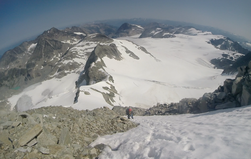
Following the Guys’ footprints in a patch of snow, we keptright as the ridge began to plunge downward. As we descended, I began to get abetter view of the terrain. The ridge we followed led west and down, butlooming over my left shoulder was a second ridge, large and definitely stillwest. Which was the established path of descent? As I stared at the secondridge, the small figures of the Guys became apparent, and I realized that oneof our groups was going the wrong way. We had followed their tracks, but weconcluded that they must have realized their mistake and backtracked, and nowwe should too. Fortunately, this detour did not prove long or difficult, but aswe finally embarked on the true route, we could see that the line we had beenfollowing dramatically cliffed-out shortly after our turn-around point. I’dlike to think that we would have questioned the route should we have reachedthe cliff, but the simple fact is that, should the immediate terrain haveseemed to offer a way down, we may have attempted to downclimb. I had to putthis thought aside to chew on later.
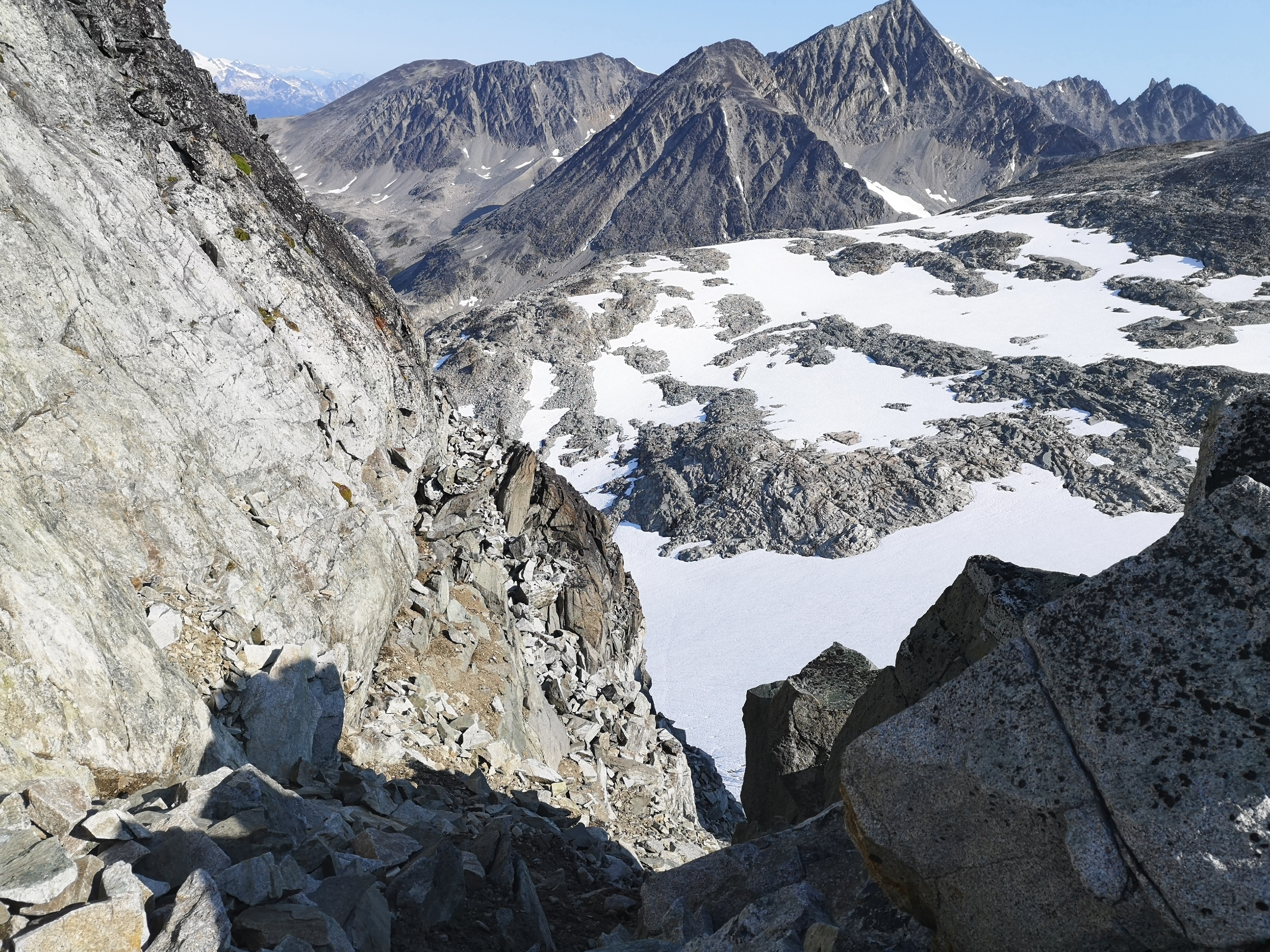
The west ridge descends in hundreds of meters of loose, terrible rock. Horrendously steep scree slopes, massively tilted boulders in delicate balance, it was hours of slow, hot, dusty descent with rocks crashing down around your feet, always on the verge of falling, always on edge. If it weren’t for the GPS map, its audio feature reminding us periodically that we were still on-route, I would have felt extremely uneasy about our chosen path, as we were going farther west than I anticipated. We stopped at a short plateau, blessedly level. The arm of the ridge continued down, extending into a deep river valley behind the west side of Parkhurst, but we needed to be on the east side. We had seen the Guys before us pause at this point, then take an unexpected turn by climbing off the steep cliff and onto the snow-pack below. Realizing that the west ridge route intended for us to descend sharply into the valley, then ascend to the top of the Wedge-Parkhurst col, we prepared to do the same.
Large rocks jutted out of the sharp, crumbly wall, offering a possible way to down-climb into the gash between the wall of the snow-pack and the cliff. Turning to face into the cliff, I slowly climbed down a few steps. Despite my caution, the entire wall began to move beneath me, and all my anxious fears of the past few hours came to a head as I fell with the dislodged rocks. Scrambling and pulling against everything I could reach, stone shower, I clung on, breathing hard and in tears as the stress of the long descent finally got to me. Above me, a hand extended down, my climbing partner trying to help. My position was so tenuous, with only one solid hold below the toes of my right foot, that I was too afraid to move, and even the offering of help was enough to dislodge some massive rocks and send them my way. The thought as a boulder the size of a dog came directly at me: “this fall is really going to hurt. Could I die?” It hit the rocks above me, kinetic energy mostly dissipated, and came to rest between my stomach and the wall. I tried to just hold on, taking some time to collect myself and breathe and think; my position was compromised by the heavy, unbalanced rock against my stomach, its considerable weight pushing me outwards, and I carefully rebalanced and twisted out of the way, letting it crash to the ground below. To the right of me, my climbing partner was making a hasty descent of the wall to get below me, to spot or support or somehow help, and out of the corner of my eye, I saw him too fall, and remain motionless at the bottom for what felt like forever, and me, frozen and burning. He shortly rose and limped over, just battered and bruised. After testing every possible option, I picked a path down as he supported the loose rocks from below.
In retrospect, I over-reacted. I’m sure the cliff was higher in my head, the rock larger, the initial fall greater. I wish I handled it better. I wish I didn’t panic and cause such a knee-jerk rescue-response from my partner. I wish I didn’t have such an immediate, physiological reaction. I understand that these things can’t be avoided when in danger, but I wonder if the response was appropriate to the level of danger. In my worn-out mental state, after hours of shaky descent, I was on the edge, and the initial fall pushed me over it. I said afterwards, as we sat quietly at the bottom of the cliff, captured in the few feet left between its mass and the ten-foot fence of the snowfield, that I thought I was going to die. Hand on knee, breath filing my lungs. I lost my gloves somewhere up on the ridge. The earlier concern about getting back into camp too tired to descend to the car that day seemed foolish now. Being tired was such a minuscule thing at that moment, and I found the perspective surprisingly heartening.
Quiet descent of the snowfield, large distance between us. I hadn’t properly adjusted my crampons, and the heels kept popping out. We were out of water in the summer heat, and my asymmetrical sunburn, carved from hours facing north, reminded me that I’d put on zero sunscreen that day. We filtered water from a silty stream below the snowfield, cold and tastier than expected, and I felt better. We talked about the cliff, and I realized my partner’s guilt at the choices he had made. I think he made the best decisions he could have with the information he had in the moment, and I am seriously thankful for his readiness to risk his own safety to help me during a moment when I fell apart. I realized also how much we had relied on the Guys that day. Their ascent gave us confidence and security, but we had first followed them in a wrong turn, and now risked disaster under the assumption that, because they descended in that spot, that it was also the best place for our descent. There were four of us on the mountain that day, separate yet together; perhaps it would have been better were there only two.
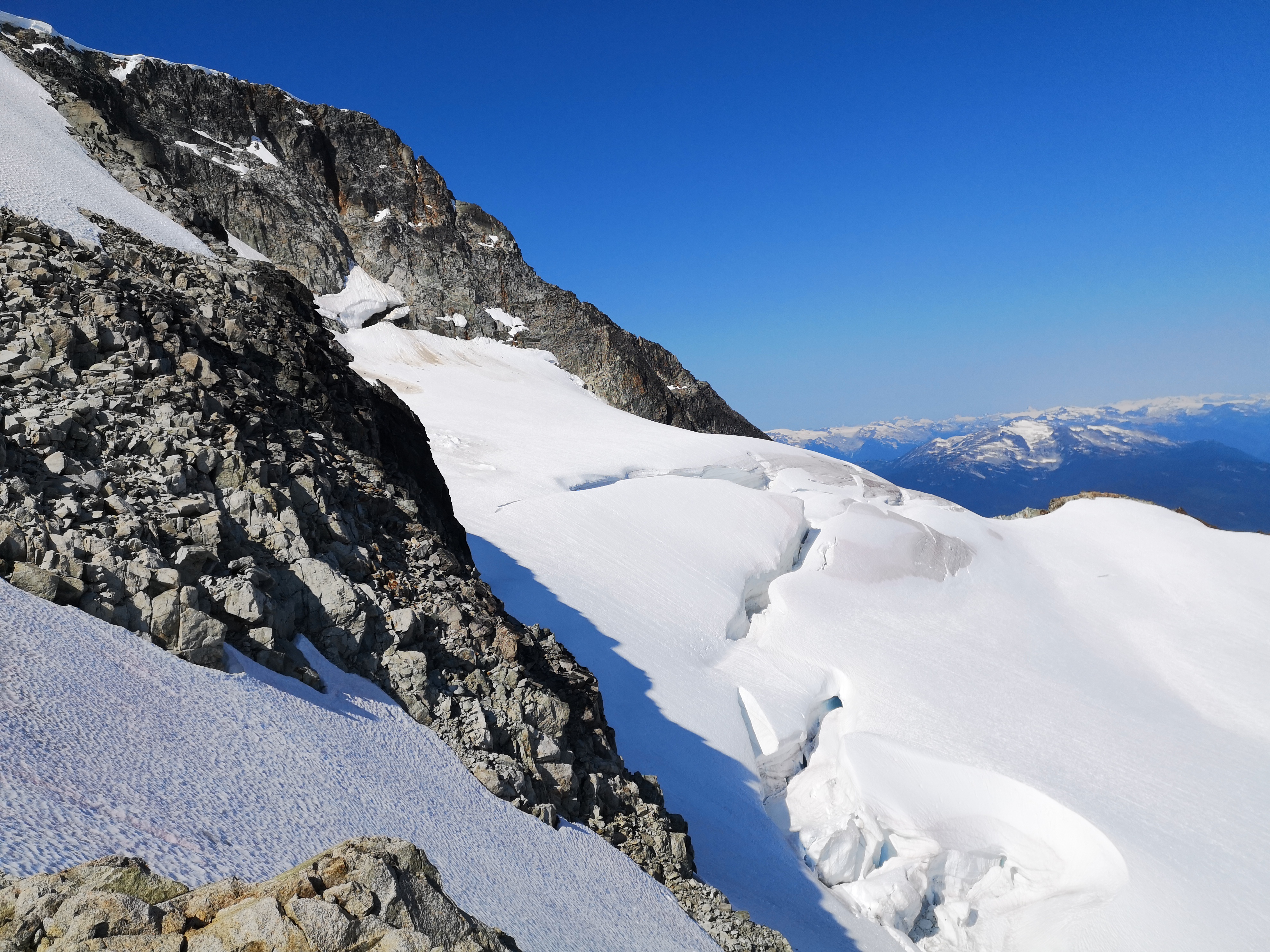
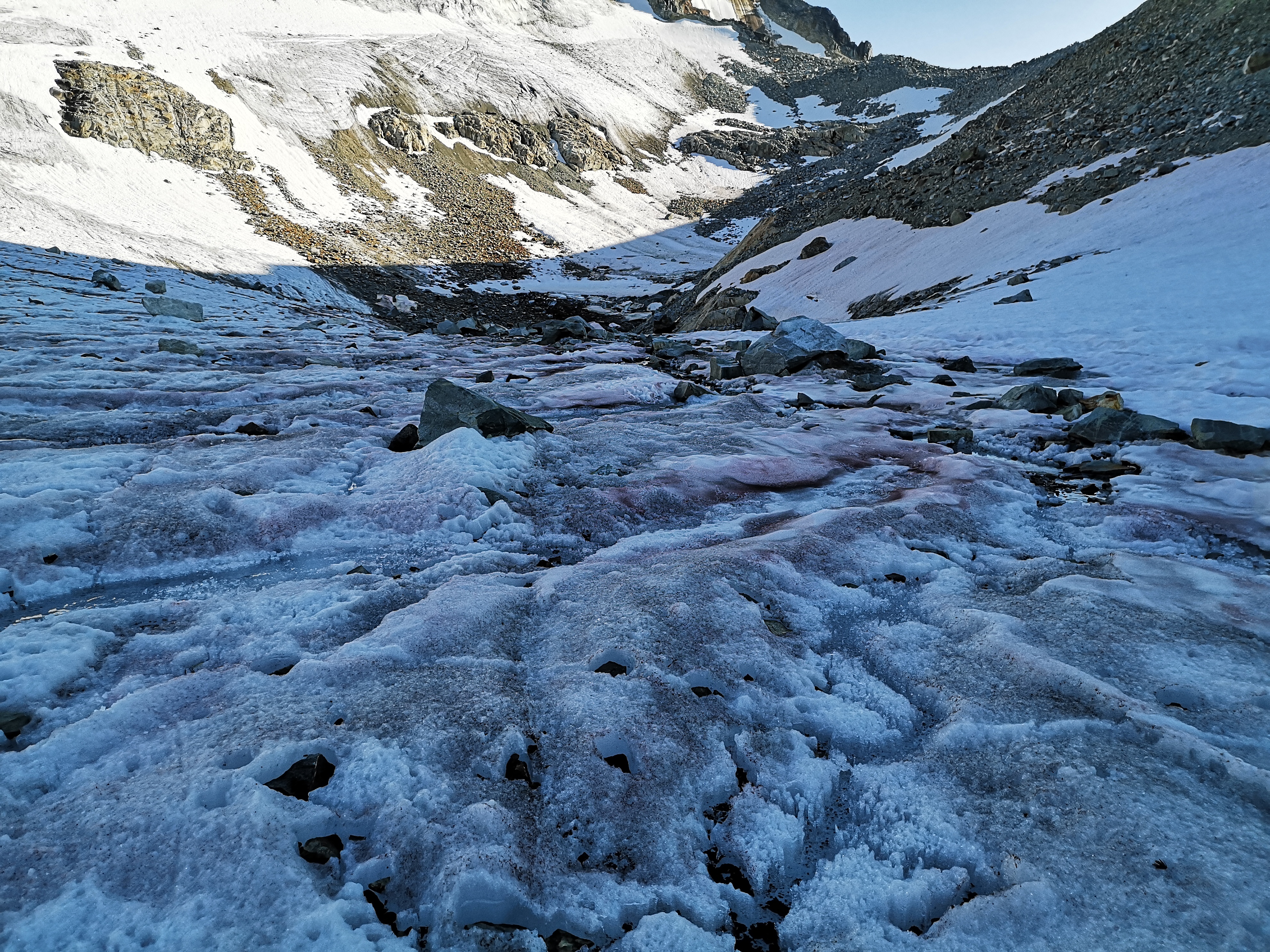
Shouldering packs now heavy with cold water, we climbed tothe top of the Wedge-Parkhurst col. From there, we would get a glimpse of theglacier we had crossed early that morning. The final unknown of the trip wasweighing on me: what would the descent from the col to the glacier look like? Howsteep would it be? How much risk would we have to accept to get back to theknown and manageable terrain of the morning? I crested the col first, andbreathed a sigh of relief at the gentle descent onto the ice below. We restedon large rocks in the shade, eating energy gels, which have never tasted soamazing. Then down the rocks, through wonderfully flat and iced rock fieldsintersected with a million twisting streams and towers and cavities of ice,stained pink from the iron-rich rocks. The sun was descending – early evening.We roped-up at the snow again, probing each step suspiciously, knowing that weprobably couldn’t psychologically handle another mishap like a major crevassefall. Winding our way around the crevasses without incident however, we weresoon back on the black ice near the glacial terminus. We took our crampons offfor the last time with satisfaction.
In final protest at our escape, the stream we had crossed in the morning, already fast and vicious, was now swollen after a day of snow melt. Our original crossing was submerged. I felt my frustration rising at this last barrier. We had been through so much, and now we were reduced to stalking up and down the edges of the raging water, trying desperately to find a place to cross. After ten minutes, we found a possible spot. My partner went first, ice axe planted in the water for stability for that final leap. I followed, his hand held back out to pull me across, and that was it.
Walking back to our tent at the campsite was as surreal as the morning ascent up the arête. We talked to some campers, who wondered at our harnesses and helmets, and us, a little dazed and certainly exhausted in the lovely calm and pink twilight. I told them that we climbed Wedge. The words felt weak, inaccurate. Was that all? We overtook the Guys near the lake campsite’s stream; they had already packed up their tent and were beginning the Wedgemount trail back down to the parking lot. With an hour of daylight left, and a camp to disassemble still, we thought it unlikely we would have the energy or willingness to make it back to our car in the dark that night. We found out the Guys hadn’t had it easy either – we all marveled at the inaccuracy of the guidebook and estimated trip-time. They experienced a chest-deep crevasse fall before a timely self-arrest suspended the motion. It was fitting to end the day with them, seeing them off as they hiked up the ridge into the yellow glow of sunset as we dropped our packs wearily in front of our tents. It had been 14 hours camp to camp. While we hadn’t intended to stay an extra night, we fortunately had enough food for the night and the morning, and we slowly dissected the day as we ate snacks and drank wonderfully hot tea as the air grew chill. My ridiculously warm and cozy sleeping bag was calling, and I fell into a deep sleep marveling at the thing we had done that day, because it truly was insane.
We woke with the clear dawn, packed quickly, and made shortwork of the Wedgemount Lake trail. While the previous day of mountaineering hadhumbled us, I was relieved to see that we could still deliver on these simpletrails. We ran down the lower portion, despite the 30-pound packs, and were backat the car in 2 hours.
What else isleft to say? We drove into Whistler, ate breakfast in the already blisteringlyhot sun, then drove home. Wedge, and back again.

Wow!!!! What an impressive and scary adventure. I’m glad you all got down the mountain relatively unscathed (if slightly traumatized)…your description made my hair stand on end. I’ve only made it as far as the lake and that’s plenty for me. Your photos are stunning. I particularly like the one with the ice axe in the foreground.
LikeLike
Thanks so much for reading Caroline, and for your kind words! I had a hard time writing this one – I’m glad I was able to convey that it was pretty amazing and scary all at the same time haha. The lake is still a very worthy destination. I’ll definitely be back for some more relaxed camping in the future. 😉
LikeLike