
Spring snowshoe to Zoa Peak at the Coquihalla Summit
We’ve been spoiled in southwestern British Colombia this year. A dry and sunny fall, and now a dry and sunny (and unusually hot) spring! While I’m getting very concerned about the raging forest fires that will plague us in a few months time, I’m certainly not complaining when another adventure-worthy Saturday morning dawns – bright, blue sky, birds singing.
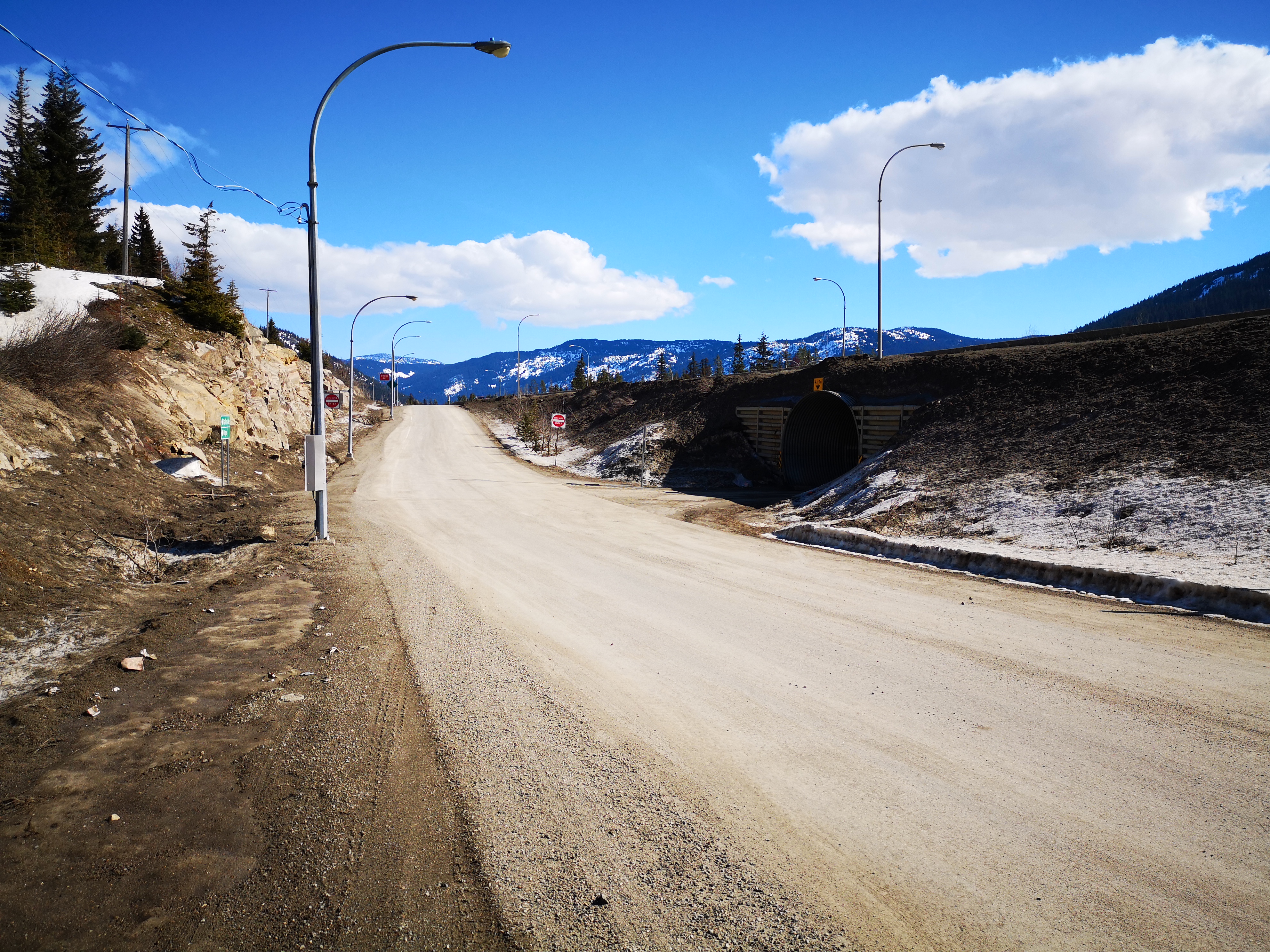
A trip to the Coquihalla Summit Recreation Area had been on my list for a few months now, and a slow, sunny Saturday seemed like the perfect time to tackle Zoa Peak. Zoa is a short, relaxed trail, well-known in the winter for gentle backcountry skiing. Heading east on Highway 1 instead of our usual west, we entered the Fraser Valley. Passing through green farmland, and stopping at a surprisingly modern cafe in Hope, we eventually began our climb via Highway 5 to the Coquihalla Summit. Our exit, #221 for Falls Lake, was easy to spot at the high point of the highway. Taking the off-ramp, you make a left turn through a questionable tunnel under the highway, then another left immediately after, as if you were heading back on the highway the way you came. Here, on the right side of the road, we found a collection of parked cars, and guessed that this was the winter parking area. In the summer, it’s possible to drive the road right into the park, but we would have to proceed on foot.
The Coquihalla Summit Recreation Area offers a number of short and high-payoff hikes. Falls Lake sits in the center of a bowl of epic peaks, and is only about 1 km in from the lot. In the summer, the lake is a popular campground. We were tackling Zoa today, but a number of other hikes here in the Zopkios Ridge had also caught my attention: Thar (another notable skiing area), Yak Peak (the impressive granite slab directly beside the Coquihalla highway, offering both hiking and rock climbing), and Needle Peak (a ridge and scramble).
We started up the wide road in the late morning wearing winter boots only, but realized at the beginning of the trail to Zoa (watch for a small wooden sign on your left) that snowshoes would be required, despite the packed appearance of the trail. After a short while, the trail diverges again, with one path heading left steeply into the trees, and the other continuing straight on. We elected for the steep route, but if you’re skiing, I hear you’re best to take the longer, gentler path. With a few weeks of warm weather behind us, and a hot midday sun beating down, the steep, sunny slopes were slippery! We stuck to the shade when we could, switchbacking the now more-rolling terrain. Keep an eye out for the orange markers on the trees here, as it’s easy to get off track in this section.
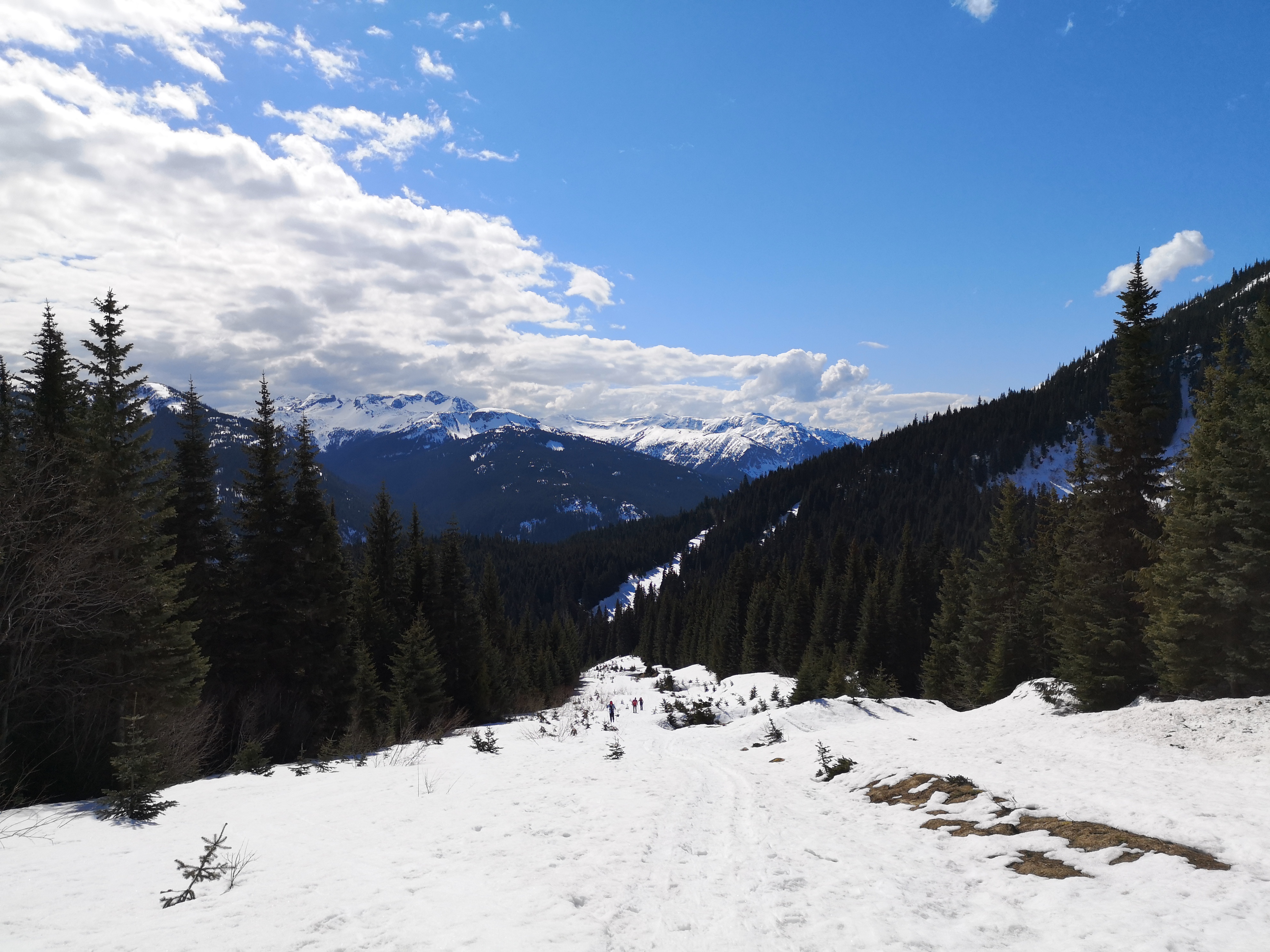
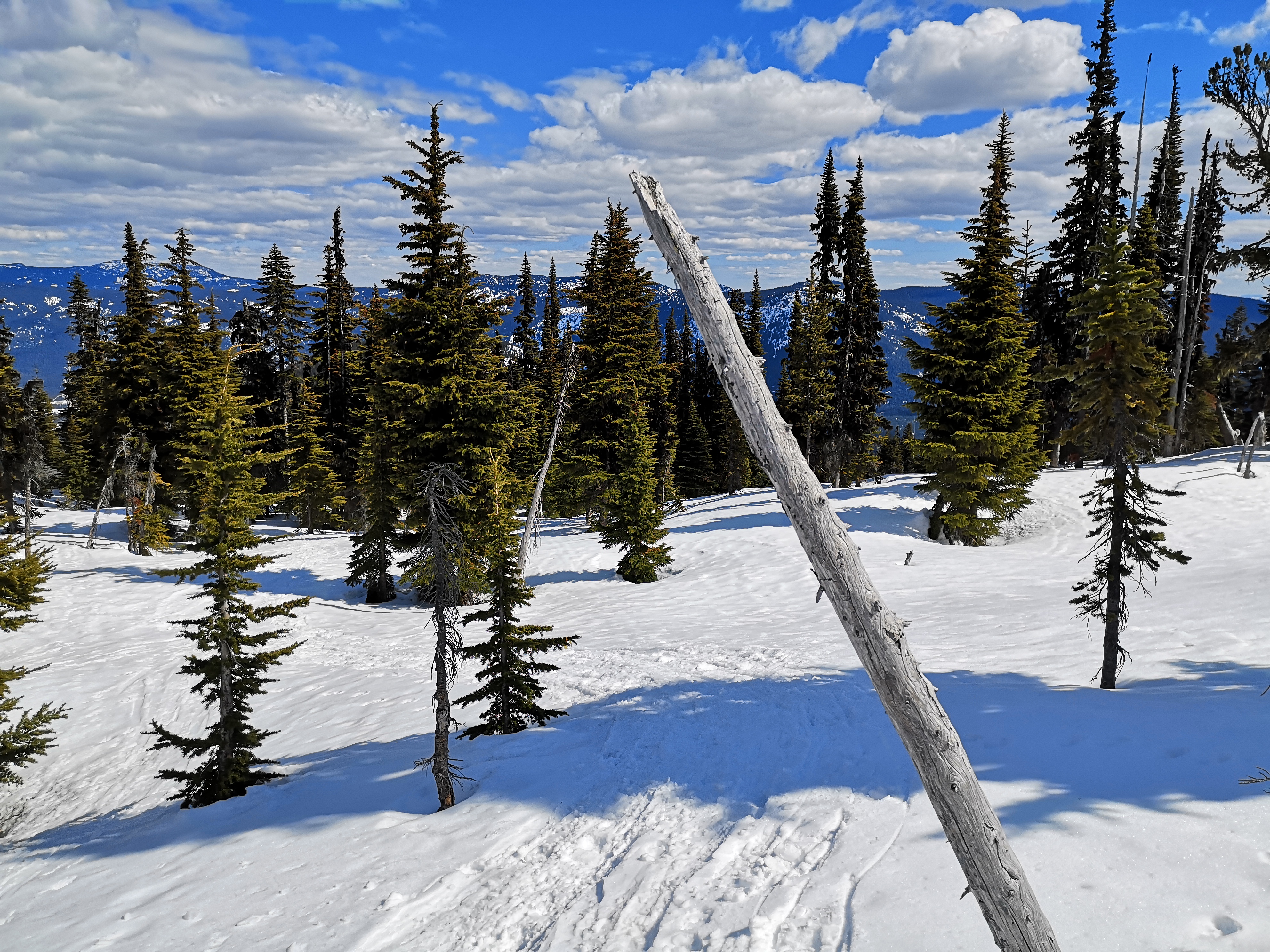
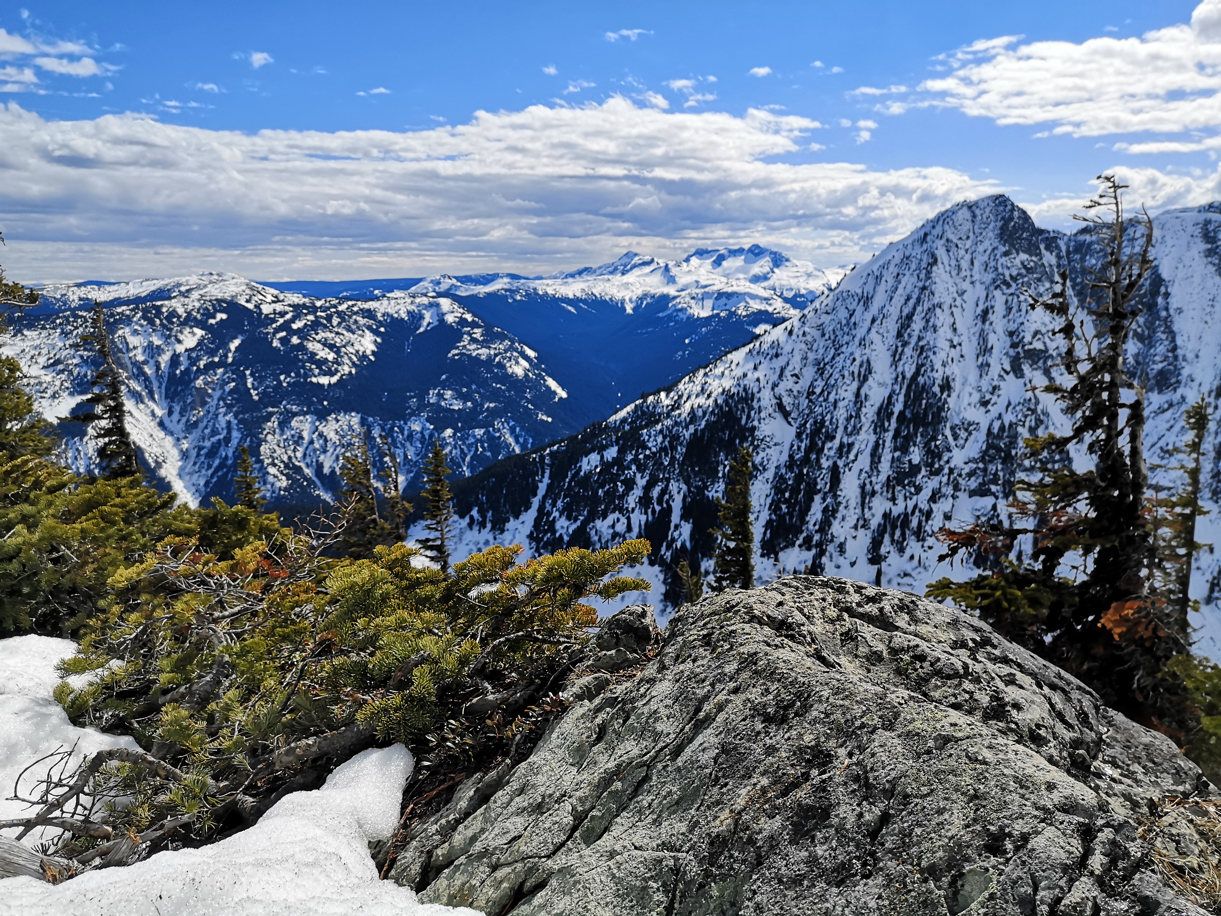
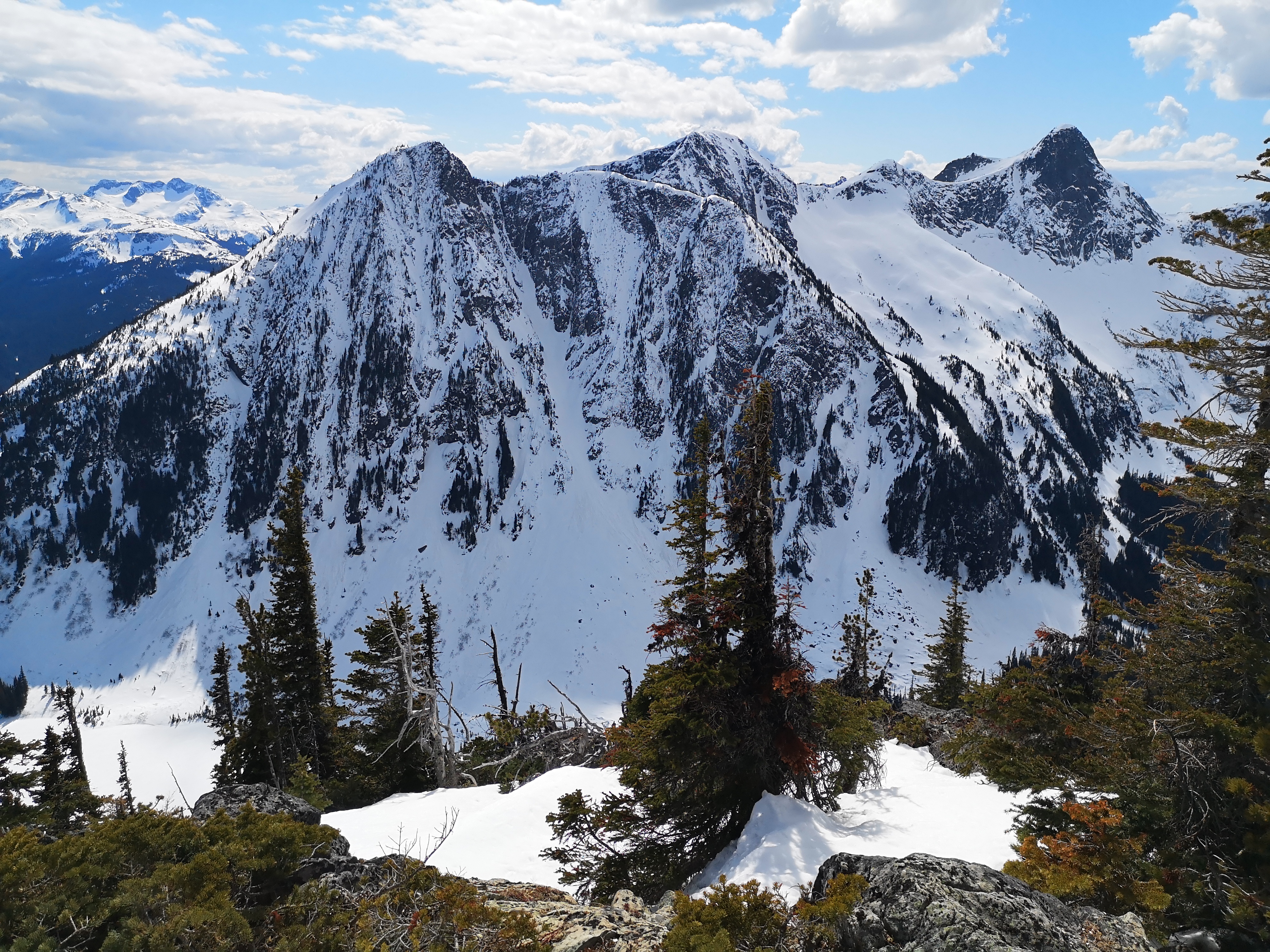
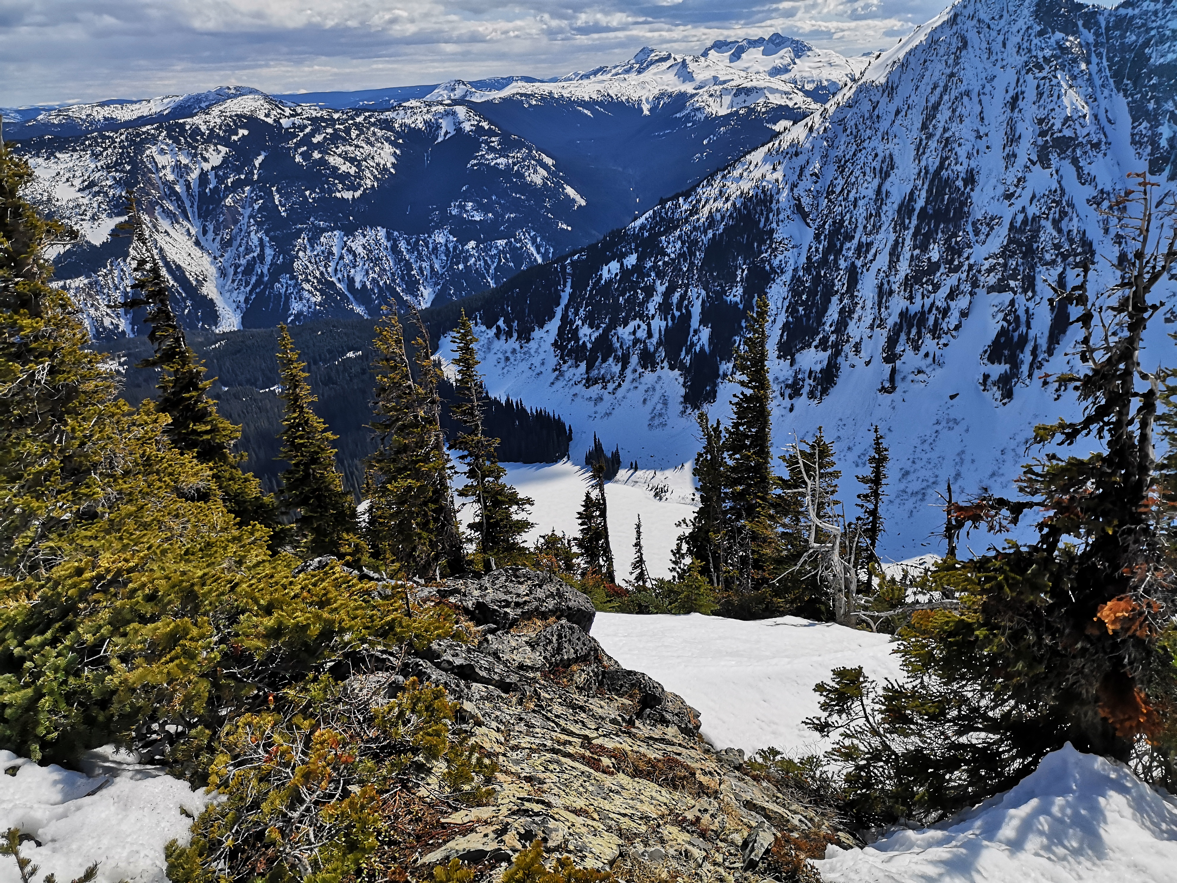
Leaving the denser trees behind, we hit the ridge, and prime skiing area. Here, the slopes are wide and rolling, and the trees more sparse, making for easy, low risk skiing when the avalanche forecast is insane. As we climbed, we were treated to continually better views of the peaks around us. Jim Kelly and Coquihalla Mountain itself, both in the park across the highway, caught our eye in particular.
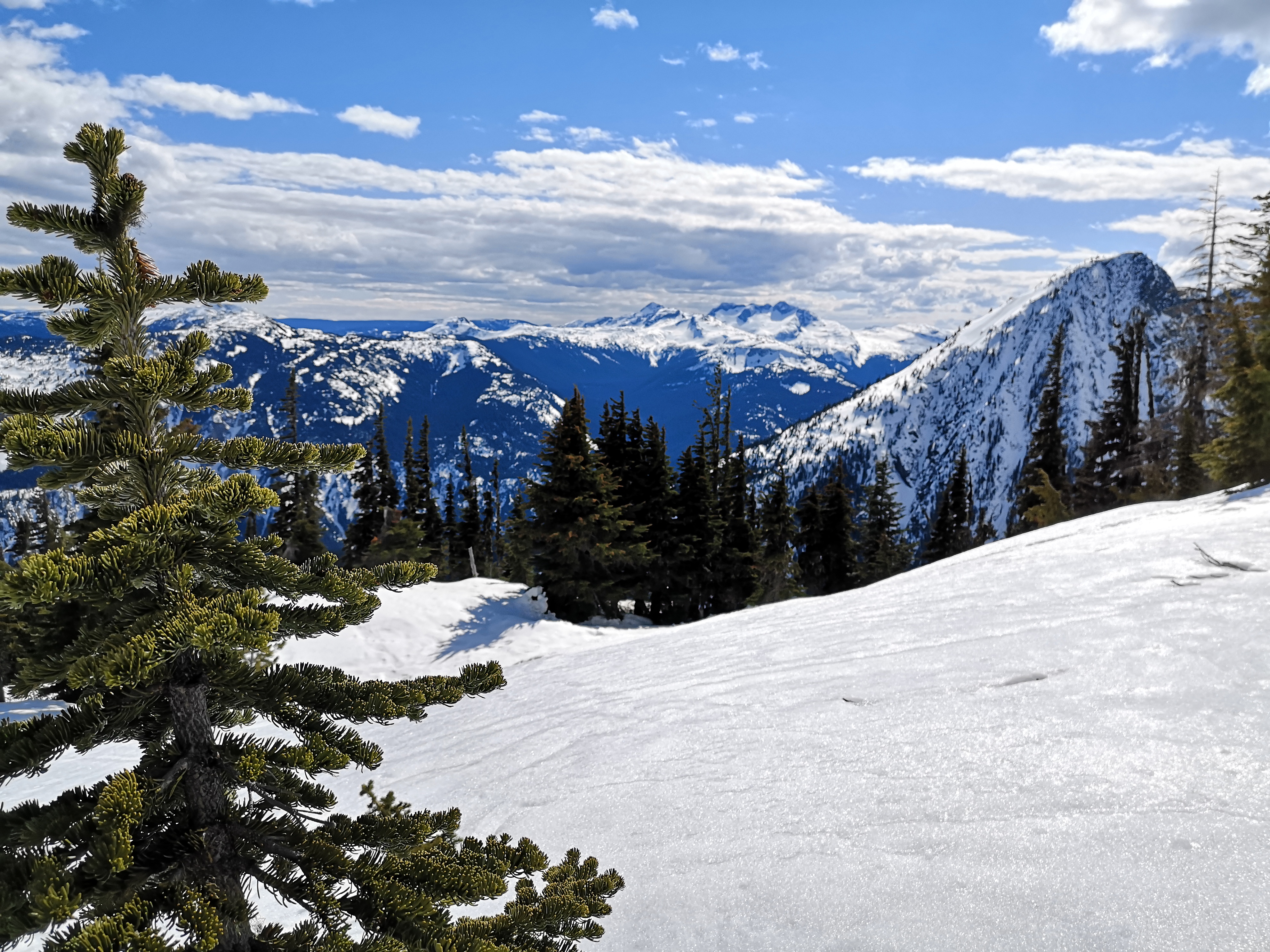
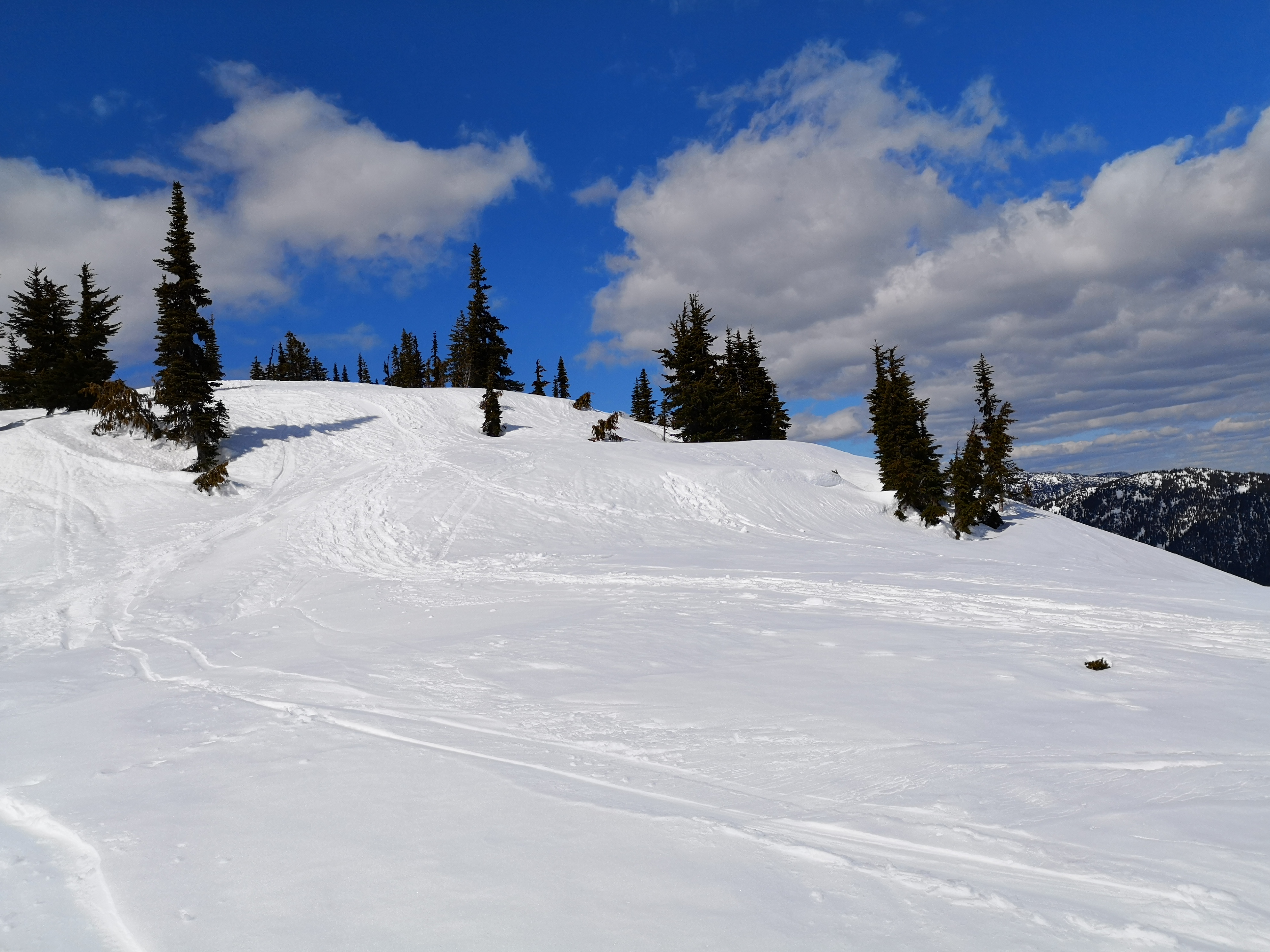
As the rolling hills came to a close, we ended at a viewpoint. This is the false summit of Zoa (the true summit requires a descent and another climb), but was good enough for our short Saturday trip. We paused here a quick lunch, admiring the view of the Zopkios Ridge peaks, the frozen expanse of Falls Lake below us, and reflecting on the insanity of skiers picking lines down the monstrously steep, lake-facing mountain slopes (apparently doable according to some guides I read, but probably not something I would ever attempt).
The descent was quick and slippery! More slush than snow, really. Despite the slides, Zoa presented a fantastic view-to-effort ratio, and we were surprised to have the whole thing nearly to ourselves – we ran into only a handful of other parties the entire day. Seems everyone has abandoned winter adventures in favour of spring ones. But as long as there’s mountains, I’ll be in them, weather be damned.
Trip Stats
We clocked in at 3 hours and 40 minutes for this one. Total distance was about 8.7 km, and total elevation was about 670 m.
Ever heard of Zoa? I know I hadn’t until three separate people mentioned it to me in the last three months. Been up any of the other Coquihalla Summit peaks? Tell me about it in the comments below!

Beautiful skies. Was my favourite part of the trip…seeing the interior skies❤️
Sent from my iPhone
>
LikeLike
Hard to not get outside when the sky looks like that! Thanks for reading!! 🙂
LikeLike
That sounds like a real adventure, for sure!
https://misscharlottelouise.wordpress.com/
LikeLike
Haha yes for sure! Any time snow is involved, things always get more serious 😉 Thanks for reading!
LikeLiked by 1 person