While spring is almost here, it’s still too soon to hang up those snowshoes! I’m frequently asked for a list of trails to tackle in the winter, so I thought I’d put together some of my favourite local Vancouver winter hikes. The best part? No special gear/vehicles/training required – just find a friend, pack a lunch, park, and play!
Hollyburn Mountain
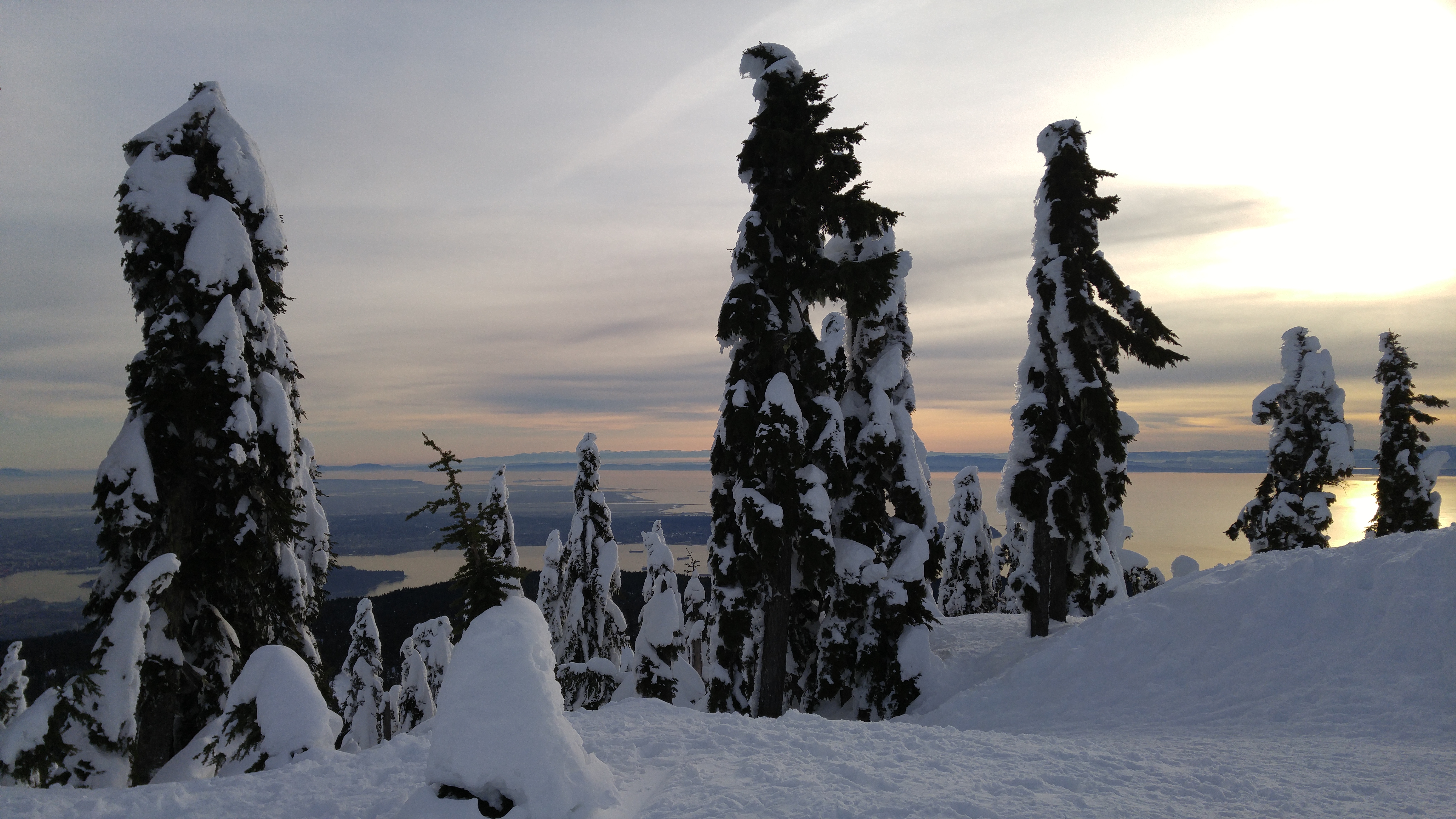
This trail has a special place in my heart, mostly because it reminds me so much of childhood sled rides down big hills! While it’s not long, this trek is a good workout – the steep sections near the top in particular will make you sweat. While the view of Vancouver from the top is fantastic, this one is all about the downhill; the slope is steep enough that sitting down and sliding is easier than walking, and is such a popular mode of descent that there are often chutes already carved out by the numerous sliders before you. For extra fun, bring a magic carpet, or even just a regular old garbage bag, and recapture your lost youth.
The trailhead for Hollyburn is located in the Nordic area of Cypress Ski Resort. Note that, while you park at the resort, the Hollyburn trail itself is located in Cypress Provincial Park, which mean that there are no entry fees. Once in the lot near the Nordic rental lodges, backtrack a bit down the parking lot to the find the trailhead.
Time: 2-4 hours Distance: 6 km Elevation gain: 400 m
Mt Seymour
The trail up Seymour is a great option when you want a quick workout, but don’t have a lot of time. It’s a steady uphill paralleling the ski run, with great views behind you of the city as you climb. While a trek to first peak of Mt Seymour, or beyond, ventures into the back-country (where avalanche and proper survival gear should be carried), a shorter trek can be made to the edge of the Seymour ‘slack-country’, marked by a large avalanche bulletin sign.
The trailhead for Seymour can be reached via – you guessed it – the parking lot for Seymour Ski resort. Head toward the Mystery Peak chair, and look for the Provincial Park signs to the left of the ski run. Then, take the trail straight up the mountain.
Time: 1.5-3 hours Distance: 4 km Elevation gain: 230 m
Dog Mountain
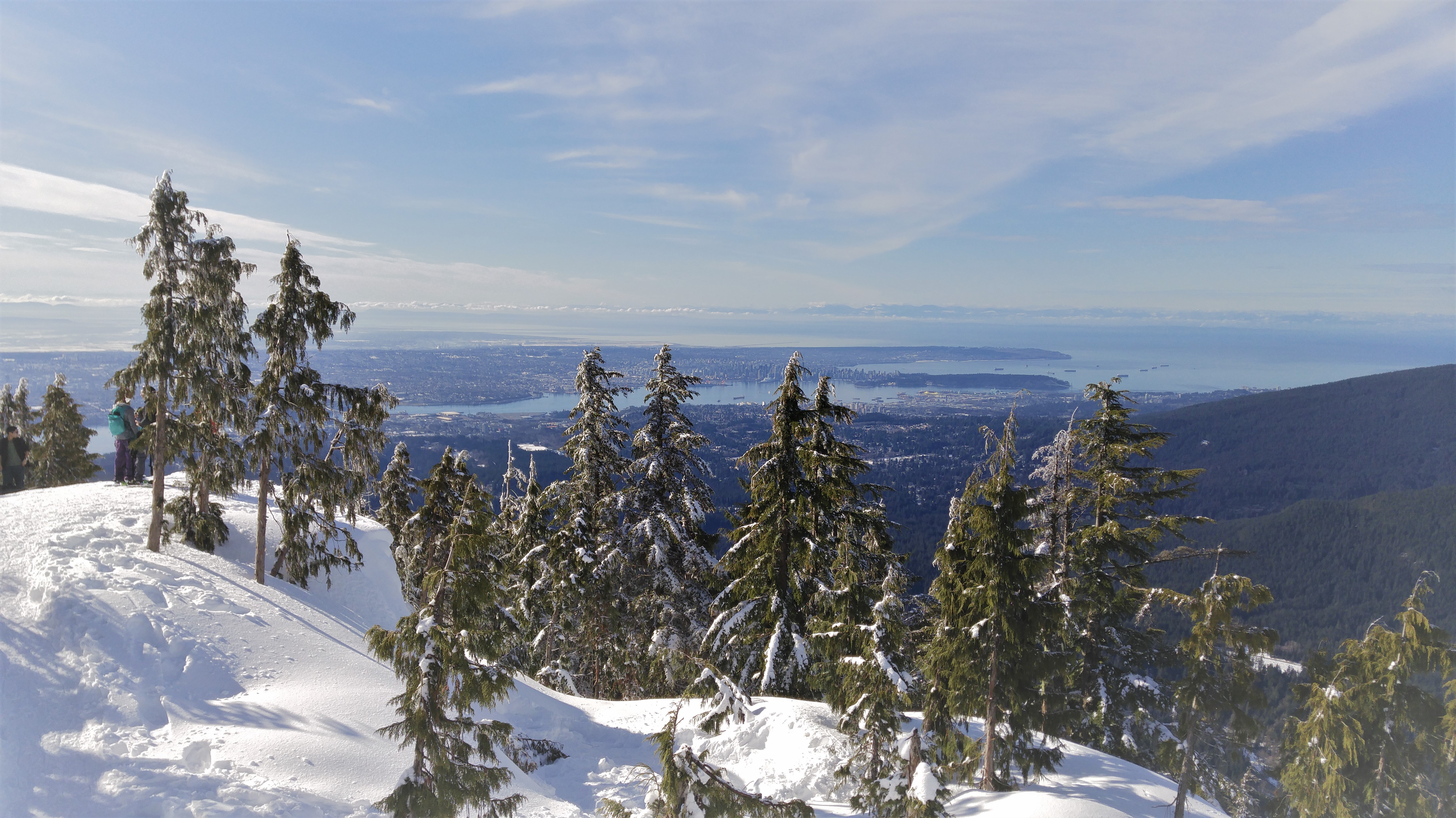
If you’re looking for a more relaxed day in the snow, plus a plethora of pups, put Dog Mountain on your list! The trail is rolling, and does not offer any serious elevation gain, but still presents a fantastic view at the end. The trail features a frozen lake, plenty of curled-over Dr. Seuss-style trees, and all the doggos you can handle.
The trailhead starts in the same location as the above trail for Seymour: from the Seymour Ski resort parking lot. Look for the signs on the far left of the Mystery Chair, then take a left at the sign for Dog Mountain.
Time: 2-4 hours Distance: 6.5 km Elevation gain: 150 m
Eagle Bluffs/ Black Mountain
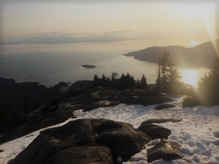
A summer Instagram classic, the trail to Eagles Bluffs and Black Mountain in Cypress Provincial Park is a much quieter option in the winter! You can take this one as far as you want – quickly pop up to the top of Black Mountain, complete the Black Mountain loop, or add on the out-and-back trail to Eagle Bluffs.
The trailhead starts from the Cypress Ski resort. Make sure to grab a back-country pass from Black Mountain Lodge in the resort before you begin (you might get stopped otherwise!) – these are free tags you put on your jacket. Head towards the ski runs (just walk around the pass-holder gates), and follow the green signs towards the Provincial Park trails. Keep left at the first fork, and you’re on your way! The trail will take you to a junction for the Black Mountain loop: right takes you straight up to the top, and left takes you down to the lake, past the turnoff for the Eagle Bluffs trail (follow the square orange markers on the trees for this detour), and then to the summit of Black before returning to the junction.
Time: 3-5 hours Distance: 8.6 km Elevation gain: 450 m
Bowen Lookout
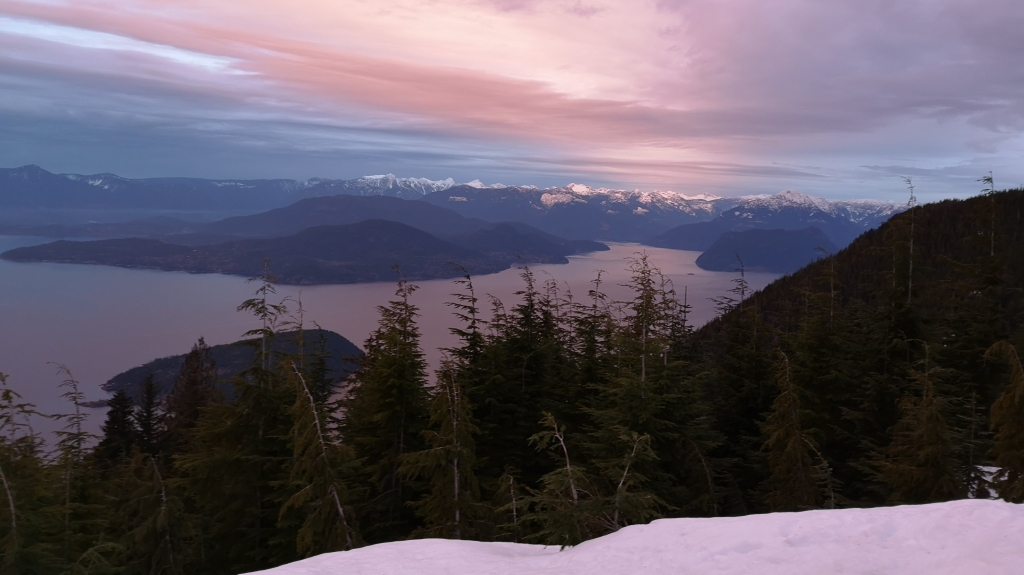
Another Cypress trail, Bowen Lookout is a great option for arelaxing walk through the park, and includes a great view of Howe Sound. Thistrail is relatively flat, with a small climb at the end. Bring a headlamp andsome hot chocolate and catch an amazing sunset at the end. The trail is dottedwith fluorescent markers, and the light from the ski resort makes it prettyeasy to navigate back after dark.
Same deal for Bowen as for Eagle Bluffs – head up to Cypress, grab a back-country pass, follow the green Provincial Parks signs, but head right at the first junction instead. You’ll pass through some open spaces and some dense trees before a short climb to the lookout.
Time: 1.5 -3 hours Distance: 5 km Elevation gain: 200 m
Red Heather (Elfin Lakes trail)
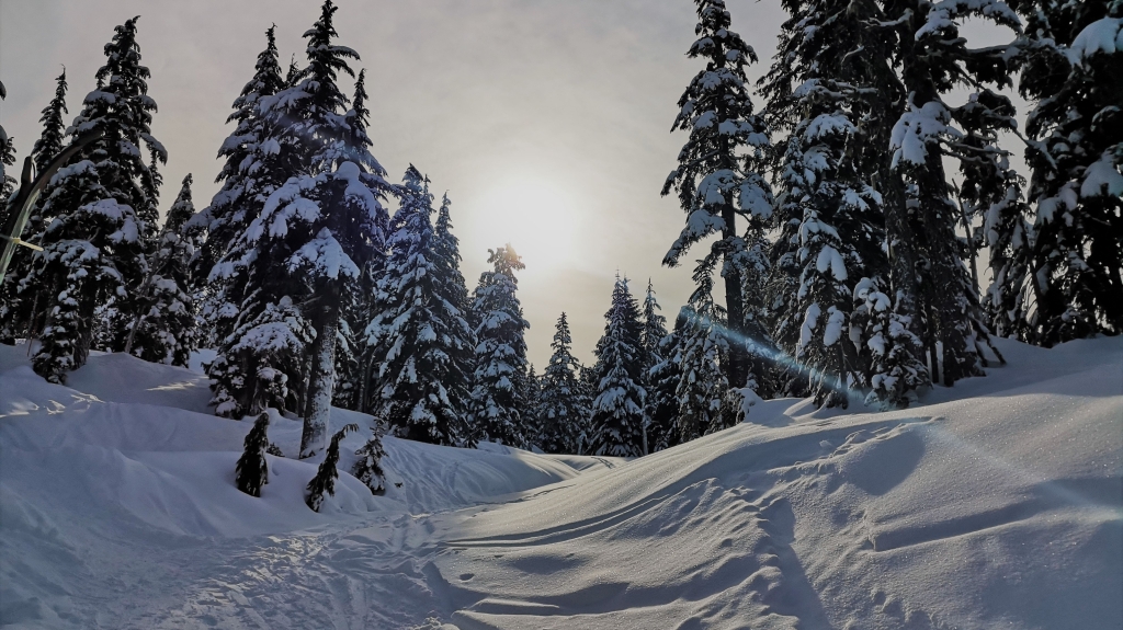
For a slightly more remote experience, consider hiking to Red Heather hut, the first part of the Elfin Lakes summer trail, in Squamish. After a steady uphill climb on a wide road through the forest, you’ll break into the open and find the hut right in front of you. Stocked with a woodstove and plenty of wood to burn, the hut is a fantastic place to warm up and have lunch. Plus, the view of the mountains outside is absolutely unreal. The trail does continue on up Paul’s ridge and to another hut at Elfin Lakes, but be warned that this section proceeds through avalanche territory, so you’ll need proper gear and training.
The trailhead for Red Heather is in Squamish. Take Mamquam Rd up the hill past Quest University. The paved road will shortly turn to gravel, so be careful of potholes and drive slowly. Note that, to reach the upper parking lot, you’ll need a good vehicle with chains. Rangers are frequently there to monitor, and will hand out tickets if they catch you proceeding chain-less. If you’re vehicle isn’t equipped to make it up, you can leave it at the lower parking lot and walk up the road about 2 km to the upper lot to start the trail.
Time: 3-5 hours Distance: 10 km (from the upper parking lot) Elevation gain: 520 m
Garibaldi Lake
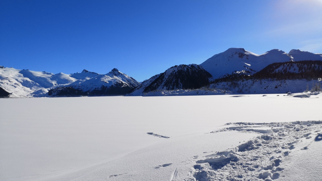
The most ambitious trail of the list, Garibaldi Lake is a hard crunch with a stunning reward. This is a full day trip that will make you sweat, so pack with care – layers, lots of food and water, headlamps/flashlights, first aid equipment, etc. (the 10 essentials, ideally). Note that this trail can get pretty icy, and the drop on the one side of the trail is pretty steep, so you’ll definitely want snowshoes, micro-spikes, or even crampons for this one. Most of the trail is a series of switchbacks until you reach the junction for Taylor Meadows (left) and Garibaldi Lake (right). Go right, and the terrain becomes more rolling as you traverse to the lake. Once you hit the lake, you’re rewarded with magnificent views of the peaks of Garibaldi Park. Have lunch on the shore or in the shelter before heading down.
To reach the trailhead, turn right onto Rubble Creek Rd off highway 99 towards Whistler (if you hit daisy Lake and the dam, you’ve gone too far). In the winter, the regular parking lot is inaccessible, so you’ll have to park at the bottom of Rubble Creek Rd and hike up, adding 2 km each way to your trip.
Time: 8-10 hours Distance: 25 km (including the road) Elevation gain: 1150 m
Note: I’ve provided a pretty wide range of times for these trails, erring on the conservative side, to allow for hikers of different speeds, photo breaks, and summit hang-out time. Snow will always slow you down, whether you’re stomping through fresh powder on snowshoes, or tackling packed snow in boots, so allow more time than you normally would in the summer.
Have a favourite winter trail you’d like to rave about? Letme know in the comments below!

Great post and fantastic photos, I don’t think there’s a city more beautiful than Vancouver and the surrounding nature with incredible array of hikes is a big bonus 😀
LikeLike
Yes I agree! We are pretty spoiled here 🙂 Thanks for reading!
LikeLike