Alpine climbing in the Tantalus Range near Squamish, BC
If I was to make a list of the top alpine objectives I’d like to complete, Alpha East Ridge would top that list. And it would have been the top for nearly the last 5 years. Ever since my first excursion to the Tantalus Range, just behind the town of Squamish, BC, I’ve been captivated. That first trip – a huge group hike up to Lake Lovelywater, a night camping on the beach, an early morning scramble of Iota and Niobe, then an absolutely epic helicopter ride back to the Squamish airport – left me itching to come back and tackle those sharp, glaciated spears of rock; their spires felt remote, mysterious, and magical with sunlight glittering on the shards of ice blanketing their feet. Despite the proximity of the Tantalus Range to the famous climbing town of Squamish, access is notoriously difficult due to the Squamish river. To reach Lake Lovelywater, the lower basecamp in the range, one must first cross the river to access the trailhead, then hike up a gruelingly steep trail for about 1100 meters to reach camp. The river crossing has inspired many shenanigans over the years, these nautical adventures ranging from the hiring of professional boating companies for a ride, to giving cash to anonymous fishermen for a lift, to a heinous crossing of two steel cables that span the length of the river on foot (packs dangling below!), to floating inflatable Thermarests across the blue waters and trying desperately not to flip. Access can be so tricky, with options changeable enough throughout the years, that hiring a helicopter for a drop off and pick up is not uncommon, in spite of the cost. But despite Alpha topping my list of climbing objectives, I had written it off this year: the Year of Adventure (aka the Year of Unemployment) was not the time to shell out for expensive helicopter charters.
I don’t exactly know how it came about, but one morning, I found myself sitting with Chris in a coffee shop in Squamish with the phone number of a cheap river ride in my proverbial lap. A phone call confirmed: $50 each, roundtrip, and reliable enough to make a multiday Tantalus trip a realistic possibility. And if we went, of course I knew what we’d be climbing: my number one, my only, my sweet sweet Alpha East Ridge.
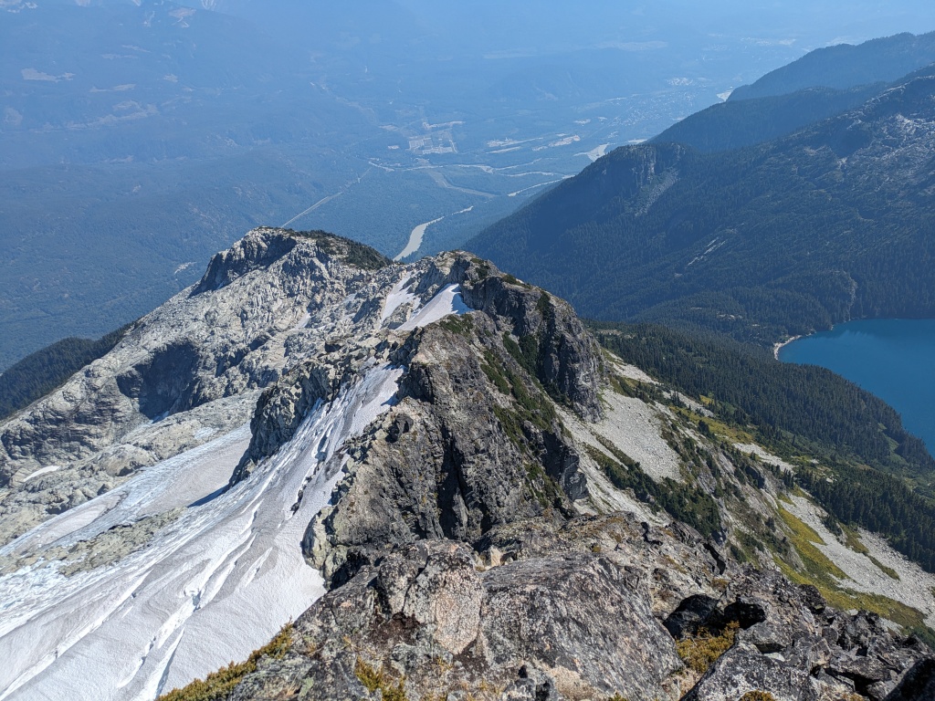
Alpha is one of a handful of extremely iconic mountains in the Tantalus range, its north face famously visible from the lookout off Highway 99 on the way to Whistler. Its classic A-shape is as elegant, and the Rumbling Glacier on its flanks as wicked, as a mountaineer could ever hope for. The East Ridge leads sharply from a low point on the treed ridge to climb a series of small towers, occasionally meeting the glacier below at the top of successive notches. This skyline is so striking that it’s become one of the most famous alpine ridge climbs in Canada. Previous experience in the Tantalus range, and the route’s grading (5.8 alpine, AD-), had always made me apprehensive about tackling it however. 5.8 alpine trad climbing could get nasty really fast, and I had learned to not underestimate grading in that range. But Chris and I had a strong year of alpine climbing and mountaineering, and another review of route descriptions and beta confirmed our thought: we were ready.
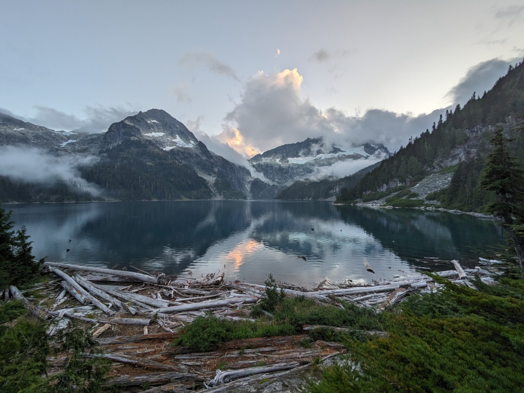
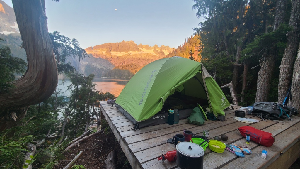
Our friendly boatman dropped us off at the Lake Lovelywater trailhead on a beautiful Friday morning, waving goodbye as he headed back down the opaque blue river. We shouldered our incredibly heavy bags (we had decided on a 3 night stay in camp, including some more indulgent (ie: heavy) food and drinks, plus our climbing gear) and trekked up the forest trail. The hike itself was harder than I remembered, likely because I was carrying much more weight this time, and also because I got stung by a bee in the thigh midway through the hike, but we made it Lake Lovelywater in good-enough time (4 hours from the trailhead). Despite a looming long weekend, we found the campsite and ACC Hut at the lake very quiet, and got our choice of tent pads. Fortunately there is also a second campsite on the beach a few kilometers away, which breaks up traffic to each site. Camping in Tantalus Park is also first-come-first-served, so perfect for long weekends when you’ve failed to plan ahead! We claimed the single best site in the entire camp, an epic pad on the small bluff above the beach. We spent the rest of the hot summer day lounging, and even dared a dip in the icy lake to cool off. Alpha loomed above us at camp, and I prayed my legs would be recovered enough for a hard slog the next day.

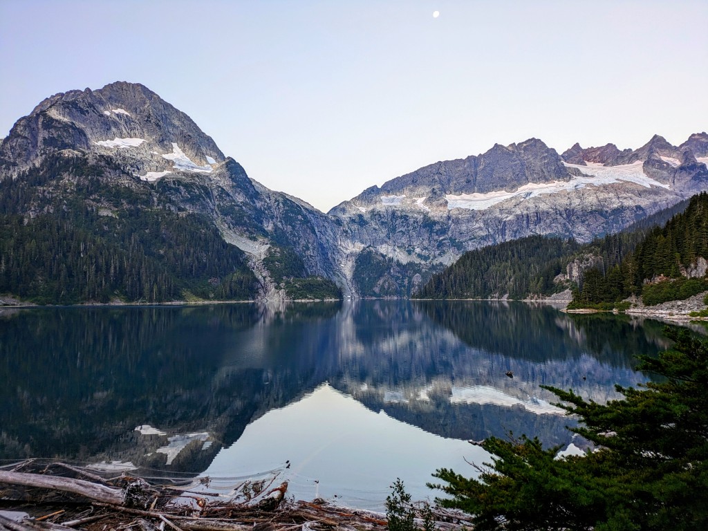
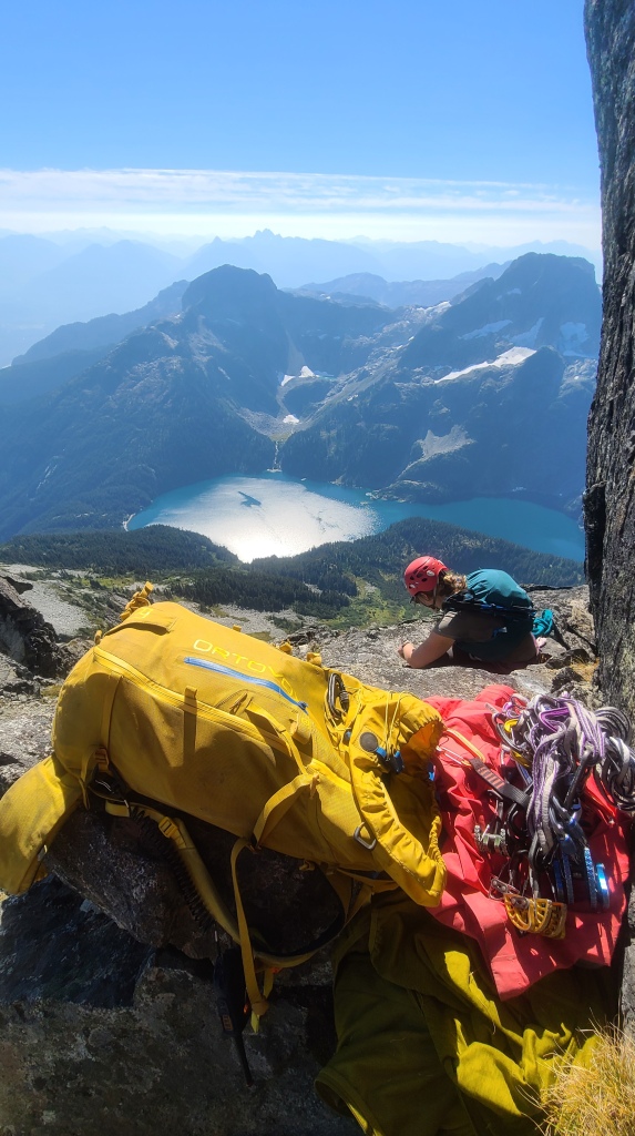
We woke up early to calm water and a milky blue sky, a rose dusting in the east hinting at the flawless weather in store for us on this early September day. We packed quickly and as minimally as possible: extra layers, food, water, Garmin in-reach, radios, harnesses, helmets, a light alpine rack (singles of BD #0.5-#3), plenty of long draws, a rope, and rock shoes for me (as I am the designated trad leader). In our haste, we forgot sunscreen however, a realization we made midway up our steep hike to the base of the ridge. The trail for Alpha’s East Ridge starts right outside the Lake Lovelywater campsite – after walking past the beach at the beginning of the trail to Lambda Lake, a faint footpath can be seen branching off right, then up through the trees. This trail was well-trodden enough to follow without major issue, and even had the odd bit of flagging tape (one minor issue included a ridiculous bushwack to get back on track). About 1.5-2 hours of steep hiking through forest and then alpine meadows and boulders deposits you at the low point on the Alpha ridge. From here, the fun begins.
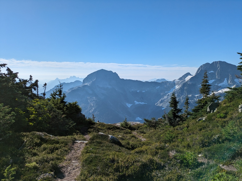
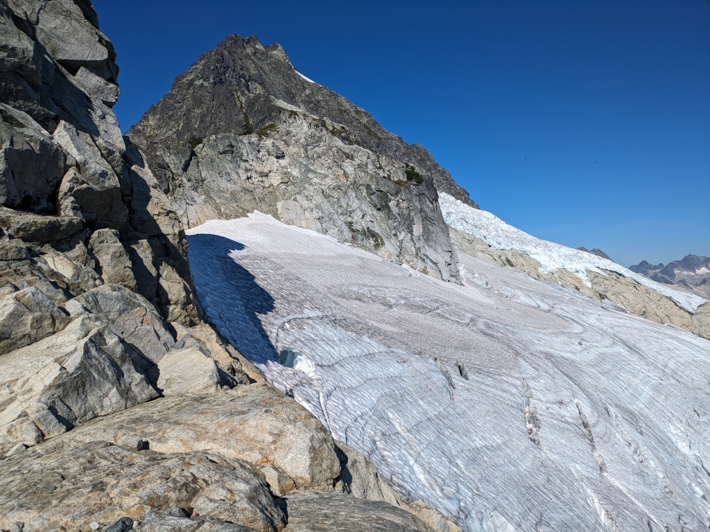
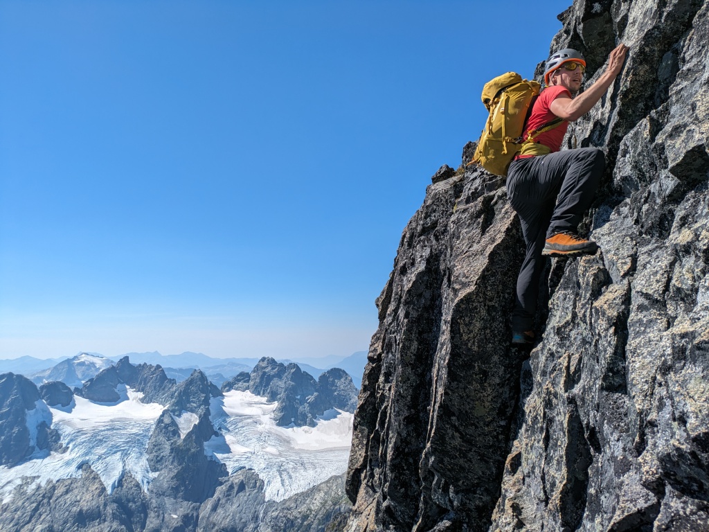
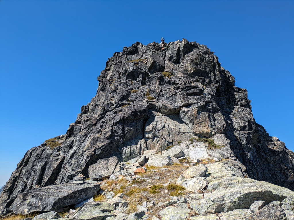
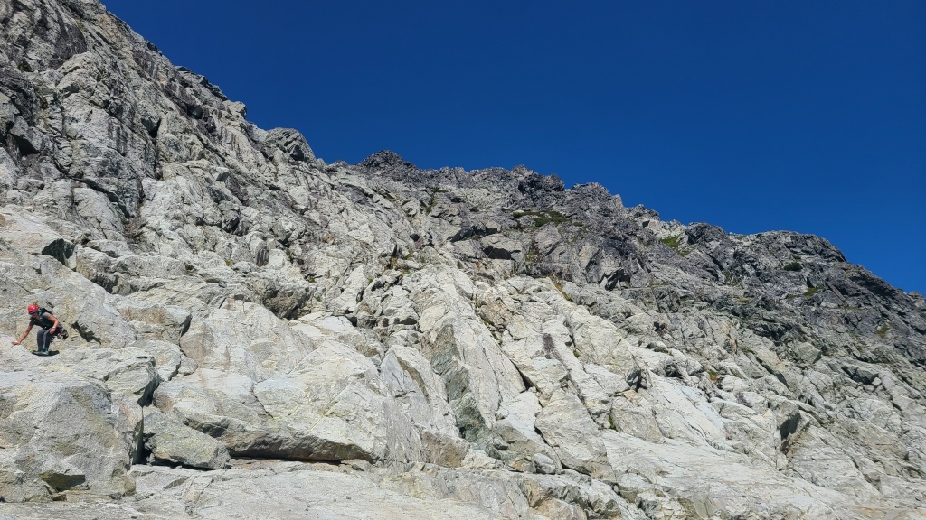
The East Ridge is well-enough travelled that a trail can been seen for much of the ridge. There are two common ways to do the route: the most straightforward is to stay on the ridge crest, following the various ups and downs, while the second is to drop onto an arm of the glacier on the north side at one of the notches, then traverse the glacier across and up to hop back onto the rock at the final notch before the summit. The advantage of the ridge-only route is that no ice gear (crampons, ice axe, crevasse rescue gear) is required, while the advantage of the glacier is that it’s likely faster with less overall elevation gain (when it’s in good condition) than the ridge. Since we were climbing late-season (early September) in a year with a notoriously thin snowpack, we opted to stay far away from the glacier and take the rock-only route (and we were glad we did! The glacier was in bad shape!). The simplicity of the ridge was appreciated: it’s impossible to get lost (just stay generally on the crest), but small micro-route-finding decisions must be made consistently to surmount the various rock towers – sometimes the easiest path is over, and sometimes around. The climbing for the majority of the ridge is a mix of straight-up walking with class 3 scrambling (we encountered a moment of something more like class 4/low 5th, but I think we might have missed an easier path). The crux of the route occurs near the very end, just beyond the final notch where the glacier rises again to meet the rock, about 4-4.5 hours from Lake Lovelywater.
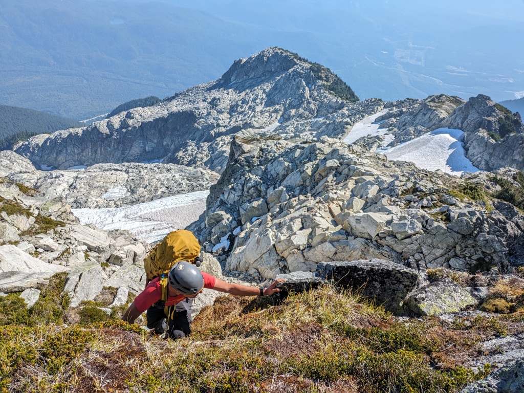
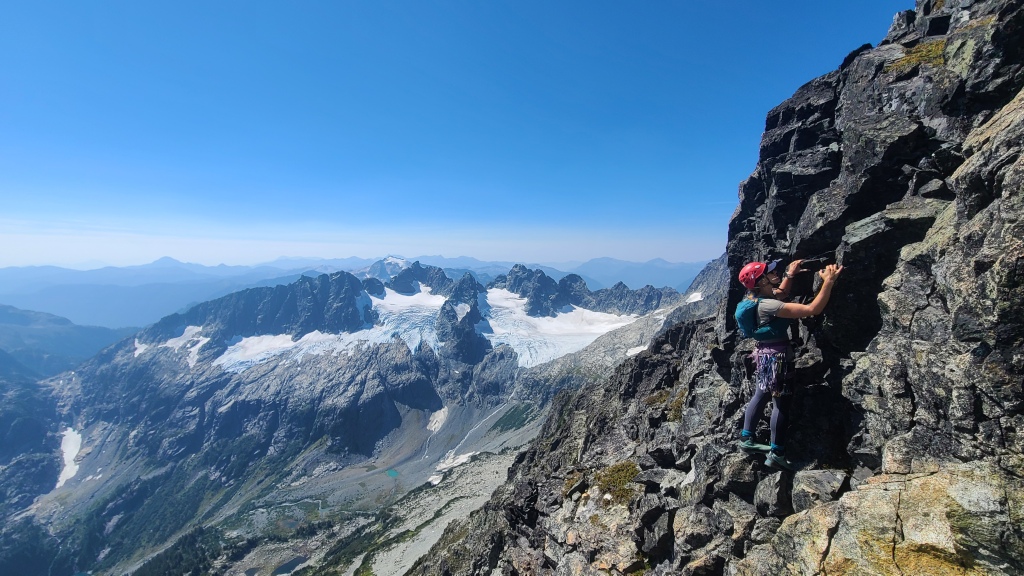
The crux of the classic route consists of two pitches of 5th class climbing. The first is a 30-40 meter pitch (depending on where you belay: from the notch, or a platform about 10 meters up) with what’s described as a 5.7/5.8 crux in Alpine Select (2001 version). The hardest climbing here is a 10-meter section of burly wide fist-crack. It’s awkward, bulgey, and in-your-face on down-sloping flat crimps, but plenty of stemming and mantling opportunities exist. After climbing it, I’ll confirm that it felt like a burly 5.8 to me, but it’s short and not too bad. For protection, an old piton sits in the wall below the wide crack crux, and the crack will take big gear (folks say to bring a #3 or #4 even (if you want to haul it)). I clipped the piton, backed it up right away with a #3 in the crack, then proceeded to run out the rest of the crux, as I did not have another large piece. Past the crux, you’re back to easy climbing – I threw a #0.75 into a flake near the top of the pitch for good measure, but didn’t need it. If I was to climb it again, I might seriously consider only bringing two #3s to protect the crux and nothing else, but everyone has their own gear preferences! After reaching a huge ledge, two shiny bolts and rap rings are located on the back wall. Belay from here.
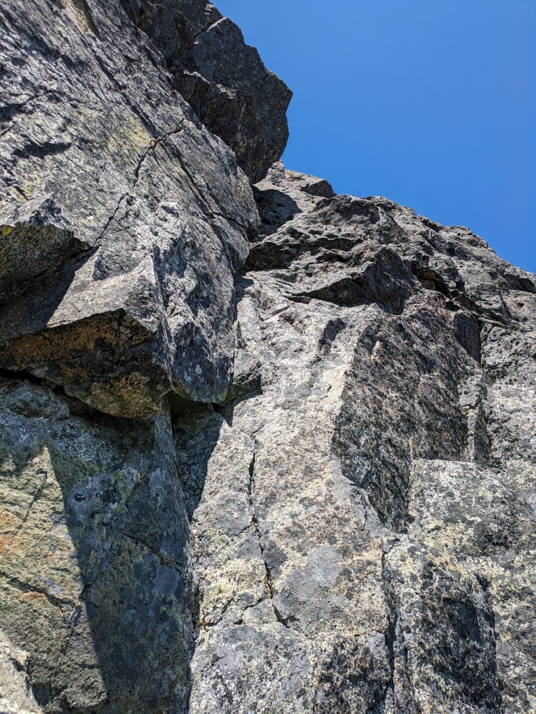
The second pitch is described as mid-5th (5.5-5.6-ish), and cannot be protected. It’s a short, 10-meter pitch vertically up the wall above the anchor station to the skyline – look climber’s right at the top and you’ll see another pair of bolts and rap rings for the anchor. I took a large crack up the sheer wall to climber’s left (some small crimps for hands and feet until some good hands emerge deep within the crack near the top, plus a massive high-step), while Chris came up in the slabby corner on climber’s right, directly beneath the anchor. He thinks that way was probably easier. It’s worth noting that both crux pitches can apparently be avoided by traversing around to the left from the notch. There is some low 5th class scrambling here instead, but you could save yourself the pain of hauling rope and cams by taking this route. However, I’m very happy we did this classic line as intended, and enjoyed the crux pitches.
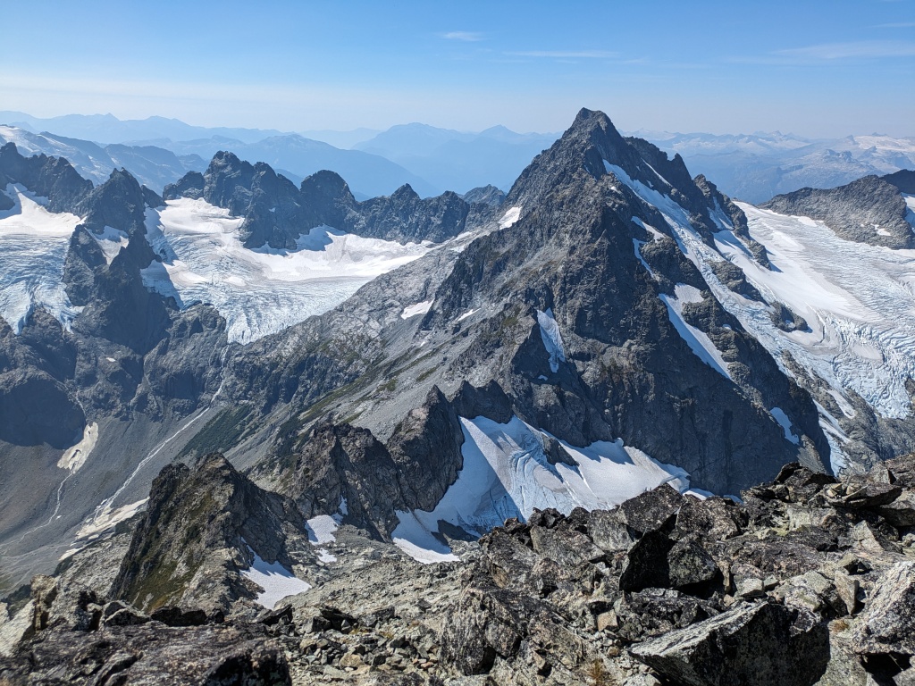
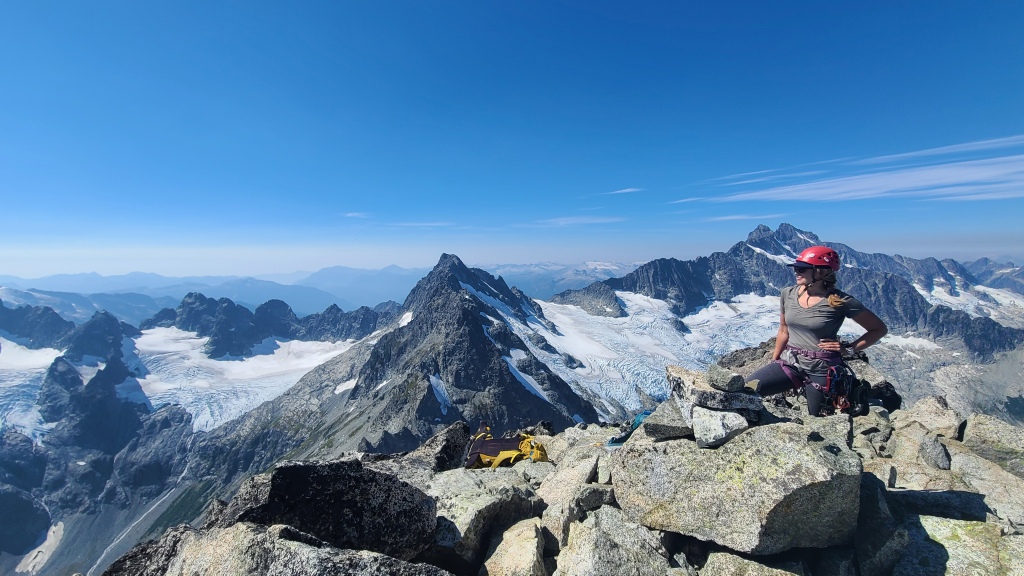
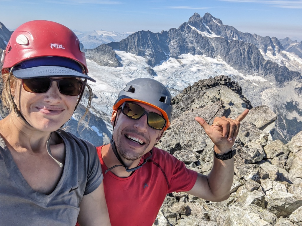
From here, stow the rope, and continue easy scrambling until the summit. The summit is a wonderful 360 of the Tantalus peaks and Garibaldi Park, with Squamish shimmering in the distance. Our summit day was fortunately windless, and the summit was hot and inviting. We were starting to feel our lack of sunscreen though – I could already see my arms reddening!
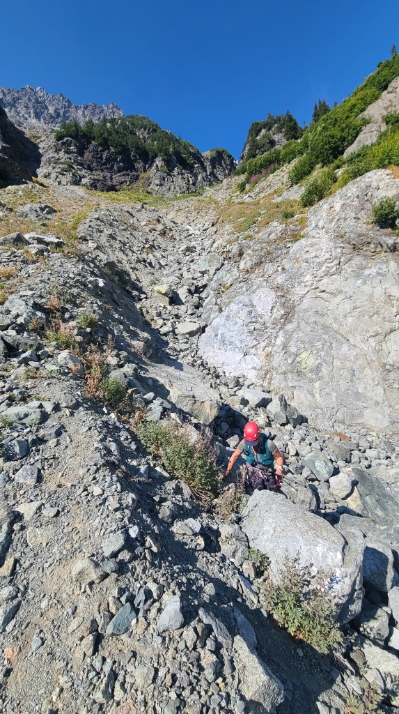
After lunch, we repacked our gear and headed down the West Ridge. The East Ridge can be reversed to descend (you can rap the two crux pitches from the stations, or scramble around them as mentioned above). We had decided to take a different descent path to see more of the park though. Our route is classically described as the descent route in Alpine Select, and is well-outlined in Matt Gunn’s Scrambles guidebook. We hiked/downclimbed easy terrain (with little moments of 3rd class scrambling) to the first notch along the west ridge, following a footpath and cairns, then took a hard left at the bottom of the notch to begin a descent south down towards Lambda Lake. From here, descend and traverse southwest towards a scree field. Cairns will take you to a scramble crux in a gully – from here, parties could rap off a large boulder (slung with tat), but we chose to downclimb instead, as it looked easy. The gully was a little reachy for me, but Chris went another way which seemed easier, and came around to spot me near the end.
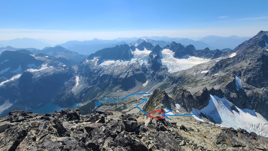
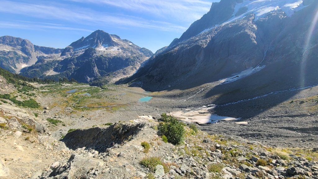
Following the downclimb, the route is a long slog with no trail for a while (make sure you have a good map/gpx to follow). We crossed a boulder field and made for grassy ledges below, always aiming southwest, and past both Lambda Lake and the tarns. Do not be tempted to go down towards the water too early – you’ll cliff out before you reach the water. The downside of this descent route is that you do go pretty far out of the way, but you do get some nice views. After traversing far enough west, we encountered a deep rocky gully (probably a river off the glacier above when there’s more melt) which marked the beginning of our descent to the tarns. Following a faint path beside the gully led us to the valley floor next to a fast-running river and a couple tarns. We took a brief break here to refill our bottles and splash some icy water on our hot and sunburnt faces. From the tarns, the river leads to the trees, and a couple large cairns mark a well-travelled trail that leads steeply downhill through the forest to Lambda Lake. From the marshes of Lambda Lake, we followed a well-established trail back to our camp at Lake Lovelywater. The trail was much wilder than we expected however. While still better than bushwacking, we encountered numerous obstacles, including a steep descent down a slimy rock face with a chain, lots of boulder-hopping, and fights up and down steep hills with hazardous tree roots poking at our faces. We reached camp with about an hour of sunshine left. The hot day and long weekend combined to find us marching back to some very busy beaches! Camp to camp, the trip took us just under 10 hours at a leisurely pace, covering about 9 km and about 1300 meters of elevation gain, and was actually easier than I had expected overall.
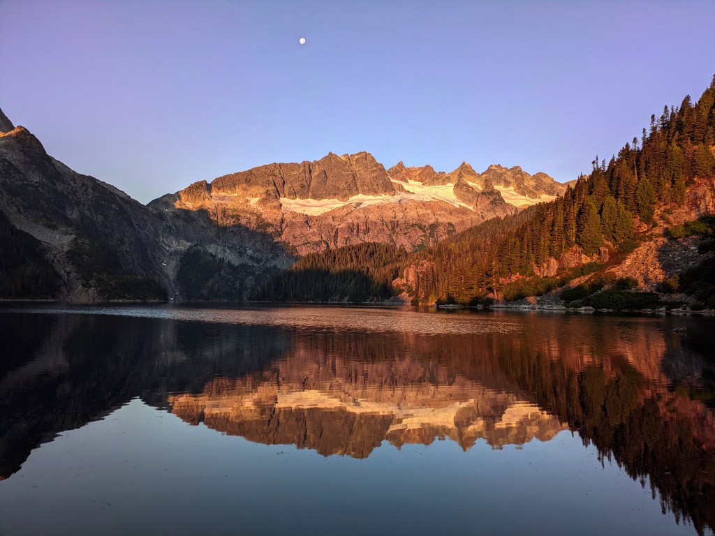
The good weather melted away the next day, leaving us surrounded by clouds and mist and fighting spurts of rain. While we meant to complete a secondary route (scrambles up Iota, Niobe, and Pelops), we ended up just taking a wet lunchtime hike to the base of the route in Niobe Meadows, and spent the rest of the day eating, napping, and nursing our sunburns! We packed up and hiked out the following morning to catch our boat back across the Squamish river. As we settled into our post-adventure victory beers at Backcountry Brewing in Squamish, I opened my trusty Mountain Objective List on my phone. Alpha East Ridge? Check. At last.