
Exploring some shoulder season hiking trails in the Squamish, Fraser Valley, and Vancouver areas
Ahhhh, the sun is out at last! The cherry blossoms are appearing, and winter coats are being relocated to the back of the closet. You’re ready to lace up those hiking boots and hit the hills – but despite this, all the mountains stubbornly refuse to give up their snow. How cruel.
Here are some low altitude off-season hikes that are sure to be clear of snow. Perfect to get you through shoulder season!
Petgill Lake
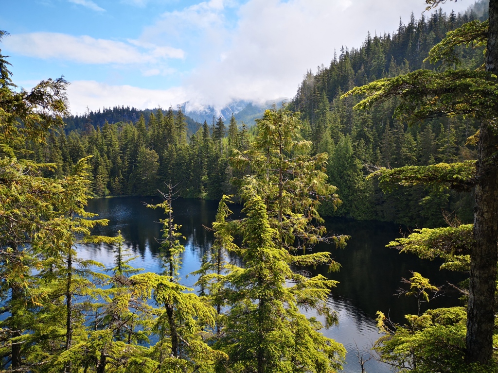
First up in the series is Petgill Lake, tucked away behind the mountains on the edge of Squamish, BC. This serene and quiet lake offers both summer swimming and a great view of Howe Sound. The trail starts steep and scrambley, but soon mellows out (I promise). You’ll encounter the lake first – if you follow the paths on your right down the rocks, you’ll reach the waterside, where you can stop for a dip and a beer. Staying high on the ridge once you see the lake below you will lead you left towards the viewpoint of Howe Sound, which is about 10-15 minutes past the lake.
Where: Parking for Petgill Lake is at Murrin Provincial Park, on the side of the Sea to Sky highway. From Vancouver, take a left off the highway into the parking lot. You’ll leave your car here, and carefully cross the highway. Begin walking down the highway on the shoulder in the direction of Squamish. After a couple minutes of walking, you’ll see a sign marking the trailhead for Petgill Lake on your right.
Stats: 11.5 km, 650 m elevation gain; allow 4-6 hours
Crooked Falls
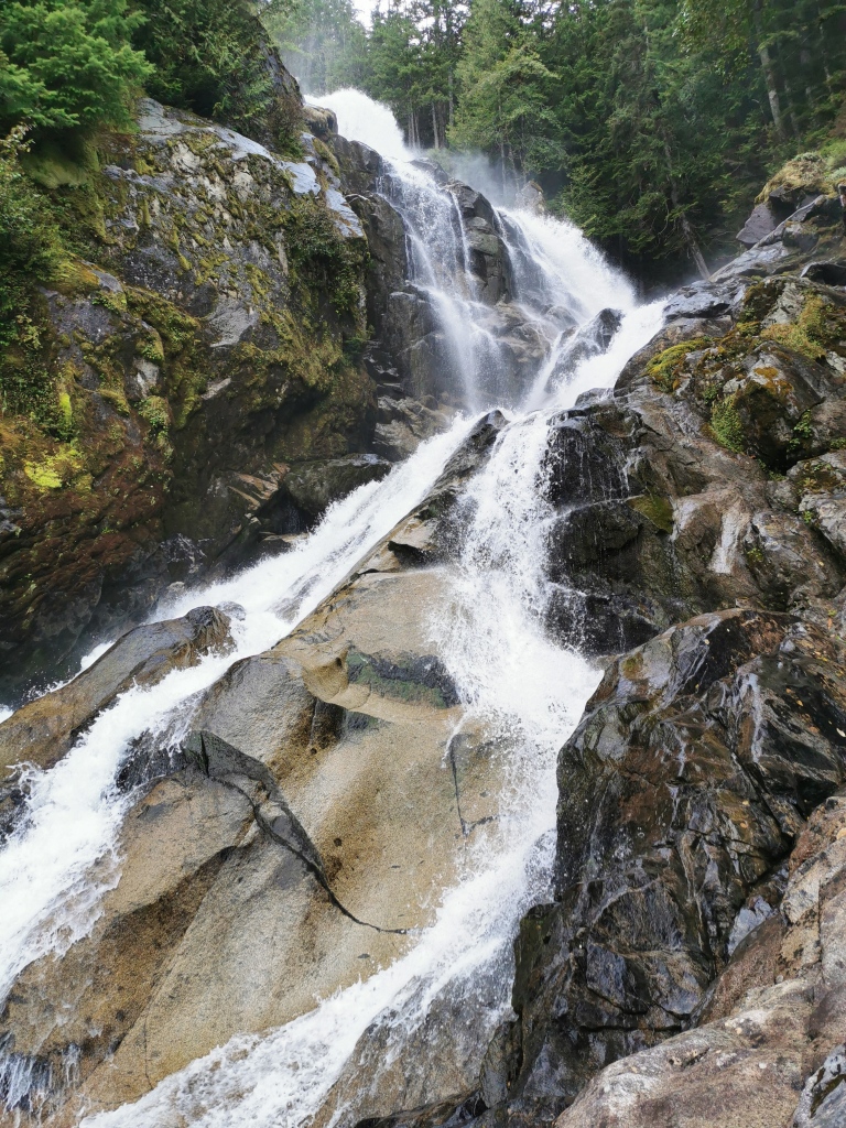
Crooked Falls is a lovely and powerful waterfall located in the Squamish river valley. The walk to the falls ranges from flat strolls through the trees, to some steep uphills, and makes for a rewarding and relatively short hike with great views of the river valley. In the off-season, you’ll cross a number of creeks and dripping waterfalls as water streams off the massive granite walls that line the trail. From the trailhead, you’ll follow the Sigurd Trail through the forest. As you near the falls, make sure you take the Crooked Falls Trail at the junction (marked with a sign), rather than continuing with the Sigurd Trail.
Where: Follow the Sea to Sky Highway through Squamish, taking the turnoff for Squamish Valley Rd (a left, if you’re driving towards Whistler). Follow the road for about 24 km, then turn left on Ashlu road (you’ll cross a bridge over the Squamish River). After about 2.5 km, you’ll cross another bridge over the Ashlu river, then the road bends to the right by about 90 degrees. The trailhead is just around this corner, on the left-hand side of the road – it’s a wide gravel path marked with a couple orange flags. Parking is on the shoulder of the road across from the trailhead. Note that the Squamish Valley road is gravel with a fair amount of pot holes, but most 2WD cars should be fine with the drive (I’ve seen Tesla and BMW sedans at the trailhead. You’ll be fine!).
Stats: 6 km, 400m elevation gain; allow 2-4 hours
Mt Gardner
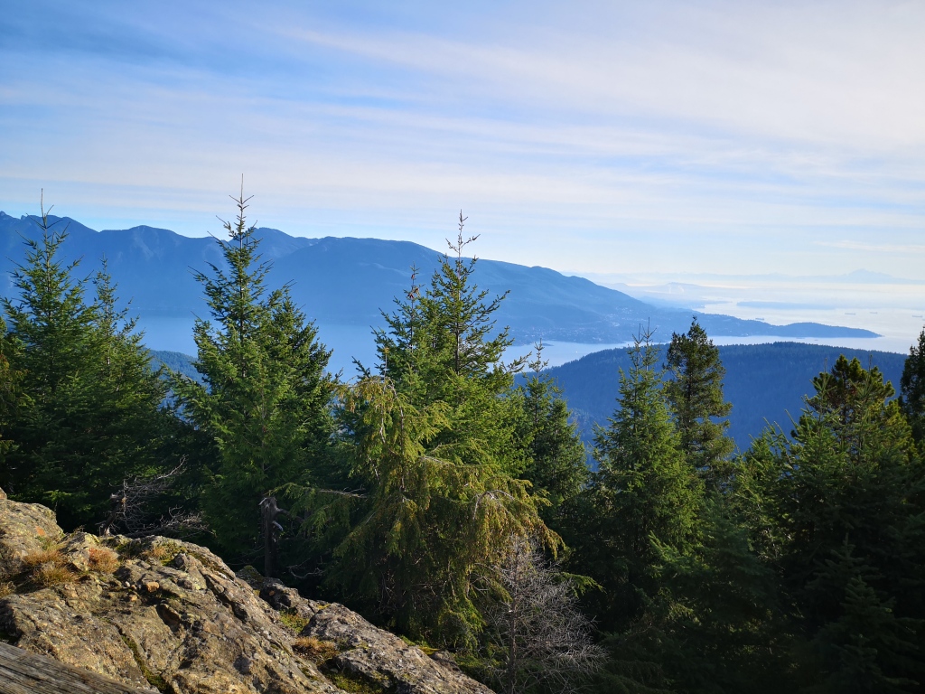
If you’re hoping for a day trip, consider taking a ferry to Bowen Island to climb Mt Gardner, the gentle summit at the centre of the island. It’s also a fun excuse to explore the cute community and take a boat. There are many trails up the mountain, so you can make this hike whatever you want it to be. Bring a trail map on your phone to make navigating the many turns easier.
Where: To get to Bowen Island, you’ll need to take a 20 minute ferry ride from Horseshoe Bay. Trailheads are located all over the island, but the most common is about 3km north of the ferries, beside Killarney Lake.
Stats: various, depending on the route
Sumas Mountain
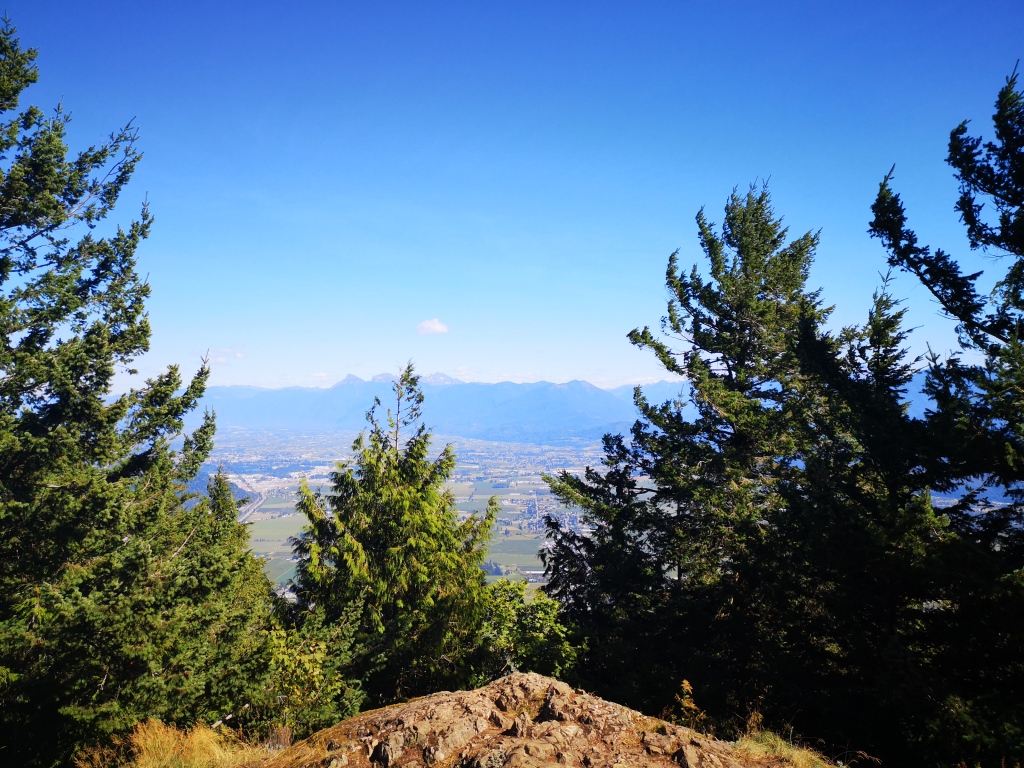
A local classic of Fraser Valley hiking is Sumas Mountain, located in Abbotsford, BC. Two easily accessible trailheads (offering both long and short versions of the hike), plus beautiful Chadsey lake, a view of the valley, and plenty of mountain biking trails, make this a popular spot all year round.
Where: To get to the trailhead, follow Highway 1 to Abbotsford. Taking the Watcom Rd exit, turn right onto North Parallel Rd. Shortly after, turn left onto Sumas Mountain Rd. Follow this until the road becomes gravel. Soon after this, you’ll see the trailhead on the right-hand side of the road, marked by a sign (and likely lots of parked cars). Park in the gravel shoulder, and you’re good to go!
Should you want to do the shortened version of this trail, you can instead drive up Taggart Rd to the upper parking lot.
Stats: 13.5 km, 700m elevation gain; allow 4-6 hours (for the whole trail)
What are your go-to hikes in spring and fall? Or do you find other ways to stay active during shoulder season? Let me know in the comments below!

That looks so breathtaking! I’ll defiantly hike there once I’ll be able to travel again(hopefully next year or so, depending on the pandemic). :3
LikeLike
Woo hoo! Yeah, I think we’re all looking forward to that! Fingers crossed for a speedy return to normal.
Thanks for reading! 🙂
LikeLike
Love your hiking routes without ropes.
LikeLiked by 1 person
Haha yes, you can still have fun without ropes I guess. 😉
Thanks for reading!
LikeLiked by 1 person
This is great Emily. I haven’t done Crooked Falls so will check this out. I tend to stay close to home for hiking this time of year. There are lots of trails above Horseshoe Bay and a great network of trails in the lower reaches of Brother’s Creek accessed from Millstream Road in the British Properties, West Van (though you get into the snow fairly quickly).
LikeLiked by 1 person
Awesome, I haven’t explored that area at all! Definitely will go check it out. 🙂 Thanks Caroline!
LikeLiked by 1 person