
A two-day spring ascent of Goat Ridge in Squamish, BC
In case you couldn’t tell by the name of my website, I’m a bit of a sucker for ridge hikes. So of course, Goat Ridge, prominent on the Squamish skyline and next to one of my all-time favs (Sky Pilot), had long caught my eye. Always holding a place on the to-do list, but never quite making it out front due to the sheer length, an unseasonably sunny mid-April weekend suddenly saw me to the trailhead of this 32 km (20 mile) beast. Armed with microspikes, snowshoes, overnight gear, and some misleadingly nonchalant trip reports, we prepared to tackle the ridge in the unpredictable spring snow conditions.
The Disclaimer:
Doable as a 13 hour day-trip for fast and fit parties, we chose to suffer a bit less and spread out the ascent over two days, but neither approach should be underestimated in the snow. Additionally, should you decide to camp, you CANNOT park overnight in Murrin Park, the normal starting point for day-hikers on the Petgill Lake trail. Instead, you’ll have to park at the viewpoint back about 1.5 kms toward Britannia Beach, which will add 3 kms and about 1 hour to your total trip time. Our total hiking time over two days was 14 hours, but more should be allowed as a margin of safety.
While we did this trail in early spring (mid April), I wouldn’t recommend this time of year unless you have lots of experience hiking in snow. You will require a GPS to route-find, portions of the trail are incredibly steep and slippery (I strongly recommend an ice axe), and the summit ridge does present some avalanche danger (small, but present). Additionally, there is some cornice hazard on the summit. That being said, you’ll feel weightless as you stroll up and down the white, rolling fields of snow against the blue sky, so if you’re experienced, prepared, and game for some extremely uncomfortable climbs through the trees, it’s worth it.
The Trail:
The Goat Ridge trail originates off of the Petgill Lake trail, about five minutes shy of the lake. For a day-trip, park in the lot at Murrin Provincial Park (note that it fills up very fast on nice days). If you’re overnighting, aim for the viewpoint 1.5 km before Murrin (if driving from Vancouver). Note that you can’t make a left into this lot, so you’ll have to make a u-turn at Murrin. From the viewpoint lot, hike along the side of the highway towards Squamish, staying on the left-hand side of the road until you reach the parking lot at Murrin (there is a concrete barrier most of the way). Carefully cross the highway at this point, then continue walking towards Squamish. After a few more minutes, you’ll see a wooden marker for Petgill Lake on your right. Take this trail.
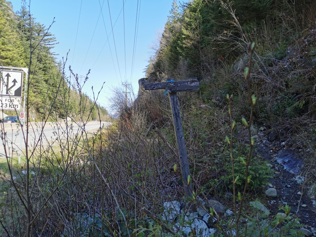
The Petgill trail starts fairly steep, but soon mellows out. It’s mostly in the trees, except for a portion up a logging road in the middle. The path is very well marked, but be warned: ensure that you’re following the markers on the trees, and not the arrows spray-painted on the rocks (these will lead you astray – they’re likely for the power line crews up there). You’ll hike just about the entire Petgill trail before you reach the Goat trailhead. From the parking lot to this turnoff will take you about 2 hours 45 minutes.
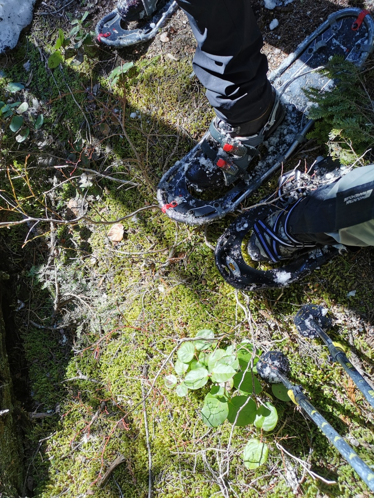
Remember the GPS I said you should use? You’ll be able to easily find the Goat trailhead using an app like Komoot. Otherwise, about five minutes out from the lake, as the trail climbs a little, you’ll see a red circular marker on a tree down the bank on your right. Just beyond the marker, the trail is remarkably well flagged (for a while anyway), so you should have no problems moving flag to flag from here. On a hot April weekend, the beginning of the Goat trail was mixed snow and bare ground; parts of the trail were visible, but the flags were still crucial for navigation. Snowshoes were also necessary for flotation. It is unlikely that the trail will be packed or well-travelled by others.
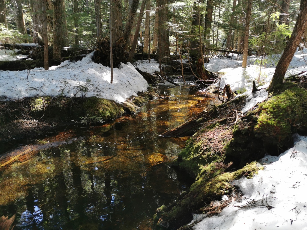
The first few minutes on the Goat trail presented a tricky problem: a fast and high creek crossing. After inspecting various potential crossing points, all of them a bit sketchy, we finally settled on removing our snowshoes and walking across a fallen log. After this crossing, several more streams presented themselves, but nothing more difficult than the first.
The trail begins climbing here. Flagging abounds, and the trickiest part was the ‘mixed climbing’ we were forced to endure in our snowshoes due to rapidly melting, but still deep, snow. Good progress was made on this section despite some bush-wacking for the simplest path, and spirits were high.
About 9 kms into the hike, the trail begins to steepen drastically, flags get buried, and the conditions get downright alarming. Careful navigation via the GPS map is essential, while also a whole lot of common sense to pick the least dangerous ascent path. We unfortunately did not bring ice axes, but I would highly recommend them to anyone doing this trail in snow, as the ascent approaches vertical, and falls could be painful. We took our time selecting the path of least resistance and very carefully kicking steps in the snow, and managed to avoid everything except a couple small, somewhat unnerving slips. The last 4 kms of the hike before we quit for the day each took nearly an hour.
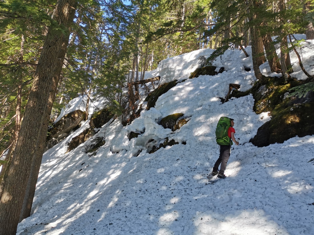
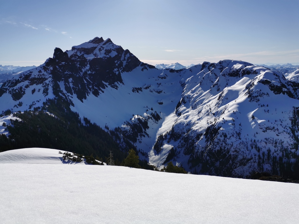
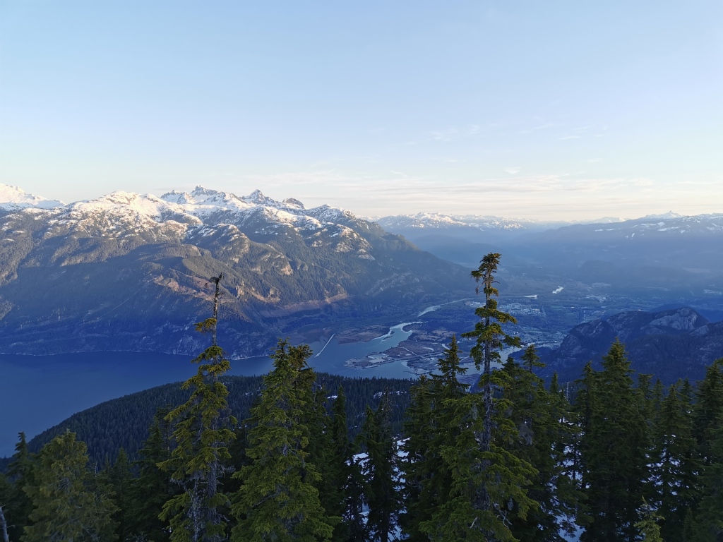
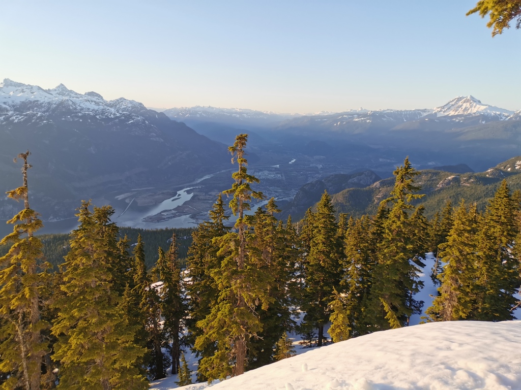
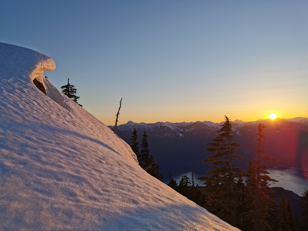
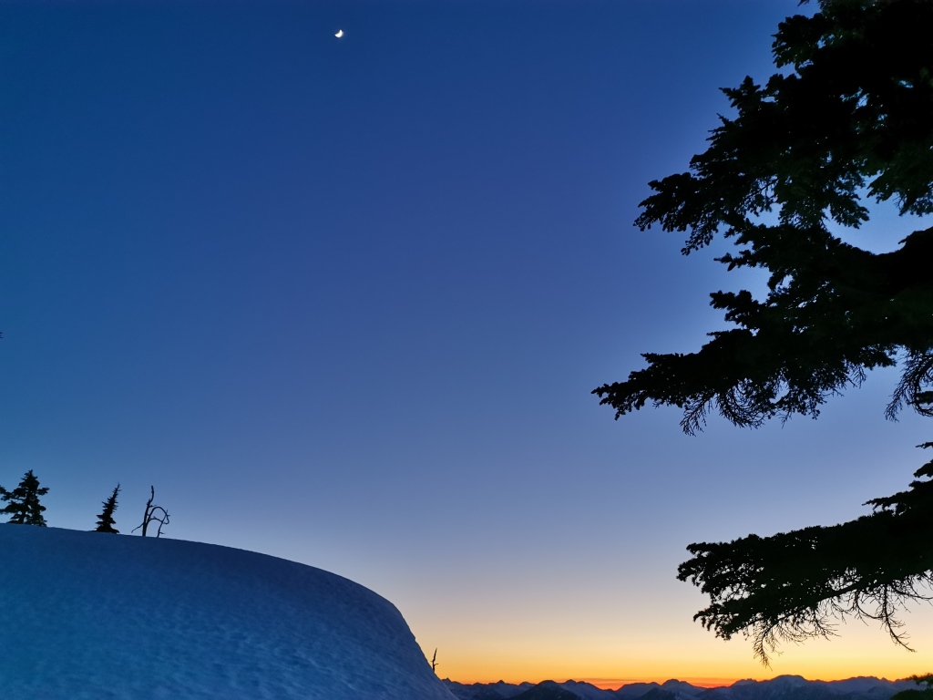
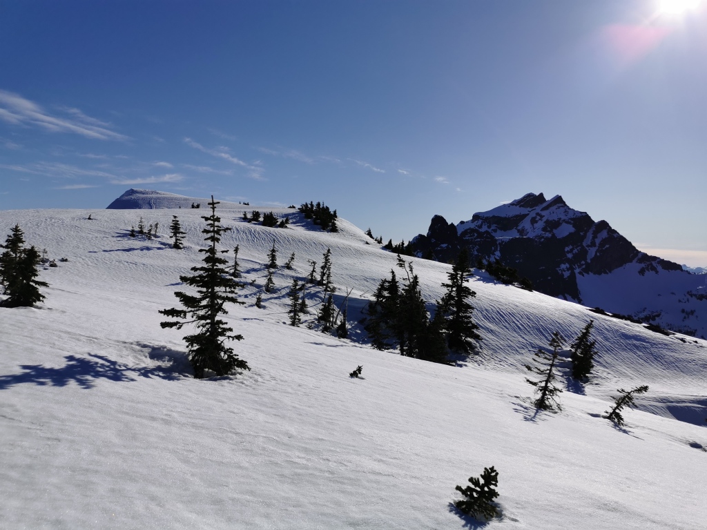
Eventually, the trees began to thin and we broke out of the trees. Climbing a few more steep hills under the cloudless blue sky, we decided to break for camp soon, as the strenuous climb with overnight gear had worn us out, the afternoon was getting on, and we had finally reached a place with a view. While we hadn’t quite hit the ridge itself, the spot we selected presented an amazing view of Squamish and the Chief, Howe Sound and the Sunshine Coast, the Tantalus Range, the Garibaldi massif, and even Habrich peeking out through the trees behind us. We made dinner and watched the sun set on the mountains.
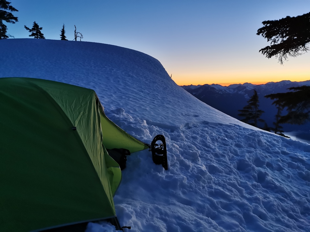
Note that water is fairly easy to come by on the Petgill Lake trail (although you should filter it). Higher up, you’ll be able to fill bottles from streams running beneath the snow/ice in some of the steeper forest sections. In the summer, there are tarns on the ridge from which you can gather water; in the spring/winter, we had to melt snow at camp.
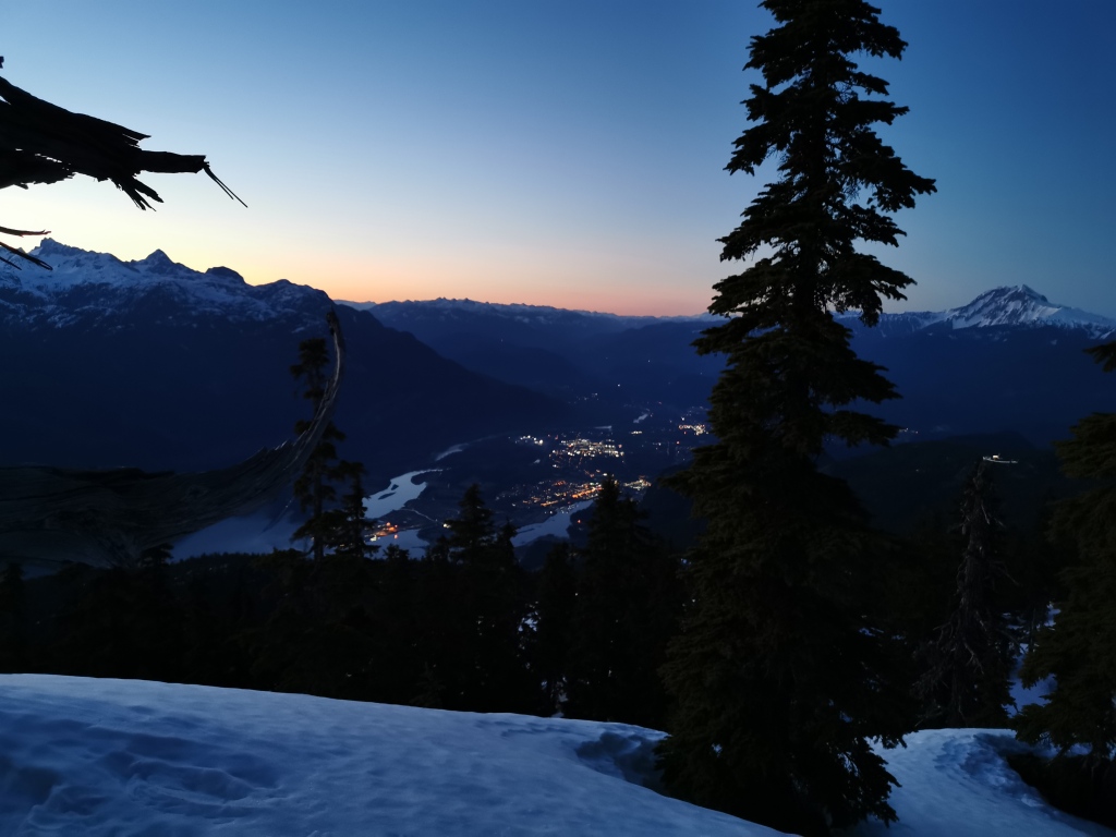
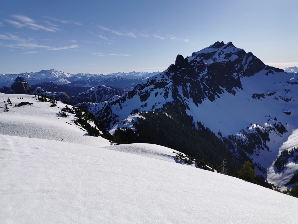
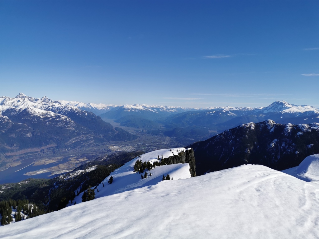
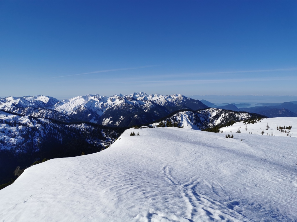
Waking early in the morning, we loaded up a summit pack and got back on the trail. Conditions were very icy; while the intense heat of the previous day had turned the top layer of snow into a soft slush, the cold overnight mountain air had frozen everything into a stiff, hard crust. I learned the hard way, on an accidental stumble high up on the ridge, that this made for very sharp ice indeed. But the firm snow worked to our advantage as we climbed a series of steep, rolling hills – our snowshoes barely sunk at all. Careful to keep to our GPS map, we made incredibly quick progress to the top of the ridge. A careful eye must be kept for hazards here – avalanche-prone slopes, cornices, steep drops, and no-fall zones – but the navigation was straightforward. Exposure on the ridge is minimal with careful route-finding. We soon found ourselves racing towards the end of a series of false summits amidst a sea of peaks: Sky Pilot, Co-Pilot, Habrich, and Al Habrich’s Ridge; Mamquam looming in the background, near the bare Garibaldi/Atwell massif, and Black Tusk far away near Whistler; the twin peaks Tantalus and Dione, Alpha beside them, and the rest of the wickedly sharp range; the Sunshine Coast and Tetrahedron Park; and the north shore peaks the Lions, Mt Brunswick, tallest of them all, and the mighty Cathedral.
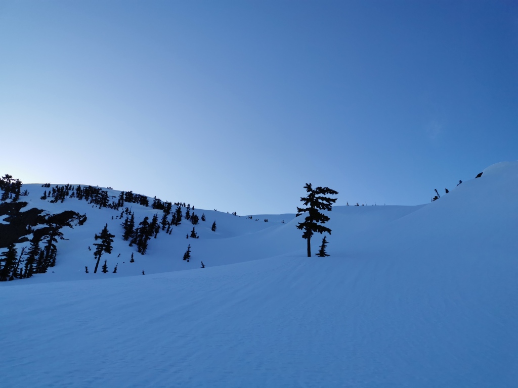
Enjoying the summit of a snow-covered mountain in April at 7am in a tank top was pretty great, but the rising heat meant we didn’t have long to savour it. We wanted to get down before conditions worsened. Following our tracks back along the ridge was easy enough, as we were the only people up there in a while it seemed. It took us 1.5 hours from our basecamp to reach the high point at the end of Goat Ridge, and about 1 hour to return to our camp. From here, we had a snack and packed up quickly, then continued the descent.
As predicted, the steep descent through the trees was slow going and miserable. Pine needles, moisture dripping from the thick trees, and spring melt had combined to scar the surface of the snow, making it surprisingly hard to follow our tracks from the previous day. Extreme caution on the descent was required – at some points, it was easier to face into the slope and downclimb, carefully kicking steps as we went and using hands/poles for stability. Fortunately, we made it through with no major mishaps, despite the slippery conditions. I did take a break to stress-eat an entire chocolate bar however.
The snow lessened as we descended, and we even ditched the snowshoes in favour of microspikes at one point, as the precision needed due to the roots and rocks outweighed our desire to not punch through the icy crust. We celebrated once we reached the questionable creek crossing again, knowing that the tame and sedate Petgill trail was just a few minutes away. Once we reached the established trail, we paused to toast with the remaining liquor from the night before. Ditching our winter footwear and again shouldering our packs, we pulled our weary bones down the last stretches of the Petgill trail, and back to the highway. From here, the 1.5 km walk back to our car at the viewpoint felt incredibly long, but boy was it satisfying to throw off that pack and marvel at the beast we had tackled that weekend, and the glorious weather that allowed us a panoramic view of the mountains we call home.
The Stats
Total hiking time over two days was 14 hours. The total distance (from the viewpoint parking lot south of Murrin to the highest point at the end of the ridge) was 32 km (20 miles). Total elevation gain was about 1800 m (5900 feet).
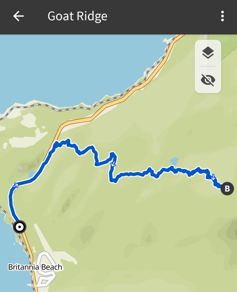
The first map shows day one: the walk from the viewpoint parking lot, past Murrin Lake, across the highway, then onto the Petgill Lake trail, detouring onto Goat before the lake, and the final stopping place for camp. Day one took about 6 hours 15 minutes; we covered 12 km and 1300 m of gain.
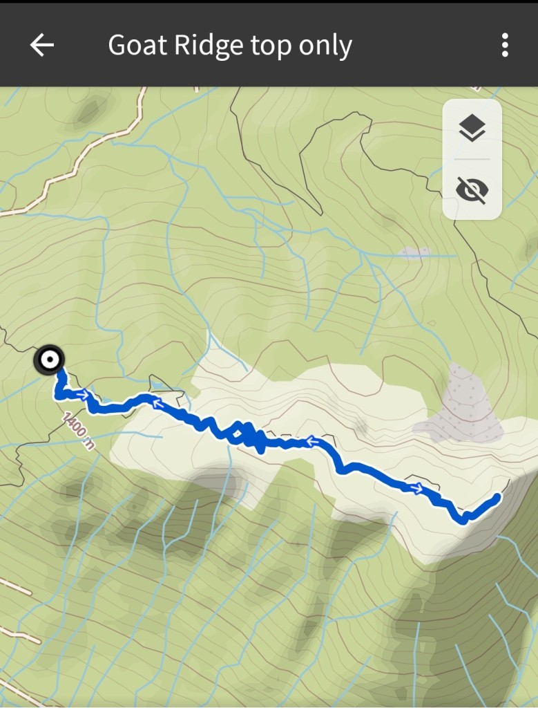
Day two saw us from our camp at 1300 m another 4 km to the summit, climbing about 400 m; the 8 km summit roundtrip took us 2.5 hours camp to camp. The total ascent for the day was about 500 m (with ups and downs on the ridge), and total descent back to the car was about 1800 m. Day two saw us up to the ridge summit and back to the car in just under 8 hours.
The second map shows the ascent and descent from camp to the high point of Goat Ridge.
Ever heard of Goat Ridge? Would you be up for a snowy spring adventure? Day trip, or overnight? Let me know your thoughts in the comments below!

Incredibly beautiful. Those photos of your campsite at sunset are magical. While I love the look of the snowy landscape, your description definitely convinced me to save this one for the summer (as an overnighter). Thanks for the detailed description.
LikeLike