
Hiking to Opal Cone and Rampart Ponds in Garibaldi Park
Saturday morning dawned, a cool and cloudy start to the Labour Day weekend, and with it, the final adventure of summer. It was not without a tinge of sadness that I crammed the last few things in my backpack; fall weekend commitments would preclude many full-weekend camping trips, so this may be the last hurrah, the send-off to a summer absolutely packed with exploration. This was the last chance for warm weather and far-away mountains, so a camping trip to explore my favourite park – Garibaldi – seemed fitting. The intent was to continue past Elfin Lakes, a classic half-day hike. As Elfin itself is a 22 km roundtrip, anything beyond these lakes makes for a nasty day-trip, and is much better done as a multi-day. We kept the plans loose, as weather was iffy, armed ourselves with a map, and prepared to be inspired by the majesty of our backyard.
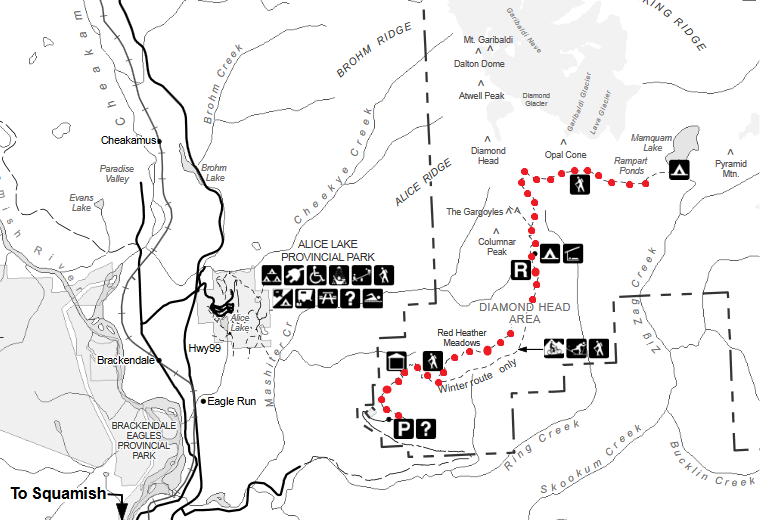
The trailhead for Elfin Lakes is located in Squamish, BC. Off highway 99, take a right onto Mamquam road, and follow signs past Quest University for Elfin/Diamond Head. Eventually, the paved road gives way to a bumpy gravel road. While the road can be a little questionable in spots, 2WD vehicles will make it up (mostly). My tiny hatchback has made it all the way to the top parking lot at the trailhead in previous summers, but it appears that the road was pretty carved up by last winter’s ice, meaning that I, and dozens of others, had to park the car on the side of the road about 500 m below the trailhead and walk. For the drive from Vancouver to Squamish, plus the gravel road, allow about 1 hour and 45 minutes of travel time.
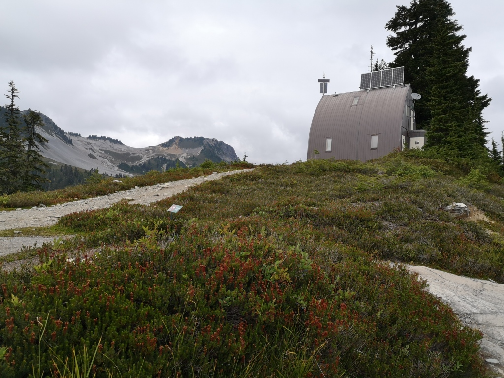
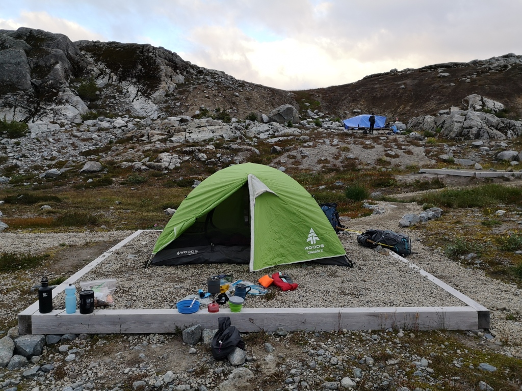
Elfin Lakes is home to an extremely popular campground, featuring about 20 tent pads, a backcountry hut, a warming shelter, picnic tables, bear cache trees, outhouses, and a lovely lake for swimming. Plus, the view from the tent pads on the ridge is probably one of the best imaginable. I’ve always considered Elfin to be one of the highest pay-off hikes in the area; the elevation gain is steady and very gradual over such a long distance, making it a relaxed hike, plus the trail offers stunning ridge views for several hours. As this was a holiday weekend, the trail and campsite at Elfin were packed!
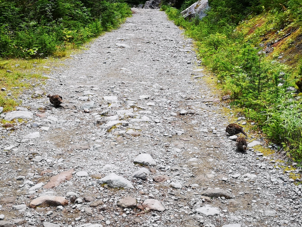
Thetrail up to the lakes was fairly uneventful, with the exception of theappearance of a family of grouse that came out to meet us. I’ve never seenthese forest-chickens so un-cowed by humans!
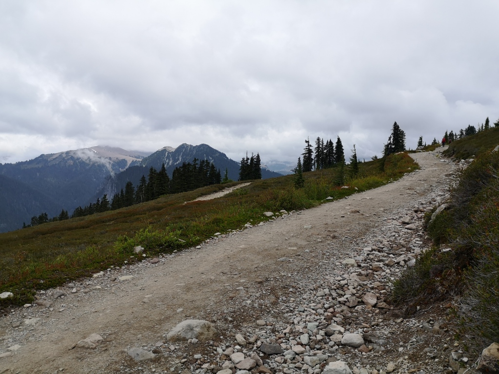
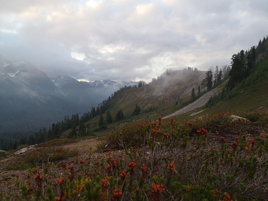
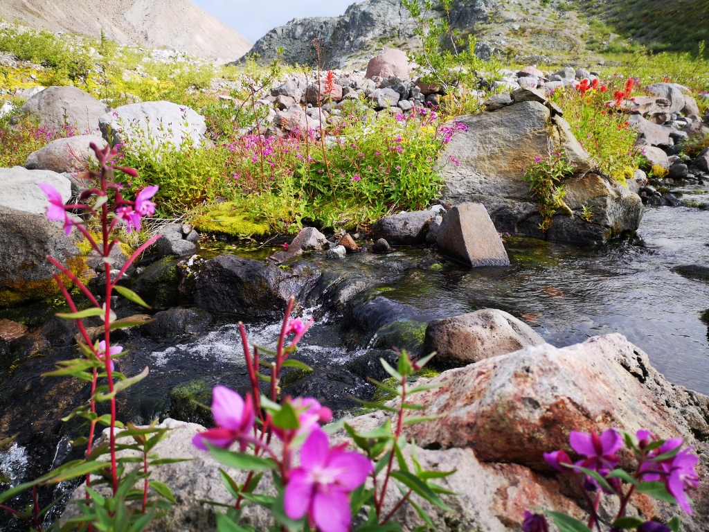
The first stretch of trail follows a wide gravel road, which gently switchbacks up the mountain. About midway (5 km), you reach Red Heather Meadows. A common winter destination for camping, skiing, and snowshoeing, there is a small winter-use hut and an outhouse. From here, you leave the trees and cross the meadows, then begin the ascent up to Paul’s Ridge. Continuing on, you follow the rolling terrain of the ridge, admiring the stunning views of the valleys and peaks, until you reach Elfin Lakes (I suspect they’re named ‘Elfin’ because they’re quite diminutive bodies of water). After a quick lunch at the lakes, we were ready to venture into new terrain.
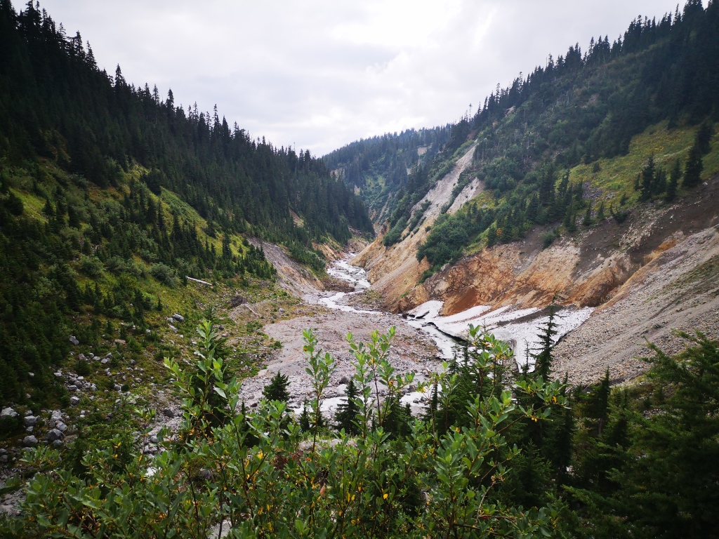
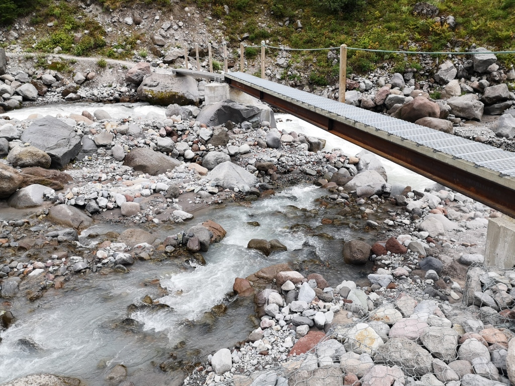
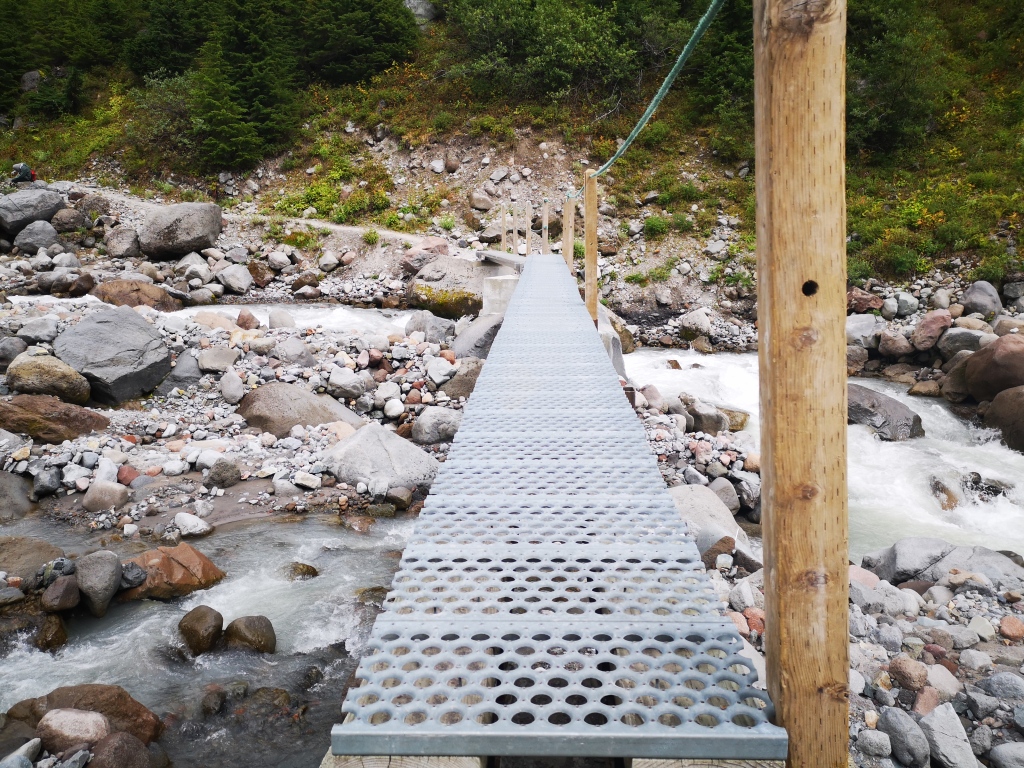
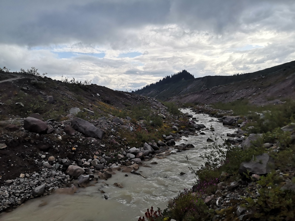
Continuing past the campsite, the trail will lead you on a gradual descent to Ring Creek. Taking a left at the first junction after Elfin will lead you towards the Gargoyles, a cluster of bizarre rock structures clinging to the side of an otherwise featureless peak. Continuing past the Gargoyles will lead you by Lava Lake, then onto Diamond Head, the peak for which the area is named. We kept right at the junction however, and soon found ourselves descending a handy wooden staircase towards the opaque waters of Ring Creek. Crossing the bridge over the water, we continued north, parallel to the river valley. This section is long, uphill, and rocky, and we were relieved to finally reach the next major junction: Opal Cone to the left, and Rampart Ponds campground and Mamquam Lake to the right.
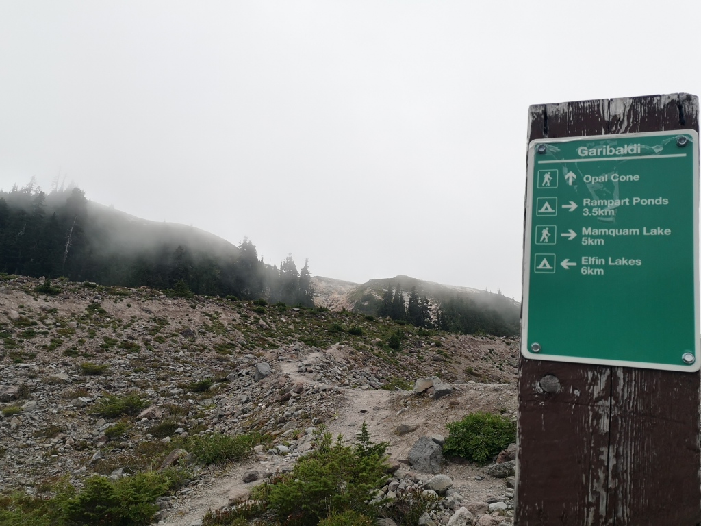
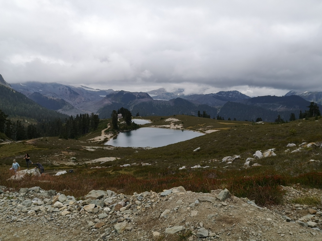
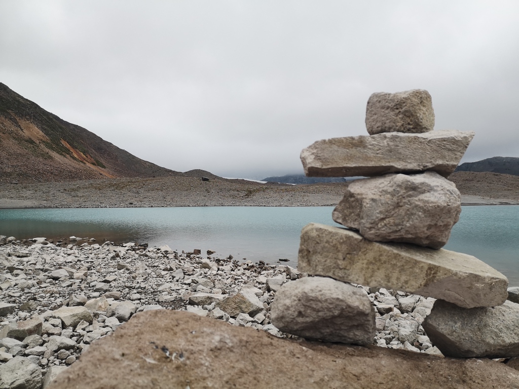
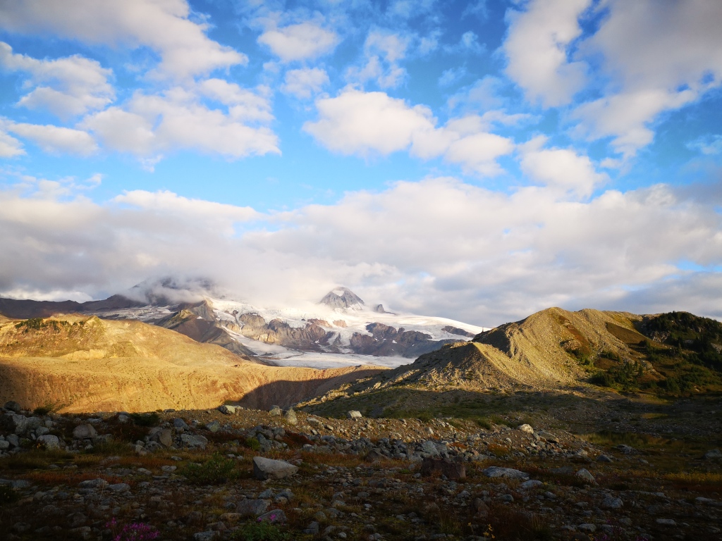
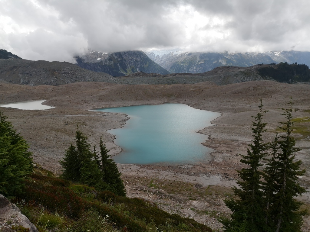
Our objectives for the day were pretty loose. While we contemplated heading up Opal Cone that day, we figured it was probably best to find a place to camp first. Continuing past the junction, we stopped and debated the merits of the beautiful blue lake beneath Opal Cone. The lake, unnamed, but that we’ve termed ‘1518’ (its elevation on the map), provided some flat and soft spots, plus fresh water, and had a stunning view of Garibaldi and Lava Glaciers. However, the somewhat desolate, volcanic landscape was not very inviting. A few hikers on the trail had told us that the next stop of note – Rampart Ponds – was amazing, so we elected to push on instead. In another 3.5 km, we arrived at Rampart.
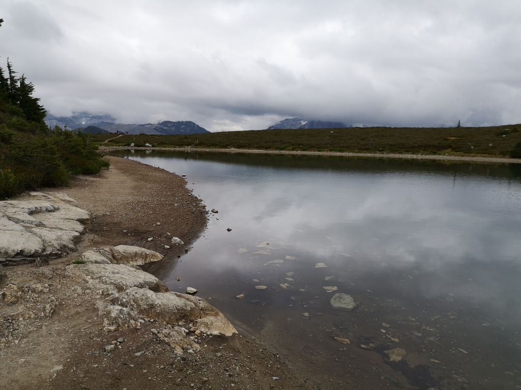
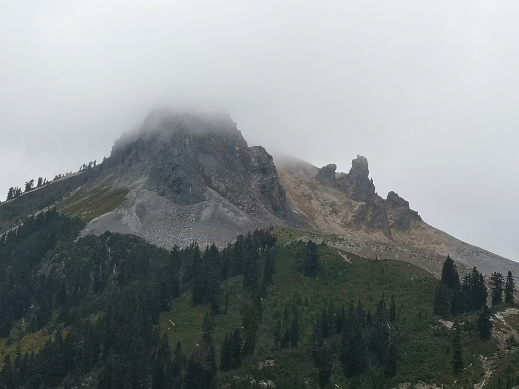
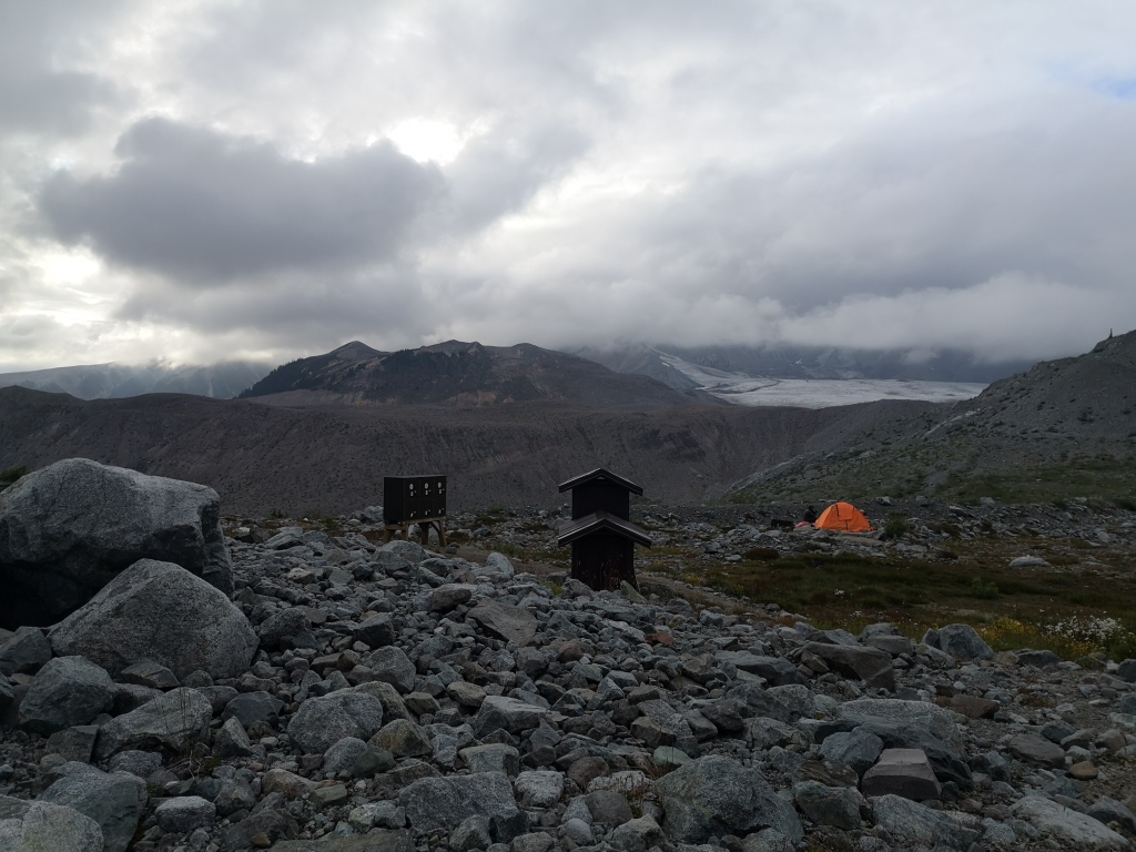
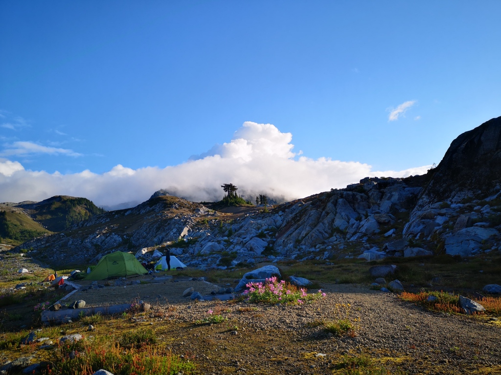
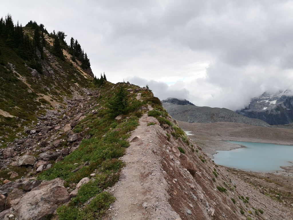
Rampart Ponds is the second backcountry campsite on the trail. Much smaller and less traveled than Elfin, perhaps because it’s a good 20+ km from the parking lot, it offers a much cozier place to spend the night than 1518 lake! A relatively new campground, intended to replace the now closed campground at Mamquam Lake, it features 12 tent pads (several were unoccupied, even on a busy weekend) with a view of sharp and wicked Atwell Peak, neighbour of the famous Garibaldi, plus a view of the Garibaldi glacier, Opal Cone, and the Gargoyles. A brief trek to the ridge above the campsite presents even more peaks: Pyramid Mountain above Mamquam Lake, plus Mirage Peak and Tyee Glacier. Pretty much anywhere you looked, it was amazing! The ponds at Rampart Ponds are quite literally ponds (I wouldn’t swim in their still waters), but are sufficient for drinking water. There is also a new outhouse, plus bear caches for storing food overnight. We set up camp and watched the clouds roll over Atwell as we made dinner, (and ate dark chocolate cheesecake pudding). After the large distance we had hiked that day, we turned in early.
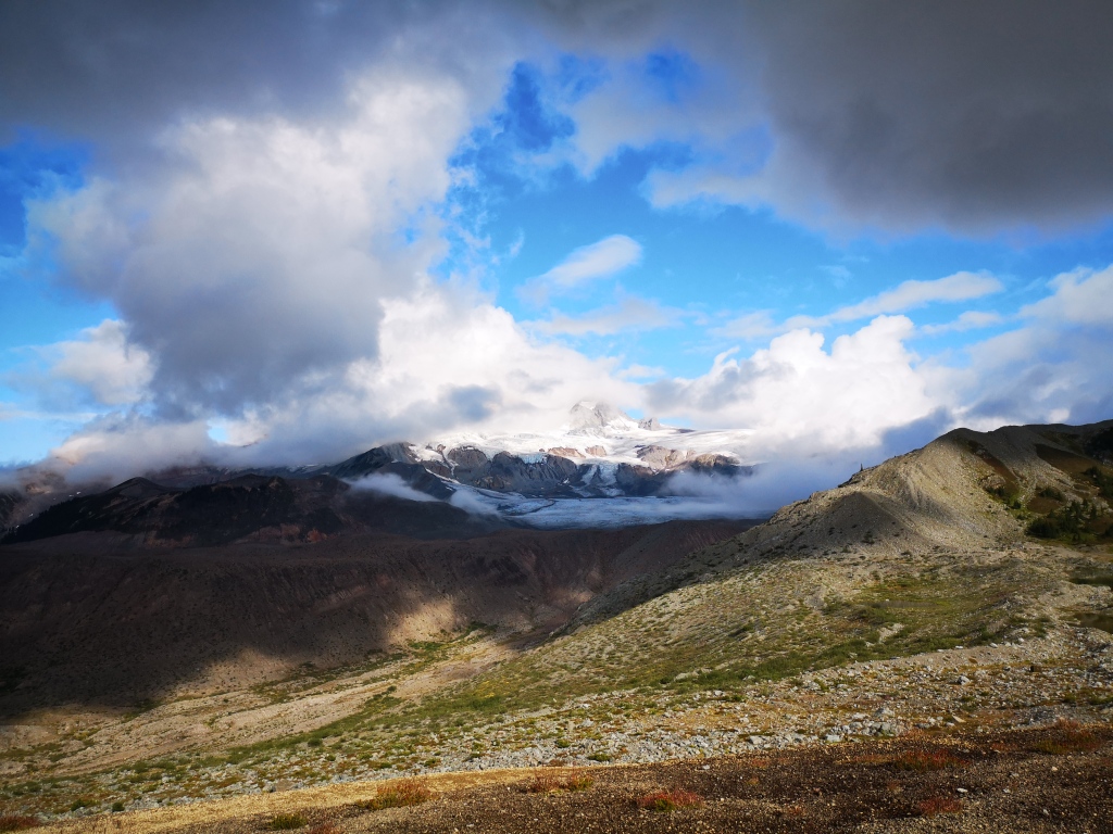
Morning dawned, frustratingly cloudy again. I woke up at 6 am (I can never sleep in when camping), grabbed my map and a bag of dried mangoes, and parked myself on the ridge, determined to wait out the weather for the views that had eluded us yesterday. Due to the low clouds, we were teased all afternoon with small peeks at jagged mountaintops, and were left to guess at how epic they were. Fortunately for me, the morning winds were high, and after 40 minutes, the clouds finally broke, and I gorged on photos. The sun hung around for a few hours that morning, all clouds driven out of the blue crystal sky, the promise of summer in the morning heat. The clouds rolled in again shortly after we had packed up camp and begun the return trip, but we were almost grateful for the cooler temperatures. Almost.
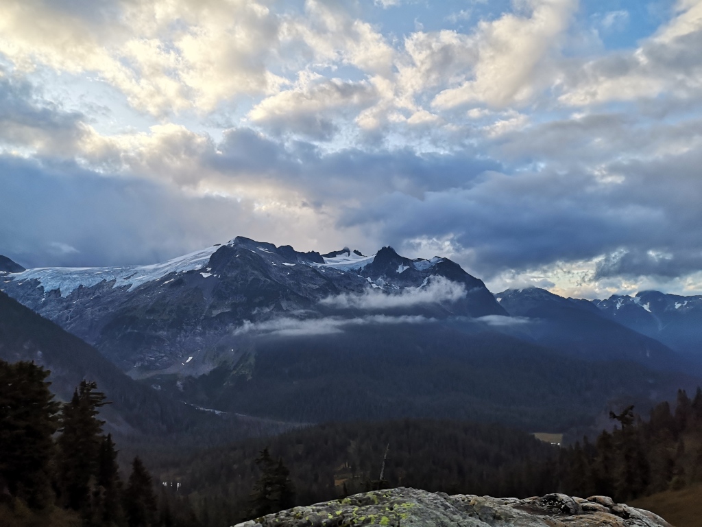

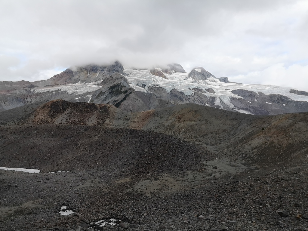
On the way back, we dropped our packs and climbed the sharp ridge towards Opal Cone. The trail is a short detour, about 1 km roundtrip, with only a few hundred meters of elevation gain. It took us 20 minutes to reach the top. Opal is a volcano, and it truly is a cone; the trail runs all the way around a large crater in the center, and provides a wonderful close-up view of the convoluted surface of Garibaldi Glacier. Below it winds the Ring Creek valley, carved by the lava flow from Opal.
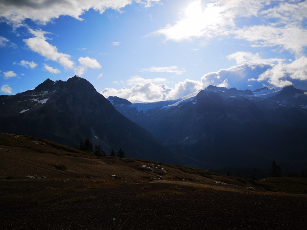
Grabbing our packs again on the way down, we continued on our way: descent to Ring Creek, bridge, stairs, then ascent to Elfin, visible in the distance as a tent-speckled hillside. After lunch at Elfin, we continued down to the parking lot, narrowly escaping a heavy cloud that engulfed the path behind us. With a total roundtrip distance of 43 km over 2 days, our feet were screaming in protest. Perhaps my feet’s way of saying: “Em, summer is over. Time to take a break!” Noted. 😛
Trip Stats
Day 1 (parking lot to Rampart Ponds) took us 21 km with 1150 m of elevation gain in about 7.5 hours. Day 2 (Rampart to parking lot, with a detour up Opal Cone) took us about 22 km with 740 m of elevation gain, with a trip time of just under 7 hours.
So the final weekend of summer was over, but boy did we pack in a lot of kilometers and mountains! How did you spend your long weekend? A new adventure, or an old favourite? Let me know in the comments below!

What a great post and photos about a place I love. I’m glad the sun came out for you…there’s something special about the lighting in your photos with the clouds starting to break up. I’d heard that Mamquam was closed but this is the first I’ve read about the campsites at Ramport Ponds. Looks like a beautiful spot that won’t be secret for too long.
LikeLike
I think the distance scares a lot of people off, so hopefully it stays quiet for a little longer yet! But definitely worth a visit soon. Thanks so much for reading Caroline! 🙂
LikeLike