
Snowshoeing to Ottomite and Iago Peaks in the Coquihalla Summit Recreation Area
With ski resort parking reservations making last-minute winter plans (or really, anything that isn’t planned three weeks in advance) a thing of the past, it’s no wonder that there’s been a surge of interest in backcountry winter trails in 2020. With no bookings, no crowds, some good exercise, and all the fresh powder you could want, hunting for ‘off-the-beaten-path’ trails mights be your new thing for the rest of this winter.
In my endless search for new hikes, I stumbled across Iago Peak, another gem in the Coquihalla Summit Recreation Area. While popular with snowshoers, Iago is also a great backcountry skiing route, and of course, a beautiful hike in the summer.
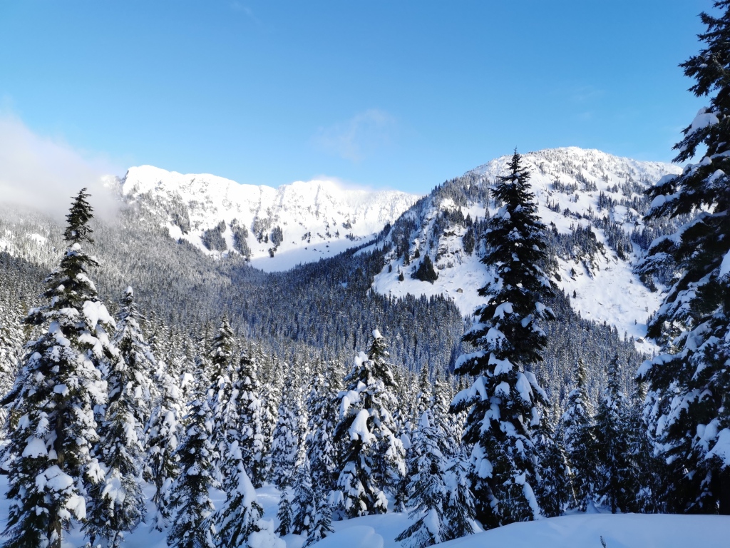
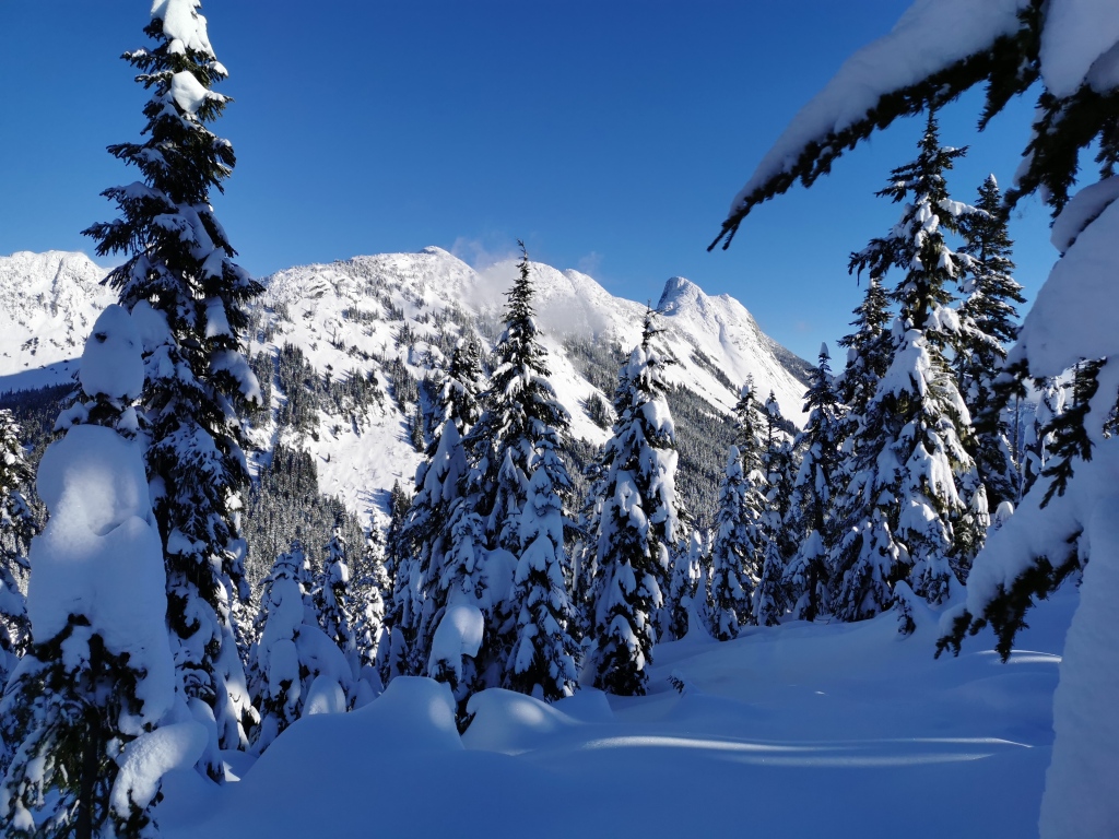
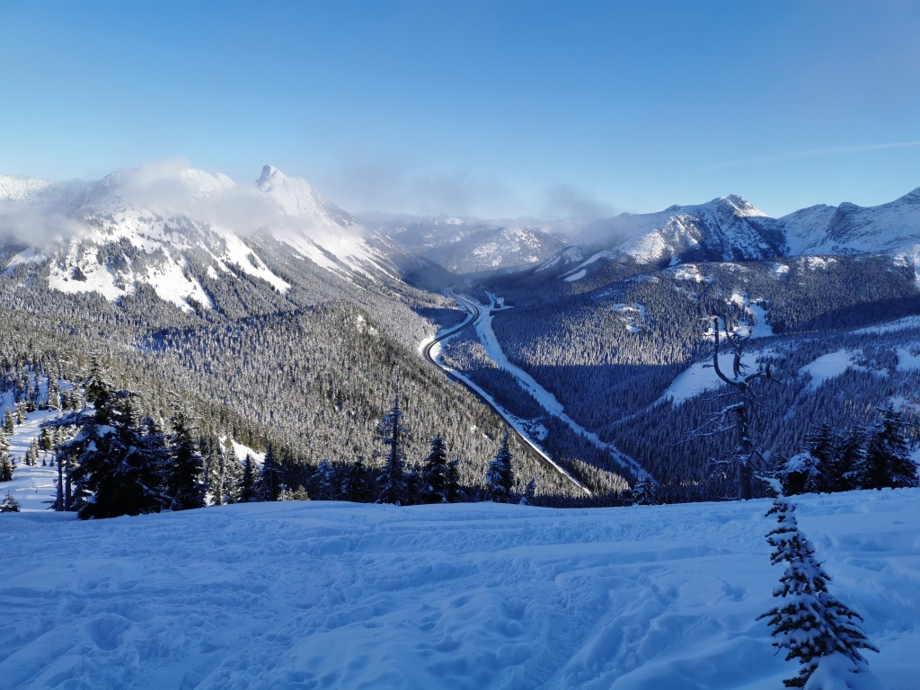
Iago borders the Coquihalla highway, and provides an amazing 360 view. With a gentle, rolling start, then a solid crunch up the ridge to the top, you’ll have time to both chat away with your hiking buddy on gentle terrain, as well as gasp for breath and stare longingly at the summit just out of reach. Additionally, an optional detour will take you up to Ottomite peak, a low, treed, and rounded viewpoint towards Yak and some other Coquihalla classics.
Directions and Parking:
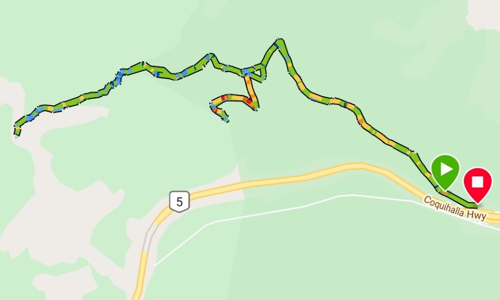
Heading east from Vancouver, take the Coquihalla highway (highway 5) after Hope, and follow the road up to the high point – the Coquihalla Summit. Right after passing through the avalanche shed (the concrete tunnel with the bears on it), you’ll take the first exit to Zopkios rest area (the sign will say ‘brake check’). Take the first left off the exit, into the tunnel that runs below the highway. On the other side, there is a wide parking lot and a heated washroom. Park here. The trailhead is on the far side of the lot, just behind the washroom building.
Note that the Coquihalla, as a mountain highway, can get pretty dangerous during storms. Check the weather forecast carefully before you go, and expect slush, snow, and ice in the winter. Make sure you have an appropriate vehicle and tires for winter driving. While the rest stop is generally decently ploughed, if you miss the exit and have to turn around at the next stop (Falls Lake road), 2WD cars might get stuck. But, being the responsible adventurer you are, you have a friend and a couple of avalanche shovels with you for digging, right!?
Description:
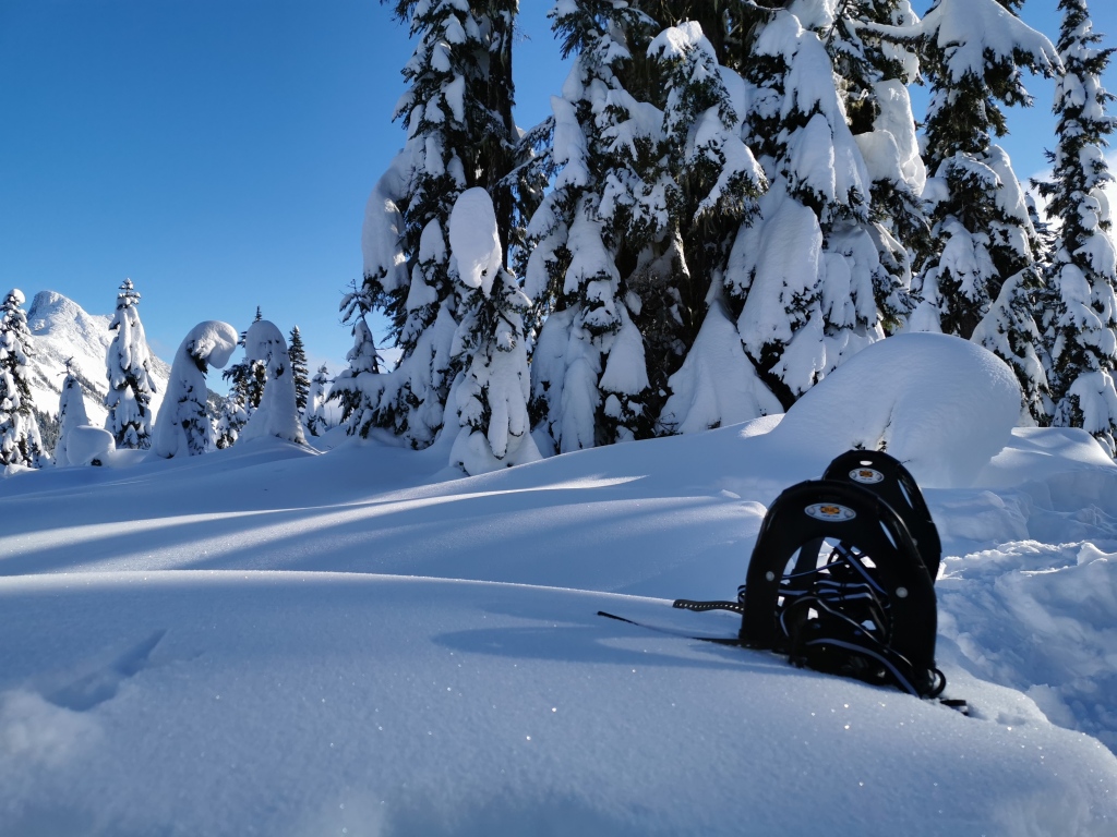
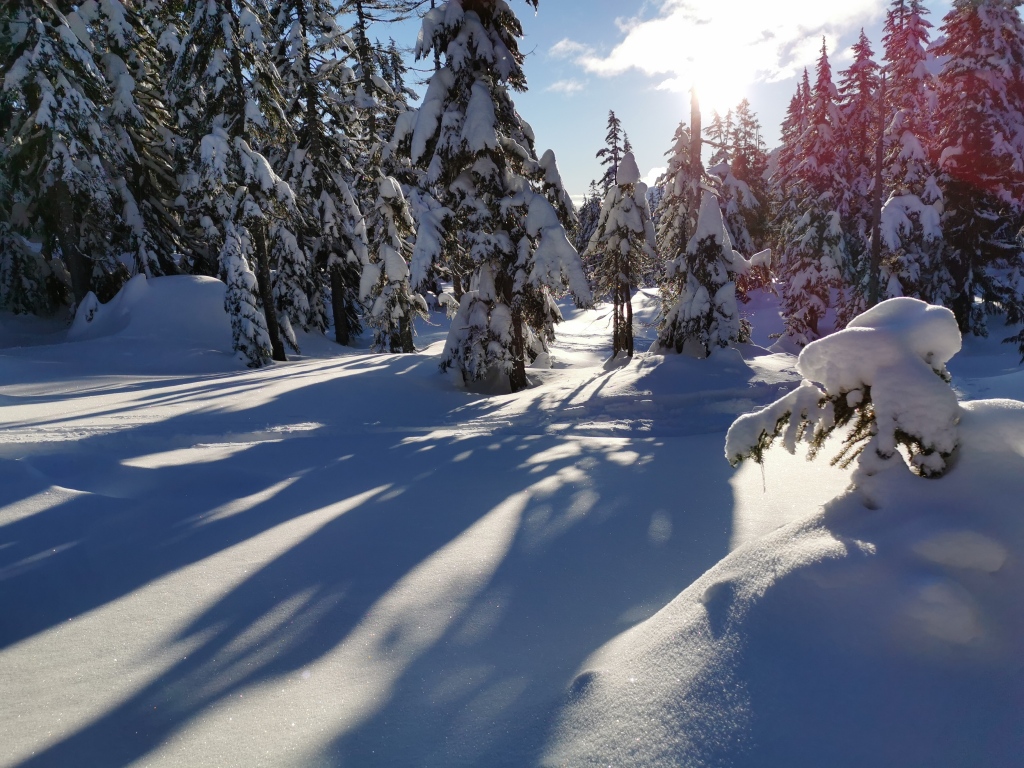
The trail to Ottomite/Iago begins just behind the washroom at the Zopkios rest area. Follow the obvious trail back west along the highway. After 5 or 10 mintues, the trail begins to cut deeper into the forest, and a gentle climb begins. It continues like this for roughly an hour. Eventually, you’ll come to the first good viewpoint on your right. Here, you’ll get a nice glimpse towards some of the other peaks a bit farther down the Coquihalla. There is a Y-junction here as well; taking the leftmost path, which climbs steadily, and takes you in the direction of the highway, will lead you to Ottomite peak, a low, round summit with a couple nice views. Taking the rightmost path at the Y-junction leads to Iago. The entire trip to Ottomite and back to the junction is only about 30 minutes, and a nice little extension.
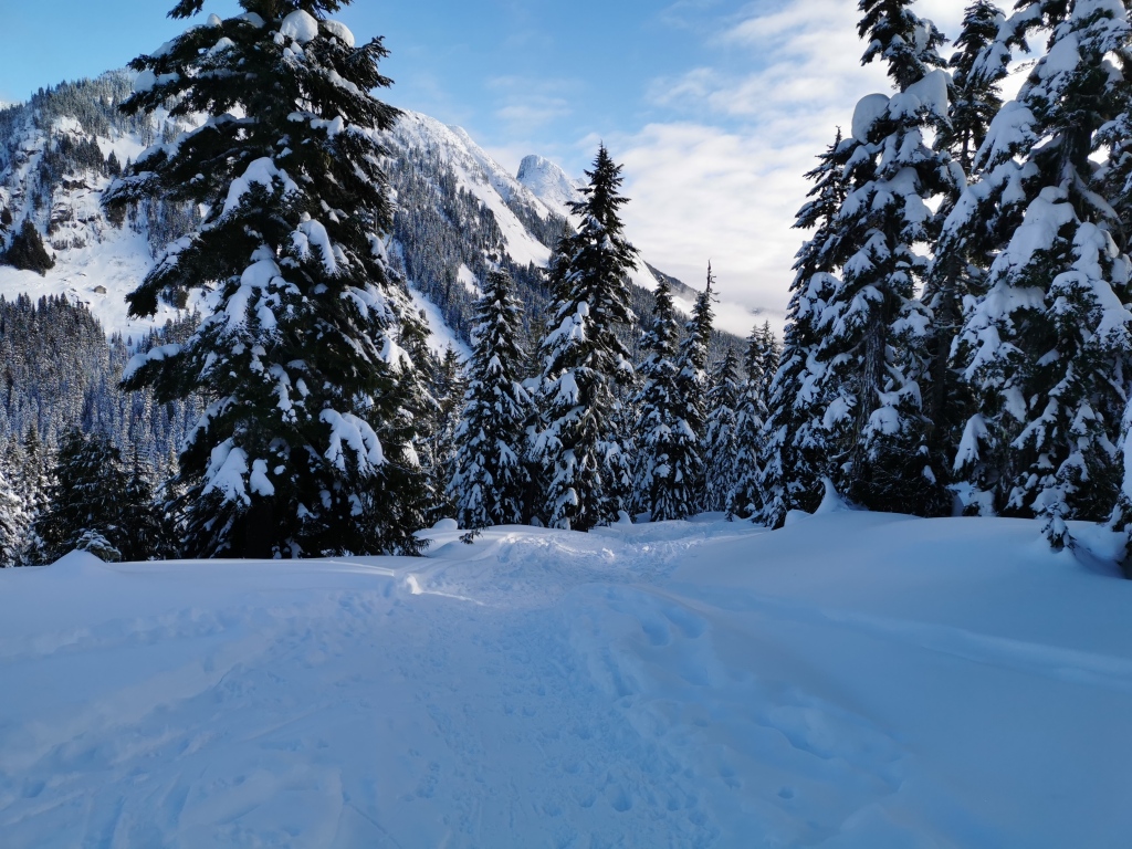
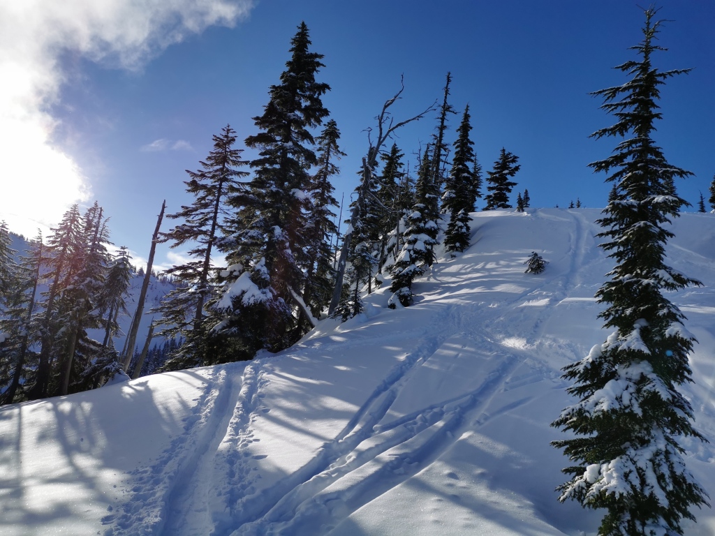
Continuing on to Iago past the junction, the trail begins to climb in short, steep bursts, and the path narrows. Passing through a lovely treed glade, you’ll steadily make your way up. While you’ll begin to see a lot of tracks (mostly skis) leaving the main path, keep following the most obvious and packed looking trail, and you’ll arrive at Iago just fine.
In about the last third of the hike, you’ll encounter about half of the elevation gain, so be prepared to sweat. The final section is a non-stop climb to the open ridge. Once here, you’ll see the round peak of Iago in front of you. While the remaining climb looks a bit daunting, it’s only another 15-20 mintues – keep pushing on!
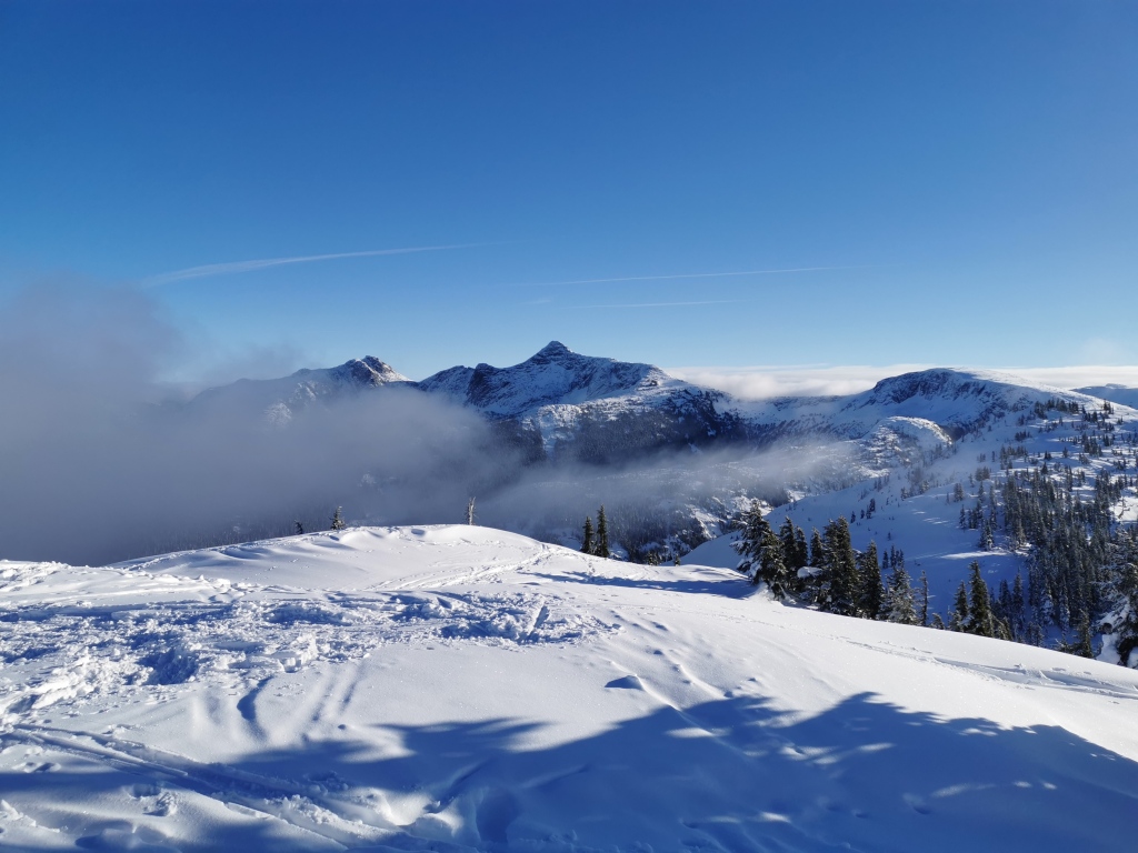
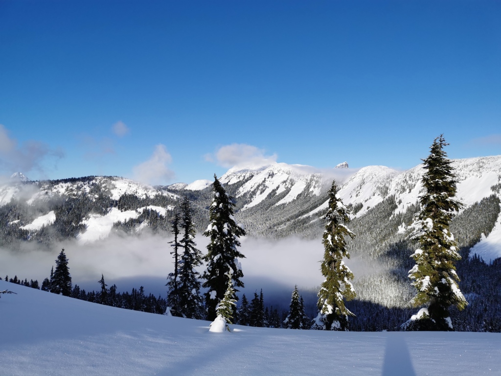
At the summit, you’ll have a wonderful 360 degree view of the Coquihalla peaks, as well as the winding highway below. Have lunch, enjoy the vastness of Canadian mountains, then descend the same way you came up.
Avalanche Conditions:
As with any backcountry winter outing, make sure to consider avalanche conditions before you go. If you’re ski touring, have your shovel, probe, and transceiver, and know how to use them (you should have taken at least the AST 1 course). While the straight snowshoe path up the Iago ridge does not directly pass through avalanche terrain, skiers should look at the forecast before venturing into the bowls.
Stats:
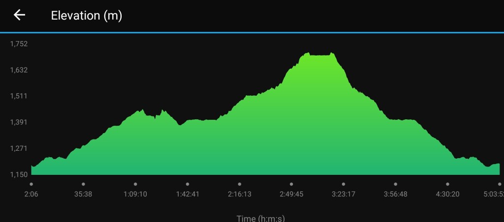
The total roundtrip distance to the summit of Iago, including a stop at Ottomite Peak, is approximately 14 km. Total elevation gain (again, both peaks) is about 690 m. If snowshoeing, allow about 5-6 hours for the trip. The drive from Vancouver is roughly 2 hours.
What are some of your favourite ‘off the beaten path’ winter trails? Let me know in the comments below!
